GIS plays a vital role in improving telecommunications services. Mapping Network Coverage with MAPOG, By mapping network infrastructure and analyzing demographic data, we can pinpoint areas with poor or no coverage and enhance the overall quality of telecommunications services in undeserved settlements.
Key Concept of Mapping Network Coverage with MAPOG
GIS allows us to identify areas lacking network coverage. By analyzing data such as powerlines and settlement locations, we can strategically place new infrastructure to improve service quality. This technology is crucial in the telecommunications industry, where reliable network coverage is essential for connecting communities and businesses. Alongside this guide, datasets will be provided for practical application. Additionally, articles like “Creating Travel Guides: Mapping with GIS Buffer Zones” and “Creating GIS Solutions for Urban Agriculture Map” offer deeper insights into GIS applications.
Here’s a simple step-by-step guide to how we use GIS in MAPOG to improve network coverage:
Step 1: Integrate Datasets:
We start by integrating datasets such as powerline and settlement data into MAPOG.
1.Click on the “GIS Library.”
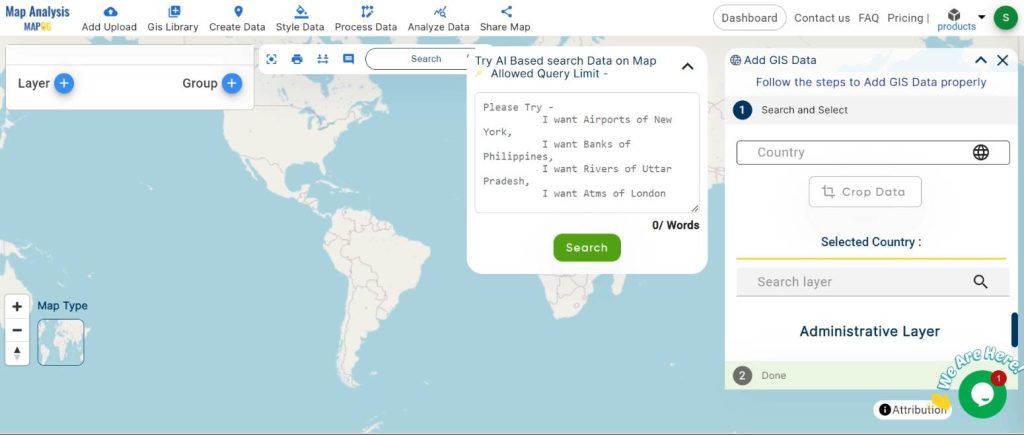
2.Search for the country name.
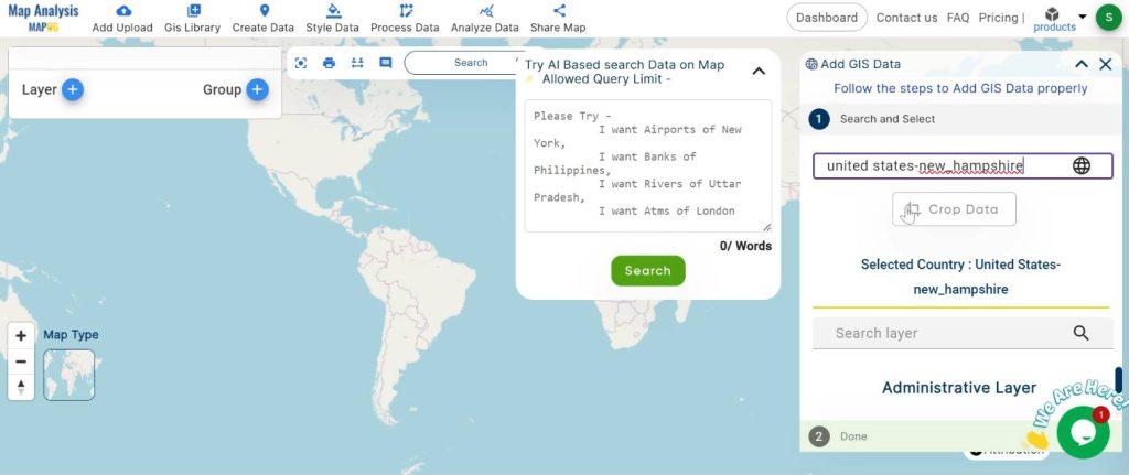
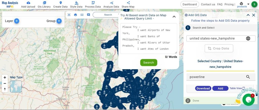
3.Select the required layer.
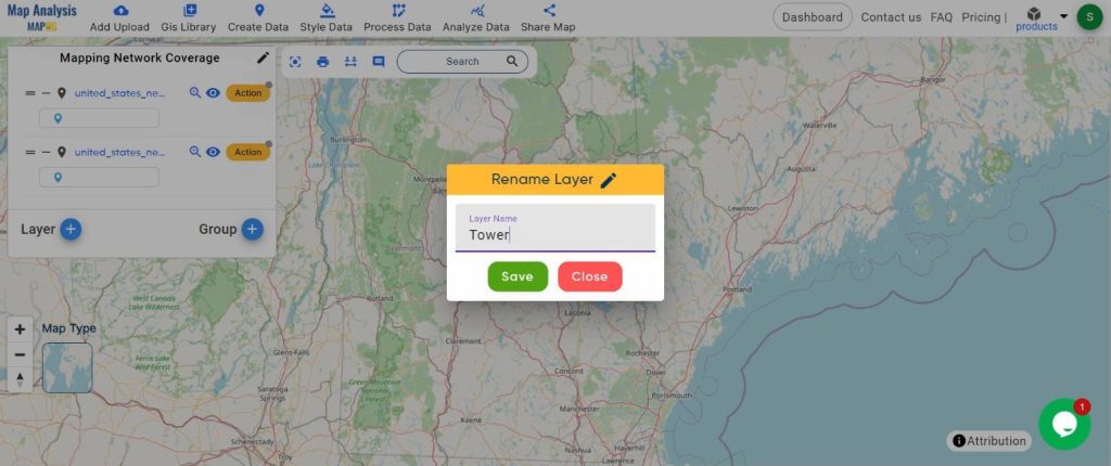
Step2: Name the untitled map and rename the layer
1.Name the map
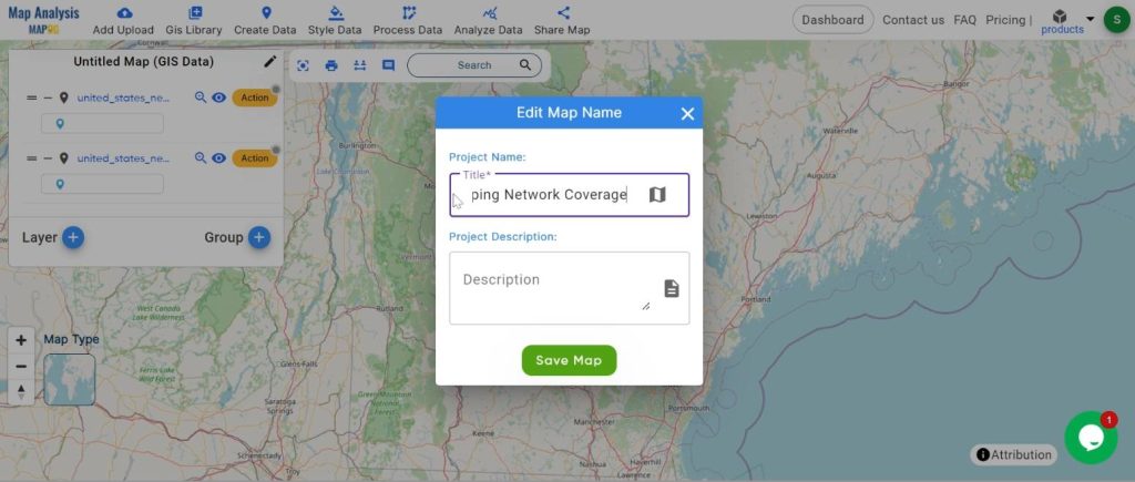
2.rename the layer
Step 2: Create Buffer Zones:
We create buffer zones around powerlines to pinpoint potential sites for new infrastructure.
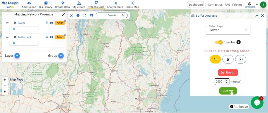
1.Click on the “Process Data” and choose “Buffer Tool.”
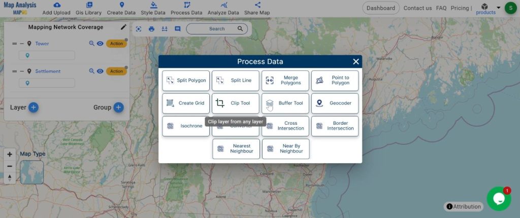
2.Select the layer and set the buffer range. Click on the “Submit” button.
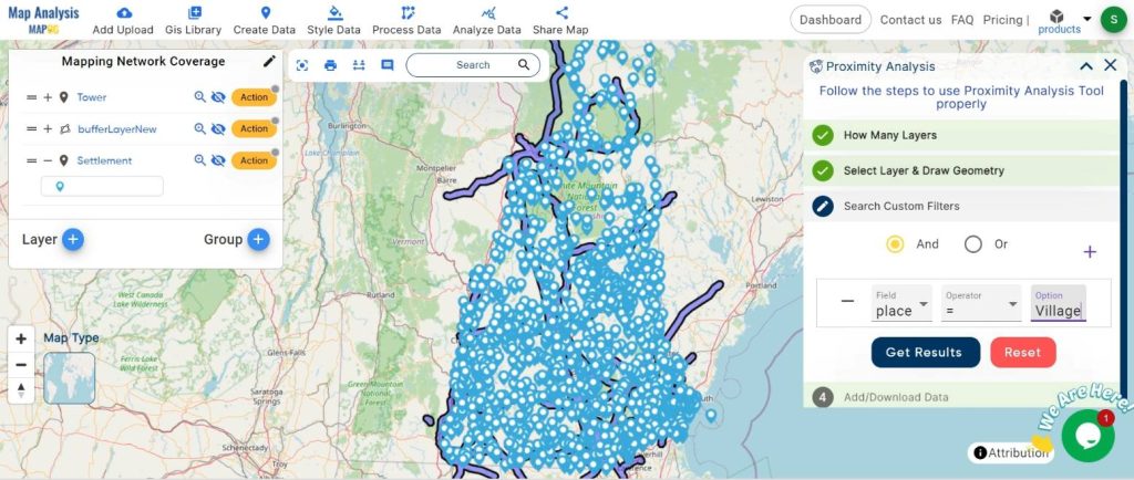
Step 3: Identify Areas with Inadequate Coverage:
Using filters, we identify areas with inadequate network coverage.
1.Click on the “Analyze Data” button and choose “Filter Tool.”
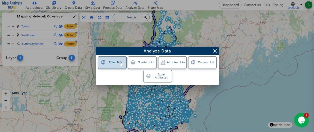
2.Select “Two Layer” and set the layers.
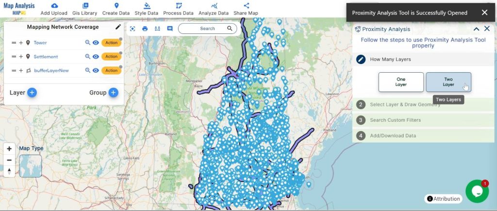
3.Choose the attribute and click on the “Submit” button.
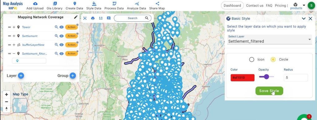
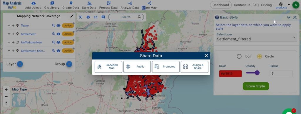
Step 4: Improve Visualization:
Change the basic style for better visualization.
1.Click on the action button and choose “Basic Style.”
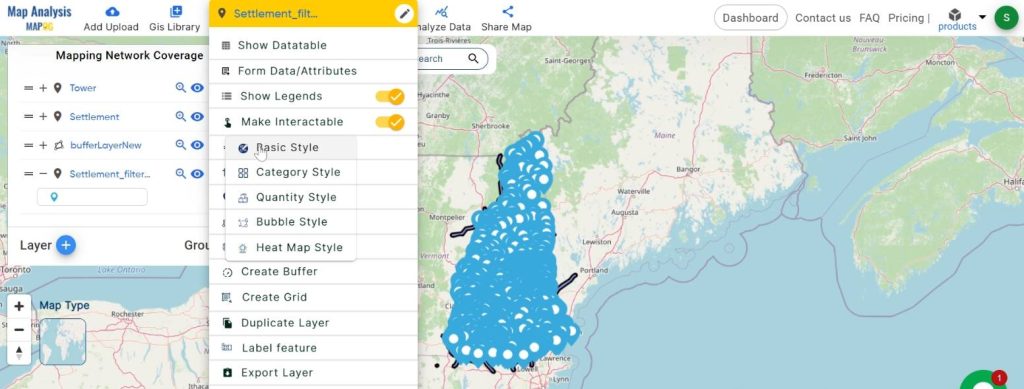
2.Set the radius and click “Save Style.”
Step 5: Share the Map:
Finally, we share the map to communicate our findings and recommendations.
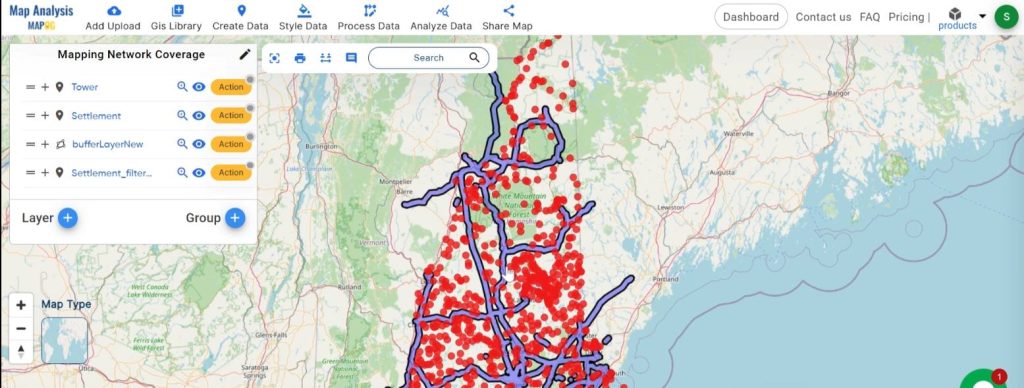
Major Findings:
Our analysis highlights specific areas lacking network coverage. This information guides telecom companies in prioritizing improvements and expanding their networks effectively.
Domain and Industry:
This process is crucial for the telecommunications industry. Reliable network coverage is vital for connecting communities and businesses, ensuring better communication and access to services.
In conclusion, MAPOG is a pivotal tool for enhancing telecommunications. By analyzing maps and optimizing infrastructure placement, we can ensure better connectivity and communication for all. Through strategic planning and data analysis, GIS helps us create a more connected and efficient world.
Link of the Data:
Explore the data further through our GIS Data product, uncovering valuable information for in-depth analysis and understanding.