Mapping is a powerful tool that helps individuals and businesses visualize data, plan strategies, and share insights. With free custom mapping solutions like MAPOG, you can create interactive and free custom maps that bring data to life. MAPOG allows users to integrate GIS data seamlessly, customise maps, and share them effortlessly. Whether for Travel Planning, Real Estate Insights, or Business Analysis, custom maps enhance decision-making and communication.
Key Concepts & Benefits of Free Custom Mapping
Free Custom mapping enables users to design personalised maps tailored to their needs. By leveraging GIS integration, geospatial data can be used for precise mapping and better analysis. The ability to collaborate and share maps enhances teamwork, while effective data visualisation simplifies complex information, making it easier to interpret and utilise.
- Custom Maps: Build your map with personalised data layers.
- GIS Data Integration: Use location-based datasets to enhance insights.
- Data Visualisation: Customise styles, icons, and labels for clarity.
- Collaboration & Sharing: Export and share maps seamlessly.
Step-by-Step Guide to Free Custom Mapping
1. Access MAPOG Platform
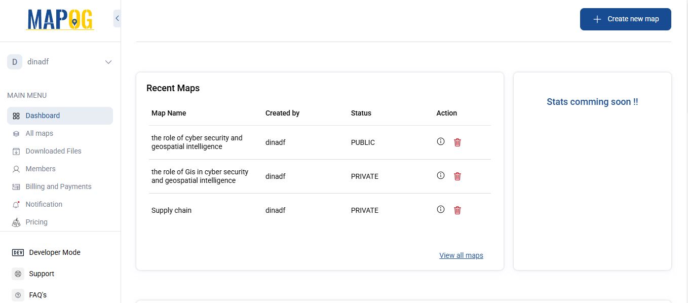
- On MAPOG , click the “Create New Map” button in the top-right corner of the homepage. by Clicking on, Give your map a meaningful name and a brief description to define its purpose.
2. Add GIS Data
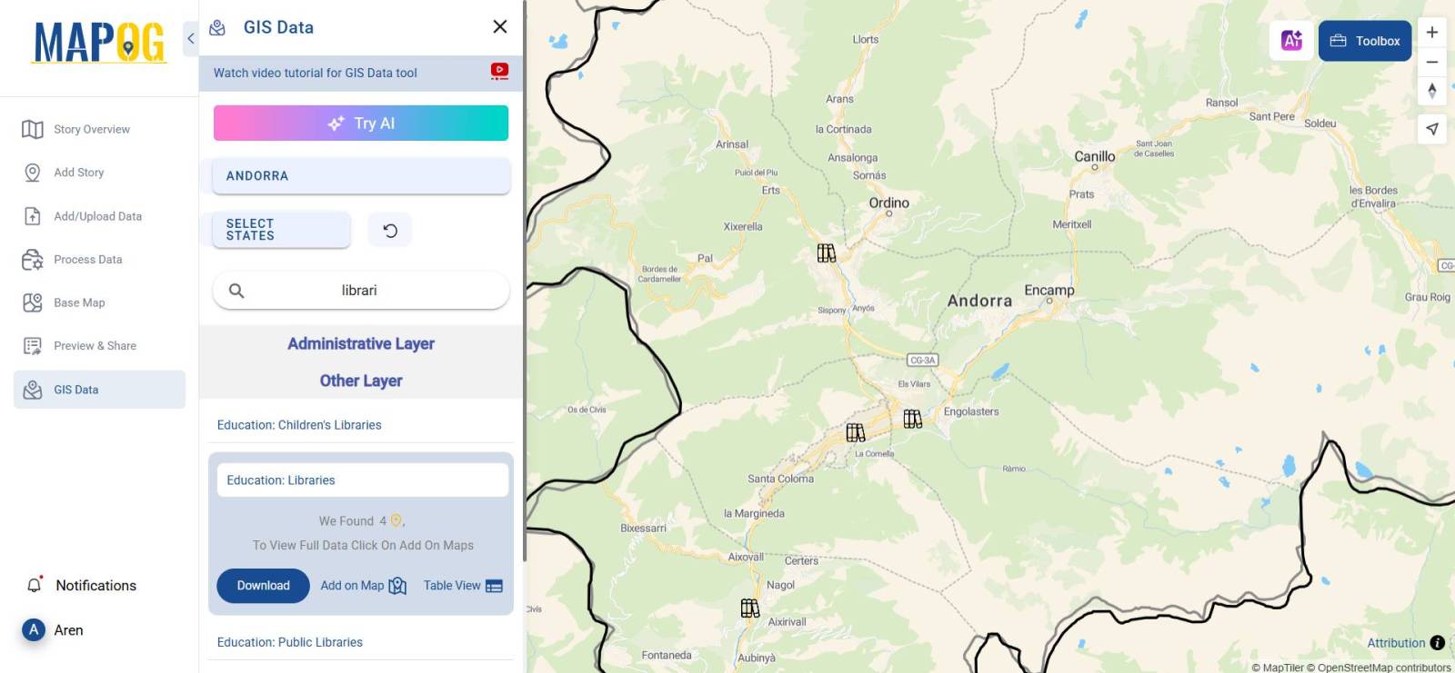
- Using the built-in GIS data, Select the Country or Region you want to map.
- Use the search bar to find specific data points (e.g., Education : School , Education : Libraries).
- Click “Add on Map” to seamlessly integrate the selected GIS data.
3. Process Data for Insights
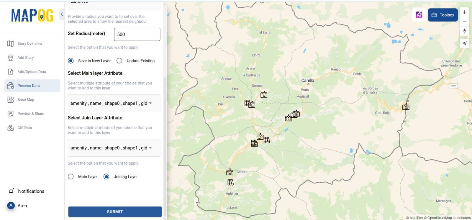
- On the left panel, Click “Process Data“ & select Nearest Neighbour Tool.
- Select School as the Main Layer and libraries as the Joining Layer and apply.
- Specify the search distance in MAPOG to show only relevant results. To find libraries near schools, set radius to 500 meters.
- Save it in a new layer and provide a desirable attribute for both the main and join layers and Submit.
4. Customise Your Layers
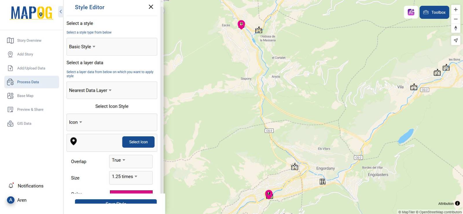
- Click Style Layer under the Action button to Adjust styles (Colours, Icons, Opacity, and Borders) for better visualisation.
- On Clicking, Style Layer > Select Style You Want to Add > “Basic Style“.
- Select a Data Layer on which you have do the Styling , Select Icon , Set Overlap , Set Size , Choose Colour & Save Style.
5. Preview & Share
- Go to the Preview & Share option in the left panel and easily share the map with colleagues and stakeholders Publicly or Privately.
- Share the Embed Map Link to any website and provide map access by adding users and assigning them desired roles as per requirements.
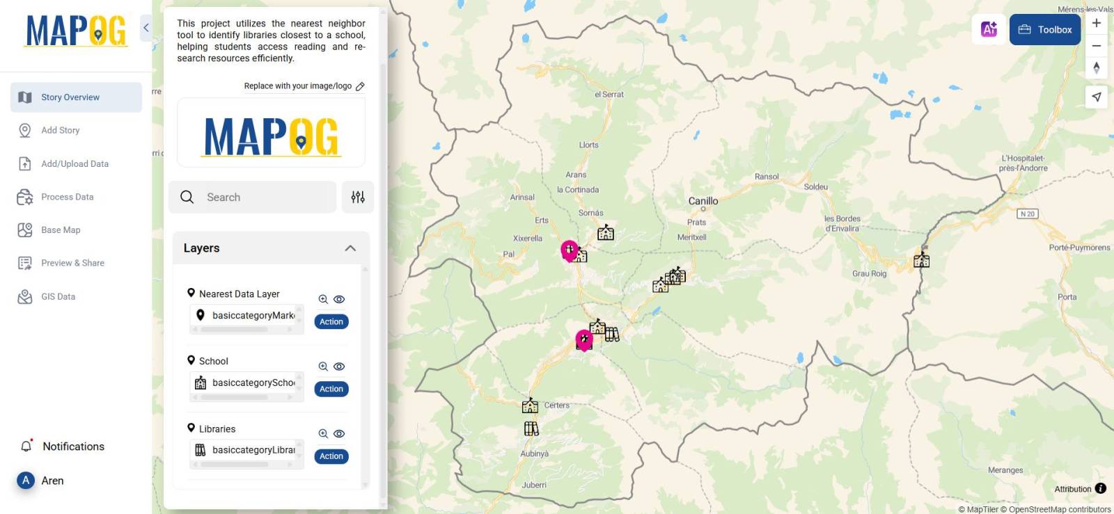
MAPOG is the go-to solution for every industry, user, and use case, offering powerful GIS tools that simplify data visualisation, spatial analysis, and decision-making. With features like seamless GIS data integration, free custom map layering, nearest neighbour analysis, and intuitive styling, MAPOG empowers users to create meaningful, data-driven maps without coding expertise. By creating this map, users can effortlessly identify libraries near schools within a defined distance, enhancing educational accessibility and planning. The ability to customize styles, share maps with stakeholders, and embed them into websites makes MAPOG an indispensable tool for urban planning, real estate, travel, logistics, and beyond.
Major Findings
- Custom mapping provides a clear and structured approach to geographic analysis.
- GIS data enhances decision-making by offering location-based insights.
- Free mapping tools allow users to create maps without coding expertise.
- Interactive maps improve collaboration and communication across industries.
Industry & Domain Applications of Free Custom Mapping
- Travel & Tourism: Route planning, destination mapping.
- Real Estate: Site selection, property analysis.
- Retail: Store location analysis, customer reach.
- Education: Teaching geographic concepts with interactive maps.
- Logistics & Transportation: Planning efficient delivery routes.
GIS Data Used
Conclusion
Free custom mapping tools like MAPOG empower users to visualize, plan, and share geographical insights with ease. Whether for personal use or business applications, interactive maps enhance understanding and decision-making.
Explore more about Free Custom Mapping in our latest blogs:
The Travel Map: Effortless Route Planning & Navigation with GIS | Best Travel Tech
Mapping Top University Nations: A Quantitative Approach
District-Wise Disability Population Analysis Using Heat Maps | Easy Insights & Mapping
Create a Tourist Itinerary Map for the Ultimate Travel Experience
Isochrone Analysis in GIS: Optimize Travel Times for Faster Delivery & Urban Planning