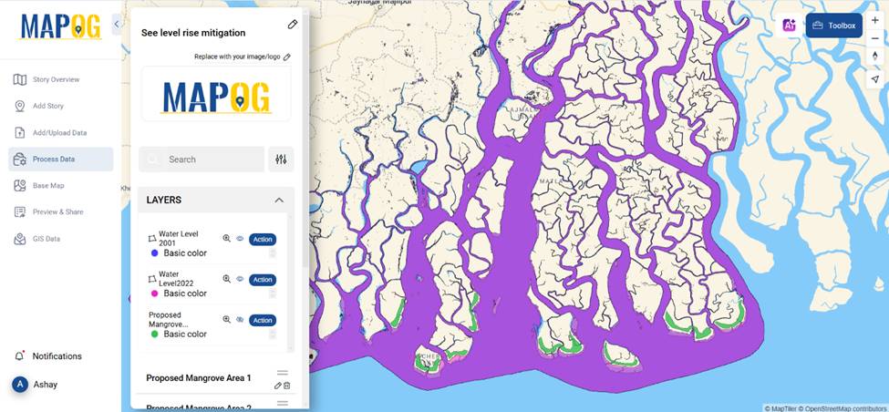
Rising sea levels pose a significant threat to coastal communities, ecosystems, and infrastructure. Geographic Information Systems (GIS) offer a powerful way to predict and mitigate the effects of rising sea levels by analyzing past water level data, modeling future changes, and planning mitigation strategies. By leveraging GIS technology, decision-makers can visualize vulnerable areas and implement proactive solutions.
Key Concept
The analysis of spatial data through GIS systems enables scientists to forecast and manage upcoming sea level increases because it determines susceptible coastal regions and generates flood projection models as well as assesses infrastructure and population safety areas. The capability of policymakers to create adaptive strategies through GIS technology allows them to develop coastal defenses and land-use planning systems which minimize climate change risks and enhance resilience.
Understanding the Impact of Rising Sea Levels with GIS
GIS enables experts to analyze historical data and predict future trends. For instance, comparing water level data from 2001 and 2022 provides insights into long-term changes. By overlaying flood zones, population density, and infrastructure data, GIS tools help assess the severity of sea-level rise on specific regions.
How GIS Helps in Mitigation
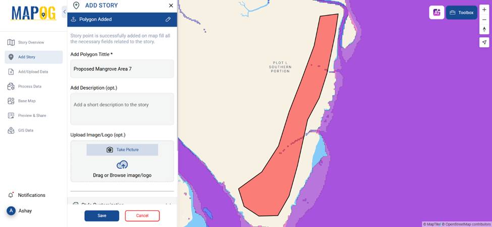
GIS is not just about predicting sea-level rise—it also aids in planning effective mitigation strategies. One such approach is the strategic placement of mangroves, which act as natural barriers against coastal erosion and storm surges. By using GIS to create proposed mangrove areas, planners can identify the most effective locations for restoration projects.
Discover how Optimizing Forest Management with GIS: Grid-Based Analysis for Sustainable Conservation becomes seamless with MAPOG’s tool—analyzing forests in grids to enhance conservation efforts and sustainability. Dive in to see GIS-powered insights in action!
Examples of GIS-Based Mitigation Strategies
- Proposed Mangrove Plantations: GIS mapping helps pinpoint areas where mangrove reforestation can absorb wave energy and reduce flooding.

- Flood Risk Mapping: By analyzing elevation data, GIS can generate real-time flood risk maps, helping authorities implement early warning systems.
- Urban Planning Adjustments: With GIS, city planners can design resilient infrastructure in flood-prone areas, ensuring sustainability.
How MAPOG Supports GIS-Based Mitigation
MAPOG plays a crucial role in tackling sea-level rise through its interactive mapping features.
By uploading water level data using the “Upload Vector data” and creating polygons for proposed mangrove areas, users can visualize changes and plan effective interventions.

MAPOG’s ability to overlay different datasets provides a comprehensive view, making it easier to implement long-term solutions.
Easily Geocode Excel Data and Create an Interactive Map using MAPOG’s powerful tool—just upload your file, convert addresses to coordinates, and visualize insights effortlessly on a dynamic map! Try it now to transform raw data into actionable geospatial stories.
Conclusion
GIS is a game-changer in how we predict and mitigate the effects of rising sea levels. By analyzing past trends, mapping risks, and planning strategic interventions like mangrove plantations, GIS empowers communities to build resilience. Platforms like MAPOG make this process accessible and efficient, ensuring that informed decisions lead to lasting environmental protection.
Have you explored GIS for climate adaptation? Share your thoughts in the comments below!
Here are some other blogs you might be interested in
- Protecting Wetlands: Guide to Create GIS Map for Nature
- Mapping Tiger Attack Hotspots – Create an Online Map and Share
- Make Routes for Military Aerial Planning- Through Bearing angle and Distance calculation – Online Route Compass
- Mapping Healthcare Efficiency: GIS Buffer Analysis of Hospital Locations
- Add WMS- Two step online view of WMS layer on a map
- Plot ATM locations on a map and embed on your website
- Map habitat locations of endangered animals & keep track of their living