Assessing transportation system intricacies is an inherently tricky task which may affect residents’ lives and involve destruction of housing. Identify Impact Zones for Future Road Project with MAPOG changes the game of developing infrastructure in straightforwardness and precision by properly determining affected structures. The solution enables efficient planning, minimizes traffic disruptions, and ensures transparency, facilitating the implementation of sustainable road systems that meet stakeholder needs. Begin your journey by uncovering the secrets of “Protecting Wetlands: Guide to Create GIS Map for Nature” where GIS emerges as a stalwart defender of fragile wetland ecosystems.
Key concept to identify Impact Zones for Future Road Project with MAPOG
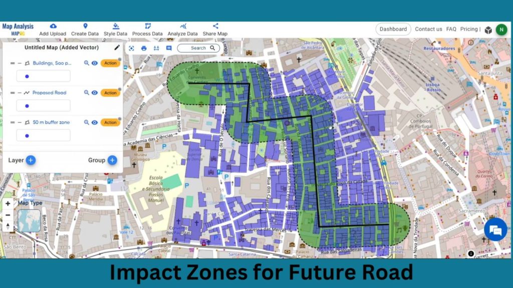
We wish to go with the construction of an illustration, which would represent all the involved structures of the proposed roads. Narrow, it is more like this. The picture expresses the thematic side of urban planning in these areas, that obtained indisputably the qualitative information. The links for GIS DATA which we’re using here are mentioned at the end of the article
Steps to create Pinpointing Impact Zones for Future Road Project Map
Step 1: Add Data
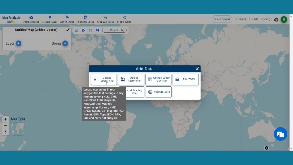
Open Map Analysis interface. Then click on the Add upload button on the header section. A dialogue box will open. Click on “Upload Vector File” to upload the data.
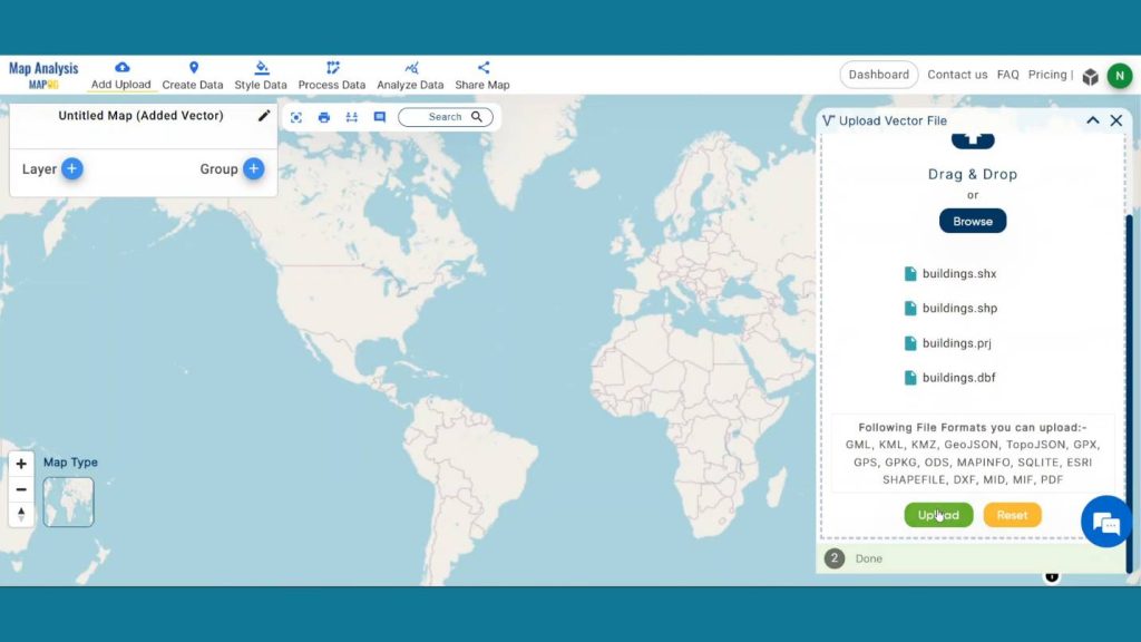
A box will open on the right side of the screen, select Browse option to browse the building data & click Upload to upload the data.
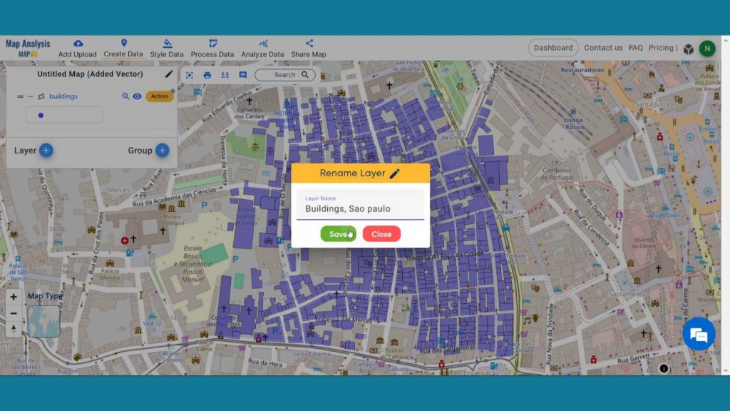
Now click the Action Button of that layer and click on that pencil icon and rename that layer by clicking on save for better understanding.
Step 2: Create New Road
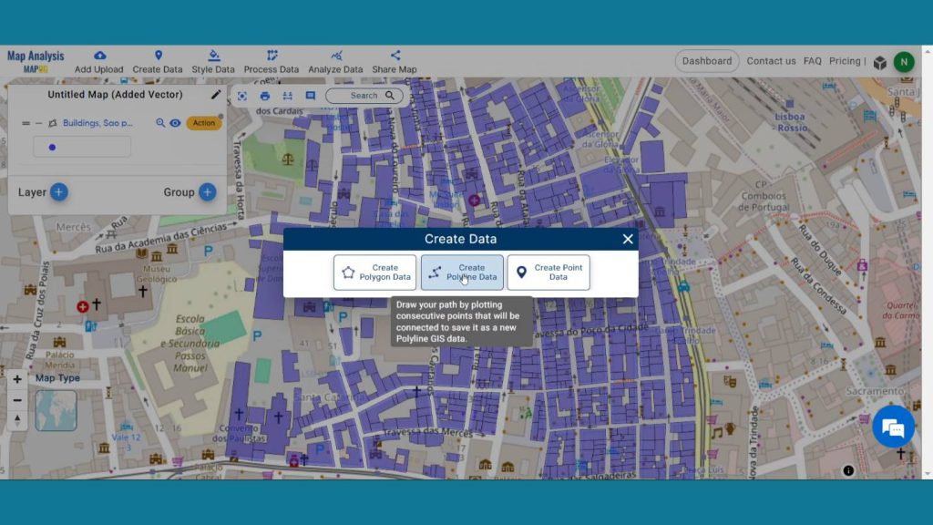
Now go to create Data Option and select the Create Polyline Data option.
Provide a layer name and start drawing a line that will represent the new road. Double click the line to finish drawing, then the attribute area provides value and click on save.
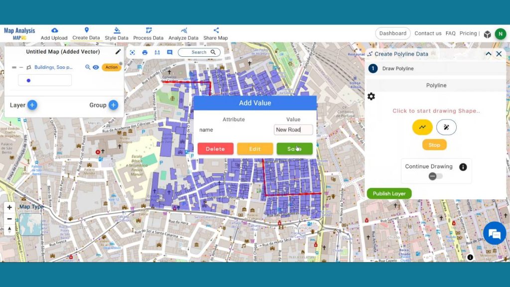
Lastly click on Publish Layer to publish the Proposed Road Layer in the map canvas.
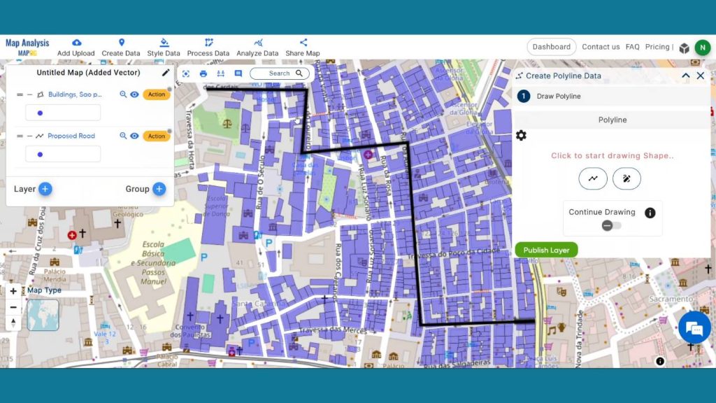
Step 3: Create Buffer Zone
Now to prepare the buffer zone click on Process Data and click on Buffer Tool.
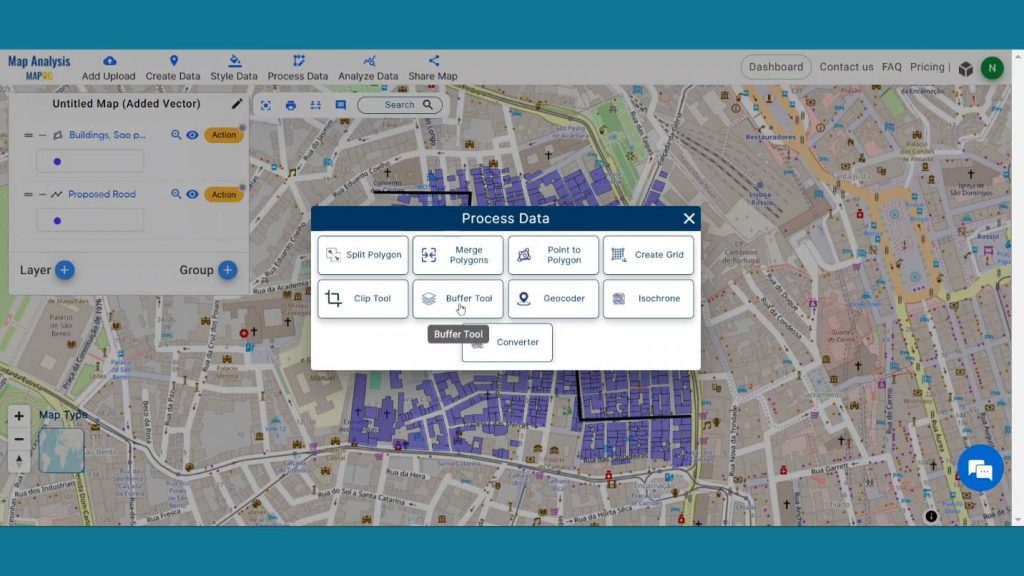
In the select layer option Select the proposed road layer and click on next. After that in the range option write 50 as we are creating a 50-meter buffer zone around the layer.
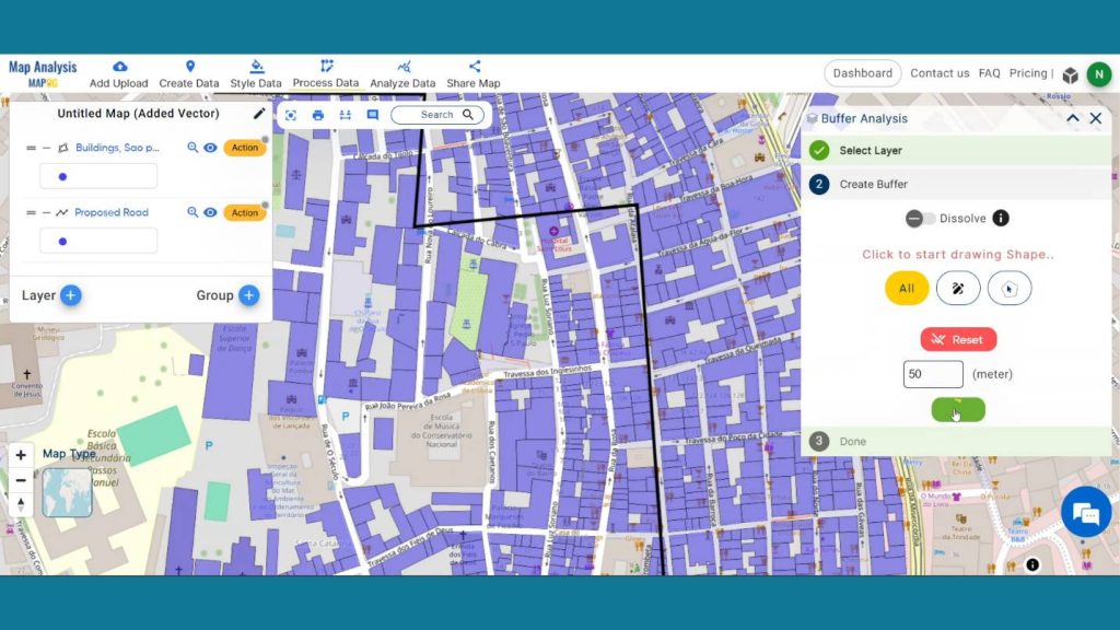
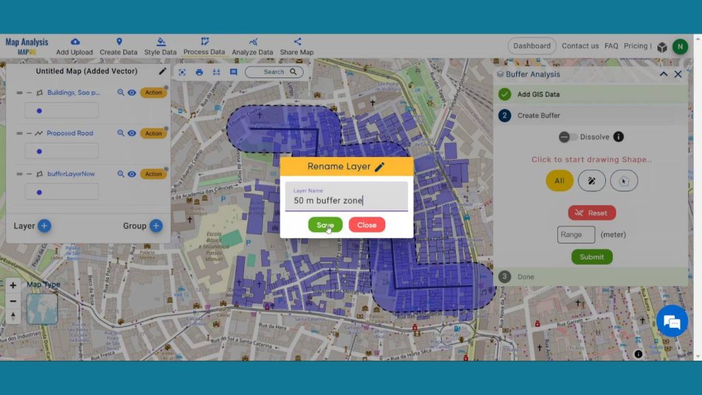
Now click the Action Button of that buffer layer and click on that pencil icon and rename that layer for understanding purpose.
Step 4: Save Project
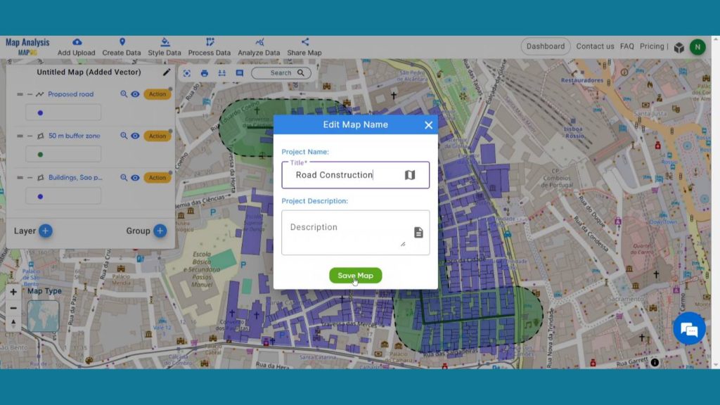
Now, click on the pencil icon situated right after the “Untitled Map” text to save the project. In the dialogue box write proper name and description that describe the project accurately. And click on save map option. Your project will be saved.
Step 7: Results & Analysis
With our map now enriched with details, let’s make those final adjustments. This map is a powerful tool for Efficient Planning, Minimized Disruptions, Enhanced Stakeholder Communication etc. Clear identification of affected structures using MAPOG facilitates transparent communication, fostering collaboration between planners, developers, and affected parties for a smoother road development process.
Major Findings
Precision in Impact Assessment: MAPOG enables precise identification of structures affected by proposed road projects, enhancing accuracy in impact assessment and aiding planners in making informed decisions.
Optimized Resource Allocation: The tool allows for efficient resource allocation by pinpointing affected structures, minimizing unnecessary expenses and ensuring cost-effective road development.
Improved Stakeholder Engagement: MAPOG fosters transparent communication by identifying affected structures, facilitating better engagement with stakeholders, and incorporating community input for a more inclusive and well-supported road development process.
Domain & Industries
This map acts as an efficient tool for Online Urban Planning, Constructing or Engineering Courses, Real Estate Development and more. In this connection, urban planners, use MAPOG to map out the structures that are prone to damage and ensure that new road networks constructed are environment friendly hence having less impacts on the existing infrastructure an the surrounding communities. With “GIS Analysis in Urban Planning: Reshaping Transportation Future Insights of state/city” you can fully immerse yourself in the dynamic landscapes of urban planning and learn how GIS can transform transportation and optimize it for a sustainable and connected future.
Conclusion
In conclusion, utilizing MAPOG for pinpointing impact zones in future road projects proves instrumental. Its precise mapping and analysis streamline planning, ensuring efficient resource allocation. Embracing MAPOG enhances project accuracy, minimizes disruptions, and fosters sustainable development in the realm of transportation infrastructure.
Here are some other blogs you might be interested in
- Fast Emergency Response: Using GIS and Isochrone Maps for 10-Minute Ambulance Arrival
- Mapping Tiger Attack Hotspots – Create an Online Map and Share
- Make Routes for Military Aerial Planning- Through Bearing angle and Distance calculation – Online Route Compass
- Mapping Healthcare Efficiency: GIS Buffer Analysis of Hospital Locations
- Add WMS- Two step online view of WMS layer on a map
- Plot ATM locations on a map and embed on your website
- Map habitat locations of endangered animals & keep track of their living