Biosphere reserves, designated areas crucial for conserving biodiversity, represent nature’s treasures unveiled. In our exploration, we delve into the significance of these pristine sanctuaries. Join us as we unveil the wonders of creating a Biosphere Reserves Map: Iconic Fauna Representation with GIS, and their contribution to our planet’s ecological well-being with MAPOG.
Key concept for Biosphere Reserves Map: Iconic Fauna Representation
Despite the vital role of biosphere reserves in conserving biodiversity and promoting sustainability, there is often a lack of awareness and understanding among the general public about their significance and importance.
Through this work, we aim to raise awareness and educate readers about the significance of these protected areas in an informative and attractive way. Also, check our other blog Map habitat locations of endangered animals & keep track of their living.
Process:
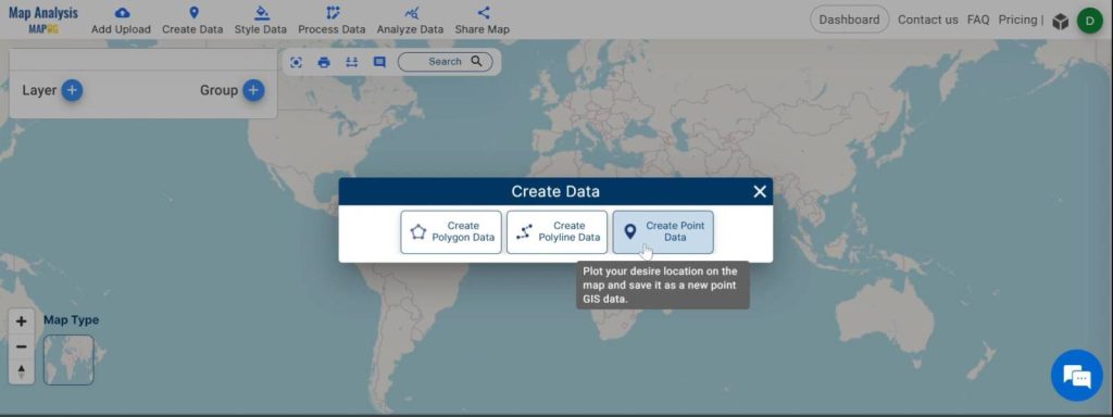
Step 1:
Navigate to MAPOG Map Analysis Interface. Once in the interface, click on the option “Create Data” from the menu toolbar. Then select “Create Point Data” to initiate the process of adding point data to the map.
Step 2:
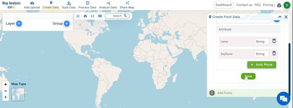
Now, a create point data tool opens on the screen. First assign a name to the layer you’re creating, ensuring it accurately represents the data you’ll be adding.
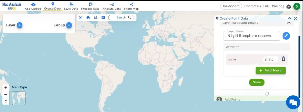
Step 3:
After naming the layer, proceed to click on the “Add More” button to include additional attributes to the data points.
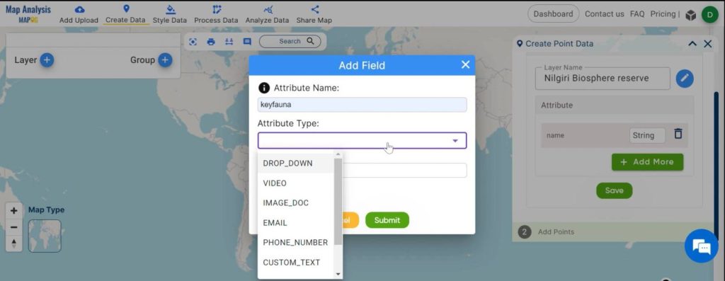
Step 4:
Enter the desired attribute name, such as “Keyfauna,” to identify the featured fauna associated with each data point. Select the appropriate attribute type from the available options, in this case, “Custom Text” to accommodate the names of the key fauna.
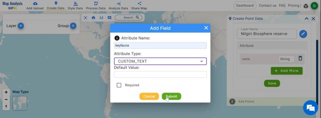
Step 5:
Once the attribute details are specified, click “Submit” to confirm the addition and click “Save”.
Step 6:
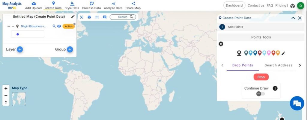
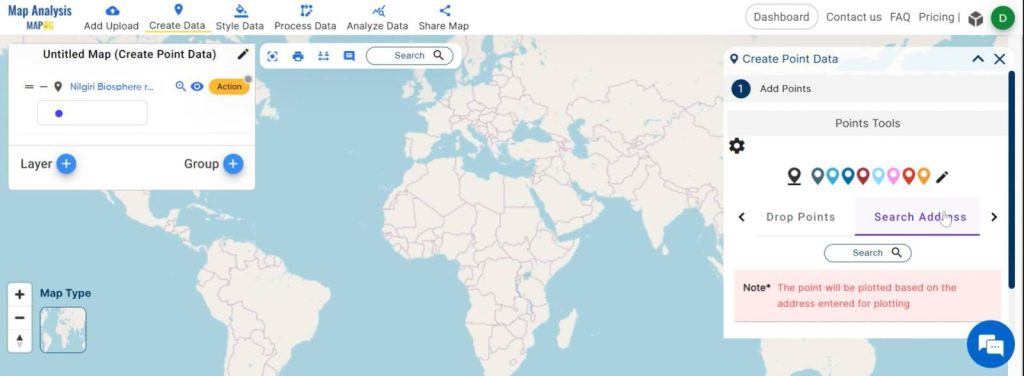
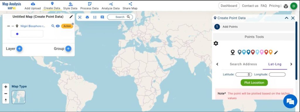
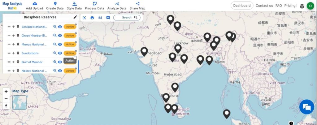
Now, you can proceed to add Point data representing biosphere reserves using one of three available options:
- Manually dropping points using the “Drop Point” feature.
- Searching for specific addresses or locations using the “Search Address” functionality.
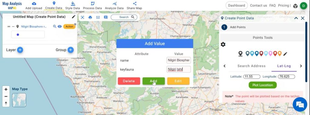
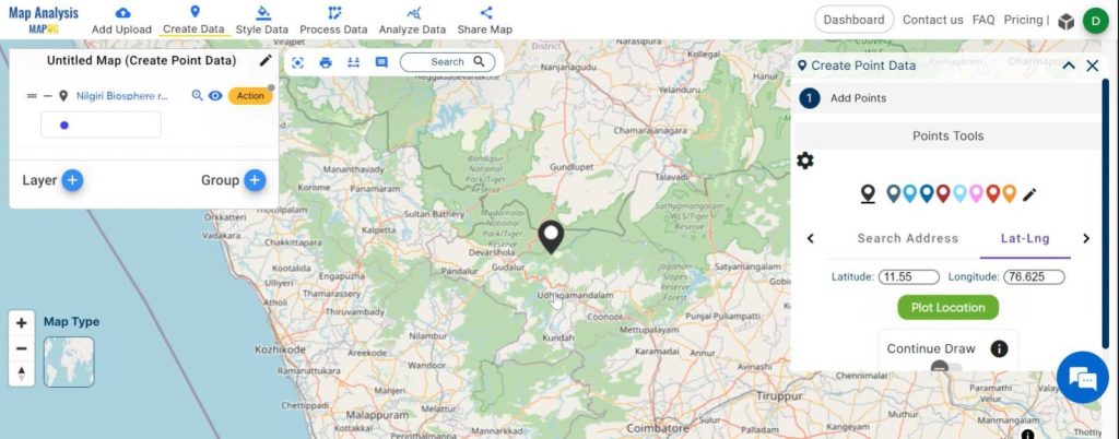
- Entering precise latitude and longitude coordinates manually via the “Lat and Lng” option. This option is preferred for this particular work. First, put the latitude and longitude, then click “Plot Location”.
Step 7:
After placing the data point, provide the relevant attribute values, including the key fauna associated with the respective biosphere reserve. Then “Add”.
Step 8:
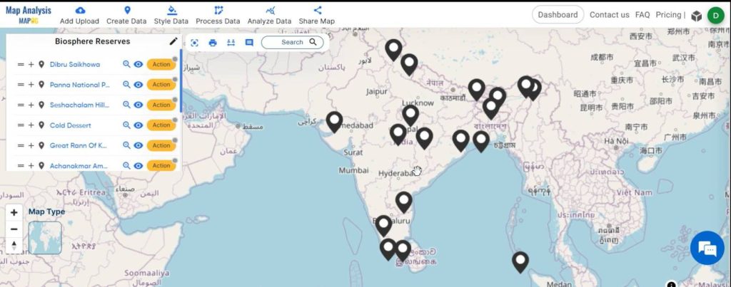
One biosphere reserves point layer is added now. Similarly, create individual point layers for each biosphere reserve.
Step 9:
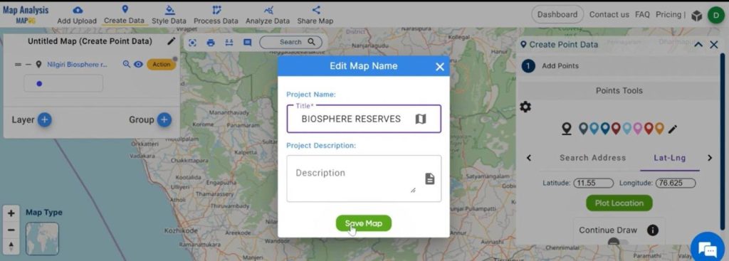
After that, give the untitled map a suitable name. Go to the “Edit Map Name” option, enter the name, and click “Save Map”.
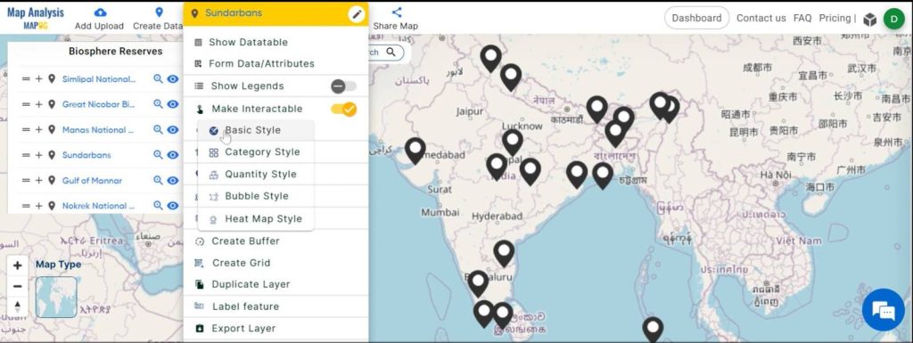
Step 10:
To visually distinguish each biosphere reserve on the map, customize the icons representing the data points by Navigating to the specific layer containing the point data. Access the “Action” button and select “Style Data.” Choose the “Basic Style” option to modify the appearance of the icons.
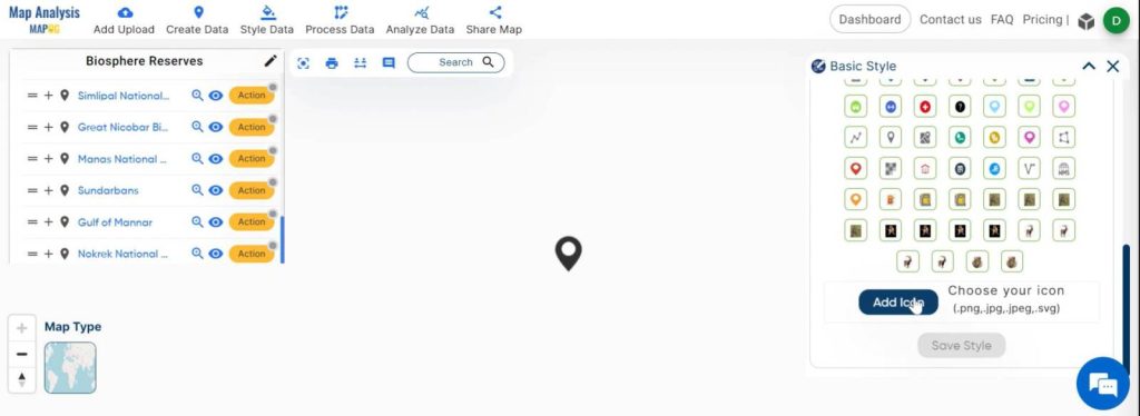
Step 11:
Now, go to the “Add Icon” option, Select your desired image file (PNG, JPG, JPEG, or SVG) depicting the key fauna to serve as the new icon. Then ” Upload and Save”.
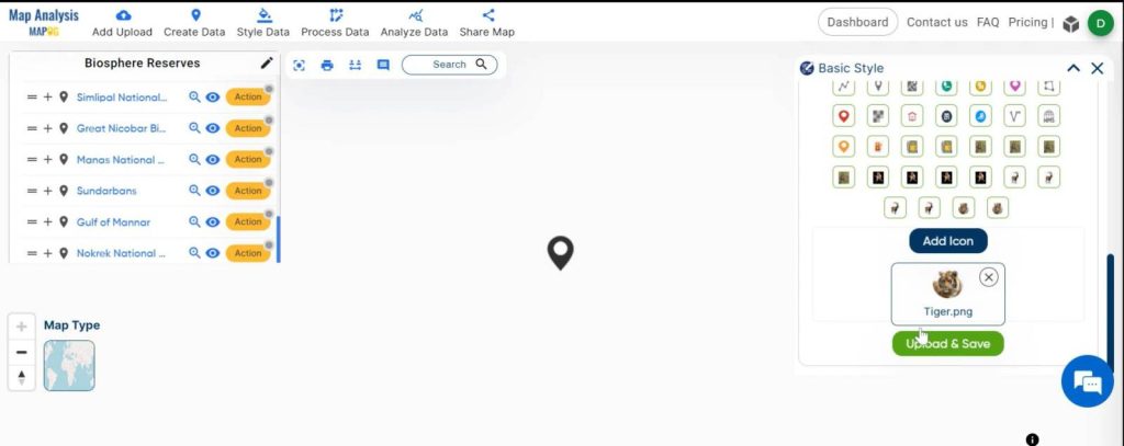
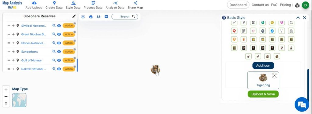
Step 12:
Repeat the icon customization process for each biosphere reserve data point, ensuring consistency in featuring the key fauna.
Step 13:
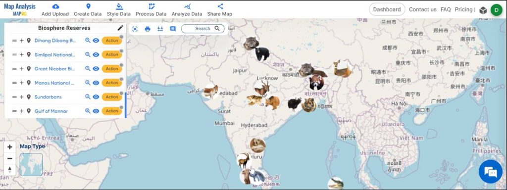
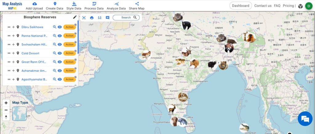
The final map showcasing biosphere reserves, each represented by an icon featuring its key fauna, is now ready for use and exploration.
Major Findings of Create Biosphere Reserves Map: Iconic Fauna Representation with GIS:
Through the exploration of biosphere reserves on the map, we gain insights into:
- The distribution and diversity of biosphere reserves of a geographic area.
- The key fauna associated with each reserve, highlight their unique ecological characteristics.
- Opportunities for ecotourism and sustainable development within these protected areas.
Industry and Domain:
Industries benefitting from biosphere reserve exploration include:
- Wildlife Conservation: Enhancing efforts to protect and preserve endangered species and their habitats.
- Environmental Conservation: Informing strategies for sustainable resource management and ecosystem restoration.
- Ecotourism: Identifying potential destinations for responsible travel and promoting awareness of biodiversity conservation.
Conclusion For Create Biosphere Reserves Map: Iconic Fauna Representation with GIS:
Our exploration of biosphere reserves through the lens of MAPOG has illuminated their critical role in preserving biodiversity and promoting sustainable practices. By harnessing the power of technology and education, we can further elevate awareness and appreciation for these invaluable natural habitats. Let’s continue to support conservation efforts and responsible stewardship of our planet’s treasures. Visit MAPOG today to embark on your own journey of discovery and conservation.