Welcome to MAPOG, your comprehensive spatial analysis and visualization tool. Today, we’ll delve into the essential process of selecting administrative boundaries and preparing data for analysis using the clip and crop tools within the MAPOG Map Analysis tool. In the realm of Geographic Information Systems (GIS), these tools are indispensable for refining datasets, extracting specific regions of interest, and enhancing the efficiency of spatial analysis. Join us as we explore how to effectively utilize these tools within MAPOG to streamline your GIS workflows and unlock valuable insights from your data.
Key Concept:
The key concept is utilizing the clip and crop tools within the MAPOG Map Analysis tool to efficiently select administrative boundaries and prepare spatial data for analysis. These tools play a vital role in refining datasets, extracting relevant regions of interest, and enhancing the overall efficiency of spatial analysis workflows. By leveraging the capabilities of MAPOG, users can streamline the process of data preparation, leading to more accurate and insightful analysis results. Additionally, MAPOG offers a range of tools, in fields such as digitalization, isochrones, route compass, urban planning, merging polygons, and environmental protection.
Step-by-Step Process
Step 1: Access the Analysis Tool
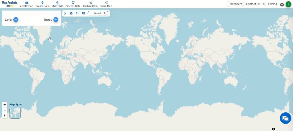
Begin by accessing the MAPOG Map Analysis tool, your go-to platform for spatial analysis tasks.
Step 2: Upload Administrative Boundary Data
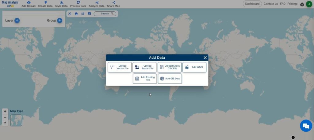
Click on “Add Upload” and select “Add GIS Data” to upload your administrative boundary datasets into the tool.
Step 3: Utilize the Crop Tool
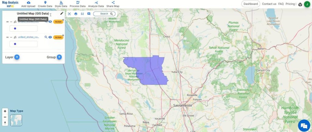
Once the data is uploaded, use the crop tool to select a specific region of interest within the administrative boundary datasets. This helps narrow down the focus for analysis.
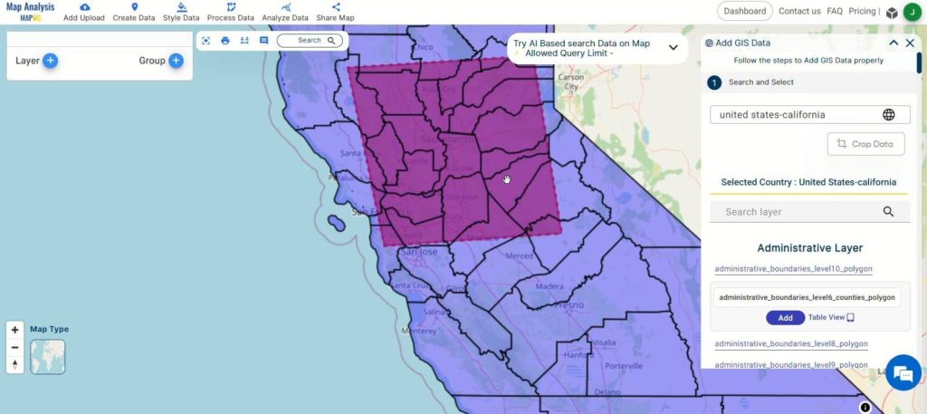
After selecting the cropped region, click on the “Add” button to add the datasets to the map analysis tool for further processing.
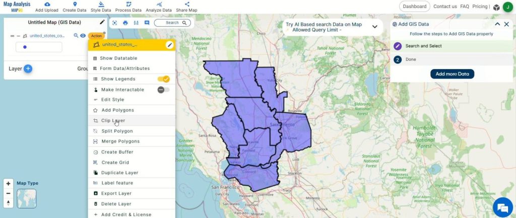
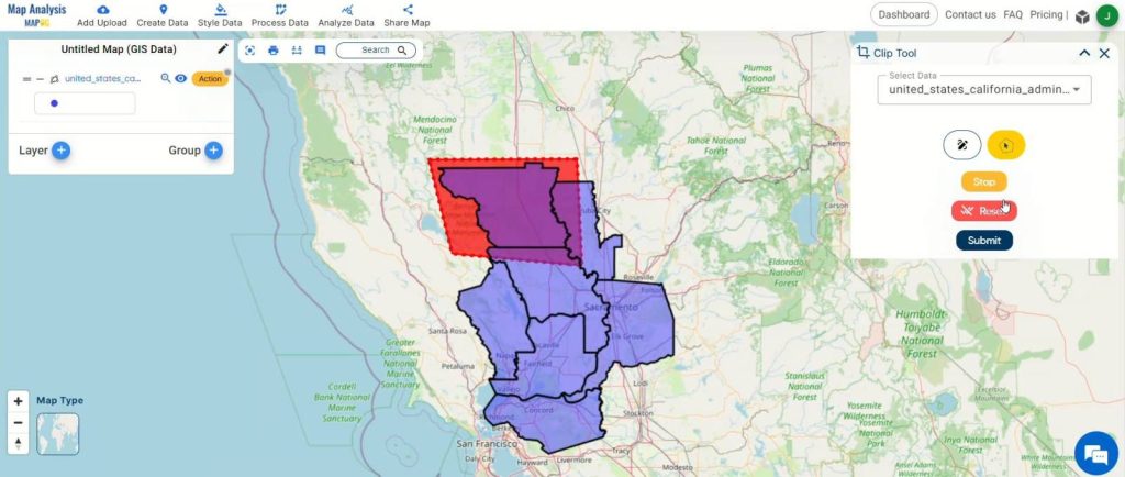
Step 5: Alternatively, Use the Clip Tool
Another method for selecting a specific region is by utilizing the clip tool. Click on the layer containing the administrative boundaries and select the clip tool to define the exact area of interest.
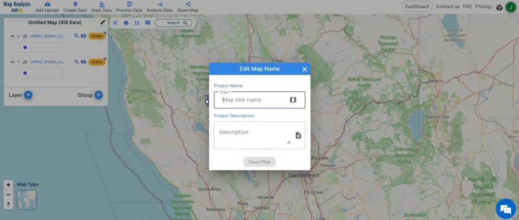
Step 6: Rename and Save Map
Click on the pencil icon to rename the map if desired. Then, click “Save Map” to apply the changes and keep your data organized.
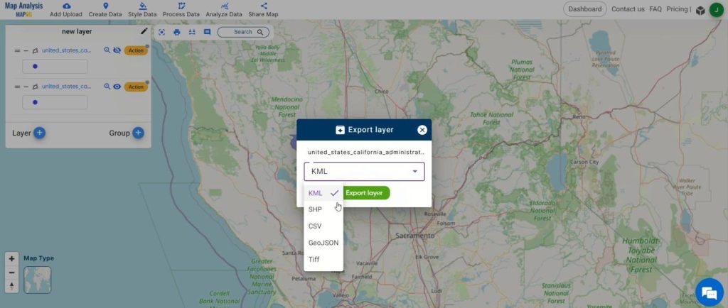
Step 7: Export Processed Data
Once the analysis is complete, export the processed data in any desired format by clicking on the action button and selecting “Export Layer.”
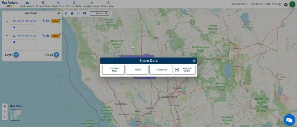
Step 8: Share Findings
Share your findings with others effortlessly to foster collaboration and informed decision-making.
Major Findings:
The analysis using MAPOG‘s clip and crop tools revealed significant findings. These tools efficiently selected and prepared administrative boundary data, enhancing the accuracy of spatial analysis. By refining datasets and extracting specific regions of interest, users gained valuable insights and improved decision-making. Overall, MAPOG‘s tools streamline data preparation and empower users to derive meaningful outcomes from spatial analysis projects.

Domains and Industries Benefiting
- Banking and Financial Services
- Retail and Commercial Real Estate
- Urban Planning and Development
- Government and Public Services
- Marketing and Advertising
- Environmental Conservation
- Transportation and Logistics
- Healthcare
Conclusion
In conclusion, the utilization of MAPOG‘s tools, such as clip and crop, facilitates efficient data selection and preparation for spatial analysis. These tools empower users across various domains and industries to derive valuable insights, optimize decision-making processes, and drive meaningful outcomes. By streamlining data preparation and enhancing analysis capabilities, MAPOG contributes to improved efficiency, productivity, and success in spatial analysis projects.
Other Articles
- Create a Map to find suitable sites for constructing a new house
- Create Map for Analyzing Water Quality using Heat Map Style
- Create Map – School Map Area Coverage Through Buffer Analysis
- Mapping Safety Create GIS Map : Game-Changing Approach to Hospital Risk Analysis
- Create Map for Real Estate Developer for Best Site Selection
- Create Map for Landfill Optimization: Spatial Analysis Approach