In ‘Forest Management Using Split Polygon Tool,’ we employ MAPOG Map Analysis to divide forested regions into equal parts, optimizing resource allocation and conservation efforts for sustainable forest management.
Key Concepts
MAPOG is an outstanding tool for creating interactive and innovative maps. We can employ this tool to divide forested regions into equal parts, optimizing resource allocation and conservation efforts for sustainable forest management.
This project provides a comprehensive output map for efficient resource allocation and conservation planning by dividing forest areas into equal segments.
Unlock the potential of highway buffer mapping for precise building overlap analysis and road extension strategies by “Mapping highway Buffer and Building Overlap Analysis – Extend Roads Width”. Explore how this technique enhances infrastructure planning and safety measures with targeted road width adjustments.
What is Split Polygon?
The split polygon tool in GIS divides a polygon feature into multiple segments, allowing for precise spatial analysis and customization. It is useful for refining boundaries, creating distinct regions, and analyzing spatial relationships within geographic datasets.
Purpose of using Split Polygon
- Refining Boundaries: Splitting polygons helps in refining boundaries of features to accurately represent geographic entities or administrative divisions.
- Analyzing Spatial Relationships: It enables the analysis of spatial relationships within polygons, aiding in identifying distinct areas or features within a larger region.
Benefits of using Split Polygon
- Detailed Spatial Analysis: Splitting polygons allows for more nuanced spatial analysis, facilitating the examination of specific areas within larger features.
- Customization: It enables the customization of geographic datasets, providing flexibility in defining boundaries and creating tailored regions for diverse applications.
Steps to create Forest Management: Step-by-Step Guide to Split Polygon for Effective Maps
Step 1: Add GIS Data
First, navigate to the Map Analysis interface. Then click on the “Add upload” button in the upper left corner. A dialogue box will open. Click on “Add GIS Data” to add data.
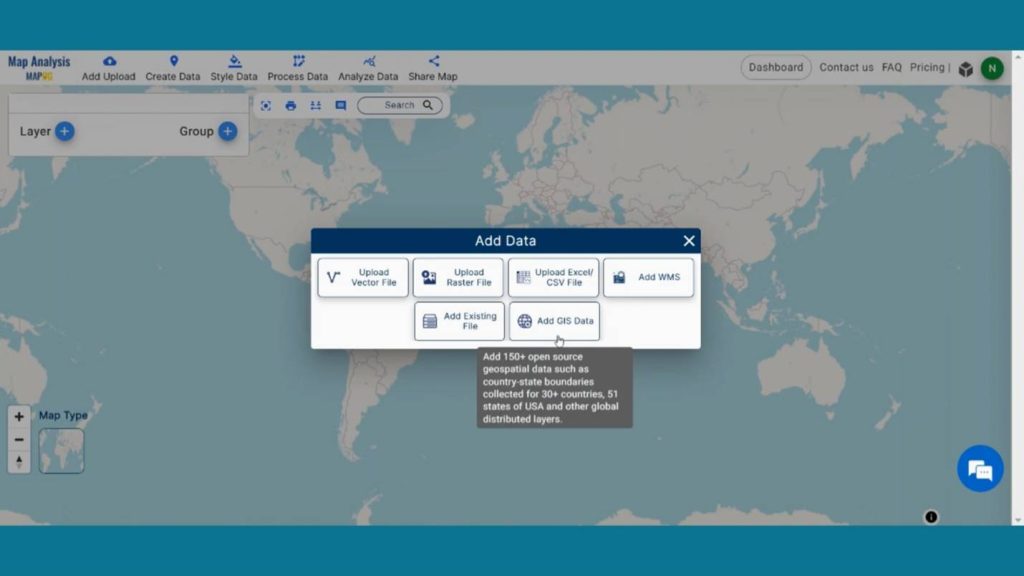
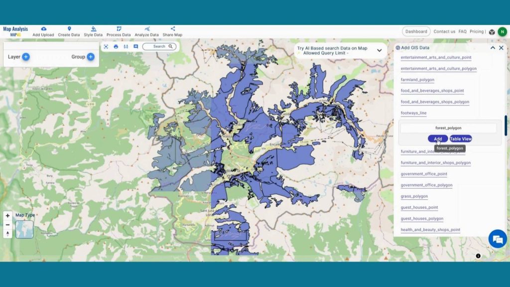
In the right corner box Provide the country name. Then, in the other layer option search for a forest area layer and by clicking Add option add this layer to map canvas.
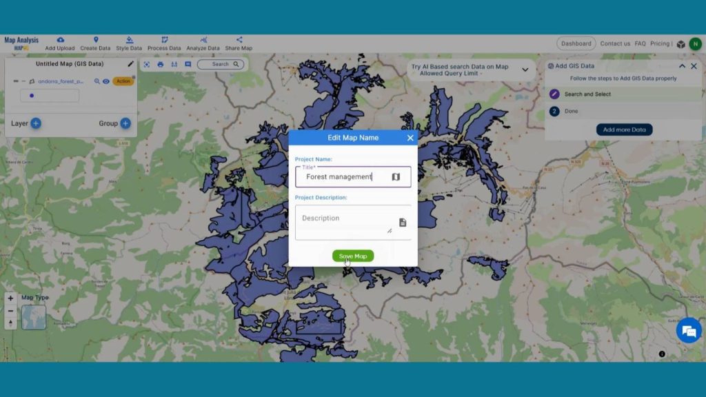
Step 2: Save Project
Now, click on the pencil icon situated right after the “Untitled Map” text to save the project. In the dialogue box write proper name and description that describe the project accurately. And click on save map option. Your project will be saved.
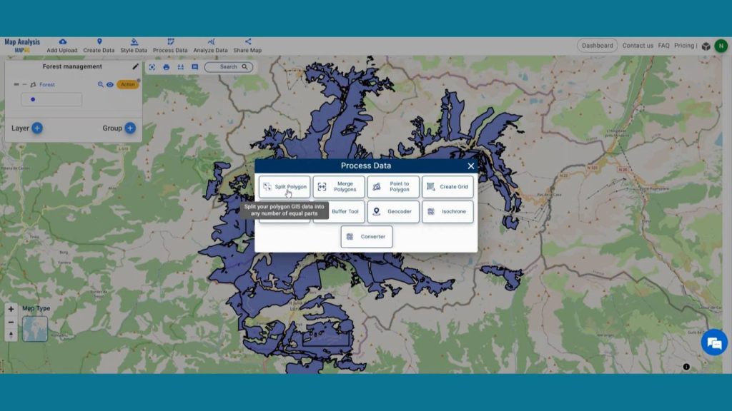
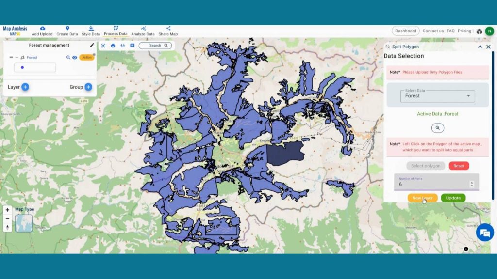
Step 3: Split Forest Area
Now we are going to split the forest using split polygons. To do that click on Process Data from the header and click on split polygon.
Create a sustainable future with landfill optimization using spatial analysis techniques. Dive into how buffers, split polygons, and grid creation revolutionize waste management strategies in “Create Map for Landfill Optimization: Spatial Analysis Approach”
In data selection select the forest layer. Then select your desirable polygon and provide the number of parts you want to split. Then click on a new polygon. Your new layer will be added on the map screen.
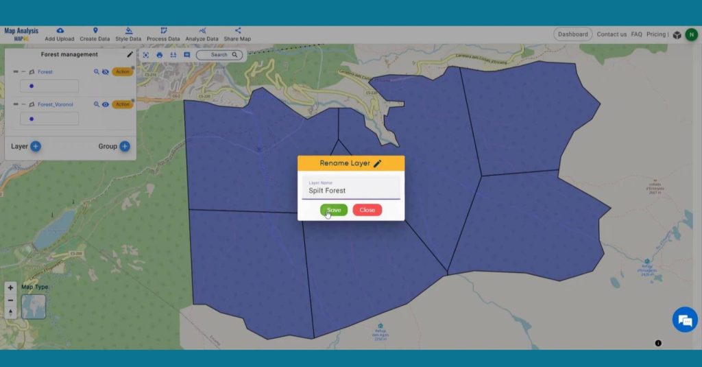
Go to the action button of the new clipped layer. Click on the pencil icon. Rename the layer for better understanding.
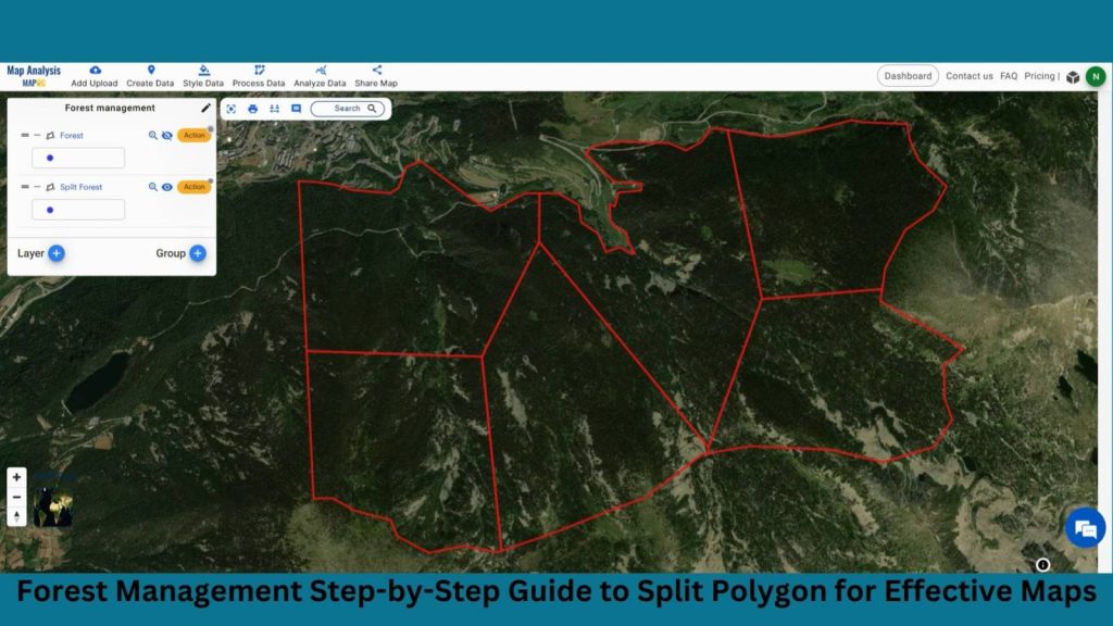
Step 4: Results & Analysis
With our map now enriched with details, let’s make those final adjustments. The utilization of MAPOG’s Split Polygon Tool allows for the efficient division of forest areas, facilitating targeted management practices to enhance sustainability and biodiversity conservation.
Major Findings
Equitable Resource Allocation: Splitting the forest area into equal parts allows for fair distribution of management efforts and resources across the landscape.
Optimized Conservation Strategies: Dividing the forest facilitates targeted conservation efforts, ensuring comprehensive protection of diverse ecosystems within each segment.
Enhanced Monitoring and Assessment: Segmenting the forest enables systematic monitoring and assessment of ecological parameters, aiding in informed decision-making for sustainable forest management.
Domain and Industry
This map is a powerful tool for Forestry Management, Environmental Conservation, Wildlife Management and beyond.
Explore the forefront of forest fire analysis with the Buffer Tool! Delve into how this technique identifies risk areas, empowering proactive measures for forest conservation and community safety in “Analysis of Forest Fire and Map Risk Areas with Buffer Tool”
Conclusion
In conclusion, employing MAPOG’s Split Polygon Tool for forest management enables equitable resource allocation and targeted conservation efforts. By dividing the forest into equal parts, it facilitates optimized monitoring, assessment, and management strategies, ensuring sustainable forest practices that preserve biodiversity and ecological integrity across the landscape.
Industries and domains
Environmental management, urban planning, land use planning, and forestry are industries where split polygons find applications for spatial analysis.
LINKS FOR THE DATA USED FOR THIS PROJECT👍
Here are some other blogs you might be interested in