In forest management, the utilization of Geographic Information System technologies is paramount for enhancing resource management and conservation efforts. Leveraging MAPOG Map Analysis, we embark on a journey to explore the utilization of grids for better decision-making. By integrating forest data onto the map and employing spatial analysis techniques, such as clipping and grid creation, MAPOG facilitates the creation of maps to enhance forest management using grids.
Key Concept
Grids serve as a systematic approach in forest management, optimizing resource allocation and analysis through MAPOG Map Analysis. By integrating forest data and employing spatial analysis techniques, MAPOG facilitates the creation of customized grid systems. This concept highlights the transformative potential of grid-based approaches in enhancing spatial analysis and promoting sustainable forest management practices.
Steps to Create a Map to Enhance Forest Management Using Grids
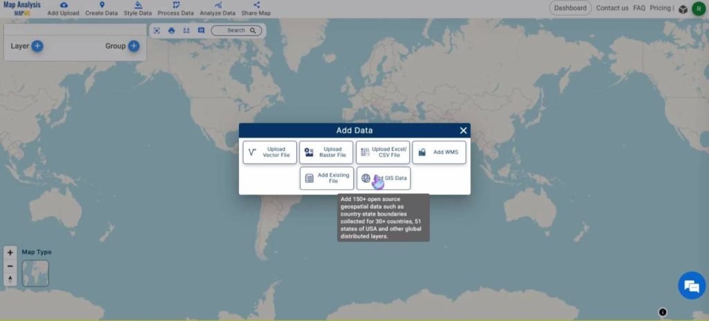
Step 1: Add Data
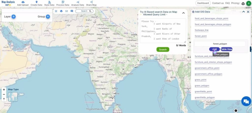
Open the MAPOG Map Analysis page and click on Add Upload in the top ribbon. Then, select the Add GIS Data option.
Give the country name and select the forest area polygon dataset.
Rename the layer to a suitable name by clicking on the Action button and then on the pencil icon near the name of the layer.
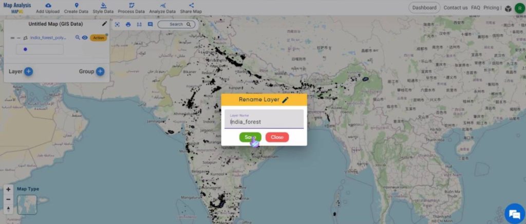
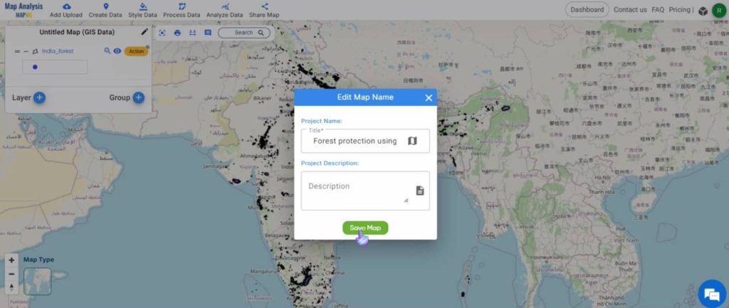
Save the map with an appropriate name by clicking on the pencil icon near the name of the map.
Step 2: Clip the data
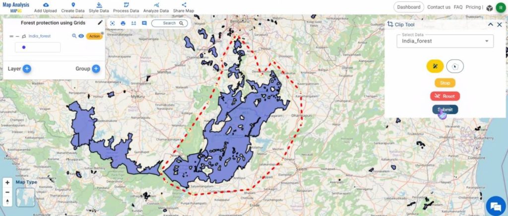
Click on Process Data and select the Clip tool.
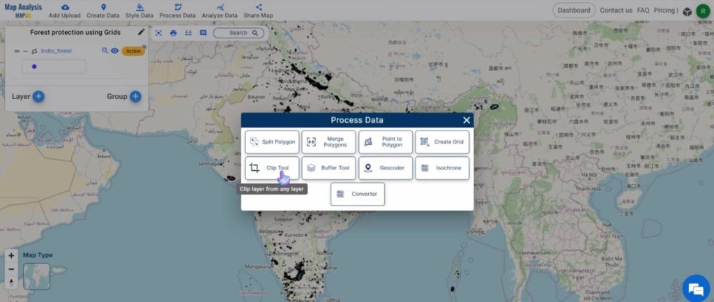
In the dialog box that appears on the right, select the forest layer from the drop-down box. Then, zoom into the required region and click on the free-hand drawing option. Draw the boundary around the required region and double-click when finished. Finally, click on Submit.
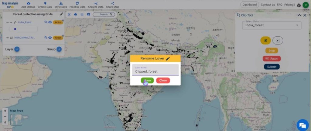
Rename the clipped layer by clicking on the Action button and then on the pencil icon near the name of the layer.
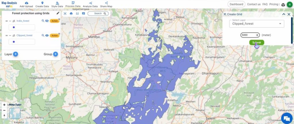
Step 3: Create Grids
Click on Process Data and select the Create Grid tool.
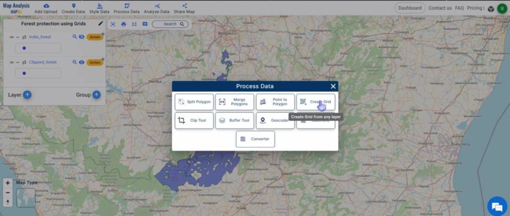
In the dialog box that opens on the right, give the layer name and the range for which the grid needs to be created.
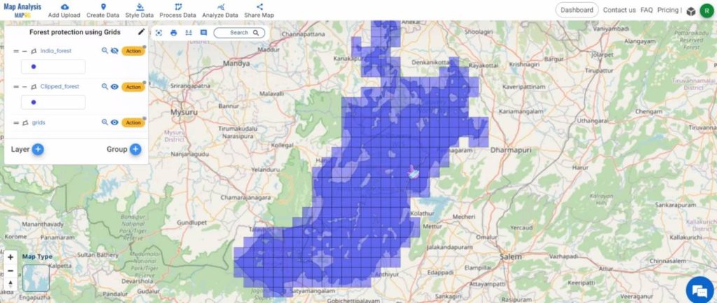
Given below is the final map.
Key Findings – Create a Map to Enhance Forest Management using Grids
- Optimized Resource Allocation: Grid-based forest management facilitates resource allocation by dividing forested areas into manageable units.
- Enhanced Spatial Analysis: The utilization of grids enhances spatial analysis capabilities.
- Improved Decision-Making: Grid-based approaches empower forest managers to make informed decisions by providing a structured framework for evaluating and prioritizing management interventions based on spatial data analysis.
- Enhanced Monitoring and Evaluation: Grid-based forest management facilitates enhanced monitoring and evaluation of forest conditions and management interventions over time, enabling stakeholders to track changes and assess the effectiveness of conservation measures.
Domain and Industry
- Forest Managers and Administrators: Grid-based forest management benefits forest managers and administrators by providing a systematic framework for resource allocation, spatial analysis, and decision-making, leading to more effective forest management practices.
- Environmental Conservation Organizations: Environmental conservation organizations benefit from grid-based forest management through improved monitoring, evaluation, and targeted conservation efforts, promoting the preservation of forest ecosystems and biodiversity.
- Local Communities: Local communities benefit from grid-based forest management by ensuring sustainable use of forest resources, supporting livelihoods, and promoting community engagement in forest conservation initiatives.
Conclusion
In conclusion, grid-based forest management using MAPOG Map Analysis offers a systematic and effective approach to optimizing resource allocation, spatial analysis, and decision-making in forest management practices. Through the creation of a structured grid system, MAPOG enables stakeholders to organize and analyze forest data with precision, leading to informed decision-making and targeted conservation efforts. By enhancing monitoring, evaluation, and stakeholder engagement, grid-based approaches promote sustainable forest management practices, supporting environmental conservation, community livelihoods, and biodiversity preservation.
Other articles
- Protecting Wetlands: Guide to Create GIS Map for Nature
- GIS Analysis in Urban Planning: Reshaping Transportation Future Insights of state/city
- Fast Emergency Response: Using GIS and Isochrone Maps for 10-Minute Ambulance Arrival
- Mapping Tiger Attack Hotspots – Create an Online Map and Share
- Make Routes for Military Aerial Planning- Through Bearing angle and Distance calculation – Online Route Compass
- Mapping Healthcare Efficiency: GIS Buffer Analysis of Hospital Locations
- Add WMS- Two step online view of WMS layer on a map
- Plot ATM locations on a map and embed on your website
- Map habitat locations of endangered animals & keep track of their living
- Create a Map to find suitable sites for constructing a new house