In Geographic Information Systems (GIS), a polygon is a fundamental geometric shape used to represent closed areas on maps. Polygons in GIS are comprised of connected straight-line segments, delineating the boundaries of geographic features, including land parcels, lakes, and administrative regions. These two-dimensional shapes facilitate spatial analysis, mapping, and visualization of geographical data, playing a crucial role in understanding spatial relationships and patterns.
Download MAPOG Mobile App from Playstore
In this article, we embark on a journey to explore the methodologies and significance of delineating and creating land parcel polygon maps using MAPOG Map Analysis.
KEY CONCEPTS
Our goal is to create a map of Land Parcels with the help of the Polygon tool from the MAPOG Map Analysis. A polygon is a two-dimensional shape defined by a closed set of connected straight-line segments. Polygon tool in GIS has many uses like Create a Map: Filter Camping Spots in a Region Within – Points in polygon and Create Point, Line, Polygon on Map.
Steps for Creating Land Parcel Maps with Polygons
Below are the steps to follow to create a map of land parcel polygons.
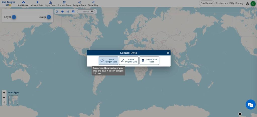
- Open Map Analysis
- From the Create Data tool, select Create Polygon Data

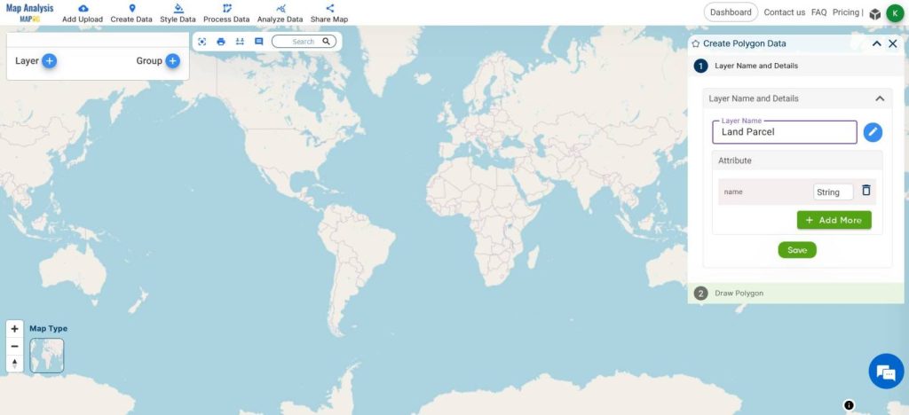
- From the right side window, Rename the layer
- Click Save
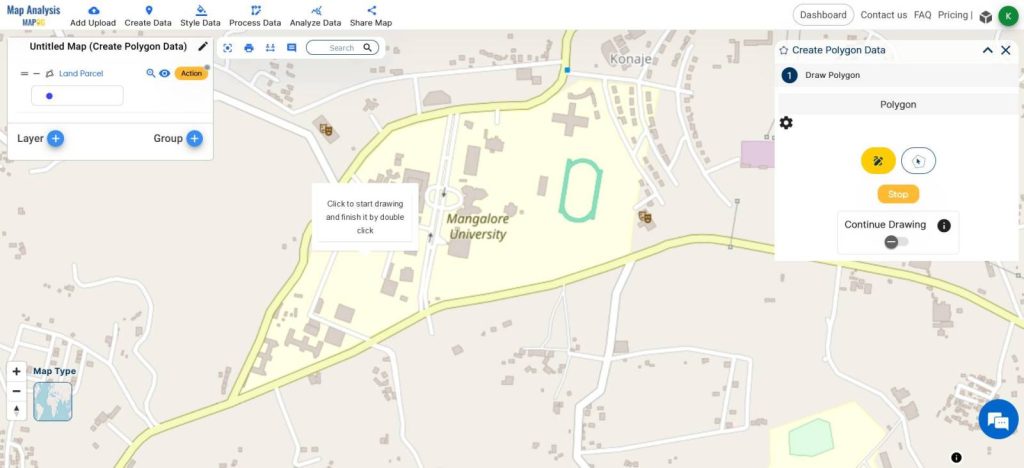
- Navigate to the Area of Interest
- Click the draw polygon icon
- Start Drawing the Polygon
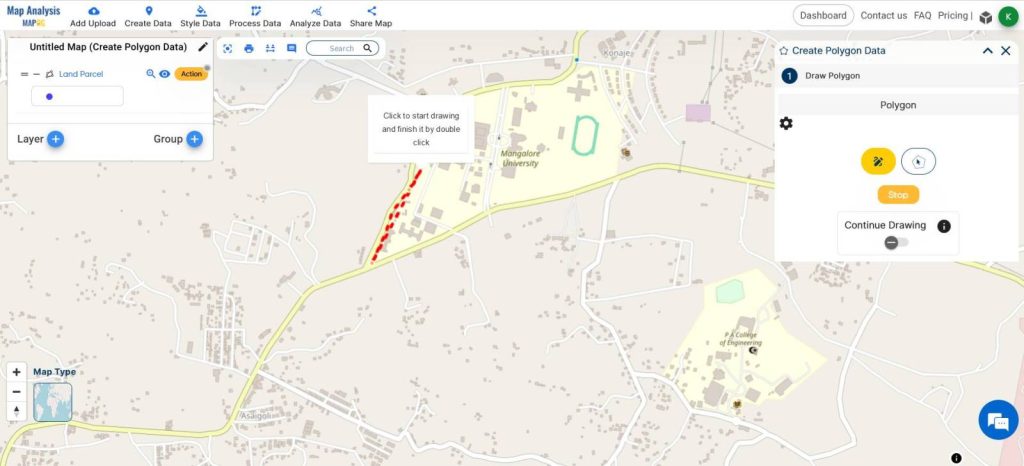
- Double Click to Save the polygon
- Input the Value and click Save
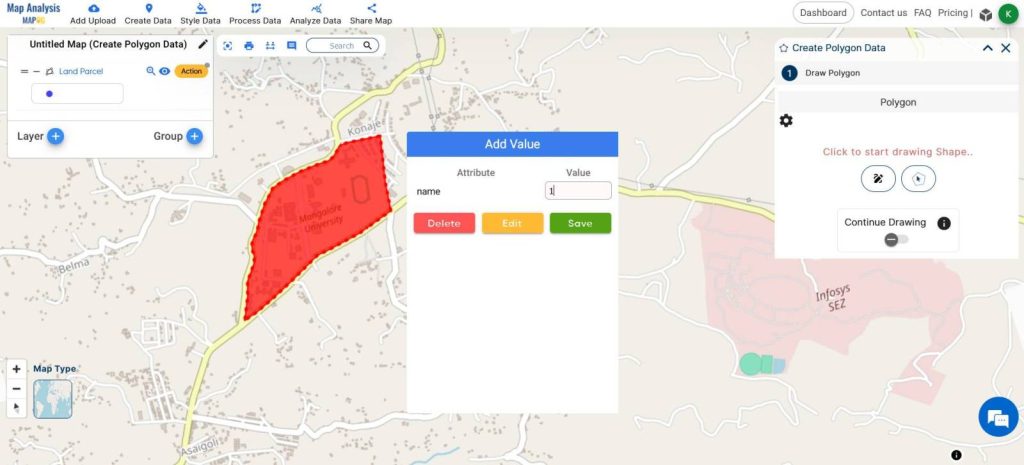
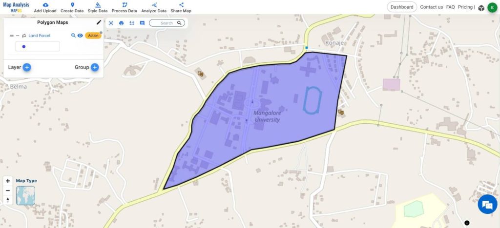
This is the Final Map
In GIS, analysts use polygons to conduct spatial analysis, map geographic features, and visualize geographical data.
This polygon represents the Land Parcel of that particular area. These data can be used by urban planners, revenue departments, and real estate developers to make proper decisions with minimum errors.

MAJOR FINDINGS
- Parcel Boundary Accuracy: Through the use of MAPOG Map Analysis tools, we achieved a high level of accuracy in delineating parcel boundaries. This precision is crucial for land management, property assessment, and urban planning efforts.
- Spatial Distribution Patterns: Analysis of the land parcel polygon maps revealed distinct spatial distribution patterns, highlighting concentrations of certain land uses or ownership types. These insights can inform strategic decision-making regarding land development and resource allocation.
- Efficiency Gains with MAPOG: Utilizing the MAPOG Map Analysis tool streamlined the mapping process, enabling faster creation and analysis of land parcel polygon maps. This efficiency gain enhances productivity and allows for more agile responses to changing spatial data needs.
BENEFICIAL DOMAIN: Urban Planning and Real Estate Development.
- Urban Planning and Development: The analysis of land parcel polygon maps provides valuable insights for urban planners and developers. Understanding the spatial distribution of land parcels empowers stakeholders to make informed decisions for sustainable urban growth.
- Real Estate and Property Assessment: Land parcel polygon maps are essential tools for real estate professionals and property assessors. These maps facilitate accurate identification of property boundaries, assessment of land values, and management of land ownership records. This information is critical for property transactions, taxation, and legal purposes, ensuring transparency and fairness in real estate markets.
For any inquiries or support needs, feel free to contact us at support@mapog.com.
CONCLUSION
Leveraging MAPOG Map Analysis tools for delineating land parcel polygon maps offers invaluable insights across diverse domains. Accurately mapping parcel boundaries and analyzing spatial patterns informs decisions in urban planning, real estate, and beyond. The efficiency gains provided by MAPOG streamline the mapping process, enhancing productivity and enabling agile responses to spatial data needs. As GIS technology advances, land parcel polygon maps will continue shaping our understanding of spatial relationships.
VIEW OUR PREVIOUS BLOGS
Airport Shopping Isochrone: Find Stores Within Your Time Frame
Create a Map: Filter Camping Spots in a Region Within – Points in polygon
1 thought on “Land Parcel Mapping with GIS: Create Accurate Polygon Maps for Urban Planning & Real Estate”