In this exploration, we delve into GIS to ensure pharmacies are strategically located near hospitals. Mapping Hospital-Pharmacy Proximity: A GIS Analysis, This analysis aims to highlight the significance of pharmacy accessibility for timely medical assistance using MAPOG.
Key Concept of Mapping Hospital-Pharmacy Proximity: A GIS Analysis
Our focus is on utilizing GIS to create maps illustrating the distance between hospitals and pharmacies. By identifying areas with limited pharmacy access, we aim to support informed decision-making for urban planning and healthcare services. Alongside this guide, datasets will be provided for practical application. Additionally, articles like “Creating Travel Guides: Mapping with GIS Buffer Zones” and “Creating GIS Solutions for Urban Agriculture Map” offer deeper insights into GIS applications.
Mapping Hospital-Pharmacy Proximity using MAPOG’s Near By Neighbour is straightforward.
Here’s a step-by-step guide:
Step 1: Data Collection:
We gather GIS data, selecting relevant layers for hospitals and pharmacies within our target region.
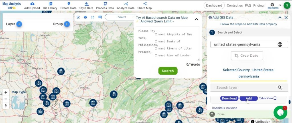
1.click on the “GIS Library”
2.Search the country name
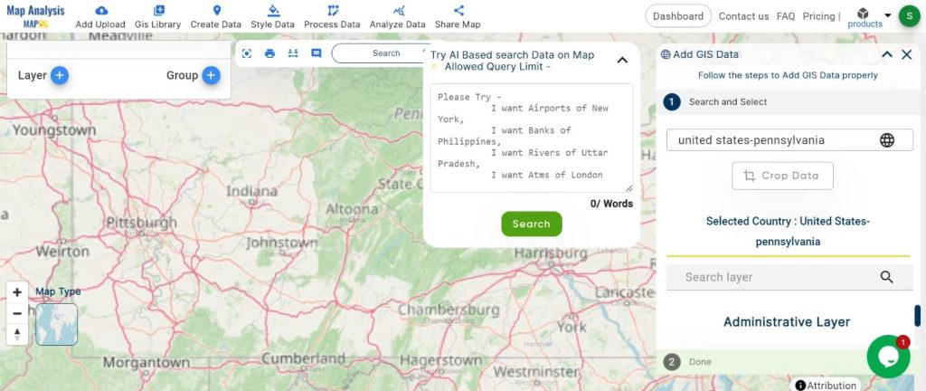
3.select the required layer.
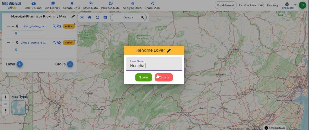
Step 2: Map Setup:
Naming the map and its layers to ensure clarity and organization.
1.Name the untitled map
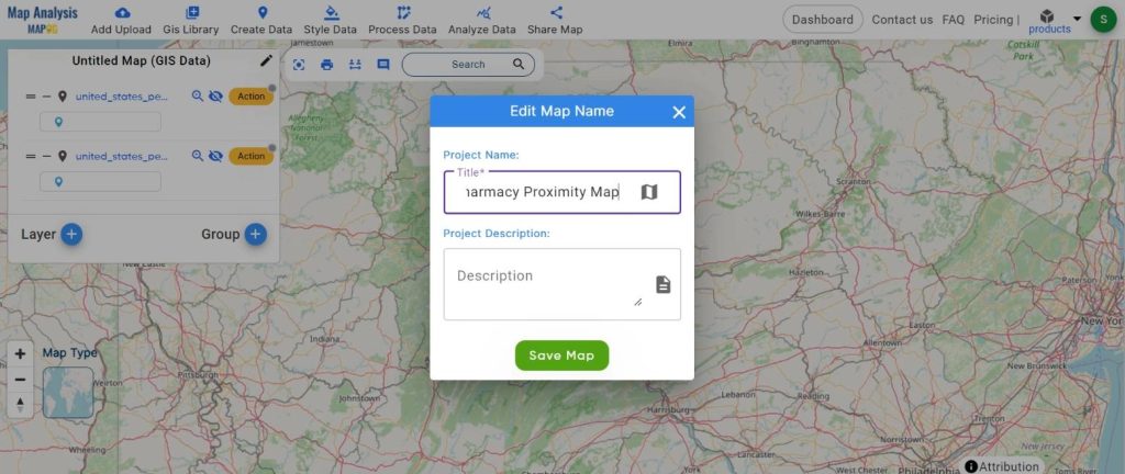
2.Rename the Layer
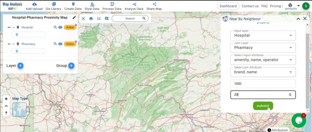
Step 3: Distance Calculation:
Employing the ‘Near by Neighbor’ tool to determine distances between hospitals and pharmacies.
1.Click on the “Process Data” button and choose “Near by Neighbour” tool.
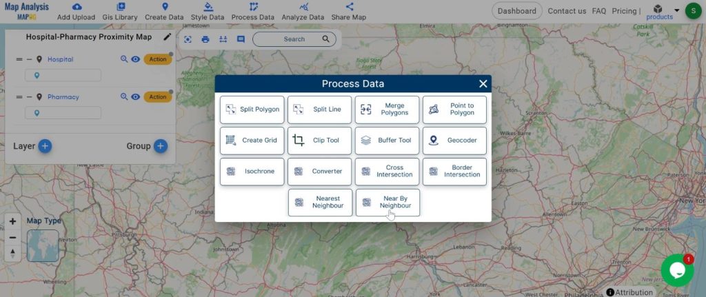
2.here add the input layer and join layer. Set the radius and click on the “Submit” button.
Step 4: Data Visualization:
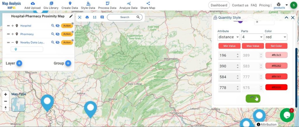
Styling the map data using the ‘Quantity Style’ tool to effectively represent proximity.
1.Click on the “Action” Button and choose “Quantity Style” tool
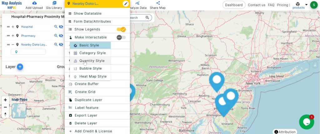
2.here set the attribute and colour. Click on the “Save Style” button.
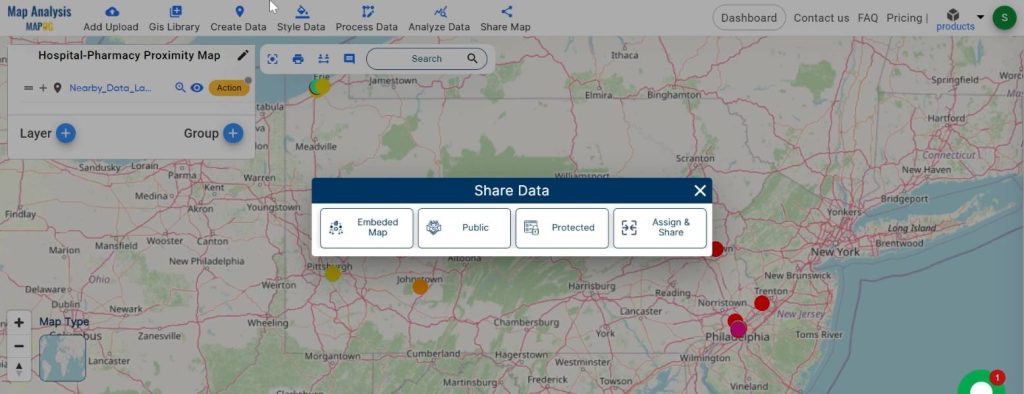
Step 5: Sharing Insights:
Presenting the mapped data to stakeholders to inform decision-making in healthcare infrastructure development.
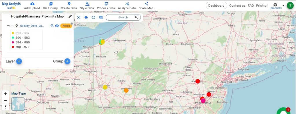
Major Findings:
Through our GIS analysis, we’ve identified areas lacking nearby pharmacies relative to hospitals. These insights enable authorities to prioritize locations for new pharmacy establishments, ensuring equitable access to essential medications for all residents.
Domain and Industry:
This GIS analysis intersects health and urban planning domains. By strategically locating pharmacies near hospitals, we contribute to improving public health outcomes and optimizing urban infrastructure.
In conclusion, GIS proves invaluable for analyzing and visualizing hospital-pharmacy proximity. Leveraging GIS technology enables informed decisions to enhance healthcare accessibility and promote community well-being. This analysis underscores the importance of strategic planning to ensure essential services are readily available to all individuals, regardless of their geographical location.