In today’s world, travelers seek convenience and efficiency when planning their trips. One of the most critical factors in trip planning is selecting accommodation that is close to desired tourist attractions. MAPOG offers a sophisticated and user-friendly platform for Optimizing Travel Plans with Nearby Accommodation Analysis for Convenient Selection.
Key Concept:
Nearby Neighbor Analysis is a spatial analytical method used to find the closest points between two sets of locations. MAPOG is a comprehensive map analysis tool that allows users to upload, process, and visualize spatial data effectively. Links of the data are given at the end of the article. Check out our other blog Mapping Population Data: Analyzing through bubble styling.
Process for enhancing tourist Accessibility with Finding near by places
Uploading Data
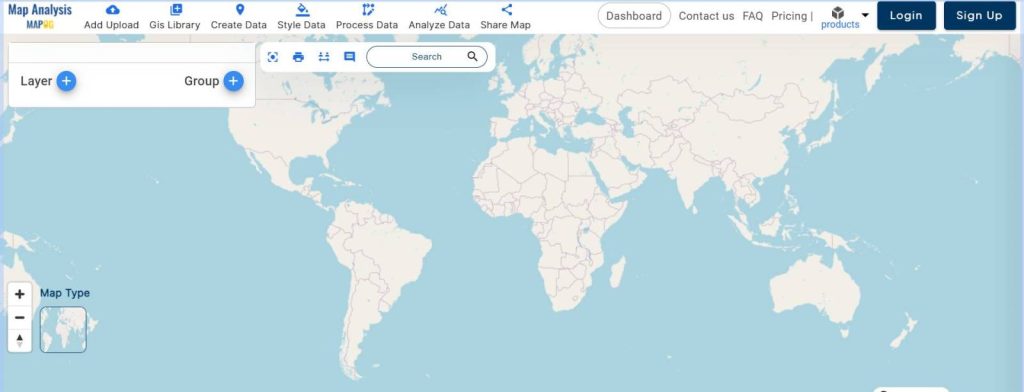
- Open the MAPOG Map Analysis interface and navigate to the “Add Upload” section.
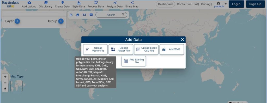
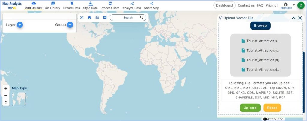
- Select “Upload Vector File” to upload the point data for tourist attractions and accommodation options.
Naming the Map
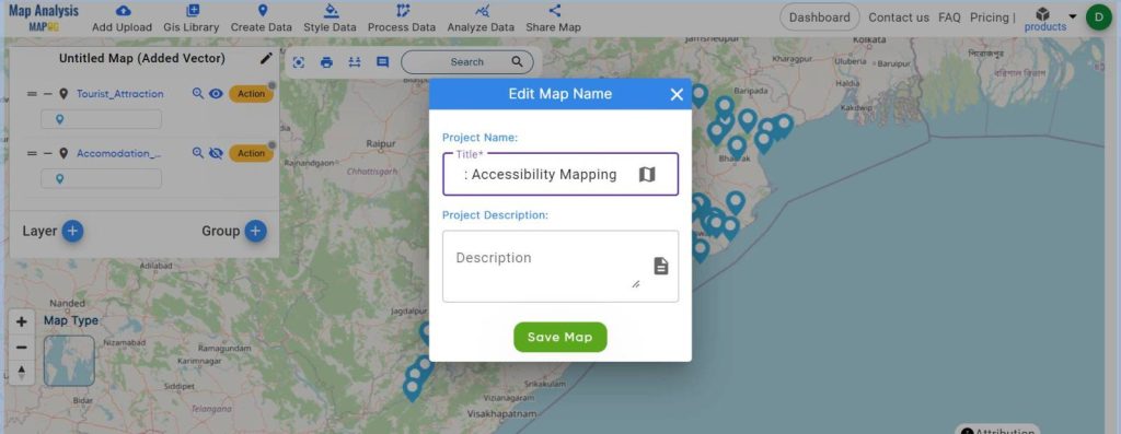
- Click on “Edit Map Name,” enter a suitable name for the untitled map, and save it.
Conducting Nearby Neighbor Analysis
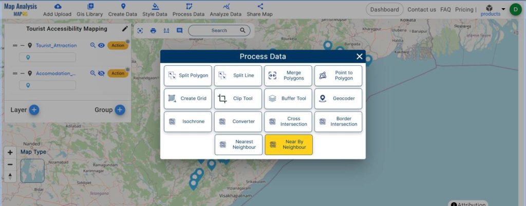
- Go to “Process Data” and choose “Near by Neighbor.”
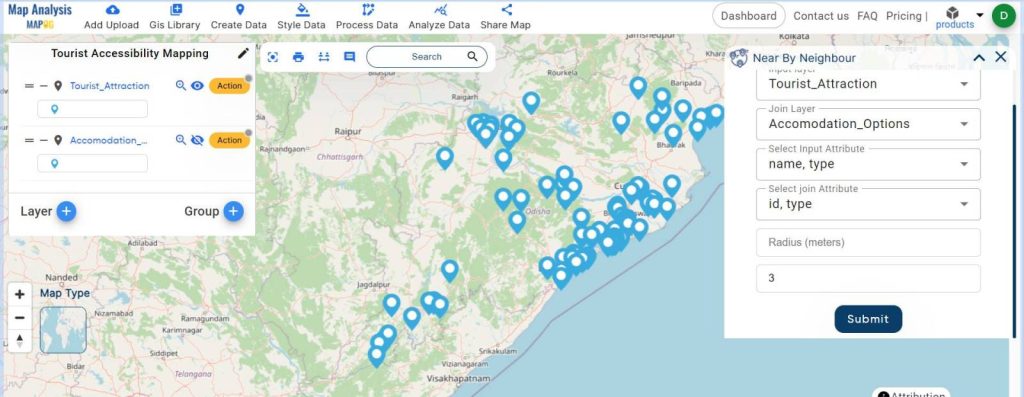
- In the new dialog box, select the input layer (Tourist Attraction Point) and the join layer (Accommodation options layer).
- Choose the input attribute and the joining attribute, set the nearby limit to 3, and submit that.
Viewing and Styling the Results
- Access the “Action” button for the new layer and select “Show Datatable” to view the joined data, which includes distances and angles between points.
- To make the map visually appealing, use “Style Data” and select “Bubble Style” to represent distances with varying bubble sizes.
- Customize the icons for tourist attractions using “Basic Style.”
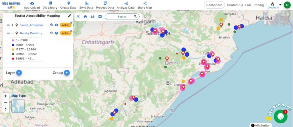
- The final output map is ready.
Major Findings:
- Visual Clarity: The map clearly displays tourist attractions with red icons and accommodations with bubbles, making it easy to identify the nearest hotels.
- Proximity Indicators: Larger bubbles indicate closer hotels, while smaller bubbles represent those farther away, allowing for quick visual comparison.
- Color-Coded Distances: Different colors are used to represent various distance ranges, enhancing the map’s readability and user-friendliness.
- Data Table Insights: The joined data table provides detailed information about the distances and angles between tourist attractions and nearby accommodations, supporting more informed decision-making.
Industry and Domain:
- Hospitality and Tourism: Optimizes hotel placement and marketing strategies by highlighting proximity to tourist attractions.
- Retail: Assists in determining optimal locations for new stores based on customer accessibility.
- Real Estate: Enhances property value assessments by considering proximity to key attractions and amenities.
- Urban Planning: Aids in designing city layouts that maximize accessibility and convenience for residents and visitors.
Conclusion:
MAPOG Nearby Neighbor Analysis offers a robust solution for travelers and industry professionals seeking to optimize accommodation selection near tourist attractions. By simplifying the process and providing clear, visually appealing results, Mapog enhances user experience and supports strategic decision-making across various sectors.
Links of the data:
Previous Blog Links:
- GIS Analysis in Urban Planning: Reshaping Transportation Future Insights of state/city
- Make Routes for Military Aerial Planning- Through Bearing angle and Distance calculation – Online Route Compass
- Create Map for Real Estate Developer for Best Site Selection
- Creating Travel Guides: Mapping with GIS Buffer Zones
Great! PLATFORM FOR Creating travel itinerary map.