Welcome to MAPOG! Today, we’re thrilled to guide you through the process of enriching your shapefiles by adding additional attributes using our Map Analysis Tool. By following a few simple steps, you’ll be able to enhance the depth and detail of your mapping projects, unlocking new insights and possibilities. Whether you’re in urban planning, environmental management, transportation, real estate, or any other industry, MAPOG empowers you to make more informed decisions with comprehensive spatial data analysis. Let’s dive in and explore how to elevate your mapping endeavors to the next level!
Key Concept:
The key concept we’re exploring today revolves around the capability of MAPOG to enrich shapefiles by adding additional attributes. This process allows users to enhance the depth and detail of their maps, enabling them to gain valuable insights and make informed decisions based on comprehensive spatial data analysis. By leveraging MAPOG’s intuitive Map Analysis Tool, users can seamlessly incorporate new attributes into their shapefiles, such as state-wise crop production data from a CSV file. This empowers them to tailor their mapping projects to their specific needs and objectives. Whether it’s demographic data, environmental characteristics, or infrastructure details, MAPOG provides the tools and functionality to enhance the richness of spatial data for various applications across industries.
Step-by-Step Process:
Step 1: Upload Data
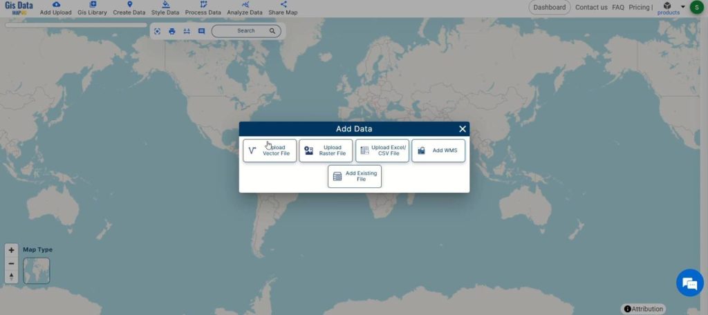
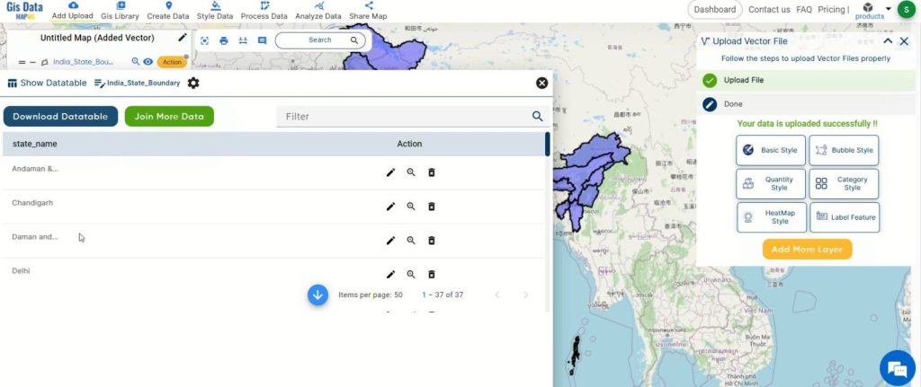
- Access the analysis tool and kick off the process by clicking on “Add Upload.” Opt for “Upload Vector File” to input your shapefile data.
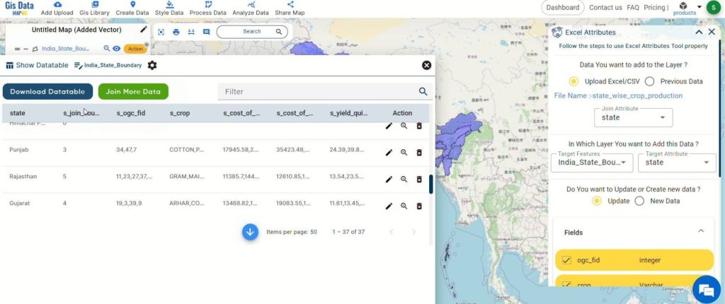
Step 2: Review Current Attributes
- Open the action button for your dataset and click on “Show Data Table” to review the current attributes of your shapefile. This will give you an overview of the existing data and help you identify where new attributes can be added.
Step 3: Merge Attribute Data
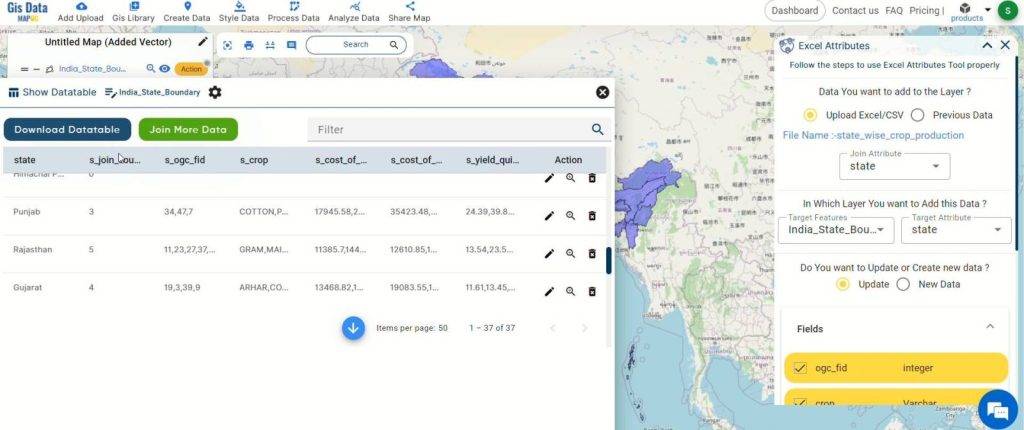
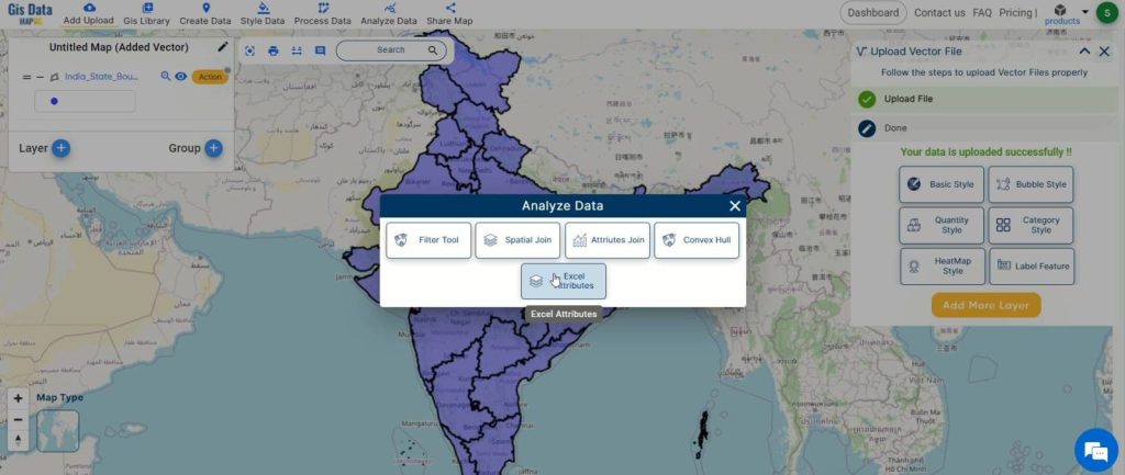
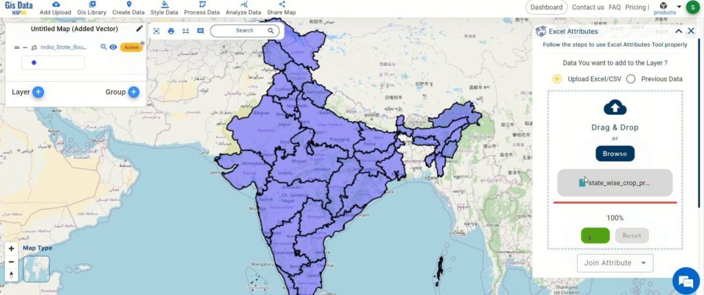
- In order to merge attribute data to this shapefile, click on the “Analyse Data” option. Then, select “Excel Attribute Tool” to merge your data seamlessly.
Step 4: Upload CSV File
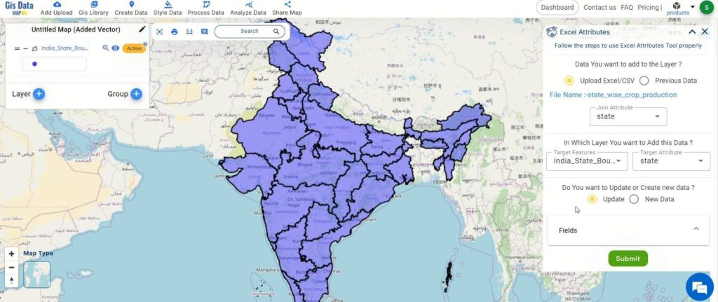
- In the Excel Attribute Tool, upload your CSV file containing the state-wise crop production data. Select the matching attributes in both the shapefile and CSV file for merging.
Step 5: Submit and Merge
- Once you’ve matched the attributes, click on “Submit.” This will merge the CSV file data as an attribute of the shapefile.
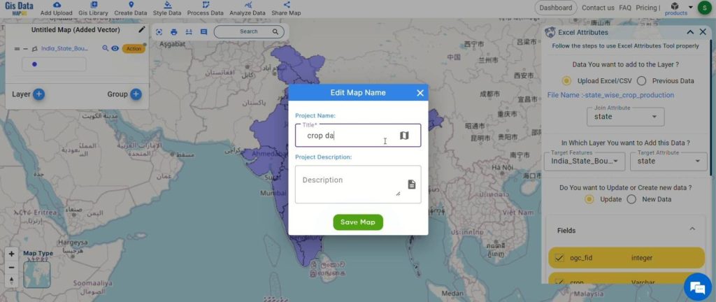
Step 6: Rename and Save Map
- Click on the pencil icon to rename the map if desired. Then, click “Save Map” to apply the changes and keep your data organized.
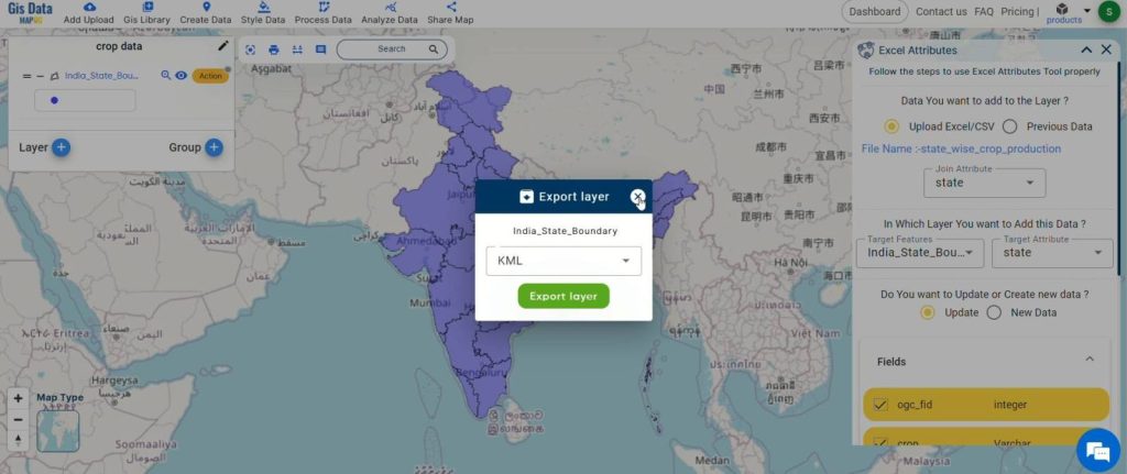
Step 7: Export Data
- Export the data in any desired format by clicking on the action button and then selecting “Export Layer.”
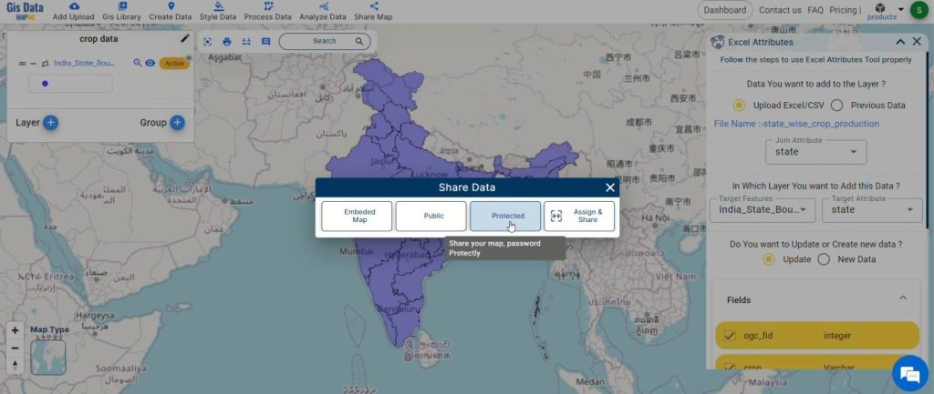
Step 8: Share Findings
- Share your findings with others effortlessly by using MAPOG‘s sharing options.
Major Findings:
Through the integration of state-wise crop production data into shapefiles using MAPOG, we achieved a significant enhancement in the depth and detail of our maps. This enriched data enables comprehensive spatial analysis, allowing for informed decision-making. The ability to seamlessly incorporate additional attributes into shapefiles with MAPOG’s intuitive Map Analysis Tool has proven to be invaluable. It empowers users to tailor their maps to specific needs, whether for demographic analysis, environmental assessment, or infrastructure planning. This process has demonstrated MAPOG‘s effectiveness in providing detailed, customized spatial data for various applications across industries.
Domains and Industries Benefiting
- Urban Planning
- Agriculture
- Hydrology
- Public Health
- Transportation
- Wildlife Conservation
- Real Estate
- Emergency Management
- Energy
Conclusion
In conclusion, the process of enriching shapefiles by adding attributes using MAPOG‘s Map Analysis Tool offers immense benefits across various domains and industries. By following a simple step-by-step approach, users can enhance the depth and detail of their mapping projects, leading to more informed decision-making and actionable insights. From environmental science to emergency management, the ability to incorporate additional attributes into shapefiles provides valuable data for analysis and planning. As demonstrated in our tutorial, MAPOG empowers users to tailor their datasets according to specific needs, ultimately contributing to more effective and efficient mapping endeavors.
If you have any questions or need assistance, please don’t hesitate to reach out to us at support@mapog.com. Thank you for joining us on this journey, and we invite you to explore the diverse applications of MAPOG in your own projects.
Other Articles
- Create a Map to find suitable sites for constructing a new house
- Create Map for Analyzing Water Quality using Heat Map Style
- Create Map – School Map Area Coverage Through Buffer Analysis
- Mapping Safety Create GIS Map : Game-Changing Approach to Hospital Risk Analysis
- Create Map for Real Estate Developer for Best Site Selection
- Create Map for Landfill Optimization: Spatial Analysis Approach