Ensuring the safety of ammunition depots and their surrounding areas is of paramount importance. Accidents at such facilities can have catastrophic consequences, not only endangering lives but also causing significant property damage and disruption. This article demonstrates how to use MAPOG, a robust mapping and analysis tool, to create safety buffer zones around an ammunition depot and determine Ammunition Depot Strategic Safety Measures. These measures help minimize risk and enhance emergency preparedness.
Key Concept:
Safety buffer zones are predefined areas around a hazardous site that indicate varying levels of risk, enabling better risk management and emergency preparedness. Check our other blog Creating an Online Interactive Map for Residential Land Use and Buffer Analysis with Thematic Visualization.
Process For Ammunition Depot Strategic Safety Measures:
1. Open the MAPOG:
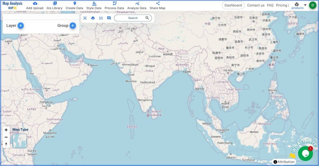
Begin by accessing the MAPOG Map Analysis interface.
2. Create Point Data:
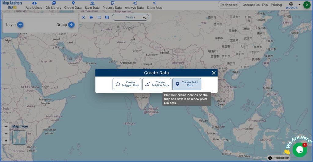
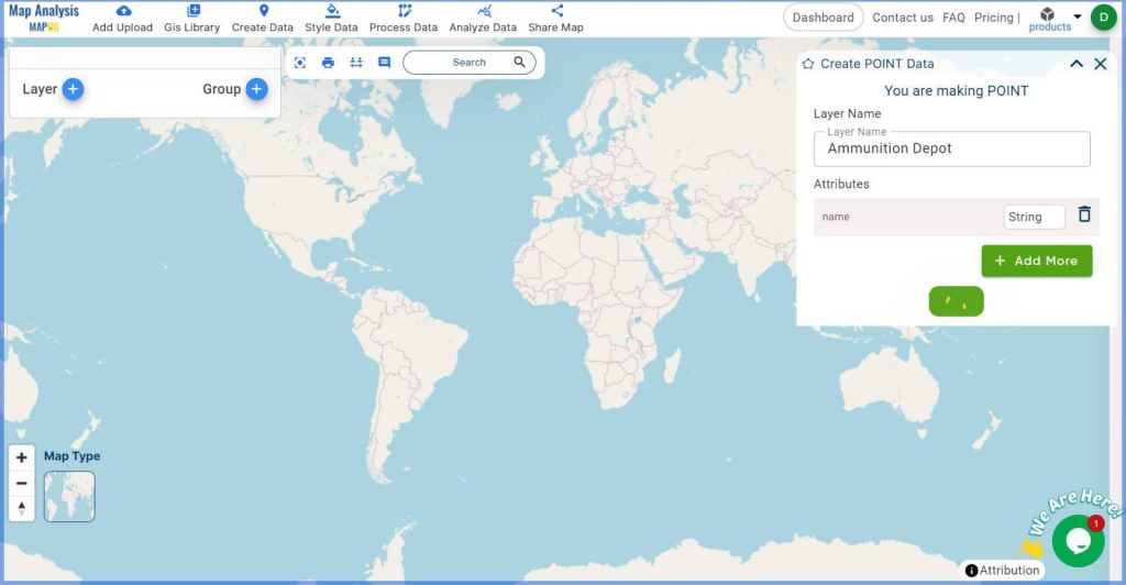
Navigate to ‘Create Data’ and select ‘Create Point Data’. Assign a suitable name to your layer. Using the ‘Drop Point’ option place the point at your desired location and save it.
3. Place the Ammunition Depot Point:
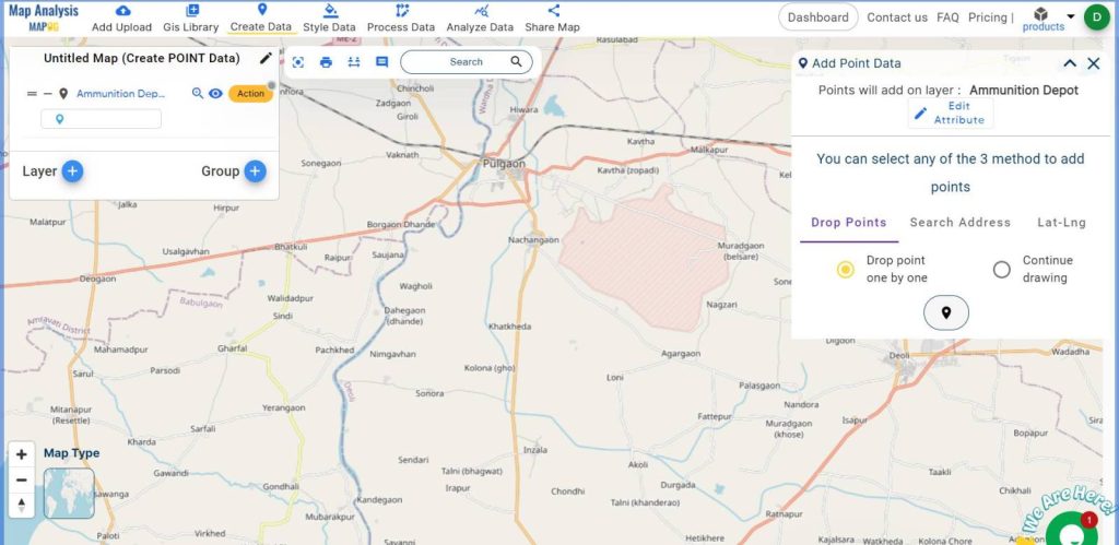
Use the ‘Drop Point’ option to place a point at the location of the ammunition depot. Save this point.
4. Name the Untitled Map:
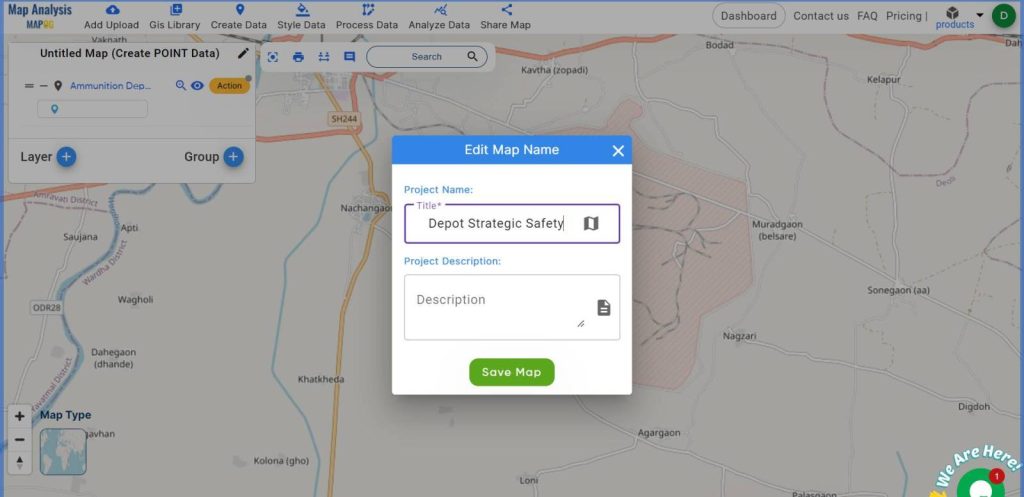
Now name the untitled map, for that, press the pencil icon and go to ‘Edit Map Name’, give the name as per your choice, then click ‘Save Map’.
5. Define Depot Icon Style:
Go to ‘Save Style‘, then ‘Basic Style‘, and choose an icon that represents the ammunition depot. Save your style settings.
6. Generate Buffer Zones:
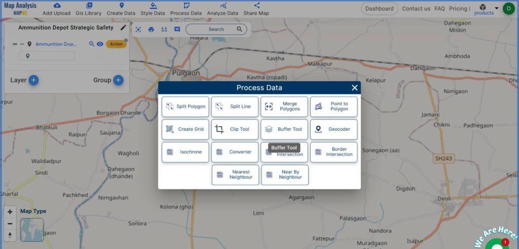
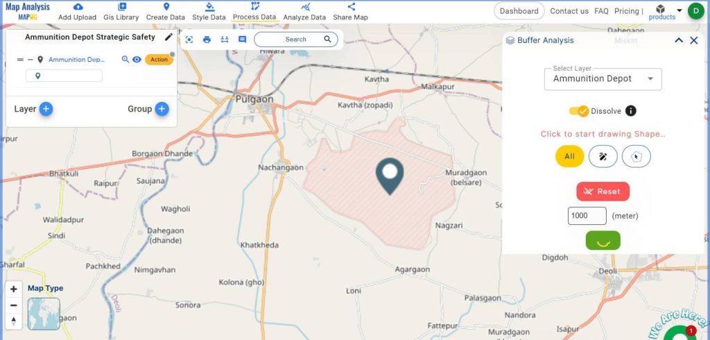
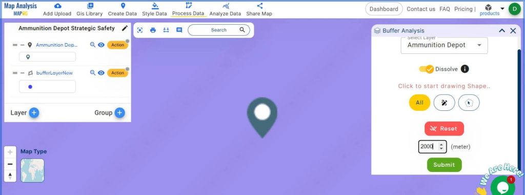
Proceed to ‘Process Data’ and select ‘Buffer Tool‘. Choose the layer and set the buffer ranges then: 1000 meters, 2000 meters, 3000 meters, and 5000 meters. Save each buffer zone.
7. Rename Buffer Layers:
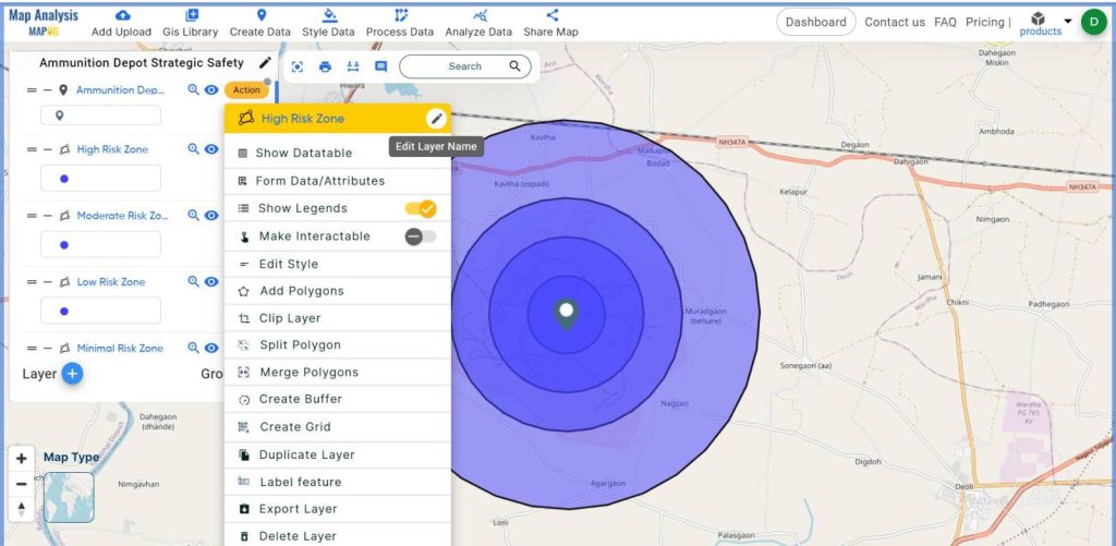
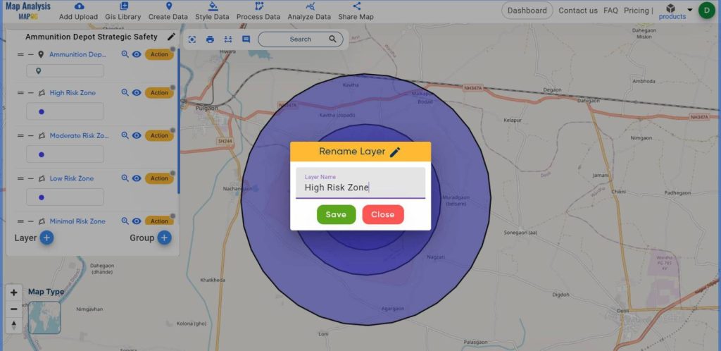
Use the ‘Action’ button to rename each buffer layer according to its risk level: High, Moderate, Low, and Minimal.
8. Style Buffer Zones:
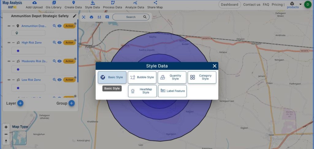
Navigate to ‘Style Data‘, select ‘Basic Style‘, and assign appropriate colors to each buffer layer. Save the styled layers.
9. Locate the Portable Fire Station:
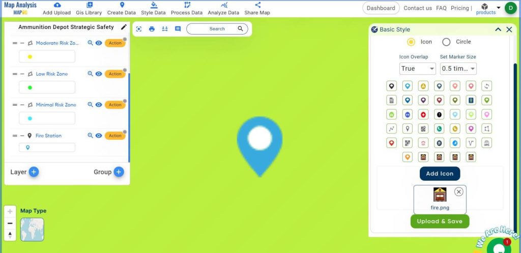
Determine the optimal location for a portable fire station within the buffer zones. Go to ‘Create Data’ and choose the ‘Create Point Data‘ option. now give the layer name and through the ‘Drop Point’ feature plot the point wherever you want. In our scenario, we place it within the 2000-meter moderate-risk zone. Then, from ‘Style Data’ select ‘Basic Style‘ to change the icon as per your choice.
10. Grouping the Layers:
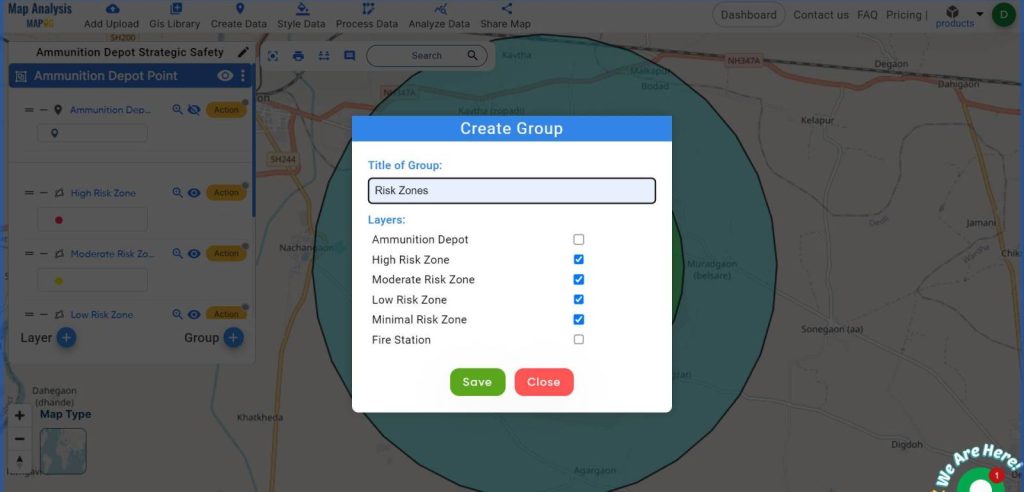
It is essential to group the layers for better map interpretation. To do this, first, go to the ‘Group’ option. Select the layers you want to group. Assign a title to the group. Hit ‘Submit’ to save the group. Grouping the layers makes it easier to understand the color codes and icons, which is crucial for interpreting the map effectively.
11. Final Output:
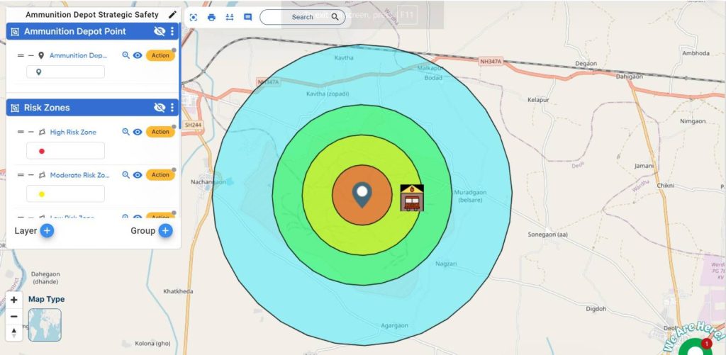
By following these steps, you can successfully create a detailed safety buffer zone analysis around an ammunition depot using MAPOG.
Major Findings For Ammunition Depot Strategic Safety Measures:
The completed analysis provides several key insights:
- Visual Risk Assessment:
The buffer zones demarcate areas of varying risk, allowing stakeholders to visually assess the level of threat in different regions surrounding the ammunition depot. - Strategic Fire Station Placement:
Positioning a portable fire station within the moderate-risk zone ensures a rapid response to emergencies, significantly enhancing the preparedness and resilience of the area. - Improved Safety Measures:
The analysis aids in planning and implementing safety measures, such as evacuation plans and safety drills, tailored to the specific risk levels of each zone.
Industry and Domain:
- Defense Industry:
Defense facilities can utilize these insights to enhance the safety of ammunition storage areas, ensuring compliance with safety regulations and minimizing the risk of accidents. - Local Government Agencies:
Municipalities can use the analysis to plan zoning regulations and emergency response strategies, safeguarding residents and infrastructure. - Emergency Response Teams:
First responders can leverage the buffer zone data to optimize resource allocation, ensuring that critical areas are adequately covered in case of an emergency.
Conclusion:
Creating safety buffer zones around an ammunition depot using MAPOG provides a detailed and actionable framework for risk assessment and emergency preparedness. This analysis is crucial for enhancing safety measures, ensuring compliance with regulations, and preparing for potential emergencies.
Previous Blog Links: