Understanding Forest Distribution: Mapping and Analyzing with Category Style
Map forest types with category style for comprehensive analysis. Visualize diverse ecosystems and land cover for informed environmental management.
Map forest types with category style for comprehensive analysis. Visualize diverse ecosystems and land cover for informed environmental management.
Explore interactive poverty rate heat maps to visualize and analyze socioeconomic disparities. Gain insights for targeted policy-making and community support.
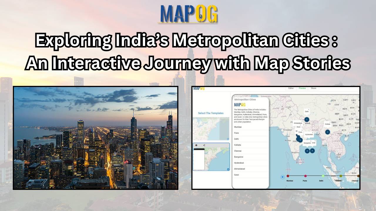
Discover India’s metropolitan cities through an engaging map story. Navigate urban landscapes and explore key features with interactive mapping
In the world of simple and smart journey planning, meet MAPOG Route Compass! It’s a tool for both engineers and adventure lovers, making route planning from Calgary to Vancouver Island. Key Concept: MAPOG Route Compass is like a friendly guide for your travels. It uses maps and numbers to make your journey easy and precise. … Read more
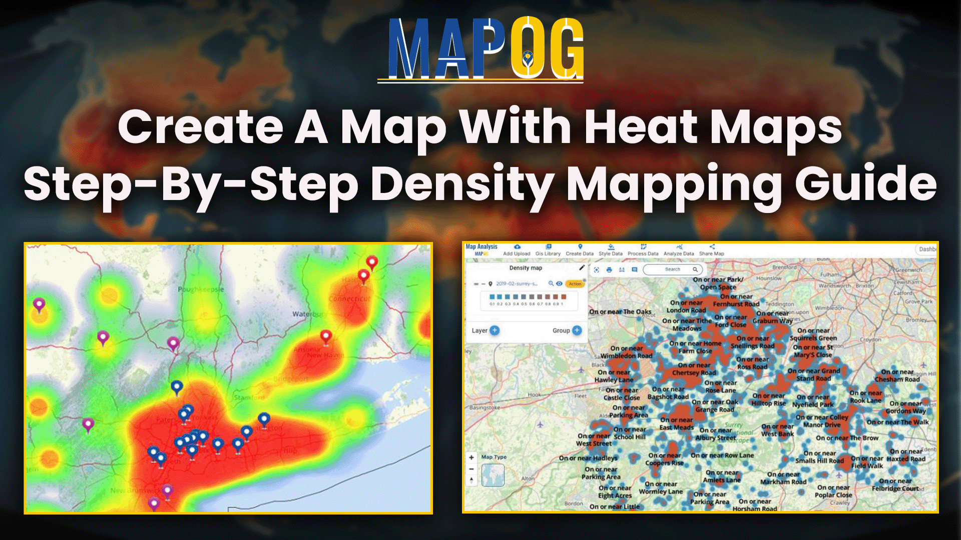
Visualize and analyze spatial data with density mapping using heatmaps. Identify patterns and trends for informed decision-making and planning.
Farming faces big challenges when wars or natural disasters hit. Figuring out the damage to agricultural land is crucial. That’s where tools like MAPOG come in. This article is all about “Agricultural Land Damage Assessment due to War and Natural Calamities.” We’ll explore simple ways to understand and tackle the damage, using tools like MAPOG. … Read more
Explore population dynamics with a demographics map. Use spatial analysis to uncover insights into community composition and trends.
Welcome to MAPOG! Today, we’re thrilled to guide you through the process of enriching your shapefiles by adding additional attributes using our Map Analysis Tool. By following a few simple steps, you’ll be able to enhance the depth and detail of your mapping projects, unlocking new insights and possibilities. Whether you’re in urban planning, environmental … Read more
Explore the intersection of cutting-edge technology and environmental responsibility in civil engineering. This article focuses on Environmental Impact Assessments (EIAs), emphasizing the role of the MAPOG Route Compass in precise spatial analysis. Discover how this innovative tool revolutionizes decision-making, shaping a future of conscientious engineering practices. Now we are on Google Play store also. Below … Read more
Unlock global trade with MAPOG’s Route Compass. Optimize world trade routes for strategic planning and seamless logistical operations