
Mapping highway Buffer and Building Overlap Analysis – Extend Roads Width
Strategic planning for highway extension and rehabilitation. Optimize infrastructure growth and enhance transportation networks.
Strategic planning for highway extension and rehabilitation. Optimize infrastructure growth and enhance transportation networks.
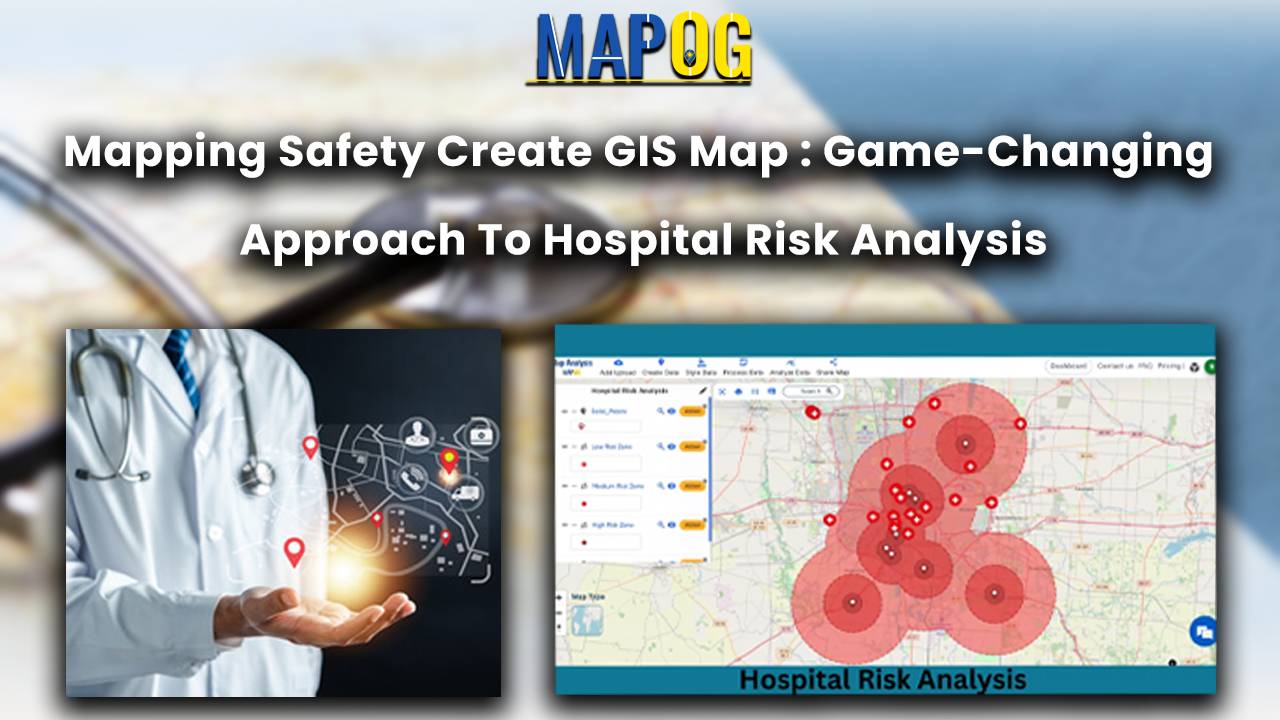
Immerse yourself in the future of healthcare safety with ‘Mapping Safety: Create GIS Map.’ Explore the game-changing fusion of MAPOG and the Buffer Tool, strategically crafting buffer zones around solid waste areas. This groundbreaking approach not only enhances safety and mitigates hazards but also redefines risk management in hospital settings. Stay at the forefront of … Read more
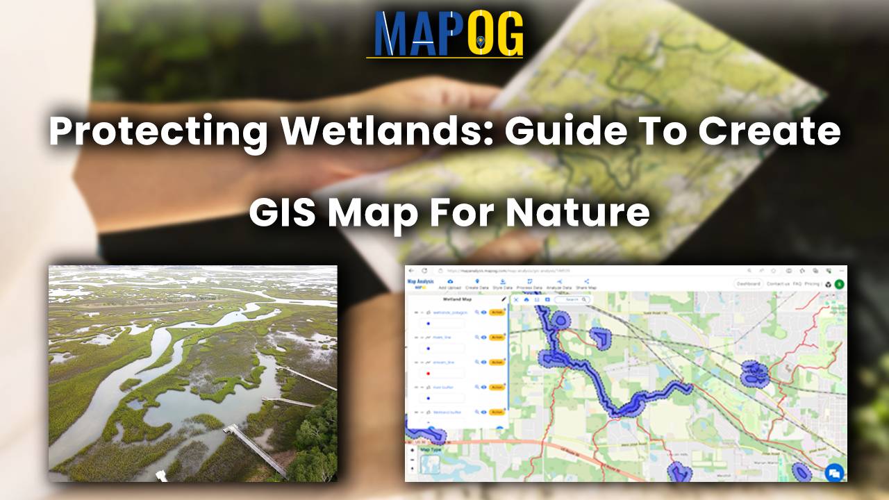
Wetland Conservation: GIS Protection Strategies are paramount as wetlands, vital for biodiversity and ecosystem services, face growing threats from human activities and climate change. Effective conservation and management strategies hinge on accurate mapping and monitoring of wetland resources. This article explores the application of MAPOG in wetland mapping, emphasizing its capabilities in executing Wetland Conservation: … Read more
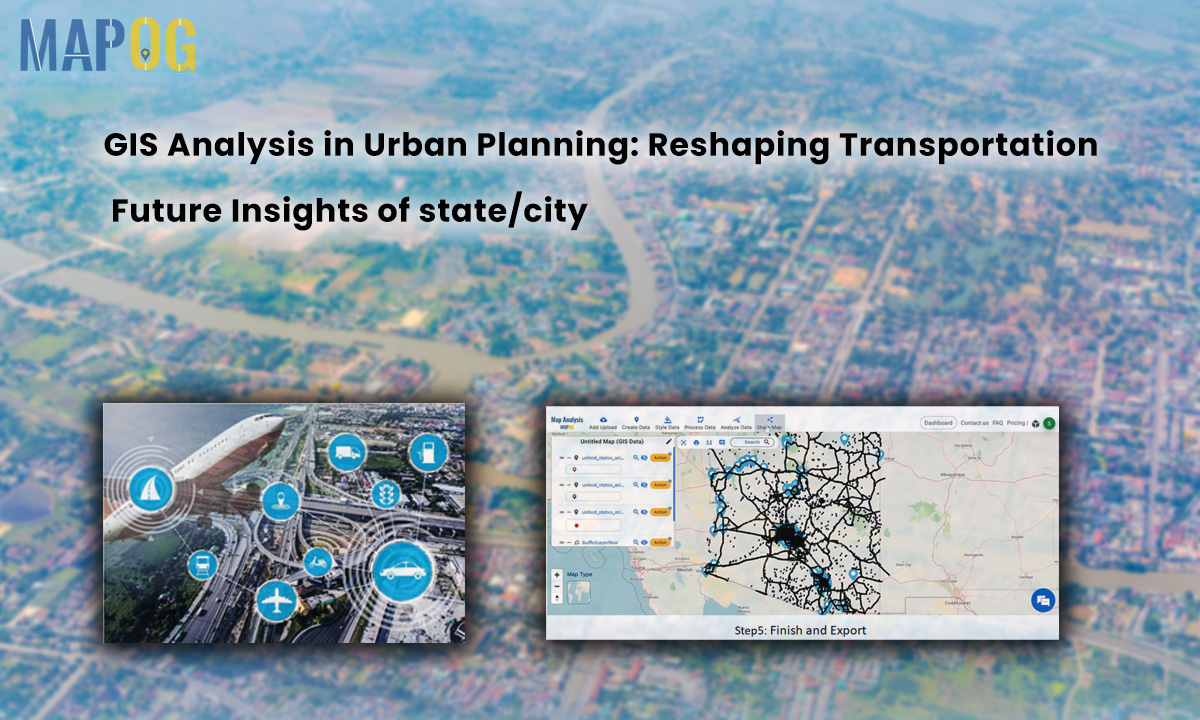
In the heart of urban development, where cityscapes and transportation networks intersect, the transformative influence of GIS analysis in urban planning takes center stage. This article delves into the intricacies of reshaping the transportation future through the lens of MAPOG GIS tool, unraveling critical insights that hold the potential to redefine the landscape of [State/City]. … Read more
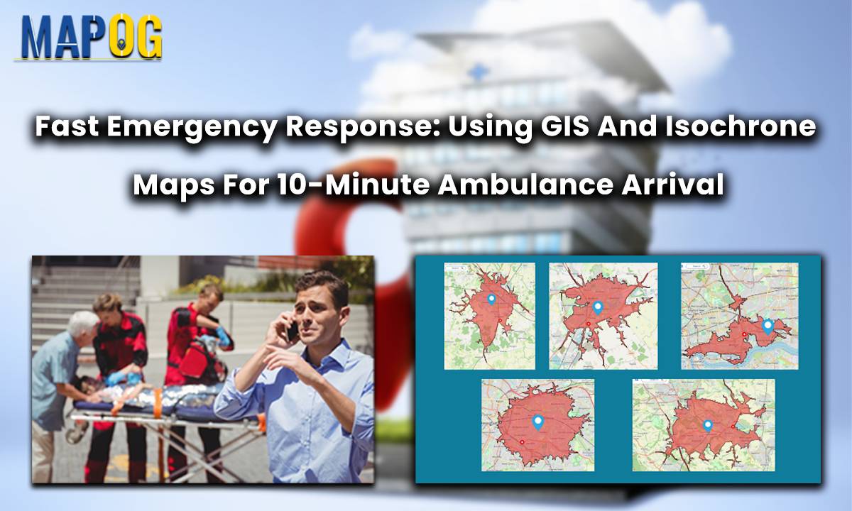
In a groundbreaking move for public safety, the Ambulance Plotting System has been introduced in Great Britain. Integrated within the MAPOG framework, this innovative system guarantees a life-saving presence within a mere 10 minutes at fatal accident sites. By swiftly coordinating emergency responses, it aims to significantly reduce fatalities and enhance overall patient outcomes. This … Read more
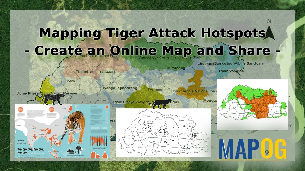
Delve into a crucial exploration with our Vulnerability Map Analysis, focusing on the total tiger attack cases in Sundarbans fringe villages. This detailed examination unveils the complex dynamics between human settlements and the formidable wildlife in the Sundarbans region.
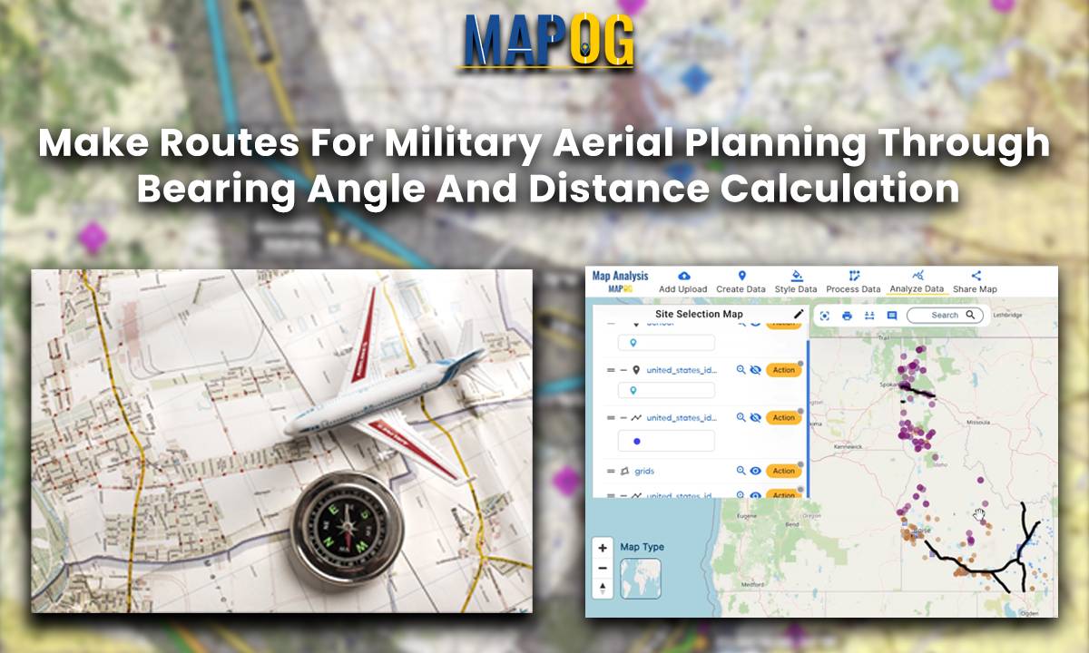
Introduction In this military aerial route planning analysis, we employ the MAPOG route compass to navigate the strategic journey from one Air Force Station to another Air Base. This tactical approach ensures efficient and effective planning for aerial movements in the specified region. Key Concept The key concept underlying this military aerial route planning analysis … Read more