MAPOG Analysis

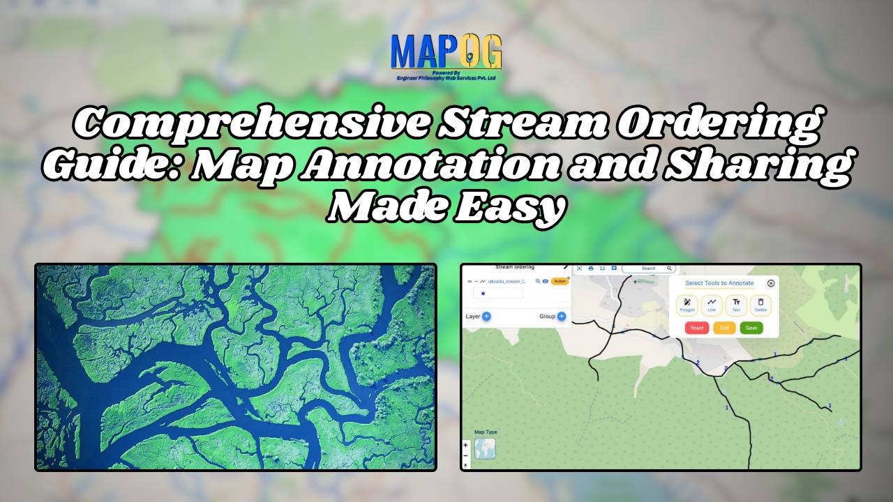
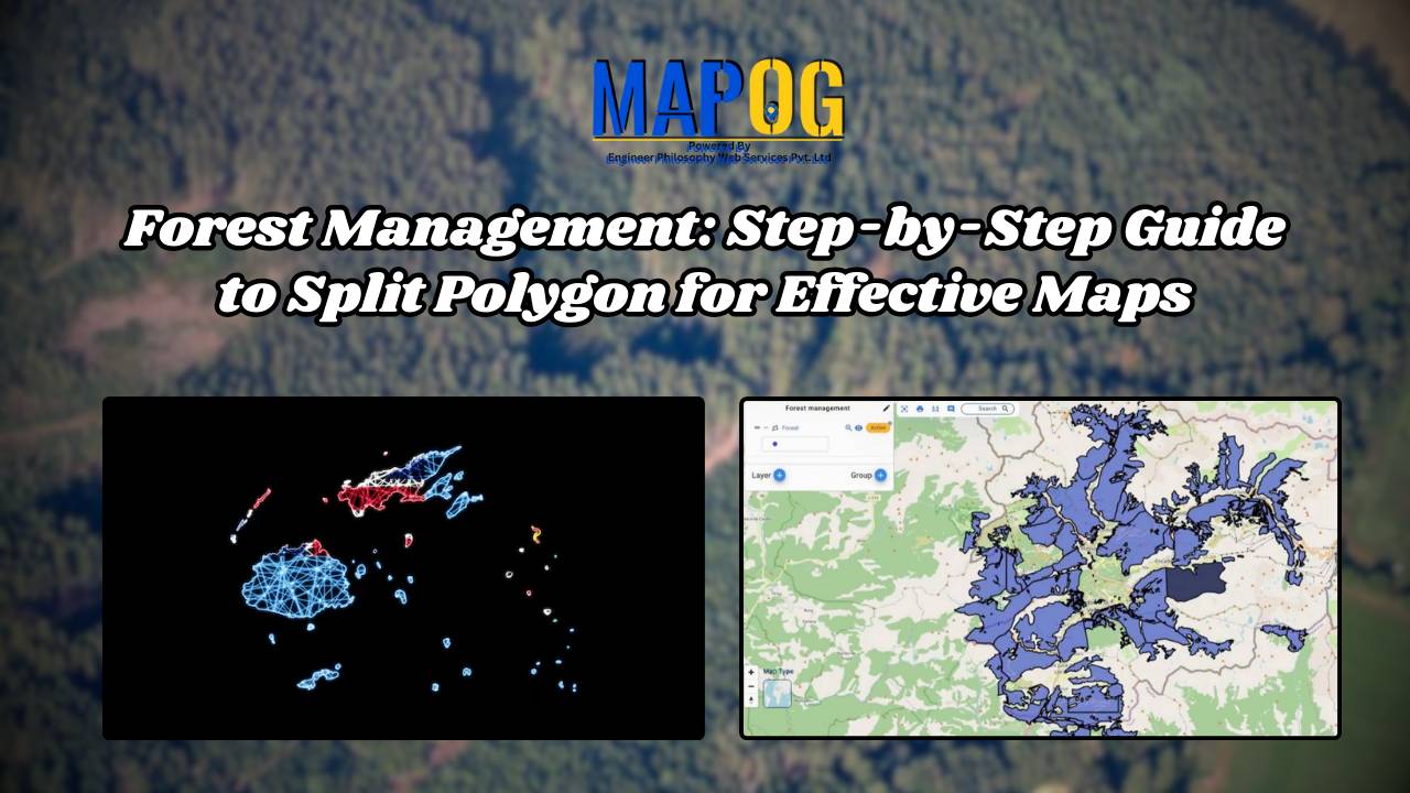
Forest Management: Step-by-Step Guide to Split Polygon for Effective Maps

In ‘Forest Management Using Split Polygon Tool,’ we employ MAPOG Map Analysis to divide forested regions into equal parts, optimizing resource allocation and conservation efforts for sustainable forest management. Key Concepts MAPOG is an outstanding tool for creating interactive and innovative maps. We can employ this tool to divide forested regions into equal parts, optimizing … Read more

How to Create Heat Maps for Forest Cover Analysis Using GIS

Forest Cover Maps a fundamental tool within GIS, serves as a potent visualization method. It utilizes colors to represent the density or intensity of data across a geographic area, offering valuable insights into various phenomena. Key Concept to Creating Forest Cover Maps: Using Heat Map Style Heat maps are super helpful when we want to … Read more

Mapping Disease Outbreaks: How GIS Enhances Surveillance and Control

In recent years, the importance of disease surveillance has been underscored by various global health challenges, including pandemics and emerging infectious diseases. Disease surveillance plays a pivotal role in public health management, enabling the timely detection, monitoring, and control of infectious diseases. MAPOG is a powerful tool for health authorities to augment traditional surveillance methods. … Read more

Comprehensive Stream Ordering Guide: Map Annotation and Sharing Made Easy

The accurate mapping of stream orders is crucial for various applications, from environmental management to infrastructure planning. MAPOG, a leading GIS platform, offers a powerful text annotation tool designed to streamline this process, significantly enhancing efficiency and accuracy. Explore this article to enhance your knowledge in Renewable energy- Create Map – DIGITIZING SOLAR, HYDROELECTRIC, WIND … Read more

Step-by-Step Guide to Mapping Accommodation Types for Tourism and Urban Planning

In today’s digital age, mapping accommodation types has become an essential tool for travelers, city planners, and businesses alike. By utilizing MAPOG’s category style feature, we can represent each accommodation type with variant colors, simplifying the process of identifying and understanding the diverse range of accommodations available. If you are interested in habitat mapping, then … Read more