Use Case - Buffer Analysis

Decade of forest fire analysis

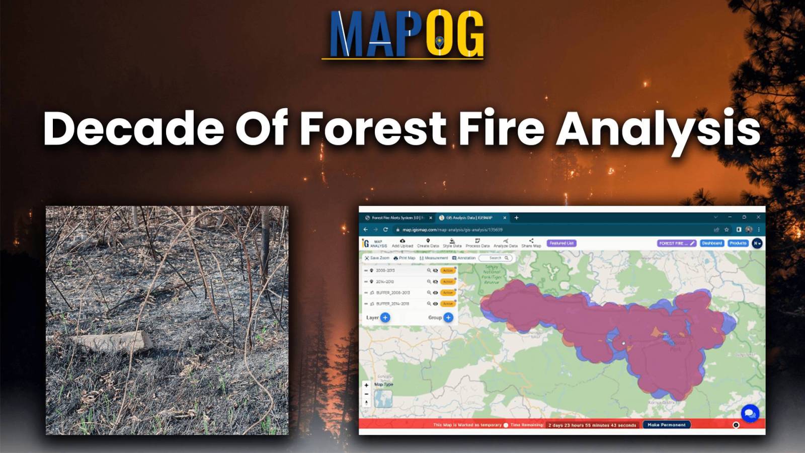
Analysis of Forest Fire and Map Risk Areas with Buffer Tool

Let yourself loose into a memorable exploration of Analysis of Forest Fire and Map Risk Areas by using the Buffer Tool within MAPOG. Dive into the revelations regarding the insights discovered, the new strategies that emerged, and the overall understanding came about relate to wildfire processes in the past 10 years. Data-driven approaches will be introduced to … Read more

Landfill Optimization

Create Map for Landfill Optimization: Spatial Analysis Approach

Landfills, where various environmental factors interact to shape microclimates and hydrological patterns, represent complex ecosystems. Effective management and mitigation strategies require a thorough understanding of these landfill areas. Therefore, this article explores the integration of the MAPOG in GIS based Landfill Optimization. If you are interested in creating Urban agriculture map, explore this article-Creating GIS … Read more

Create Map – School Map Area Coverage

Create Map – School Map Area Coverage Through Buffer Analysis

Welcome to an insightful exploration of education accessibility through comprehensive map analysis using MAPOG. In this journey, we focus on school district coverage, using a Country as an example. Our purpose is to employ Buffer Analysis, as indicated in our topic Create Map – School Map Area Coverage Through Buffer Analysis, to unveil areas with … Read more

Hospital Risk Analysis

Mapping Safety Create GIS Map : Game-Changing Approach to Hospital Risk Analysis

Immerse yourself in the future of healthcare safety with ‘Mapping Safety: Create GIS Map.’ Explore the game-changing fusion of MAPOG and the Buffer Tool, strategically crafting buffer zones around solid waste areas. This groundbreaking approach not only enhances safety and mitigates hazards but also redefines risk management in hospital settings. Stay at the forefront of … Read more

Protecting Wetlands: Guide to Create GIS Map for Nature

Protecting Wetlands: Guide to Create GIS Map for Nature

Wetland Conservation: GIS Protection Strategies are paramount as wetlands, vital for biodiversity and ecosystem services, face growing threats from human activities and climate change. Effective conservation and management strategies hinge on accurate mapping and monitoring of wetland resources. This article explores the application of MAPOG in wetland mapping, emphasizing its capabilities in executing Wetland Conservation: … Read more