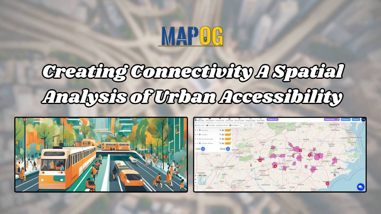
Creating Connectivity: A Spatial Analysis of Urban Accessibility
Creating Connectivity: A Spatial Analysis of Urban Accessibility links bus stops and healthcare, revealing areas and strategic real estate opportunities within 20 minutes.
Creating Connectivity: A Spatial Analysis of Urban Accessibility links bus stops and healthcare, revealing areas and strategic real estate opportunities within 20 minutes.
You can optimize your supply chain using the Isochrone tool, With MAPOG MAP ANALYSIS. Isochrone mapping helps visualize travel times around supply depots, pinpointing the best locations for efficient deliveries. Discover how this simple yet powerful technique can transform your logistics. KEY CONCEPTS Our goal is to create a simple and interactive map that covers … Read more
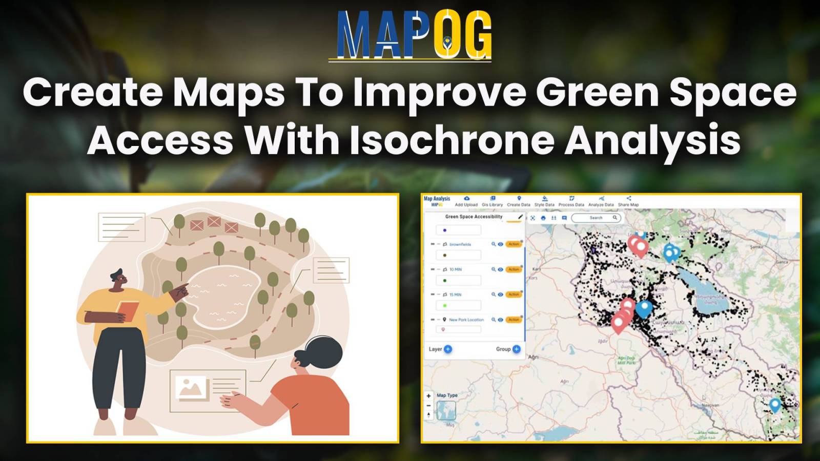
In “Green Space Accessibility using Isochrones in MAPOG, we utilize isochrone maps to evaluate and improve access to green spaces. This approach helps identify areas with limited accessibility and guides urban planning efforts to enhance community well-being. Key Concepts By using isochrones in MAPOG, we can analyze and optimize the accessibility of these green spaces, … Read more
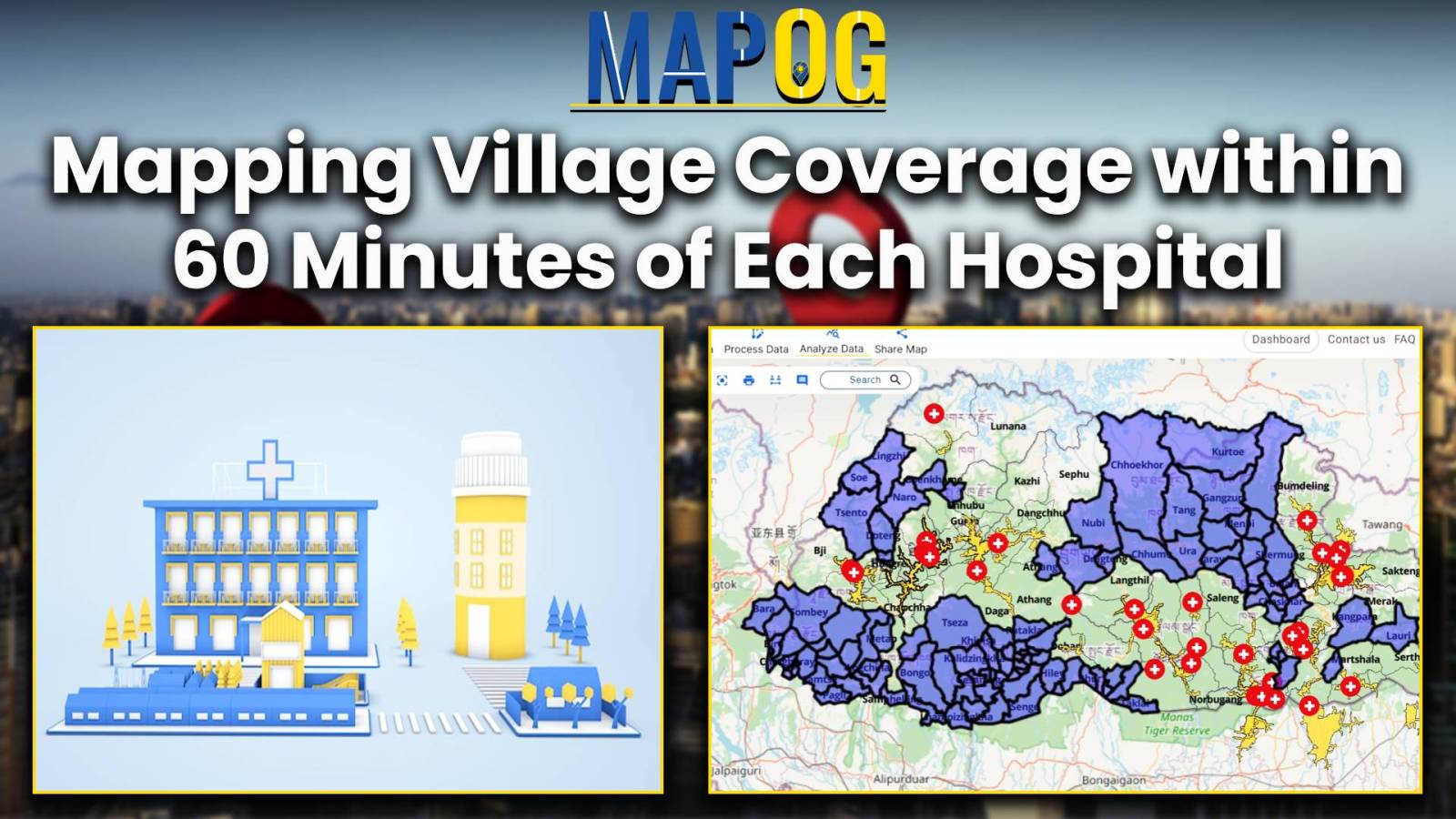
Improve public health by analyzing hospital accessibility with MAPOG. Discover how to strategize healthcare infrastructure for diverse communities.
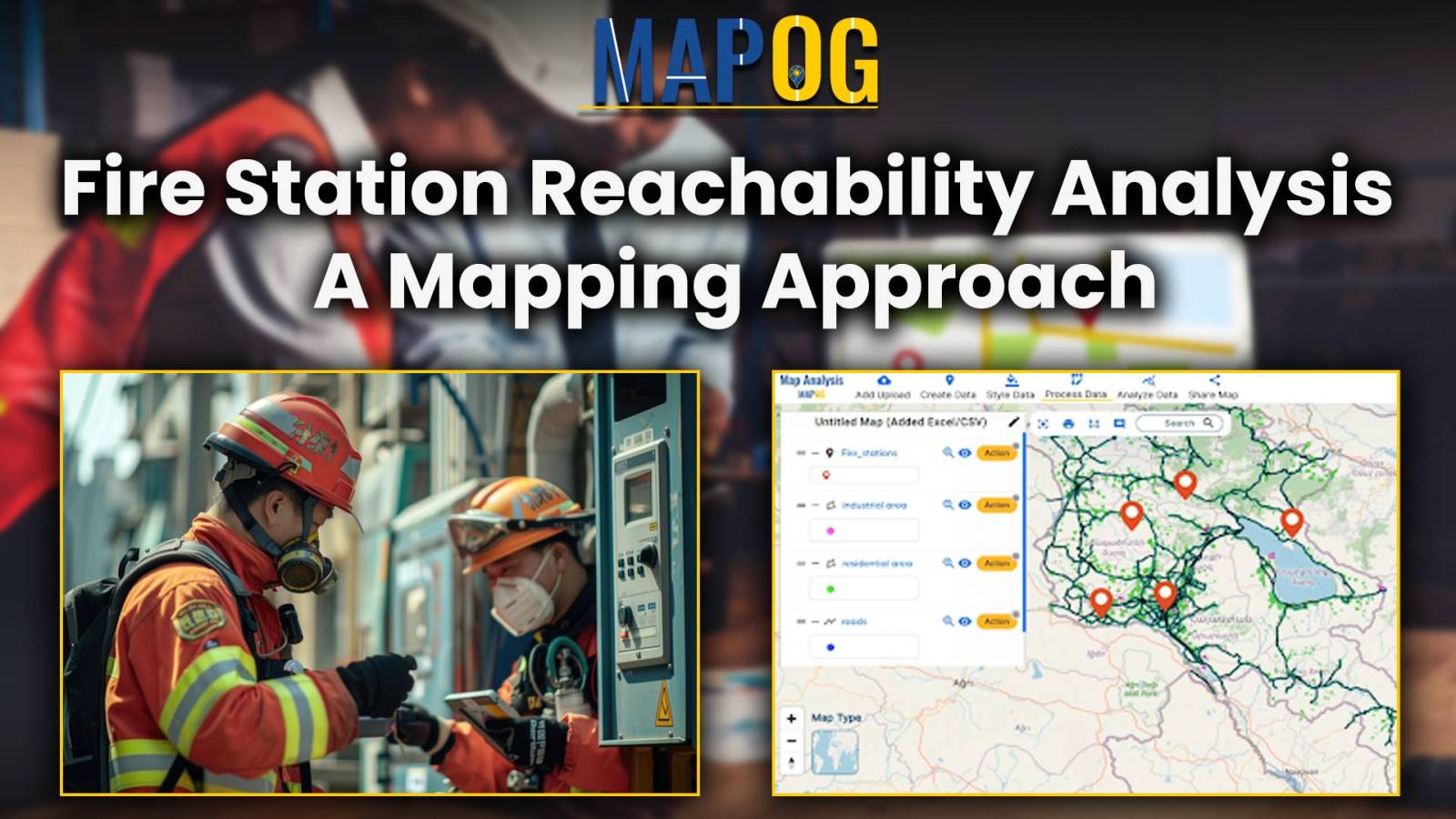
In emergency management, the strategic placement of fire stations plays a critical role in ensuring the safety and well-being of communities. Rapid response times can mean the difference between containment and devastation during a fire emergency. MAPOG offers powerful tools for evaluating potential fire station locations by analysing accessibility to road and travel time to … Read more
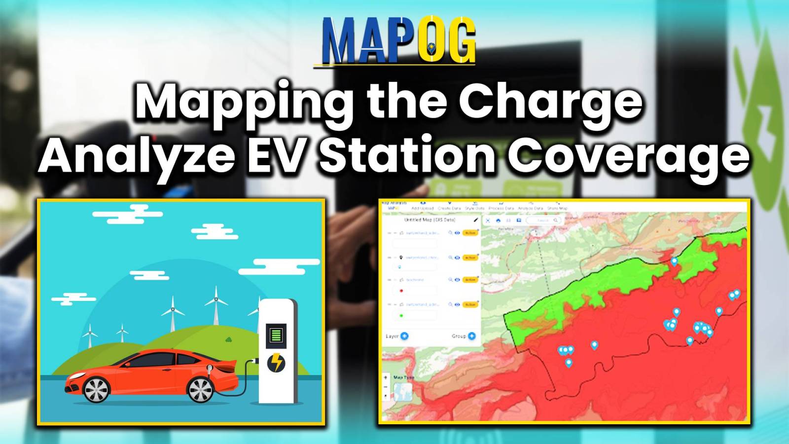
In today’s era of rapid urbanization and the push for sustainable transportation, the accessibility of charging stations for electric vehicles (EVs) has emerged as a critical consideration. In this article, we delve into the importance of evaluating the accessibility of charging stations, employing the powerful methodology of MAPOG MAP Analysis. By harnessing this innovative approach, … Read more
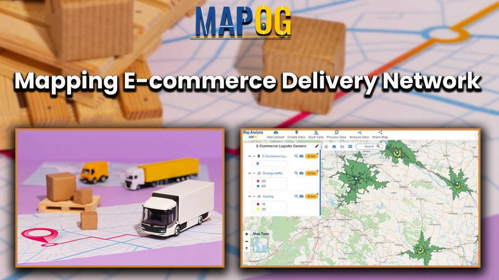
In the dynamic realm of e-commerce, optimizing last-mile delivery is paramount for customer satisfaction and market competitiveness. E-Commerce Logistics Isochrone Analysis Mapping Strategy, facilitated by tools like MAPOG, plays a pivotal role in refining logistics operations and elevating delivery efficiency. By strategically mapping e-commerce delivery networks using isochrone analysis, businesses can gain valuable insights into … Read more
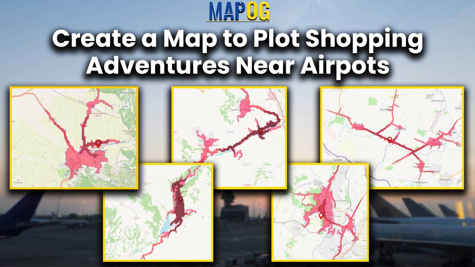
In the realm of modern travel, airports not just serve as gateways to destinations but also operate as hubs for retail exploration. Nevertheless, maneuvering through shopping adventures in close proximity to airports can prove overwhelming. This is precisely where MAPOG steps in—a GIS platform that revolutionizes the exploration of premium shopping experiences near airports. This … Read more
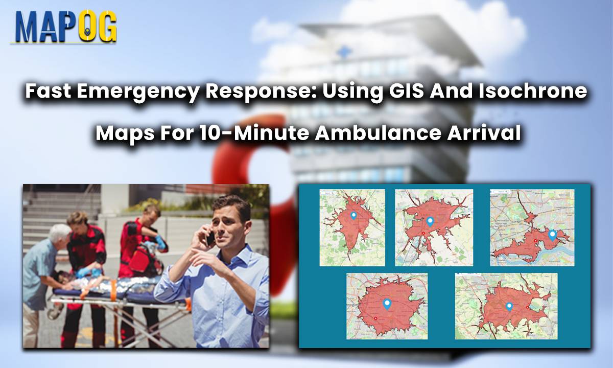
In a groundbreaking move for public safety, the Ambulance Plotting System has been introduced in Great Britain. Integrated within the MAPOG framework, this innovative system guarantees a life-saving presence within a mere 10 minutes at fatal accident sites. By swiftly coordinating emergency responses, it aims to significantly reduce fatalities and enhance overall patient outcomes. This … Read more