Comprehensive Hospital Facility Analysis Using Population and GIS Data: Step-by-Step Guide
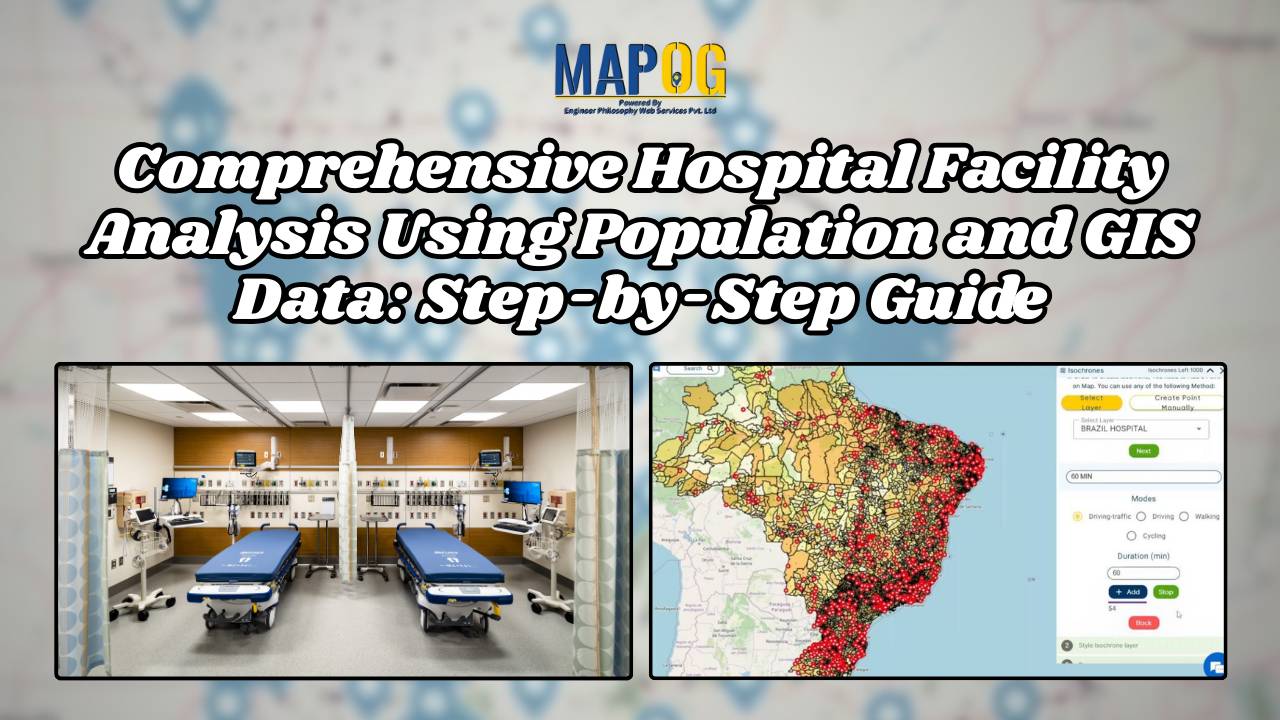
Explore the intricate relationship between healthcare accessibility and demographics in hospital facility analysis.
Explore the intricate relationship between healthcare accessibility and demographics in hospital facility analysis.
Find out how MAPOG is improving mail experiences in Cambodia with its innovative post office site selection strategy.
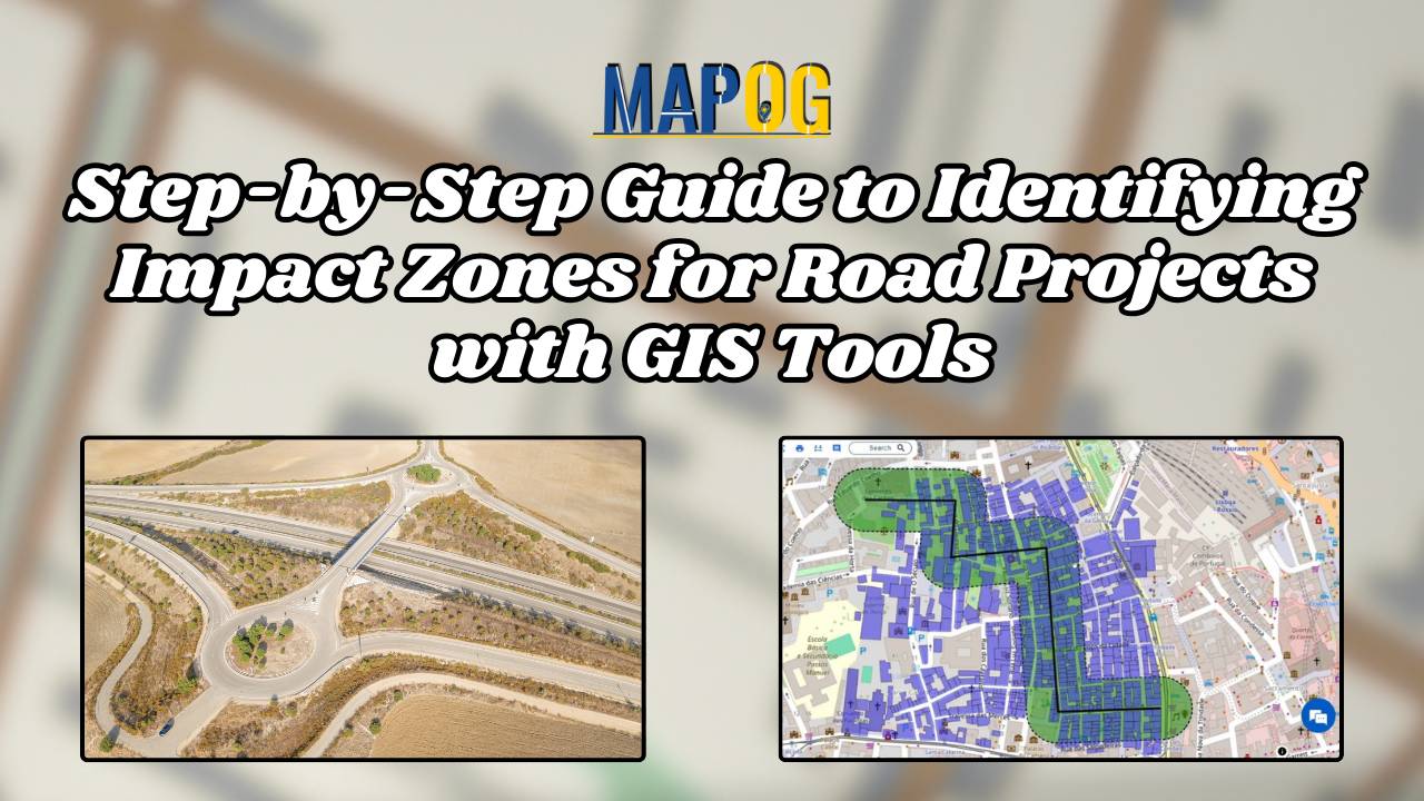
Explore how MAPOG streamlines infrastructure planning by identifying impact zones for future road projects with transparency and precision.
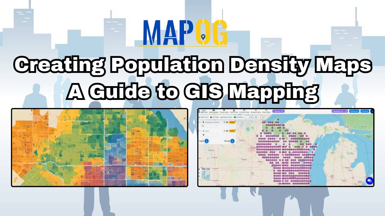
MAPOG’s population density map illuminates spatial patterns, guiding urban planning, healthcare, and policy decisions.
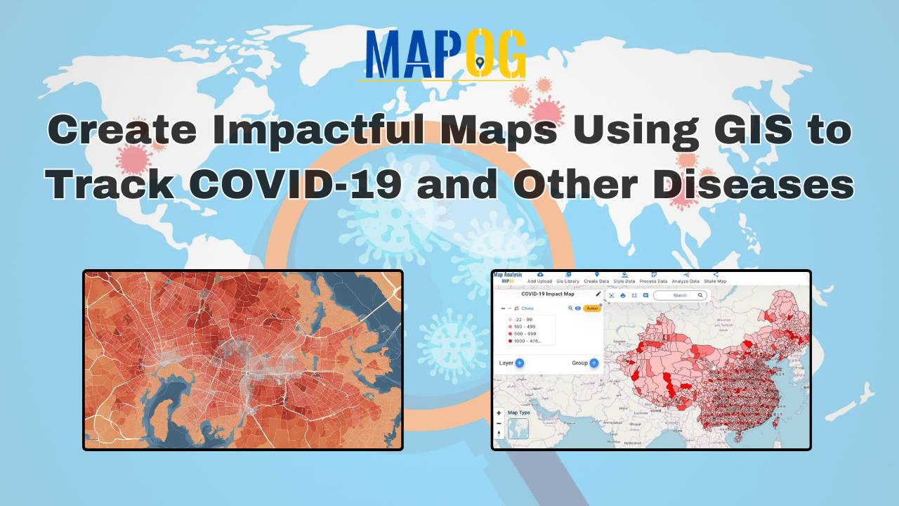
Mapping COVID-19 Impact: This analysis identifies hotspots, low case areas, and trends over time, aiding in effective resource allocation and policy-making.
Mapping the rivers within a state is crucial for understanding their interaction with other geographical features. Using the MAPOG Map Analysis platform, you can easily visualize these intersections. The Cross Intersection tool helps you identify where rivers cross roads, railways, and boundaries, providing valuable insights for environmental monitoring and urban planning. Discover how MAPOG can … Read more
GIS analysis reveals where pharmacies should be located near hospitals, ensuring timely access to medicine and enhancing public health outcomes.
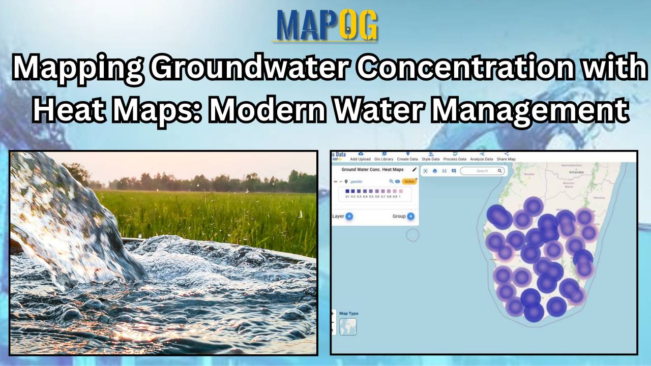
Learn how to map groundwater concentrations with MAPOG MAP ANALYSIS. In this article, we explore the transformative power of heat maps in mapping groundwater concentration. Discover how this innovative approach revolutionizes our understanding of groundwater quality and aids in the protection of vital water resources. KEY CONCEPTS Our goal is to create a simple and … Read more
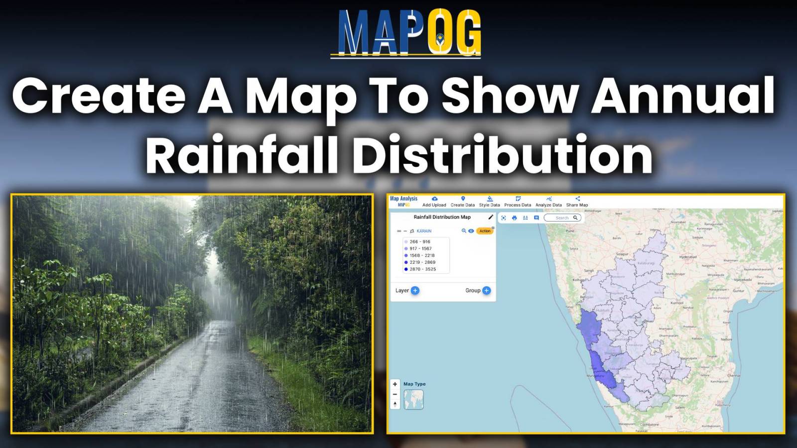
Embark on a journey through the intricate world of mapping annual rainfall distribution, where each droplet paints a picture of climate variation and geographic uniqueness. Leveraging MAPOG’s Map Analysis tools, we unravel the complexities of precipitation patterns with precision and clarity. Join us as we navigate the art and science of visualizing rainfall distribution, offering … Read more
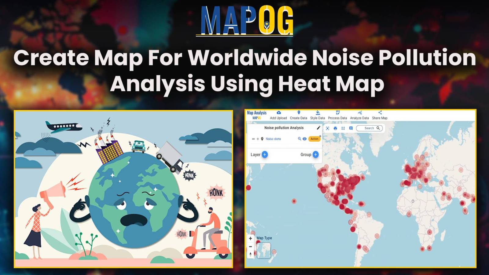
Unveiling Noise Pollution: Worldwide Analysis In MAPOG, let us converge our means available and join in the task of using both technology and natural awareness, so that we may initiate a move towards the future of sustainability, using the language of noise, so let´s decipher it with accuracy and clarity. Through MAPOG, we can discover … Read more