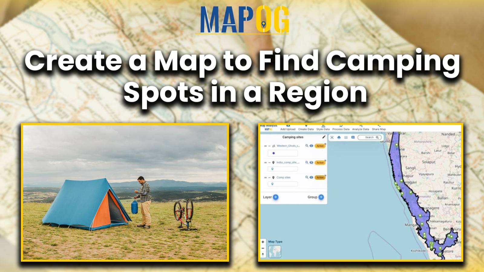
Create a Map: Filter Camping Spots in a Region Within – Points in polygon
In the dynamic world of outdoor recreation and tourism, finding ideal camping spots within a region can be challenging. Using shapefiles for the region and point files for camping locations, proximity analysis becomes a formidable tool. In this use case, we explore MAPOG Map Analysis for identifying optimal Camping Spots: Points in Polygon Analysis. Join … Read more