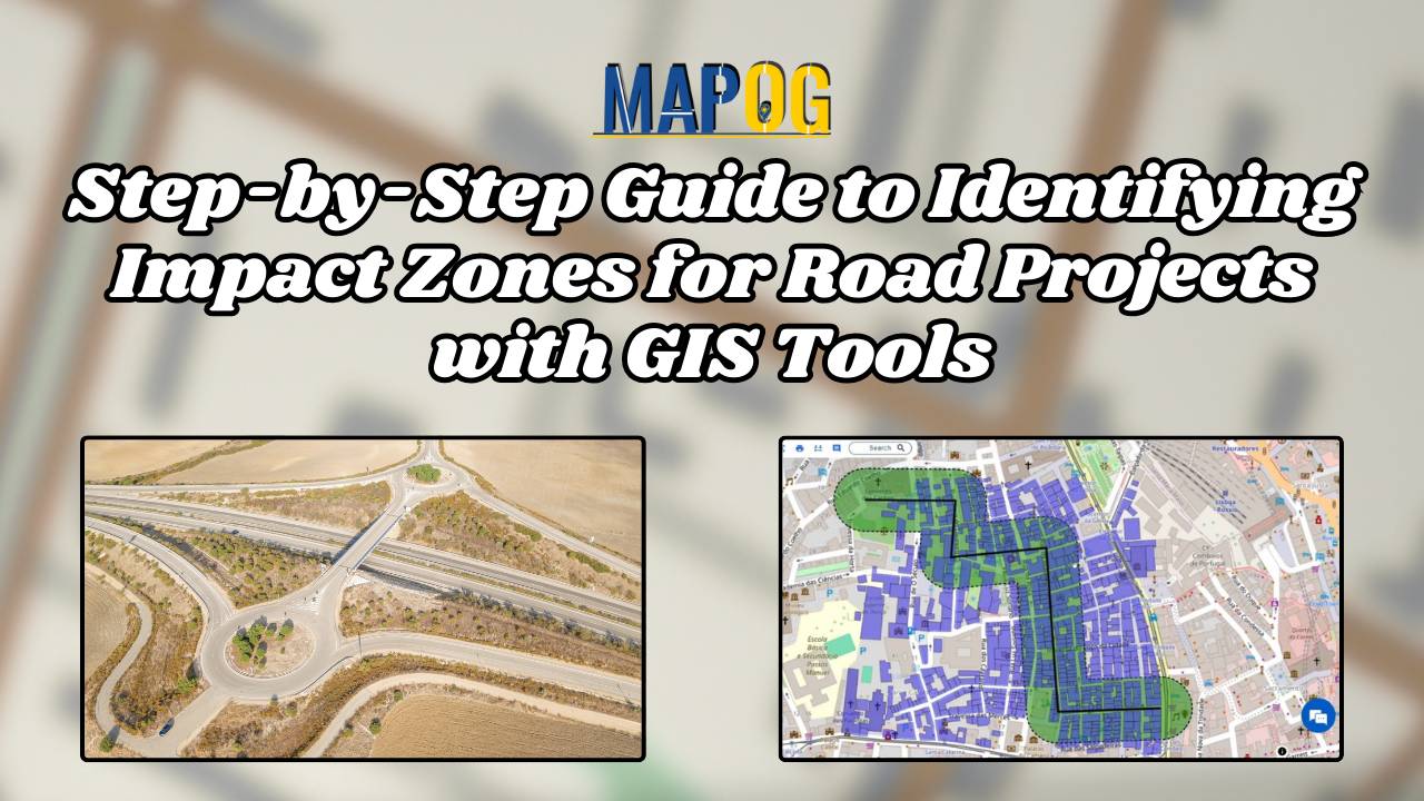
Step-by-Step Guide to Identifying Impact Zones for Road Projects with GIS Tools
Explore how MAPOG streamlines infrastructure planning by identifying impact zones for future road projects with transparency and precision.
Explore how MAPOG streamlines infrastructure planning by identifying impact zones for future road projects with transparency and precision.
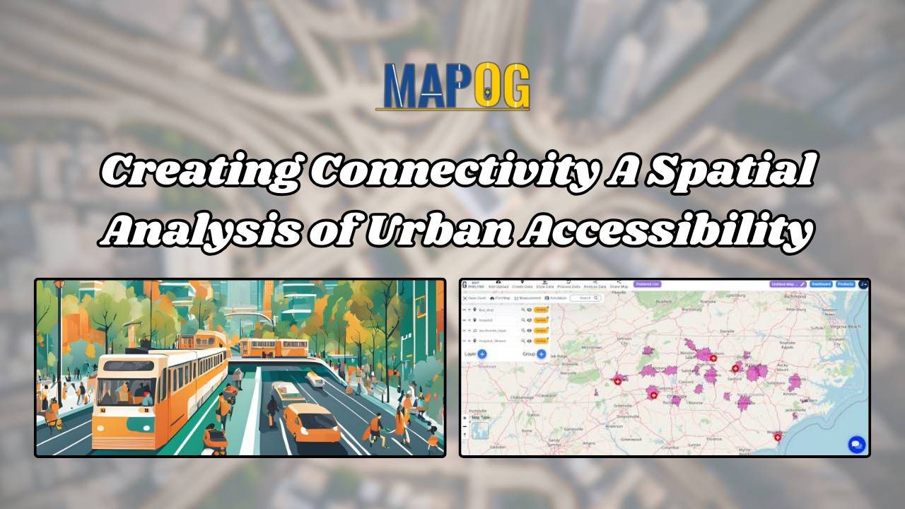
Creating Connectivity: A Spatial Analysis of Urban Accessibility links bus stops and healthcare, revealing areas and strategic real estate opportunities within 20 minutes.
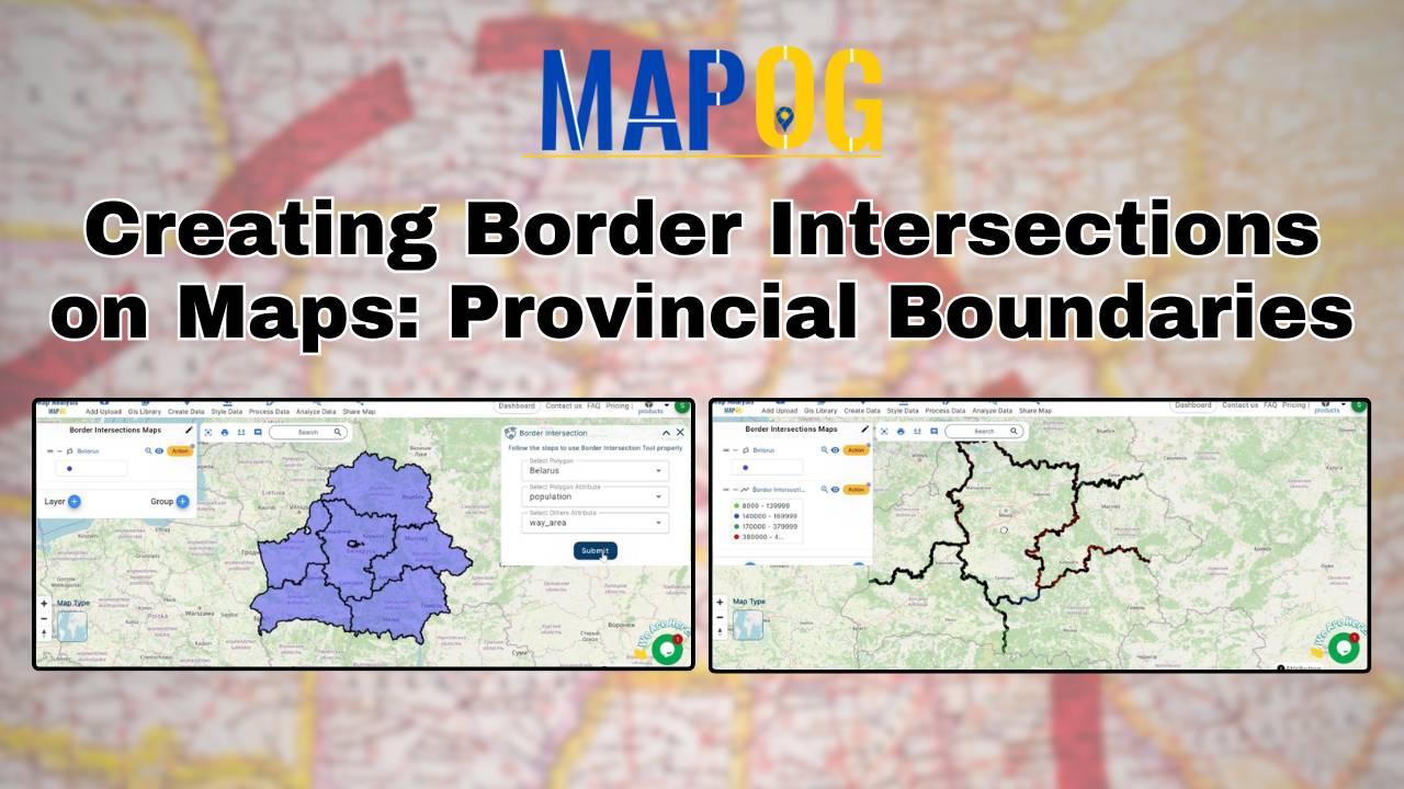
Learn how to map provincial boundaries using MAPOG. Understand border intersections for urban planning, environmental management, and political geography.
Understanding and analyzing sports activities in various areas is crucial for making informed decisions about community health, engagement, and infrastructure investments. Mapping Sports Activity: Using Levels for Analysis, By using the level feature and category style in GIS, we can visualize and categorize sports activities on a map effectively. Key Concept of Create Sports Maps … Read more
Proximity analysis reveals spatial relationships, aiding resource management decisions by identifying patterns, risks, and opportunities efficiently.
Unlock spatial insights with MAPOG, revealing population distribution, settlement patterns, and strategic opportunities for urban planning, health interventions, real estate, and telecommunications.
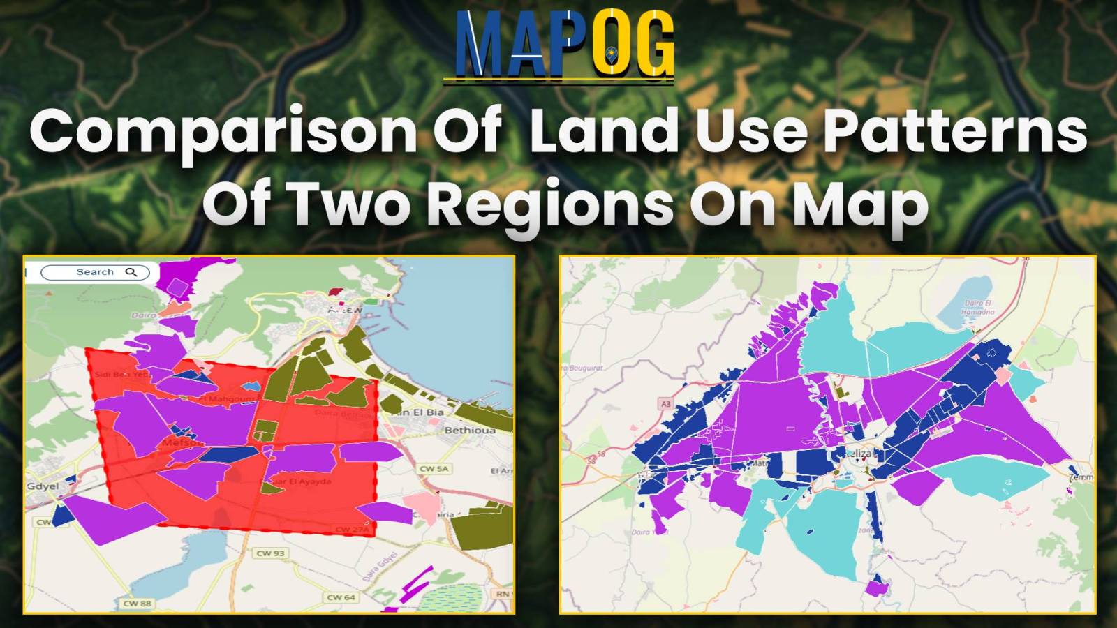
leveraging MAPOG’s category style options and clip tool to provide a comprehensive comparison of land use characteristics between two regions.
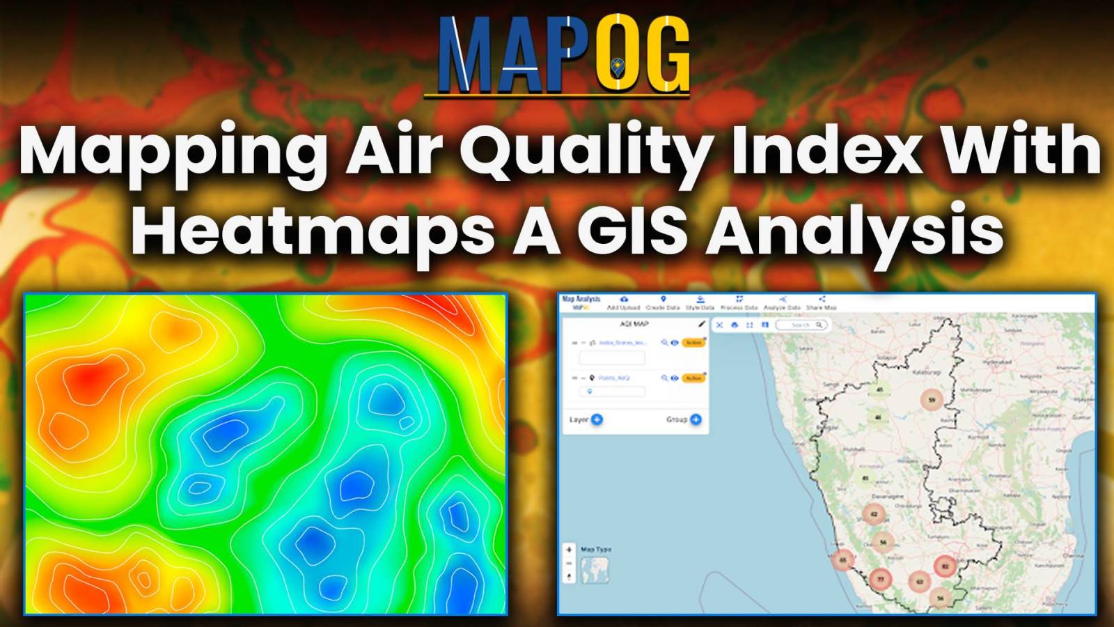
In this article, we examine the utilization of MAP OG’s MAP ANALYSIS techniques for visualizing Air Quality Index (AQI) data and Mapping Air Quality Index. Discover how GIS tools offer insights into pollution patterns, aiding informed decision-making for environmental health. Through sophisticated mapping techniques, we uncover nuanced insights into air pollution distribution. Explore how these … Read more
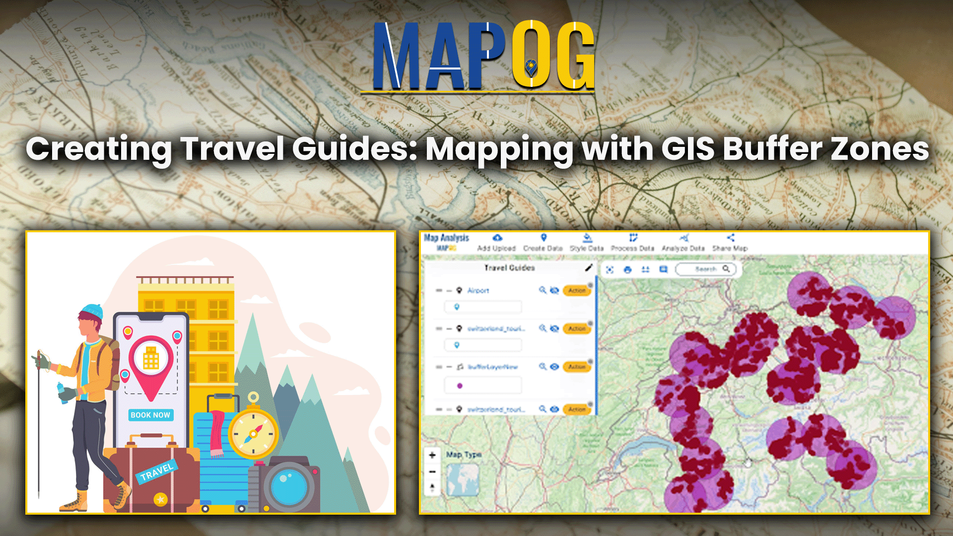
This analysis merges airport and tourist data using GIS, creating travel guides maps for travelers to find nearby attractions from airports.
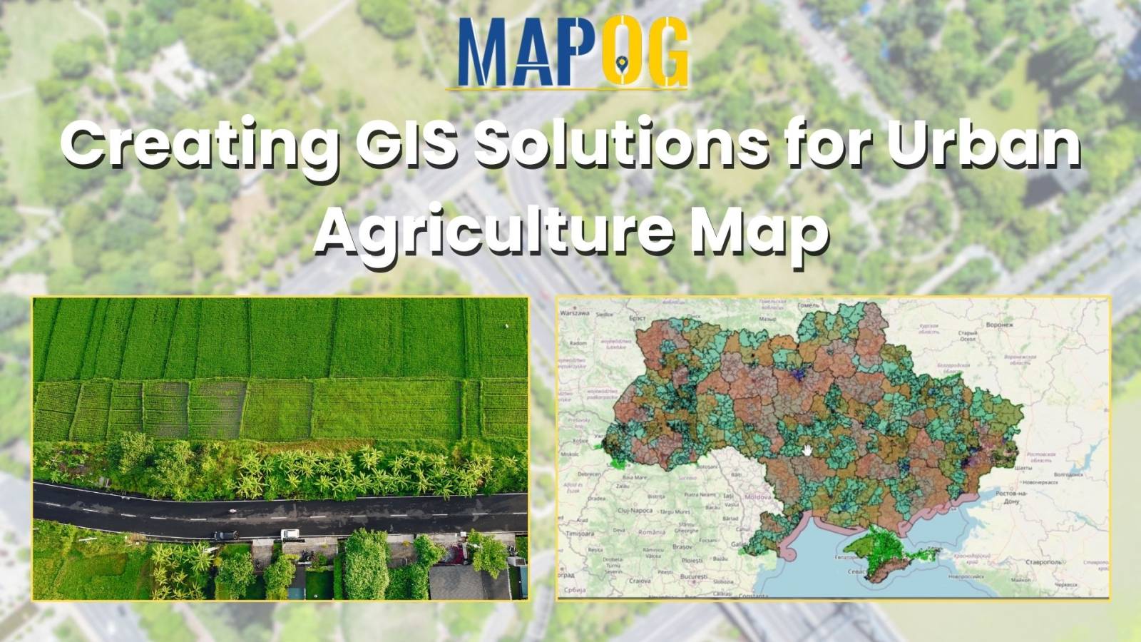
Insights into farmland distribution, urban encroachment risks, agricultural potential, and mitigation strategies for urban agriculture.