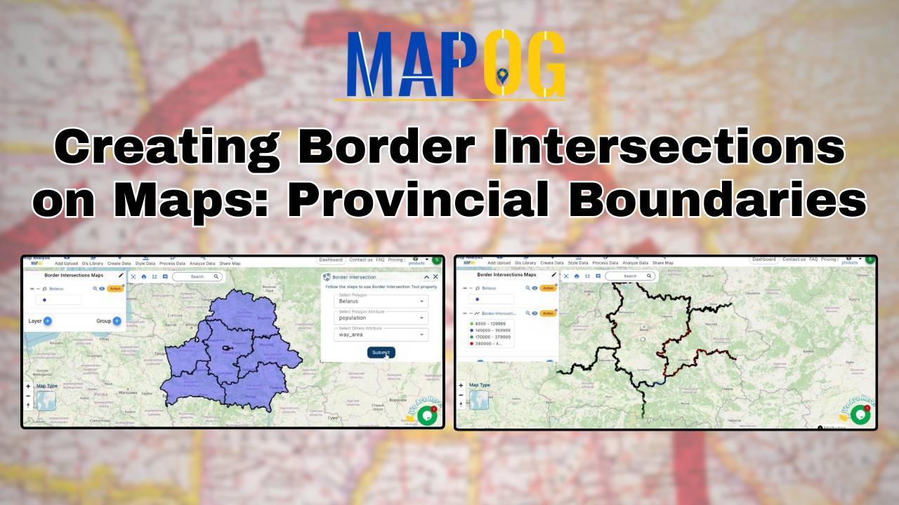
Creating Border Intersections on Maps: Provincial Boundaries
Learn how to map provincial boundaries using MAPOG. Understand border intersections for urban planning, environmental management, and political geography.
Learn how to map provincial boundaries using MAPOG. Understand border intersections for urban planning, environmental management, and political geography.
Mapping the rivers within a state is crucial for understanding their interaction with other geographical features. Using the MAPOG Map Analysis platform, you can easily visualize these intersections. The Cross Intersection tool helps you identify where rivers cross roads, railways, and boundaries, providing valuable insights for environmental monitoring and urban planning. Discover how MAPOG can … Read more
GIS analysis reveals where pharmacies should be located near hospitals, ensuring timely access to medicine and enhancing public health outcomes.
Understanding and analyzing sports activities in various areas is crucial for making informed decisions about community health, engagement, and infrastructure investments. Mapping Sports Activity: Using Levels for Analysis, By using the level feature and category style in GIS, we can visualize and categorize sports activities on a map effectively. Key Concept of Create Sports Maps … Read more
GIS analysis identifies coverage gaps, places new infrastructure strategically, and optimizes resource allocation for telecom improvements
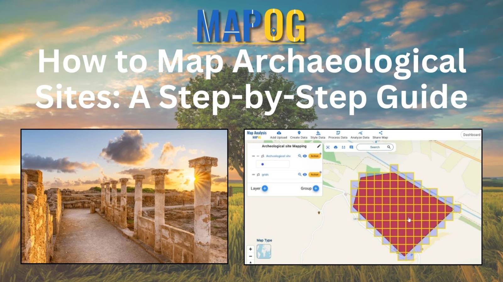
In the timeless pursuit of understanding our collective history, archaeologists rely on various innovative techniques to uncover ancient civilizations. MAPOG tools for site mapping can revolutionise the field, offering precise and efficient ways to document and analyse archaeological sites. In this article, we delve into the fascinating realm of archaeological site mapping, focusing on the … Read more
In the realm of Geographic Information Systems, the ability to visualise spatial data is crucial for understanding patterns, making informed decisions, and communicating information effectively. One fundamental aspect of data visualisation is the representation of specific locations or features on a map using points. Customising these points with distinct icons adds clarity, context, and visual … Read more
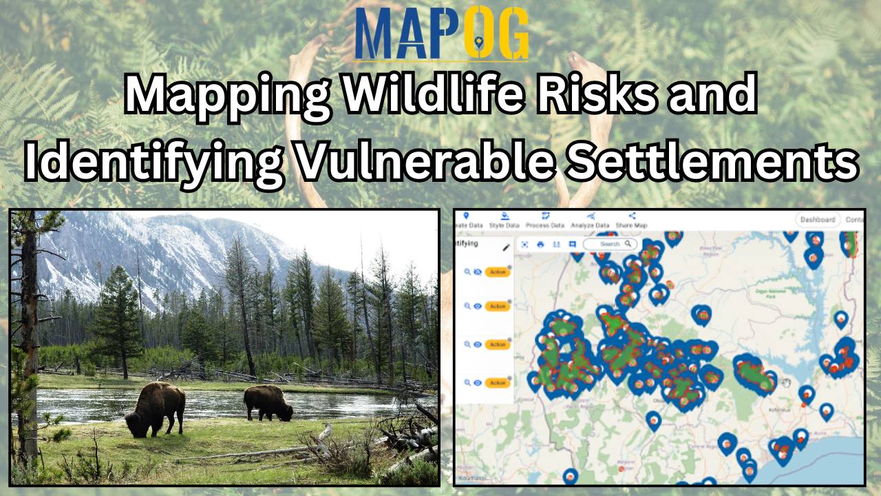
As urban areas expand and encroach upon natural habitats, the potential for conflicts between humans and wildlife increases. Understanding and mitigating these risks is important for both human safety and wildlife conservation efforts. MAPOG serves as an invaluable tool in this attempt, enabling the identification and mapping of vulnerable settlements near forests or wildlife habitats. … Read more
Spatial Joining – Add GIS data – easy interface to do this – Join with within clause – Easily check the data table
Serving as vigilant electronic eyes, CCTV systems are indispensable tools which capture crucial visual evidence in crime investigation. However, not all cameras are equally effective in aiding investigations. Identifying the right cameras, strategically placed in an area, can significantly enhance crime-solving capabilities. By employing MAPOG tools, law enforcement can efficiently identify CCTV cameras that are … Read more