Resource Management GIS Proximity Analysis: Understanding Spatial Relationships
Proximity analysis reveals spatial relationships, aiding resource management decisions by identifying patterns, risks, and opportunities efficiently.
Proximity analysis reveals spatial relationships, aiding resource management decisions by identifying patterns, risks, and opportunities efficiently.
The task of creating a “Enhancing Hotel Experiences with Mobile Data Collection Survey App” falls to MAPOG. MAPOG information gathering makes it simple to obtain traveler acquisition details. Hotel operators may thus better cater to local tastes, enhance their offerings, and provide a more enjoyable stay for their patrons. Visitors will think it’s a great … Read more
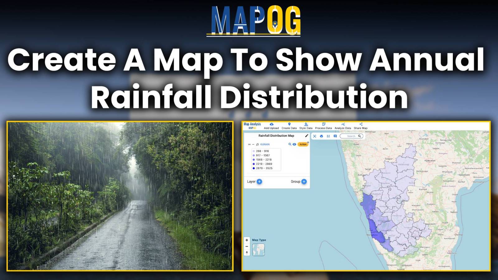
Embark on a journey through the intricate world of mapping annual rainfall distribution, where each droplet paints a picture of climate variation and geographic uniqueness. Leveraging MAPOG’s Map Analysis tools, we unravel the complexities of precipitation patterns with precision and clarity. Join us as we navigate the art and science of visualizing rainfall distribution, offering … Read more
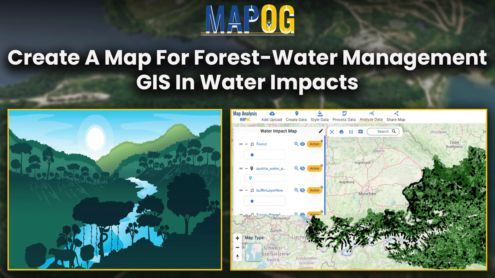
This analysis reveals forest areas influenced by nearby water, aiding decisions in timber, water management, ecotourism, and conservation.
Insights from GIS data: Urban planning, environmental protection, healthcare, real estate benefit, aiding decision-making.
Explore population dynamics with a demographics map. Use spatial analysis to uncover insights into community composition and trends.
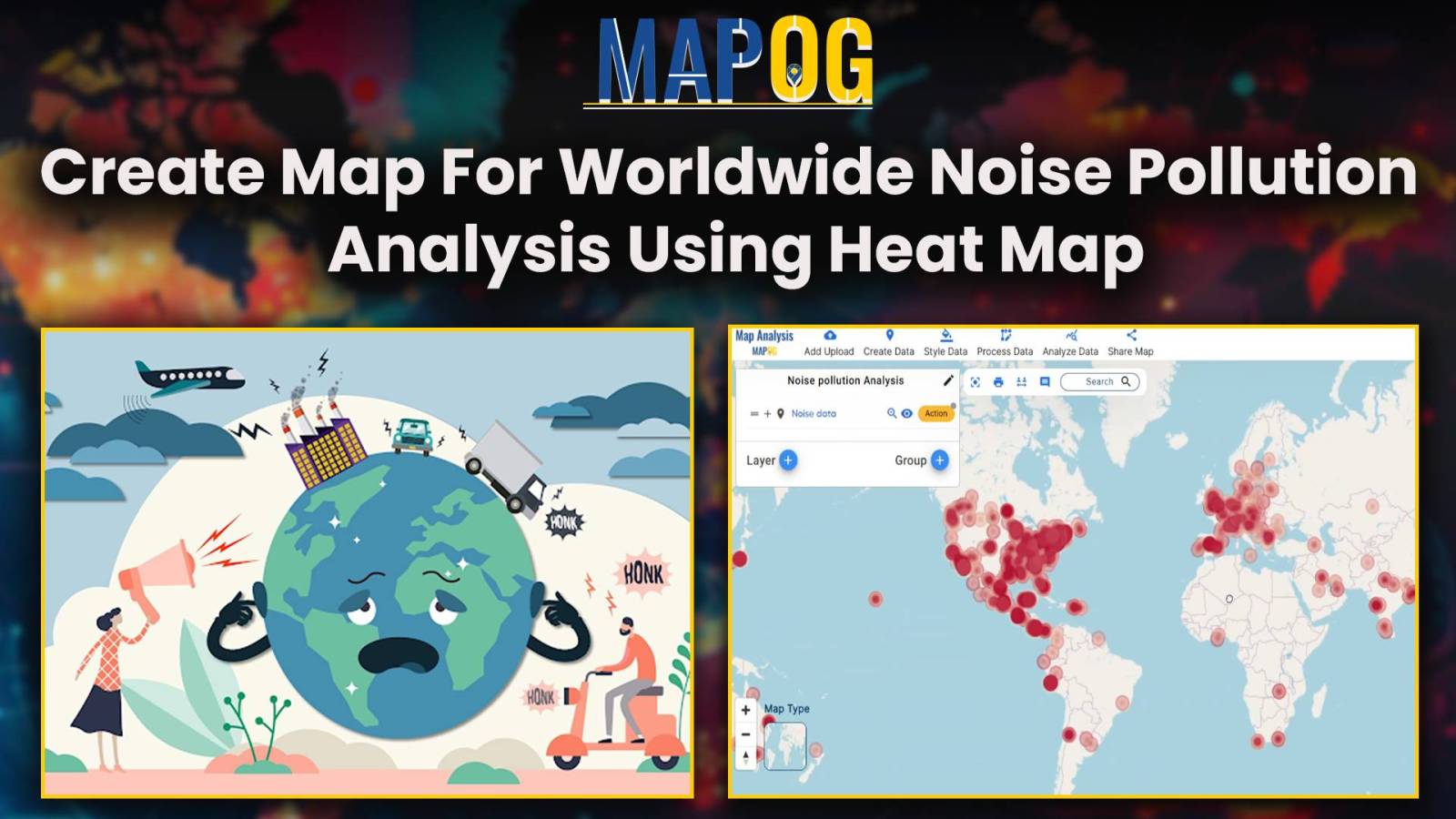
Unveiling Noise Pollution: Worldwide Analysis In MAPOG, let us converge our means available and join in the task of using both technology and natural awareness, so that we may initiate a move towards the future of sustainability, using the language of noise, so let´s decipher it with accuracy and clarity. Through MAPOG, we can discover … Read more
In energy infrastructure management, ensuring the safety and integrity of pipeline networks is very important. The influence of pipelines extends far beyond their physical footprint, encompassing the communities, ecosystems, and infrastructure that lie in their vicinity. Understanding and mitigating the potential risks of pipeline activities necessitate a holistic approach. In this article, we delve into … Read more
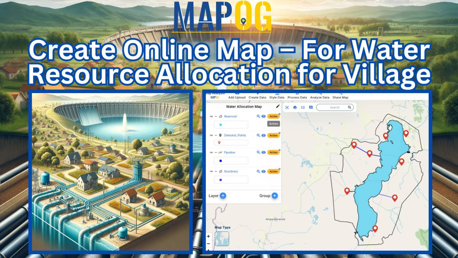
Water resource allocation maps offer a crucial solution to the challenge of uneven water distribution. This article explores their pivotal role in promoting fairness, sustainability, and resilience in communities. With insights from MAPOG Map Analysis, we unveil how these maps are transforming the water management landscape. KEY CONCEPTS Our goal is to create a map … Read more
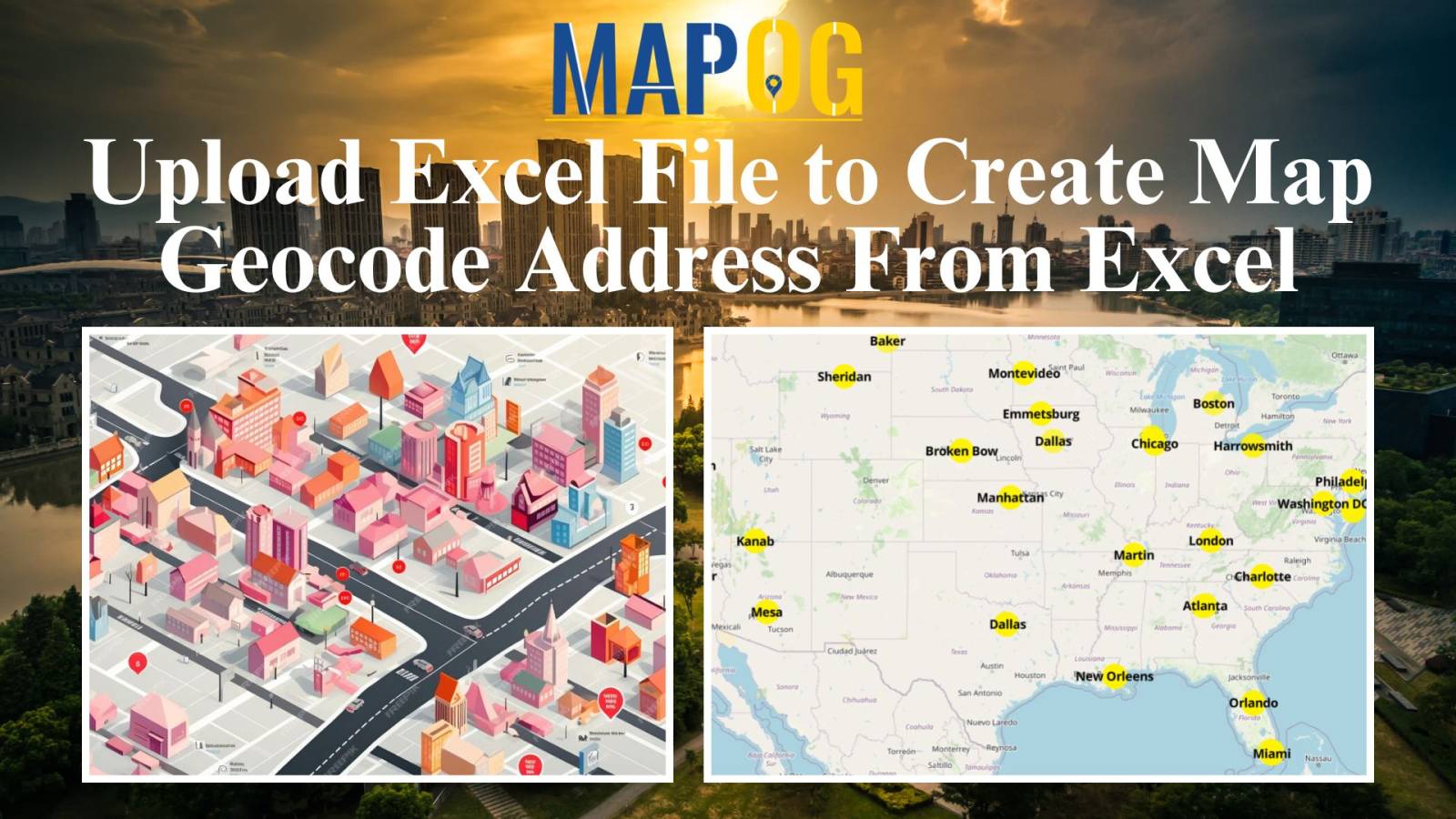
Mapping locations through addresses using the Geocoder tool is a game-changer in the field of Geographic Information Systems (GIS). MAPOG Map Analysis leverages this technology to convert addresses into precise geographic coordinates, enhancing accuracy in urban planning, navigation, and emergency services. Discover how MAPOG’s powerful Geocoder tool can transform your mapping projects. KEY CONCEPTS Our … Read more