Create a map of Intersecting Paths: A Proximity Analysis of Road and River Crossings
In the realm of Geographic Information Systems (GIS), the task of mapping road- river intersections have long been a cumbersome and error-prone endeavor. However, with the advent of advanced tools like MAPOG, this process has undergone a transformative evolution. At the forefront of this evolution is MAPOG‘s powerful intersection analysis tool, which promises to revolutionize how engineers and planners approach the construction of bridges over rivers.

Explore the application of MAPOG in wetland mapping-Protecting Wetlands: Guide to Create GIS Map for Nature.
Key Concept for Mapping Road-River Intersections
By harnessing the proximity analysis option offered by MAPOG, engineers can now efficiently identify and analyze intersections between roads and rivers. This capability is paramount in the construction of bridges, where precise mapping of intersection points is essential for ensuring structural integrity and safety. For more information on fast emergency response, check out our article – Fast Emergency Response: Using GIS and Isochrone Maps for 10-Minute Ambulance Arrival.
Steps for Mapping Road-River Intersections
Step 1 Upload the data
Navigating to the MAPOG map analysis tool, add the GIS data for our needs.
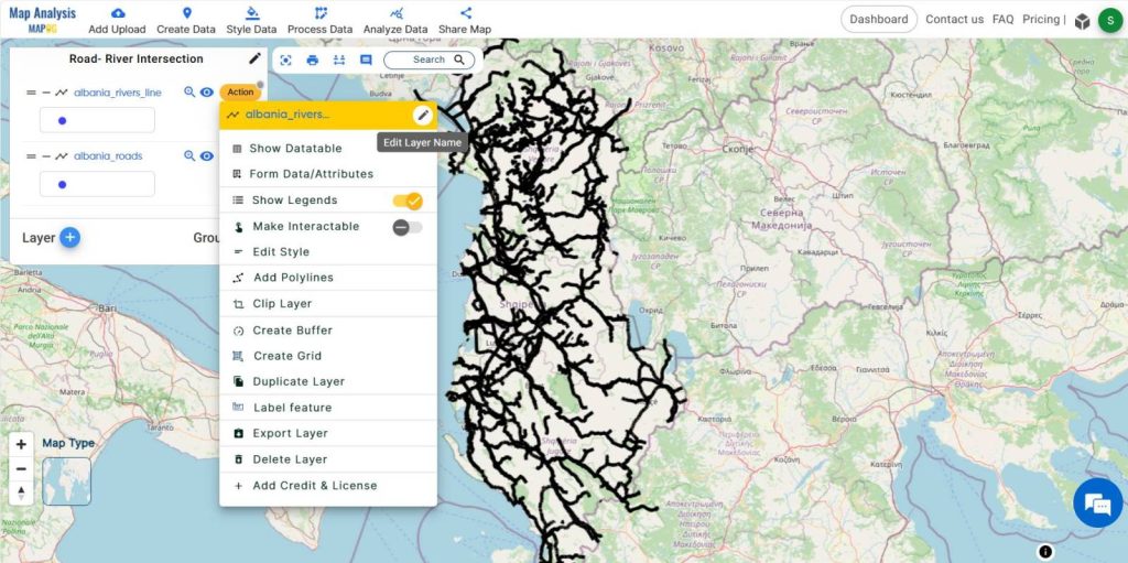
Transitioning to the MAPOG map analysis tool, we add the GIS data for our needs. MAPOG offers a wide range of data. Herein, the road line and river line in an area are added. You may opt to manually select or utilise the AI search option for data addition.
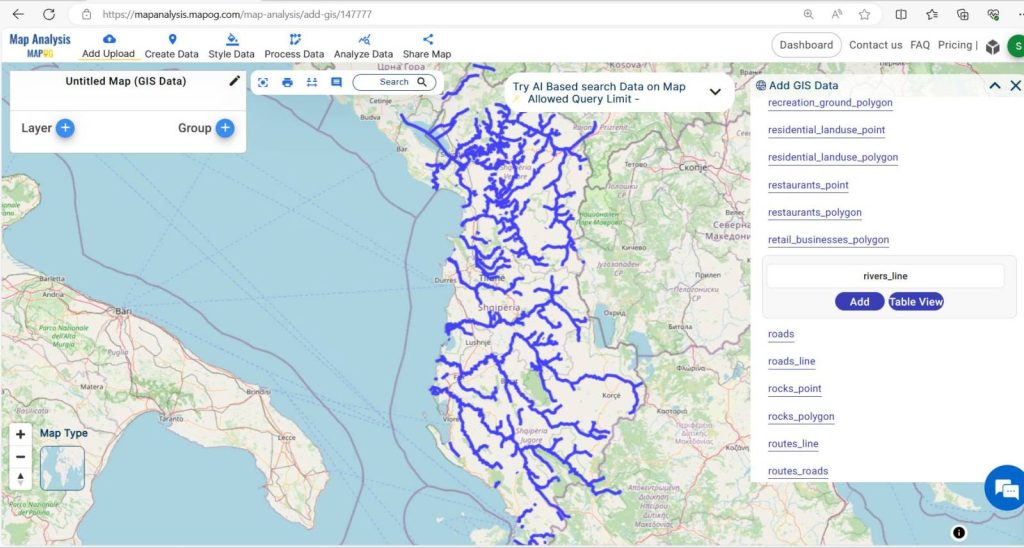
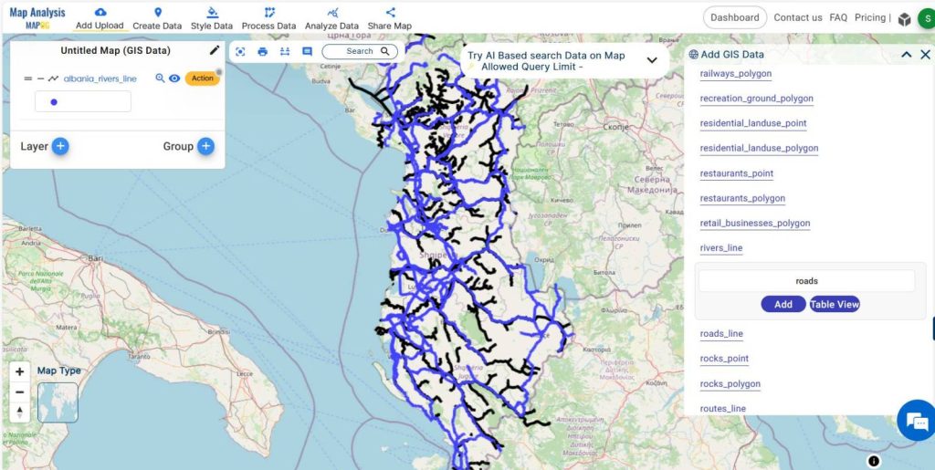
Selecting the road and river line data and adding them to the layer, the data in this area becomes visible on the screen.
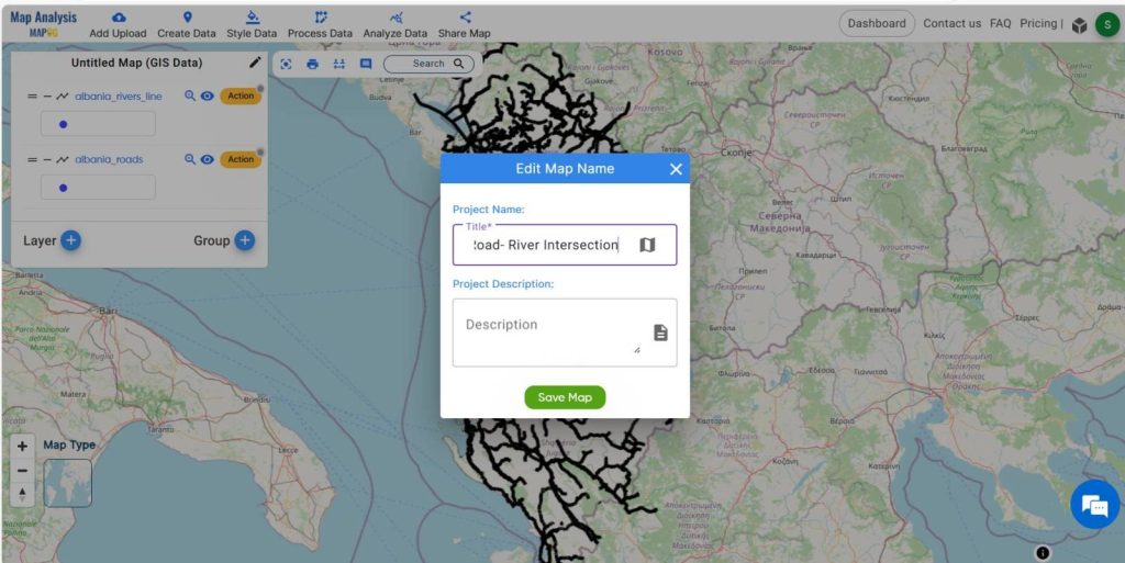
Step 2 Project Title
Give the project a title instead of leaving it untitled. Additionally, describe your project in the description box.
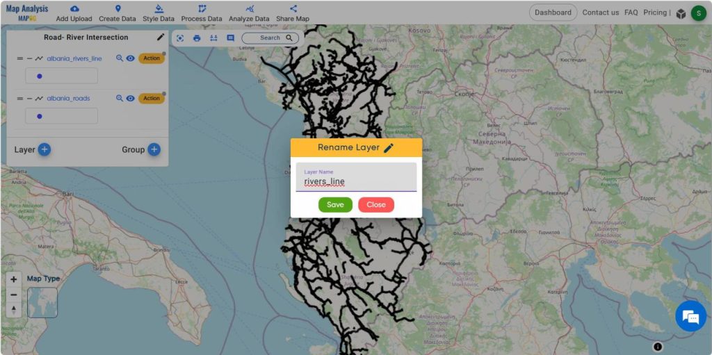
Also, rename the data layer by clicking on the action button associated with each data layer.
Then, rename the layer for better understanding.
Step 3-Styling
Select the action button on the road data layer added. Select the basic style option. Choose an appropriate colour to apply for river line data and save it.
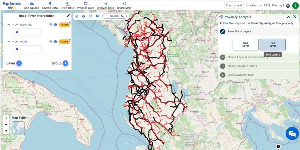
Step 4 Proximity Analysis
To find out the intersection of roads and rivers, select the analysis data option in the menu bar. Then a window for proximity analysis appears. Select the two layers option, so we have two layers to check for proximity.
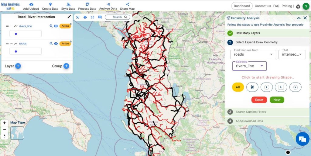
Then select the intersect option and choose both the data layers. Then submit it.
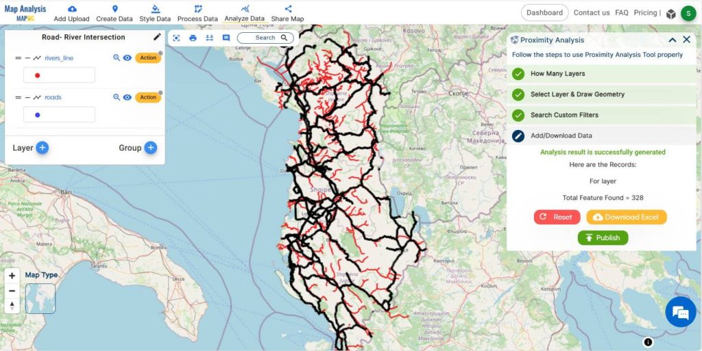
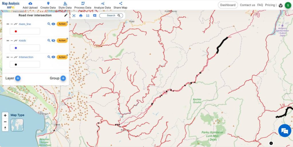
The result shows the number of intersections. Publish the data and hide all other layers to identify the road river intersection points.
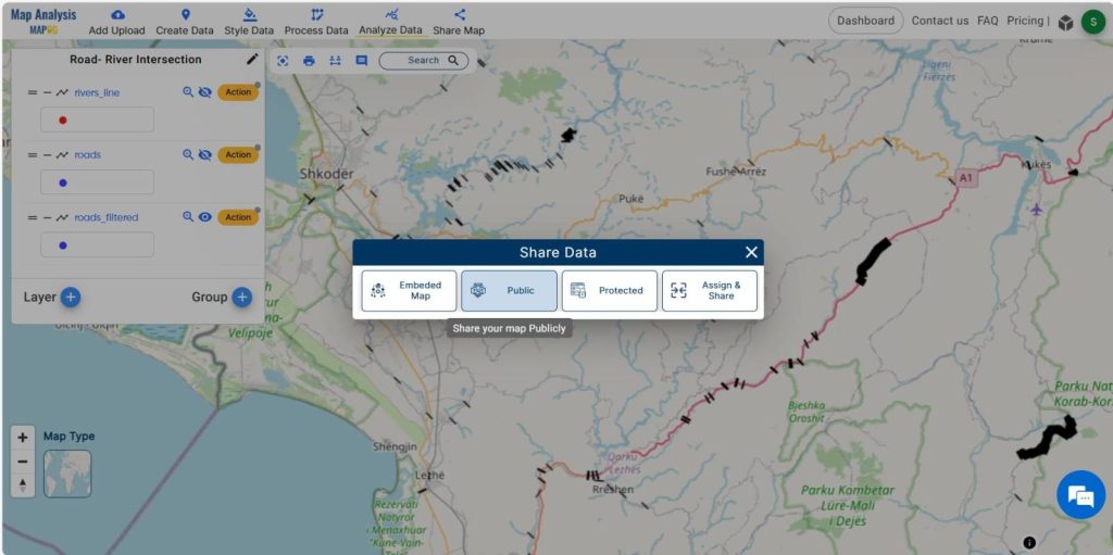
Step 5 Share the Map
Share this map to public using share data menu.
Major Findings
- Accurate identification of road-river intersections.
- Streamlined selection of optimal bridge locations.
- Enhanced planning and execution of infrastructure projects.
- Reduction of time and resources required for site surveys.
- Improved safety and accessibility for communities.
Domain and Industry
The application of MAPOG‘s intersection analysis tool extends across various domains, with a particular emphasis on transportation and safety. In the transportation sector, accurate mapping of road river intersections is crucial for optimizing infrastructure development and improving traffic flow.
Conclusion
MAPOG‘s proximity analysis tool represents a significant advancement in the field of GIS mapping, particularly in the context of road river intersection mapping. By offering a faster, more accurate, and reliable solution, MAPOG empowers engineers and planners to tackle complex bridge construction projects with greater efficiency and confidence.
If you have any questions or need assistance, please don’t hesitate to reach out to us at support@mapog.com. Thank you for joining us on this journey, and we invite you to explore the diverse applications of MAPOG in your own projects.
Are you interested in Habitat Mapping? Check this article-Map habitat locations of endangered animals & keep track of their living
GIS Data Links-Road line data, River line data