In the realm of environmental analysis and land management, extracting specific geographic features from larger datasets is essential for informed decision-making. In this use case, we explore the extraction of forest areas from a larger dataset using the Filter Tool in MAPOG Map Analysis. By uploading a shapefile of the region and a forest area polygon shapefile, we demonstrate how the Filter Tool can be employed to isolate and extract forest polygons present within the designated area. Join us as we navigate the process of creating a map to extract forest areas using a filter tool and uncover insights into forest distribution and land cover within the region.
Key Concept
This use case focuses on extracting forest areas from a larger dataset using the Filter Tool in MAPOG Map Analysis. By applying spatial filters based on the region’s shapefile, users isolate and extract forest polygons within the designated area. This process allows for targeted analysis of forest distribution and land cover, facilitating informed decision-making in land management and environmental conservation efforts.
Steps to Create a Map to Extract Forest Areas Using Filter Tool
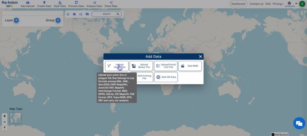
Step 1: Add Data
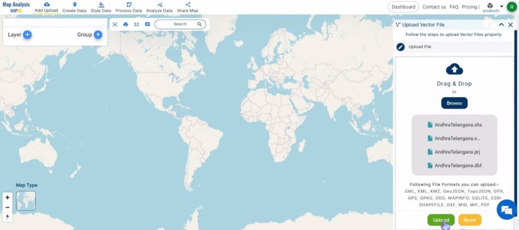
Click on Add Upload and select Add Vector File.
Browse the required shapefile of the region and the supporting files. Once selected, click on Upload.
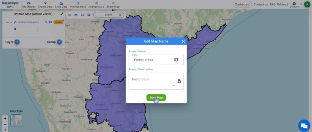
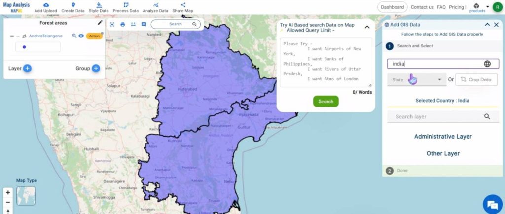
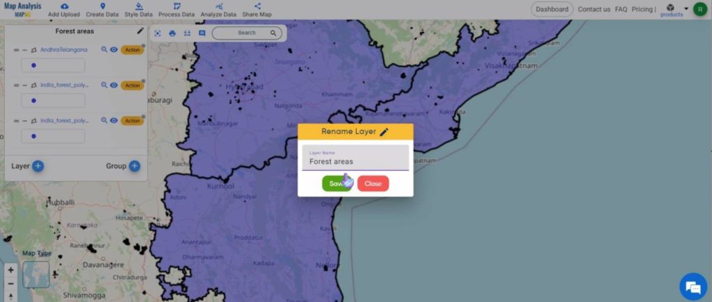
Rename the map to a suitable name by clicking on the pencil icon. Click on Save Map to save the name.
Next, click on Add Upload and select Add GIS Data.
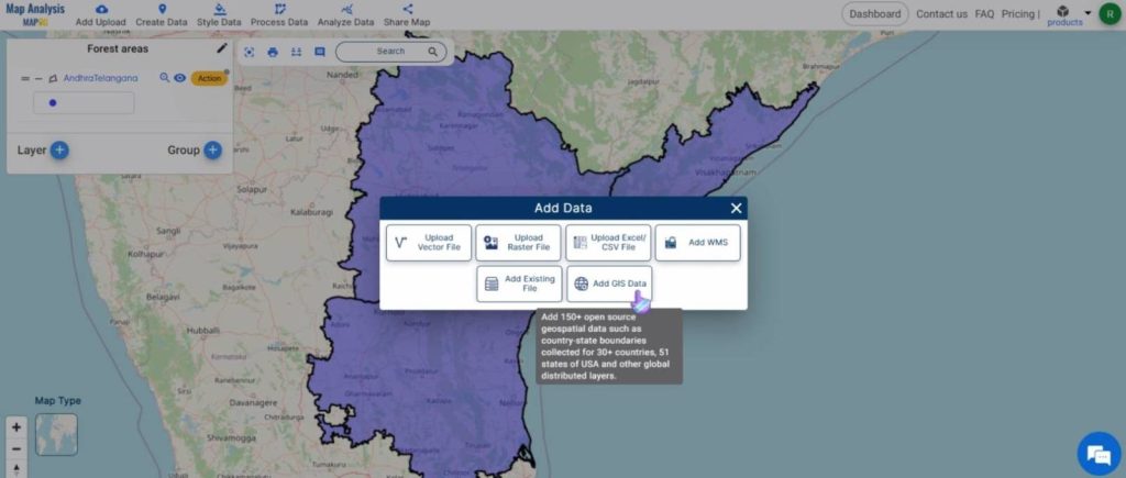
Give the country name in the drop-down box.
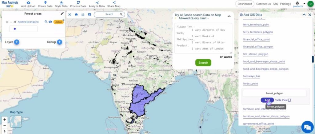
Then, search for the forest polygon dataset and Add it to the map.
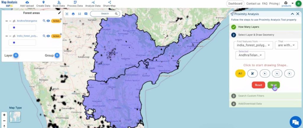
Step 2: Filter Data
Click on Analyze Data and select Filter Tool.
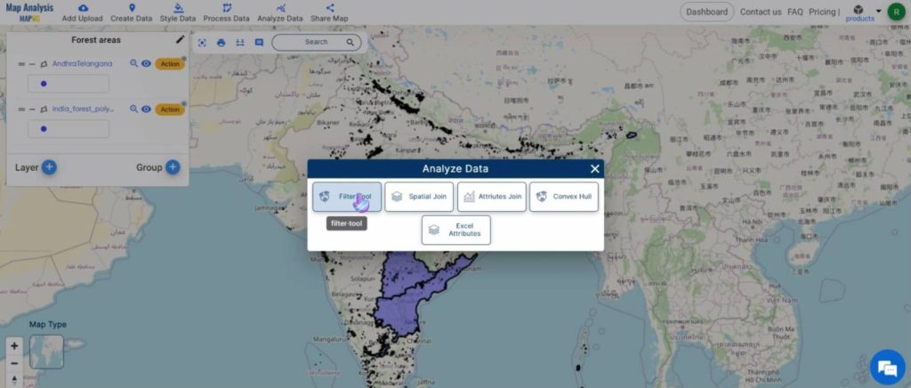
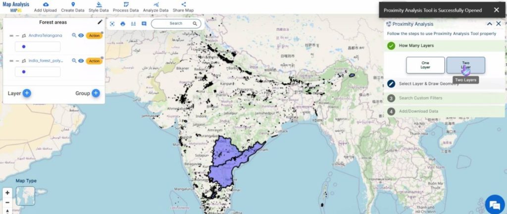
Under the How Many Layers tab, select Two Layers.
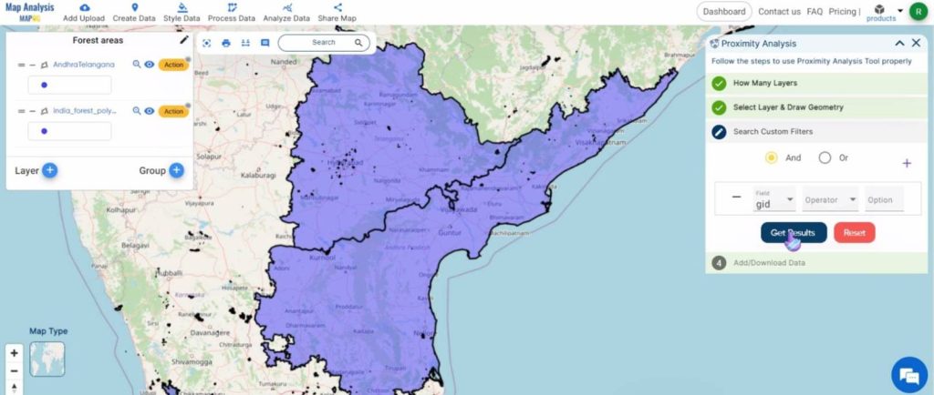
In the next tab, select the Forest polygon layer in the first drop-down and the region shapefile in the last. Then, click on Next.
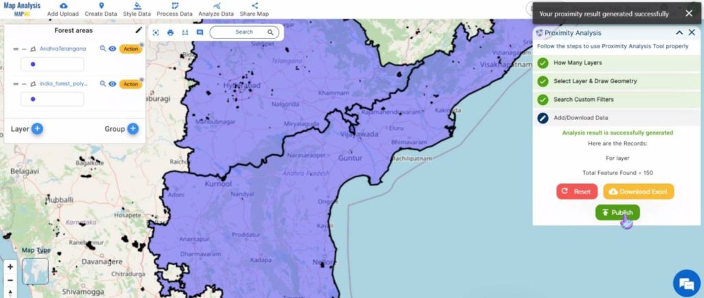
Click on Get Results and then on Publish to add the extracted features to the map.
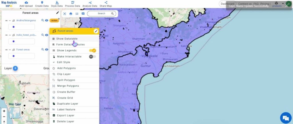
Rename the newly formed layer by clicking on the Action button and then on the pencil icon near the name of the layer.
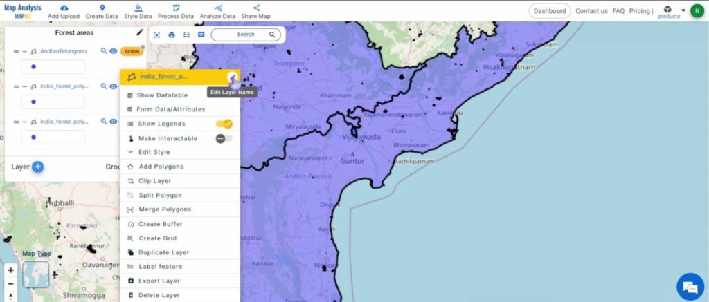
Click on Save to rename the layer.
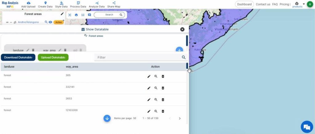
To know more about the features, click on the Action button and then on Show Datatable.
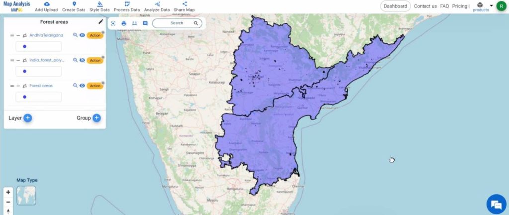
Shown below, is the final map.
Key Findings – Create a Map to Extract Forest Areas Using Filter Tool
- Precise Extraction: Precise extraction of forest polygons within the designated area provides accurate delineation of forested areas for further analysis.
- Visualization: Extracted forest polygons can be visualized on a map, allowing easy identification and analysis of the spatial distribution of forested areas within the region of interest.
- Quantification: The extracted forest polygons can be quantified to determine the total area of forest cover within the designated region, providing valuable information for land management and conservation planning.
Domain and Industry
- Forestry Departments: Precise extraction of forest areas allows monitoring of forest cover changes, implementation of sustainable forest management practices, and conservation efforts.
- Environmental NGOs: Extracted forest data is used to advocate for forest conservation, biodiversity protection, and sustainable land management practices.
- Land Use Planners: Extracted forest areas are used to inform land use planning decisions, ensuring that forested areas are appropriately zoned and protected from incompatible development activities.
Conclusion
The Filter Tool enables precise extraction of forest areas, offering valuable insights for stakeholders. Efficient data processing and visualization allow accurate delineation and quantification of forest cover. This supports informed decision-making for forestry departments, NGOs, land use planners, researchers, communities, government agencies, and indigenous peoples. Leveraging extracted forest data, stakeholders can implement sustainable forest management practices and advocate for conservation efforts. As we continue to utilize GIS technology, let’s collaborate to protect and manage forests sustainably for generations to come.
Other articles
- Protecting Wetlands: Guide to Create GIS Map for Nature
- GIS Analysis in Urban Planning: Reshaping Transportation Future Insights of state/city
- Fast Emergency Response: Using GIS and Isochrone Maps for 10-Minute Ambulance Arrival
- Mapping Tiger Attack Hotspots – Create an Online Map and Share
- Make Routes for Military Aerial Planning- Through Bearing angle and Distance calculation – Online Route Compass
- Mapping Healthcare Efficiency: GIS Buffer Analysis of Hospital Locations
- Add WMS- Two step online view of WMS layer on a map
- Plot ATM locations on a map and embed on your website
- Map habitat locations of endangered animals & keep track of their living
- Create a Map to find suitable sites for constructing a new house