Welcome to an exciting journey of mapping iconic Marathon Routes with the precision of bearing angles using MAPOG Route Compass. In this article, we will explore the step-by-step process of leveraging this powerful tool to chart the course of one of the most renowned marathons globally. From adding points with precision to sharing and downloading route information, MAPOG Route Compass ensures a seamless mapping experience.
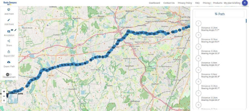
Key Concept of Marathon Route with bearing angle
The key concept revolves around the transformative role of MAPOG Route Compass in orchestrating comprehensive and participant-centric marathon planning. This innovative tool empowers event organizers with precision mapping, result analysis, and real-time adjustments, ensuring strategic logistics, enhanced safety measures, and an overall optimized marathon experience. From choosing the route to sharing and downloading information, MAPOG Route Compass emerges as a strategic advantage in the meticulous planning and execution of iconic marathon events. Route compass tool finds practical use cases in civilian aviation, emergency response coordination, maritime navigation, and even in the realm of outdoor activities such as Marathons .
Use of MAPOG Route Compass in Event Planning
Precision in Logistics: Event planners can use MAPOG Route Compass to plan logistics with utmost precision. By incorporating detailed information about key locations, medical facilities, and helping points, organizers can streamline resource allocation and emergency response planning.
Enhancing Safety Measures: The tool’s ability to mark medical facilities and helping points ensures quick response times in case of emergencies. This contributes significantly to participant safety, a paramount concern in marathon events.
Steps to Marathon Mapping
Step 1: Choosing the Marathon Route
Select Your Marathon Route: Begin by choosing the marathon route you want to map using MAPOG Route Compass. Gather essential details and landmarks to ensure accuracy in creating a comprehensive representation of the course.
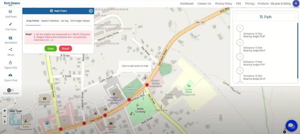
Step 2: Precision Mapping with ‘Add Points’
Utilize ‘Add Points’ Feature: With the chosen route in mind, use MAPOG Route Compass’s ‘Add Points’ feature for precision mapping. Drop points on the map, search addresses, input coordinates, or use Dist Angle Values for meticulous placement. This step lays the foundation for your marathon route.
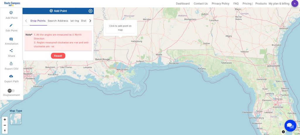
Define Key Locations: Whether marking starting points, landmarks, or checkpoints, utilize ‘Add Points’ to define crucial locations such as water points, helping points, and medical facilities along the marathon route.
Step 3: Enhance Clarity with Icons and Annotations
Assign Icons for Representation: As you add points along the marathon route, assign icons for a comprehensive representation. Use icons for checkpoints and water stations, enhancing clarity and providing valuable information for participants.
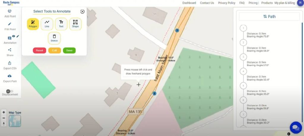
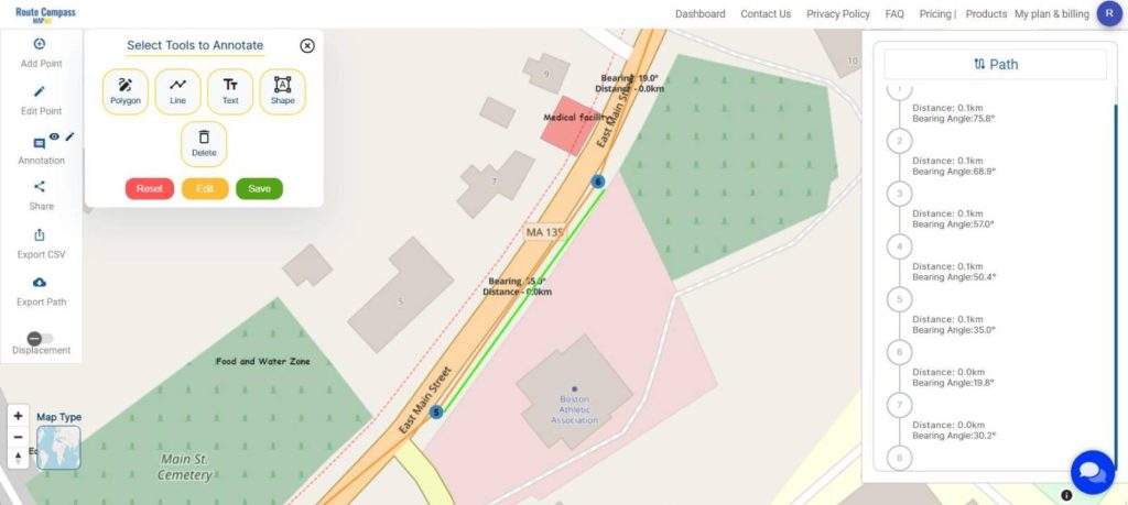
Utilize Annotation Tools: Incorporate annotation tools like Polygon, Line, Text, and Shape for a detailed and accurate map. These tools help mark specific areas, indicate route variations, and provide additional information to participants.
Step 4: Share and Collaborate
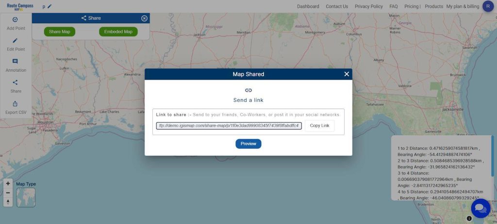
Click ‘Share Map’: Easily share the marathon route with friends or on social networks by clicking ‘Share Map.’ Increase awareness and engagement by spreading the interactive map.
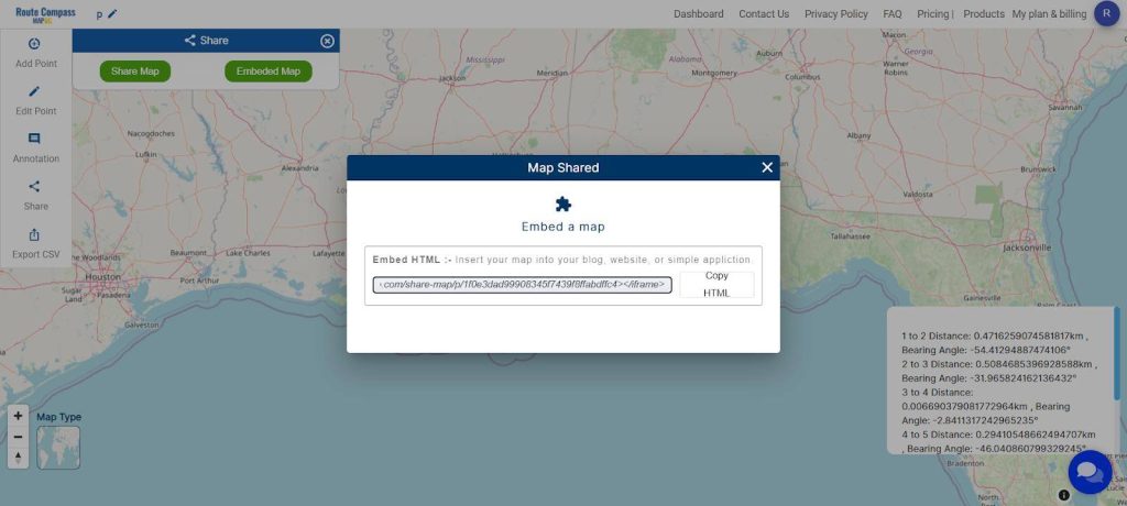
‘Embed Map’ for Online Platforms: For seamless integration into blogs or websites, use the ‘Embed Map’ feature. This is particularly useful for creating an interactive display of the marathon route.
Step 5: Download Information in CSV Format or export path in other formats
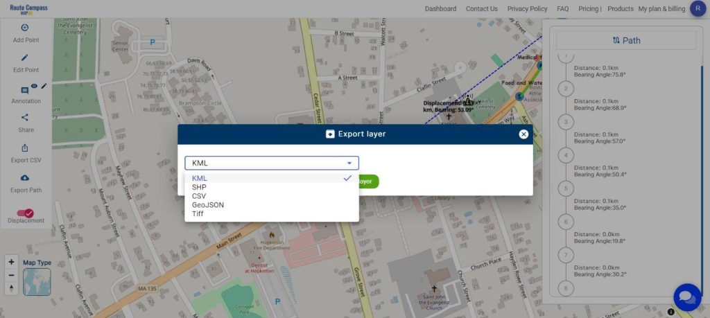
Download as: MAPOG Route Compass offers the option to download all information in a convenient CSV file format or in shp, Kml, GeoJSON, Tiff. This is valuable for further analysis, data management, or sharing detailed information with stakeholders.
Step 6: Check Displacement from the Starting Point to the Last Point
Evaluate Displacement: After mapping the marathon route, use MAPOG Route Compass to check the displacement from one point to the last point. This additional step allows organizers to analyze the overall progression of the route and make informed decisions about adjustments or improvements.
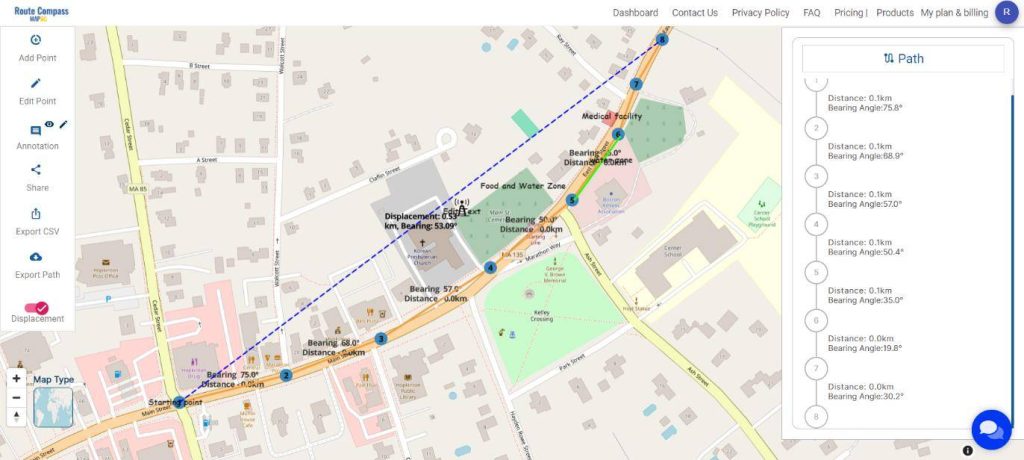
Major Findings
MAPOG Route Compass transforms marathon route planning through result analysis, allowing organizers to:
- Analyze Key Metrics: Gain insights into checkpoint distribution for strategic route optimization.
- Add Important Points: Enhance the map by marking key locations, aid stations, medical facilities, and landmarks for participant awareness.
- Customize Icons: Employ a variety of icons to signify checkpoints, water stations, and other crucial points, improving map clarity.
- Real-time Adjustments: Dynamically modify the route based on real-time analysis, ensuring adaptability to unforeseen challenges.
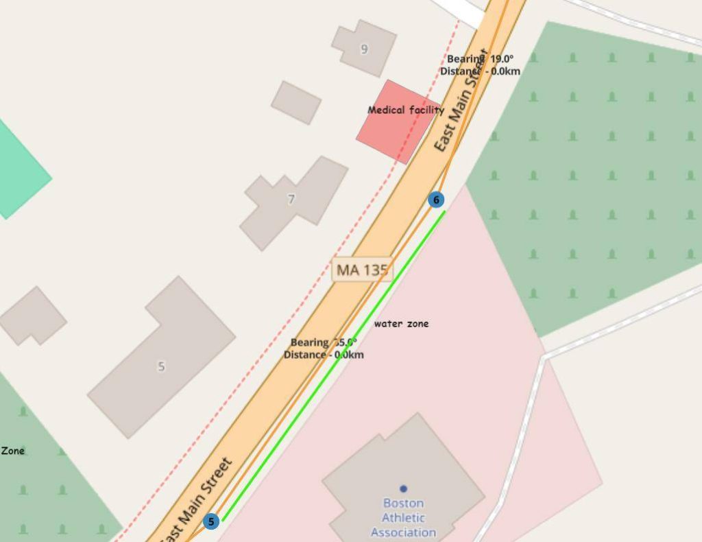
Result analysis with MAPOG Route Compass goes beyond mapping; it empowers organizers to create an optimized and participant-centric marathon experience.
MAPOG Route Compass proves to be an indispensable tool for comprehensive marathon planning. From precise mapping to result analysis, checking displacement, and continuous improvement, this guide demonstrates the tool’s effectiveness in delivering optimal marathon experiences. In a world where precision is paramount, MAPOG Route Compass emerges as a strategic advantage in orchestrating exceptional events.
Domains and Industries Benefiting
- Event Management
- Logistics and Transportation
- Public Safety Services
- Urban Planning
- Technology and Software Development
- Research and Academia
Conclusion
In conclusion, MAPOG Route Compass stands as an invaluable tool for marathon planning, offering precision mapping, result analysis, and real-time adjustments. From enhancing participant safety to optimizing logistics and providing dynamic insights, this guide demonstrates the tool’s effectiveness in orchestrating exceptional marathon experiences. As event organizers navigate the complexities of route planning, MAPOG Route Compass emerges as a strategic advantage in ensuring a seamless and participant-centric marathon journey. For inquiries or further exploration, feel free to contact support@mapog.com. Harness the power of MAPOG Route Compass for an unparalleled marathon mapping experience.