Banks strive to ensure that their branches and ATMs are conveniently located for their customers. Mapping Bank and ATM Locations Using Near by Neighbour Analysis, To achieve this, they use a sophisticated technique called ‘Near by Neighbour’ analysis. This method helps banks determine the optimal placement of ATMs and branches, ensuring customers have easy access to banking services.
Key Concept: Mapping Bank and ATM Locations Using Near by Neighbour Analysis
‘Near by Neighbour’ analysis is a method used to find the closest points between two sets of locations. For banks and ATMs, it identifies the distances and directions between each bank and the nearest ATM. This information is crucial for optimizing the placement of ATMs and branches, ensuring they are conveniently located for customers. Alongside this guide, datasets will be provided for practical application. Additionally, articles like “Creating Travel Guides: Mapping with GIS Buffer Zones” and “Creating GIS Solutions for Urban Agriculture Map” offer deeper insights into GIS applications.
Creating Bank and ATM Locations map using MapOG’s Grid tool is straightforward. Here’s a step-by-step guide:
Step 1: Adding Data:
we added the bank and ATM data to our map.
1.click on the “GIS Library”
2.Search the country name
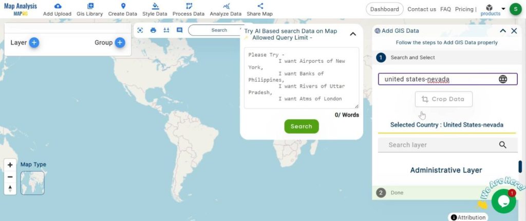
3.select the required layer.
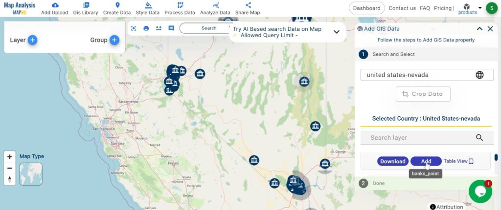
Similarly add the other data.
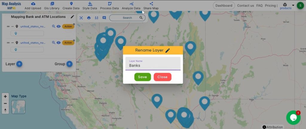
Step 2: Naming the Map and Layers:
1.we named our map
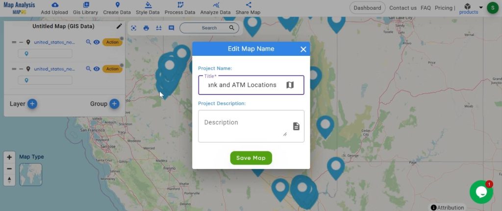
2.Renamed the layers to keep things organised.
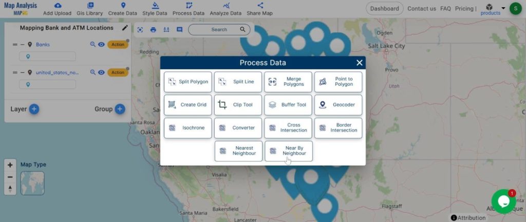
Step 3: Using ‘Near by Neighbour’ Analysis:
we used the ‘Near by Neighbour’ analysis to find the distances and angles between each bank and the nearest ATM.
1.click on the “Process Data” button and choose “Near by Neighbour” tool.
2. Here select the input layer and join layer and the attributes.
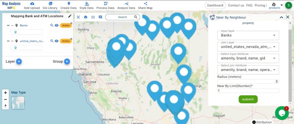
click on the “submit” button.
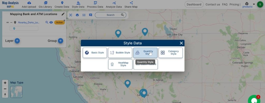
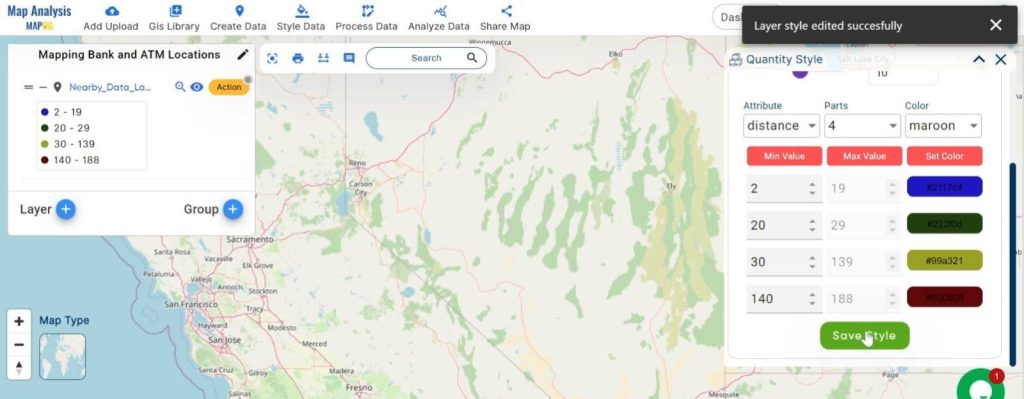
Step 4: Visualisation with Quantity Style:
we visualised the data using quantity style, making it easy to see the distances and directions.
1.click on the “Style Data” button and choose “Quantity Style”.
2.here set the attribute and colour. Click on the “Save Style” Button.
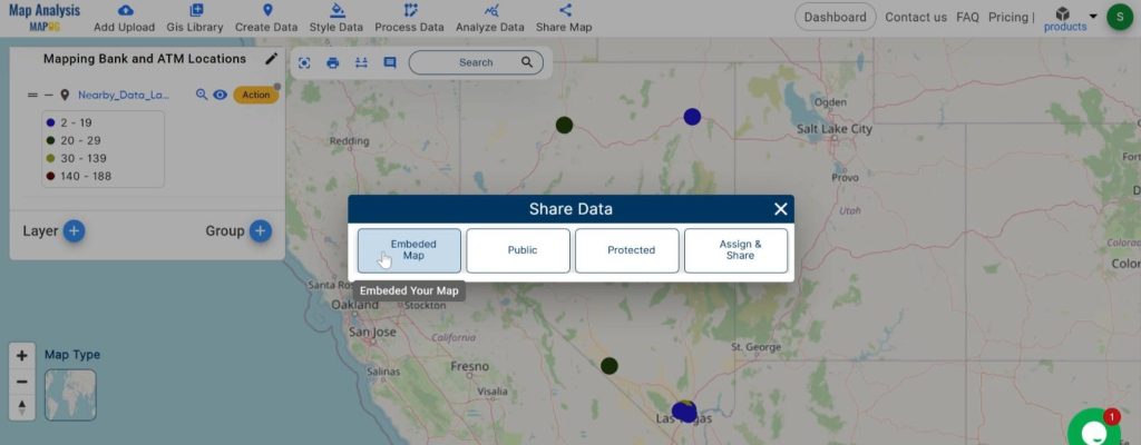
Step 5: Sharing the Map:
we shared the map with our team and stakeholders for better planning and decision-making.
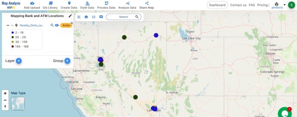
Major Findings
Our analysis revealed that some areas have excellent coverage, with ATMs located very close to banks. However, other areas were identified as needing more ATMs for better access. This insight helps banks optimize their services to better serve their customers.
Domain and Industry: Banking and Finance
Near by Neighbour analysis is especially useful in the banking and finance industry. It allows banks to strategically place ATMs and branches, enhancing customer convenience and service efficiency. By understanding where the gaps in coverage are, banks can make informed decisions on where to expand or enhance their presence.
Near by Neighbour analysis is a powerful tool that helps banks ensure customers have easy access to banking services wherever they are. By strategically placing ATMs and branches based on this analysis, banks can provide better service and meet customer needs more effectively. This method is a crucial part of modern banking strategies, improving both accessibility and customer satisfaction.
Link of the Data:
Explore the data further through our GIS Data product, uncovering valuable information for in-depth analysis and understanding.