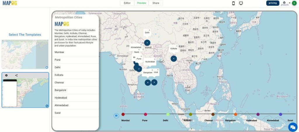
Welcome to our journey through India’s Metropolitan Cities using MapStory! MAPOG MapStory is an innovative tool that combines the power of maps with storytelling, allowing us to create interactive and immersive journeys through the bustling streets and iconic skylines of India’s urban centers. With MAPOG MapStory, we’ll delve into the rich cultures, histories, and landscapes that define these vibrant metropolises. Join us as we navigate through the unique narratives woven into the fabric of India’s cities, exploring their past and present in a dynamic and engaging way. Let’s get ready to uncover the fascinating stories that make these cities truly remarkable.
Key Concepts
The key concepts we’re exploring today revolve around the use of MapStory to create interactive and engaging narratives about India’s metropolitan cities. MapStory allows us to combine maps with storytelling, creating dynamic and immersive experiences. By leveraging MAPOG, a user-friendly platform, we can seamlessly integrate various data and craft detailed narratives, enhancing our exploration and understanding of these urban centers. This approach not only enriches our knowledge of the cities’ cultural, historical, and geographical aspects but also provides a powerful tool for educational and informational purposes across multiple domains, including tourism, urban planning, and historical research.
Step-by-Step Process
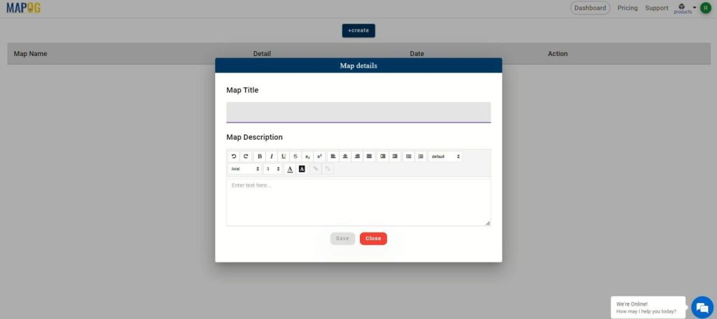
Step 1: Navigate to MAPOG’s platform and start by creating a new project in MapStory. Input project details such as the title and description to set the stage for your exploration of India’s metropolitan cities.
Step 2: Click on the ‘Add Story‘ button to begin crafting your interactive map narrative.
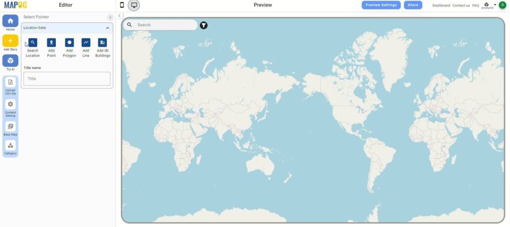
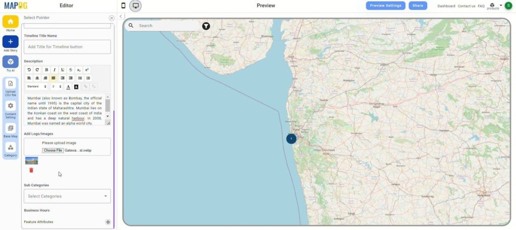
Step 3: Use the ‘Add Point‘ feature to mark each city on the map. After placing a point, click ‘Save’ to confirm the location.
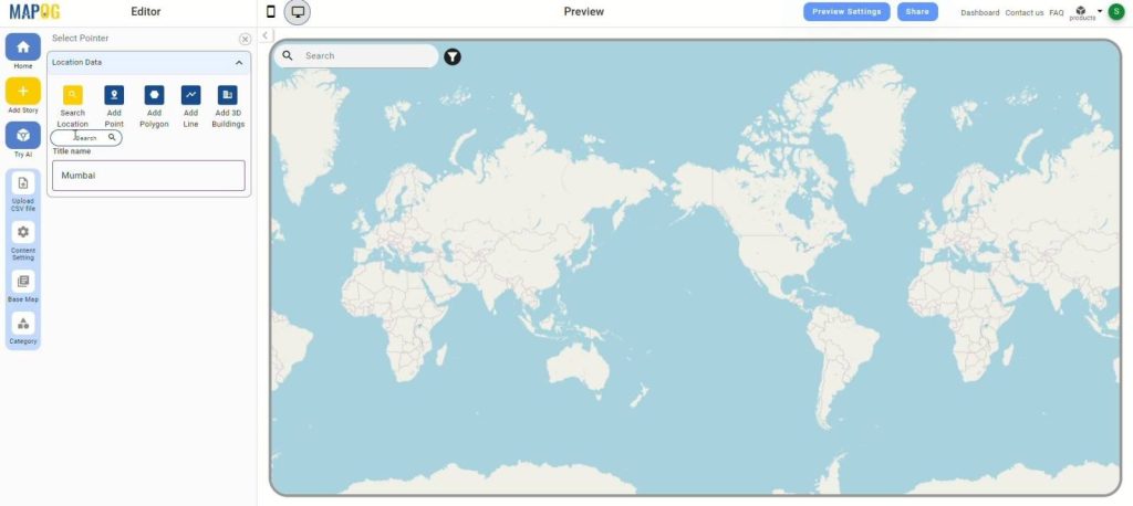
Step 4: Provide a title and description for each point you’ve marked on the map, then click ‘Save’ to store this information.
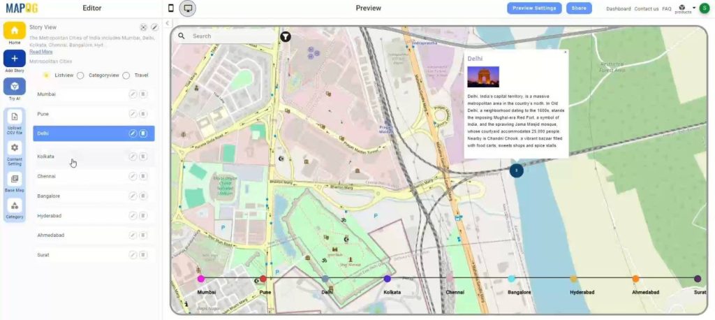
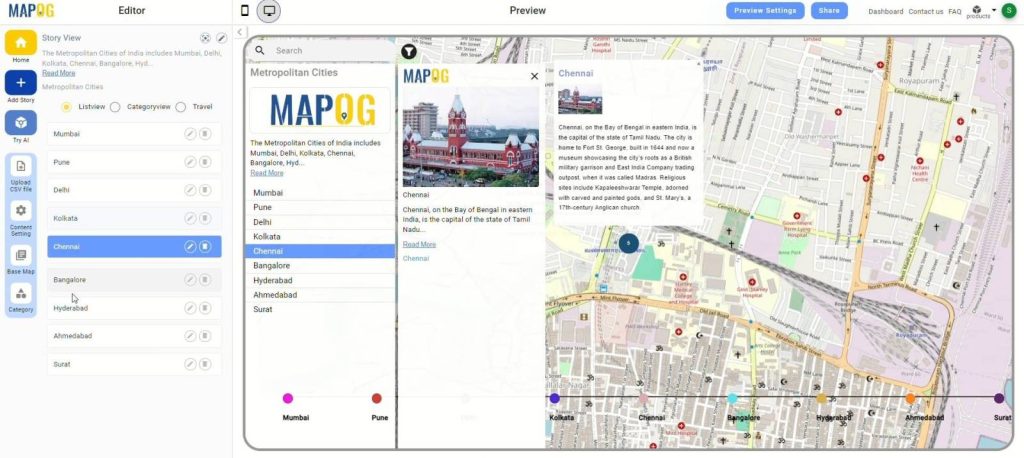
Step 5: Click on ‘Preview’ to see the MapStory you’ve created. Use the ‘Play’ button to view your narrative in action and ensure it meets your expectations.
Major Findings:
The exploration of India’s metropolitan cities through MAPOG MapStory revealed key insights into their cultural diversity, historical significance, and urban development. It highlighted the fusion of traditions, languages, and cuisines, and illustrated the evolution of landmarks and infrastructure. MapStory offered a comprehensive perspective on the rich and dynamic nature of India’s metropolitan cities.
Domains and Industries Benefiting
- Urban Planning
- Tourism
- Real Estate
- Environmental Studies
- Transportation
- Education
- Cultural Preservation
- Economic Development
Conclusion
In conclusion, using MAPOG to create a MapStory offers an engaging way to explore and understand India’s metropolitan cities. This approach not only enhances the visualization of urban data but also brings to life the rich cultural, historical, and geographical narratives of these vibrant cities. By integrating storytelling with mapping, MAPOG facilitates a deeper connection with the spatial dynamics of urban environments, making it an invaluable tool for various industries and applications. For further assistance, feel free to contact us at support@mapog.com. Explore more innovative solutions with MAPOG.
Other Articles
- Create a Map to find suitable sites for constructing a new house
- Create Map for Analyzing Water Quality using Heat Map Style
- Create Map – School Map Area Coverage Through Buffer Analysis
- Mapping Safety Create GIS Map : Game-Changing Approach to Hospital Risk Analysis
- Create Map for Real Estate Developer for Best Site Selection
- Create Map for Landfill Optimization: Spatial Analysis Approach