Embarking on a journey from one city to another can be riddled with challenges, but with the remarkable MAPOG Route Compass, the path between two destinations becomes notably smoother. In this article, we’ll delve into key concepts, walk through processes, unveil major findings, and assess the impact of this innovative tool on the engineering and construction industry. Throughout, we’ll use generic locations to demonstrate the effectiveness of the Compass. Now, let’s dive in and discover how ‘Smoother Construction Travel: Finding the Best Routes with Distance and Bearing Angles’ becomes a reality.
Key Concept to Finding the Best Routes with Distance and Bearing Angles
At the heart of this seamless navigation experience lies the MAPOG Route Compass, a user-friendly guide designed to simplify route planning. This tool empowers construction teams to traverse between two points with ease, steering clear of any potential obstacles along the way. The precision and efficiency it offers make it an invaluable asset for professionals in the engineering and construction domain.
Below are the steps to harness the power of MAPOG’s Route Compass, a user-friendly tool
This systematic process effortlessly guides us in creating efficient routes, exemplified by the journey. Let’s delve into each step to make this navigation journey a seamless experience.
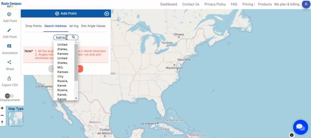
Step 1: Starting Point :
Begin the journey by pinpointing the starting location. With a simple search and a dropped pin, the MAPOG Route Compass sets the stage for a hassle-free exploration.
- click on the “Add Point” button and choose the option “Search Address”.
- here you have to search the address.
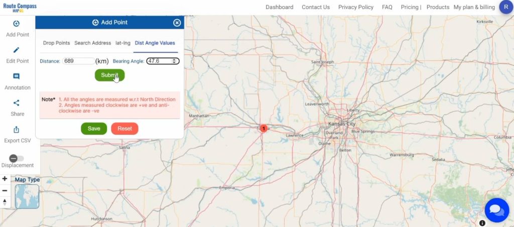
Step2: Precision Plotting – Dist-Bearing Angle:
The MAPOG Route Compass goes beyond basic navigation. It allows for precise plotting, utilizing distance and bearing angles to create an optimal route.
- Click on the “Add Point” button and choose “Dist-Angle Value”.
- Now plot the Distance and Bearing angle for each point.
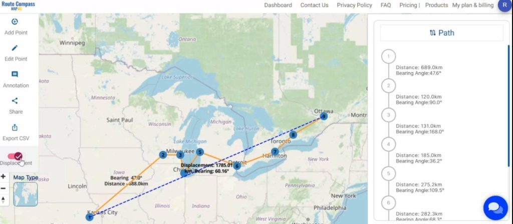
Step3: Displacement – Measure Your Straight-Line:
Measure the straight-line distance, known as the displacement. This step reveals a shortcut, ensuring a more direct and efficient route for your journey.
- Click on the “Displacement” button on the left side of your screen.
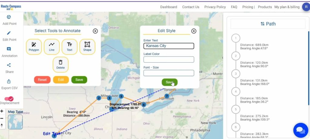
Step4: Add Text File – Enhancing Route Details:
Enhance clarity by incorporating a text file containing crucial details about the route. This addition ensures that everyone involved understands the intricacies of the journey.
- Click on the “Annotation” button and here choose the “Text” option.
- Now here, write the “Enter Text” and change “Label Color”, “Font-Size” accordingly.
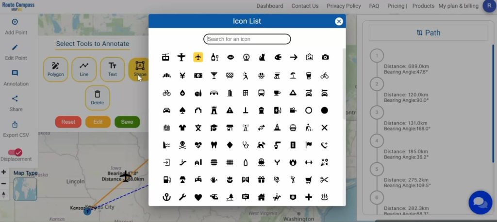
Step5: Icons for Clarity – Adding Visuals:
Inject visual flair into the route map by incorporating icons. These symbols visually represent different aspects of the journey, making the map easy to comprehend for all team members.
- Click on the “Annotation” button and here choose the “Shape” option.
- Choose your required Shapes.
Final Touch – Download or Upload Vector File:
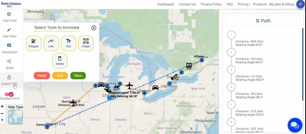
Conclude the process by either downloading or uploading the vector file. This comprehensive file encapsulates all route details, facilitating easy sharing and future reference.
- Click on the “Export CSV” for export your route details
- Click on the “Share” option to share the route map.
Major Findings:
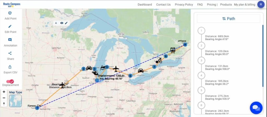
- MAPOG Route Compass allows for more accurate route planning, ensuring you take the most precise paths.
- The tool makes measuring straight-line distances a breeze, helping you find the shortest and most efficient routes.
- By adding text files and visuals, MAPOG Route Compass ensures a clear understanding of your journey, making navigation straightforward.
- Enjoy the ease of downloading or uploading vector files, making it simple to share and reference your routes whenever needed.
Industry and Domain:
Engineers and professionals in the construction industry stand to benefit significantly from incorporating the MAPOG Route Compass into their workflows. This handy tool ensures safe and efficient travel, making it an indispensable asset for those navigating. The construction industry finds a reliable companion in MAPOG, ensuring that projects progress smoothly and without unnecessary delays.
Conclusion:
The MAPOG Route Compass emerges as a game-changer, streamlining the journey. Tailored for professionals in the construction and engineering domain, this user-friendly tool provides efficiency and ease of use. Following the outlined process guarantees a hassle-free travel experience marked by precision, clarity, and seamless sharing. As we navigate the roads connecting one city to another, MAPOG stands out as an indispensable companion, making our journeys both smoother and safer. For any queries, feel free to reach out to us at support@mapog.com Safe travels!
Exploring Our Previous Blogs:
- GIS Analysis in Urban Planning: Reshaping Transportation Future Insights of state/city
- Make Routes for Military Aerial Planning- Through Bearing angle and Distance calculation – Online Route Compass
- Create Marathon Route Navigation Map – With Bearing and Distance
- Create Off-Road Hiking Routes: Using Bearing Angles and Distances