Start a historical trail with MAPSTORY and follow the route and importance of “Gandhi’s Dandi Aviyan: A Path to Freedom with MAPSTORY” a critical event in the fight for India’s independence. Use MAPOG’s immersive mapping technology to explore the route and the significance of this historical march.
Key Concepts
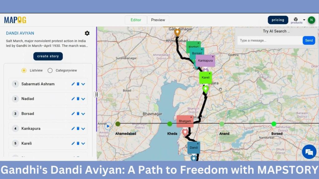
This is a way to digitally retrace the historic path of Mahatma Gandhi’s Salt March, thereby, giving a better insight of India’s independence movement through the mapping of the different heritage sites, scenes of the historic day and the interactions of the people that day.
Steps to Mapping Vasco da Gama’s Journey to India
Step 1: Create Story
First, navigate to the MAP STORY and click on the create button. A box will open named Map Details, provide a name and description to the project. Then hit save.
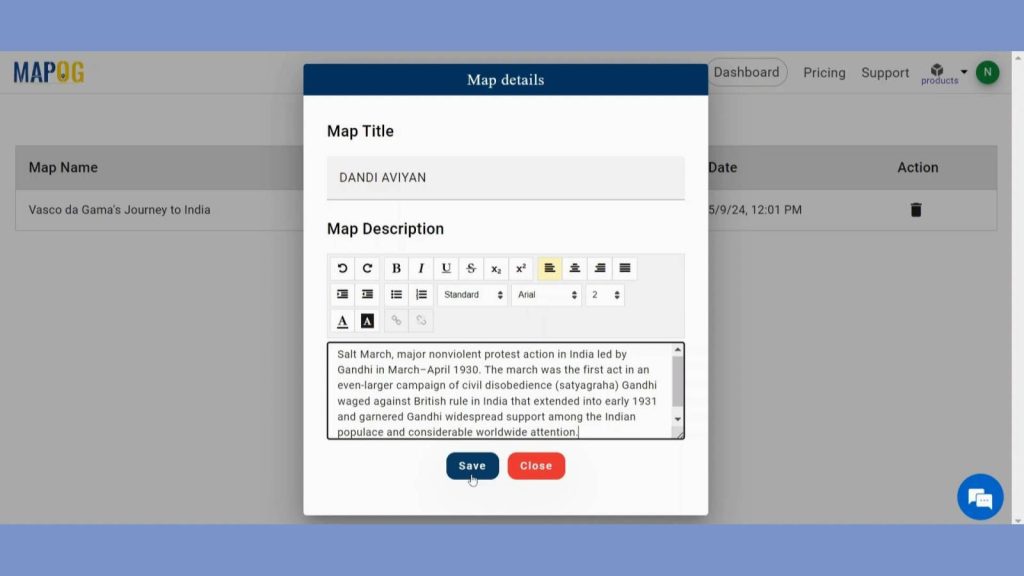
After coming to the MAP STORY interface, you will find create story button in the left panel. Click on that to create your own story.
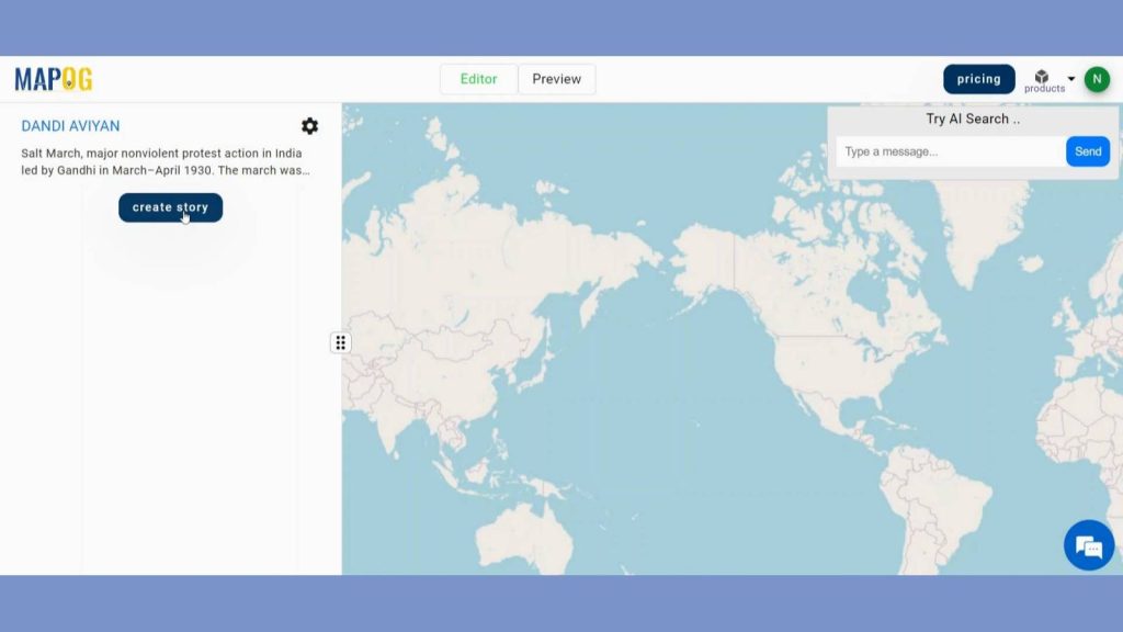
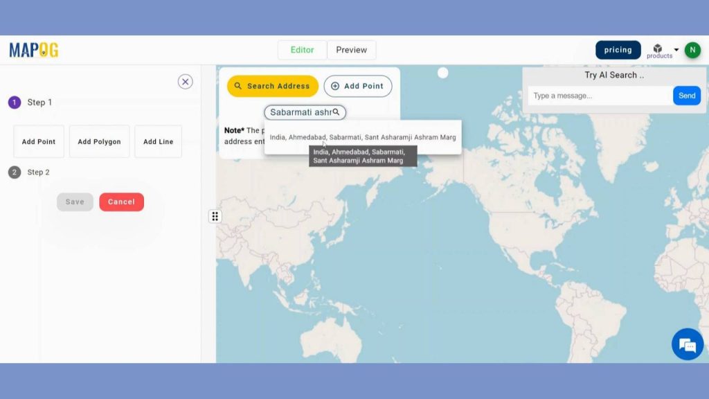
Step 2: Add Point
By clicking the Create story user will get three options like add Point, Line, Polygon. Click on add point to plot the landmarks. You can add the points either by searching address or by manually. AI feature will give you the description also when you search for your points.
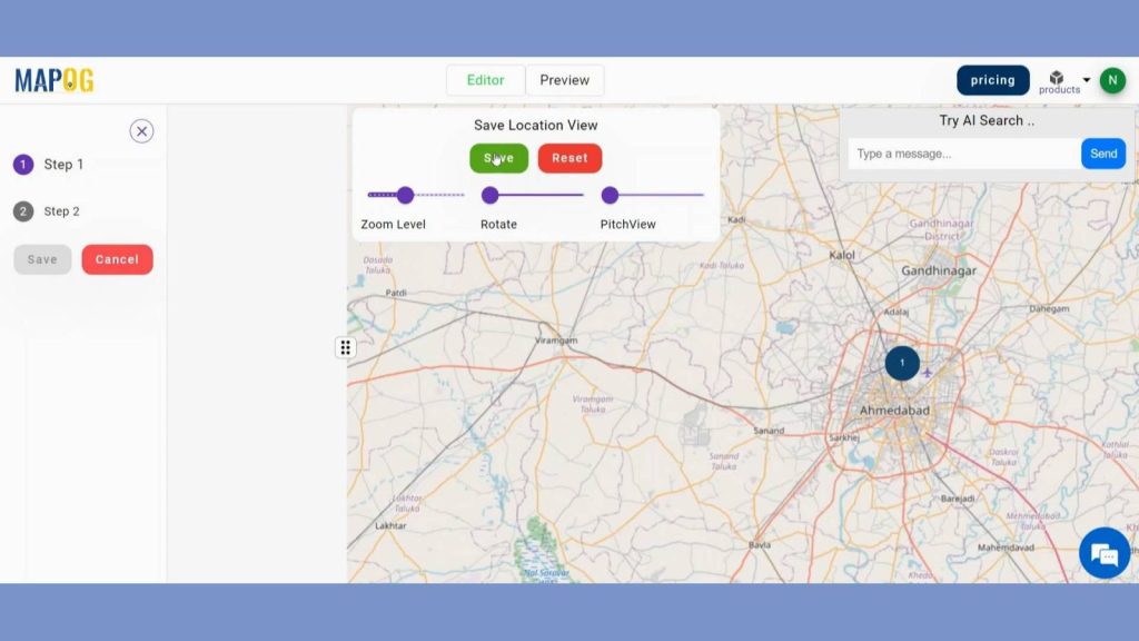
After you added the point to map canvas you can change the zoom level, pitch view and rotation of the point. Save the location view when you are satisfied.
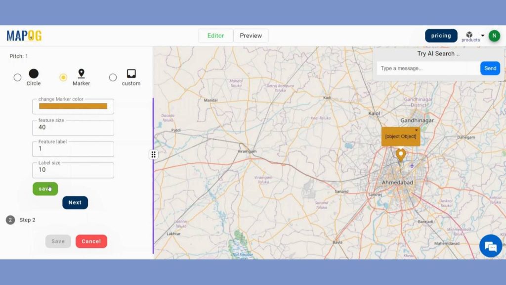
Step 3: Customize Point View
Now we are going to enhance visualization of those points. In step 1 users can put circle, markers and even custom legends to the points and click save to save the view. And it even gives you opportunity to put line or direction between two points.
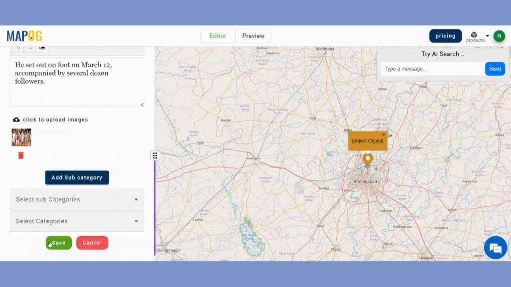
Then to make the point more appealing, in step 2 you can add a title, descriptions, and images that describes the point. Include more categories if needed. Then hit save. Like that repeat the steps for the remaining voyage.
Press the Play button on the timeline to test the tale.
Step 4: Preview the Story
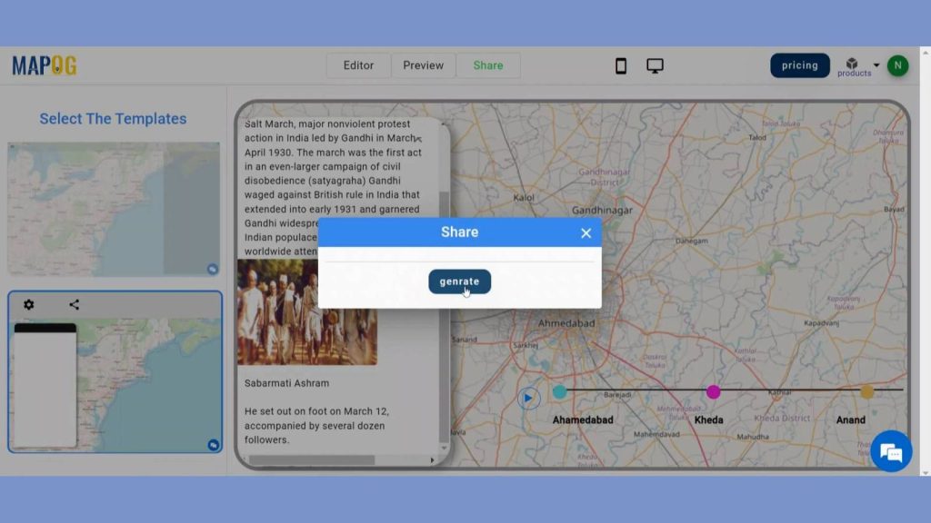
By clicking the PREVIEW, you can see the story. Select which of the two templates to view. To see the story, click the Play button on the timeline.
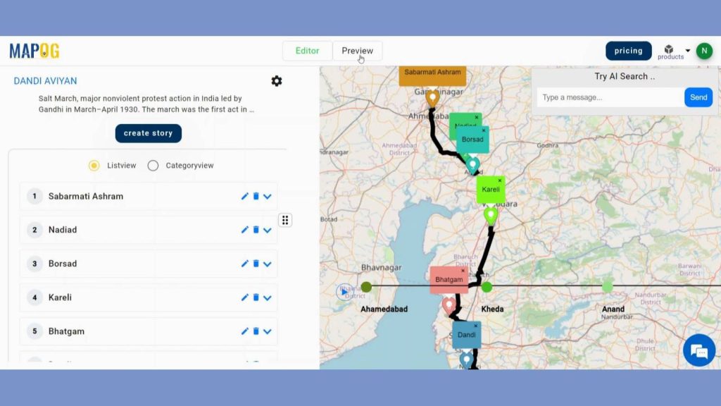
Use the share button to distribute the map.
Step 4: Results & Analysis
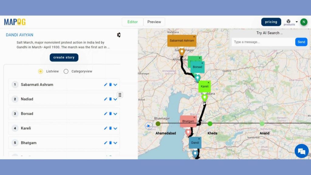
The subsuming of Gandhi’s Dandi Aviyan into MAPOG offers a captivating visual journey through historic landmarks, enriching understanding of India’s struggle for independence.
Major Findings
1. Historical Route Mapping: MAPSTORY accurately traced Gandhi’s Dandi March route, highlighting key stops and significant events along the journey.
2. Community Engagement: The platform showcased the widespread local support and participation, mapping communities that joined Gandhi in his march.
3. Impact Visualization: MAPSTORY effectively visualized the march’s influence on India’s independence movement, illustrating its role in mobilizing nationwide civil disobedience.
Domain and Industry
Map Story has applications in many domains like Education, Tourism, Research and Academia, Cultural Heritage Preservation, etc.
Questions
1. How does MAPSTORY help visualize the route taken by Gandhi during the Dandi Aviyan?
2. What key historical sites and events can be highlighted using MAPSTORY for the Dandi Aviyan?
3. How can MAPSTORY be used to educate people about the significance of Gandhi’s Dandi Aviyan in the Indian freedom struggle?
Conclusion
In conclusion, It vividly brings to life the historic journey, illustrating its significance in India’s struggle for independence. MAPSTORY enhances understanding by providing an engaging and interactive exploration of this pivotal event.
Here are some other blogs you might be interested in