In urban planning and land management, digitization of land parcels and equitable division stand as pivotal tasks. Digitization emerges as a transformative tool, promising accuracy, transparency, and accessibility in the division process. In this article, we delve into the process of digitizing land parcels and equitable division using MAPOG Map Analysis. Join us as we navigate the land parcel digitization and discover how to create a map to digitize and divide land parcels. To find suitable construction sites, read our blog on Creating a Map to find suitable sites for constructing a new house.
Key Concept to Digitize and Divide Land Parcels
At the core of land parcel digitization and equitable division lies the promise of efficient resource allocation and fair distribution of land rights. By using digital technologies, stakeholders can create detailed maps that accurately represent land parcels. This key concept underscores the potential of digitization in land management, increasing accuracy and equity in land allocation.
Steps to Create a Map to Digitize and Divide Land Parcels
Step 1: Create Data
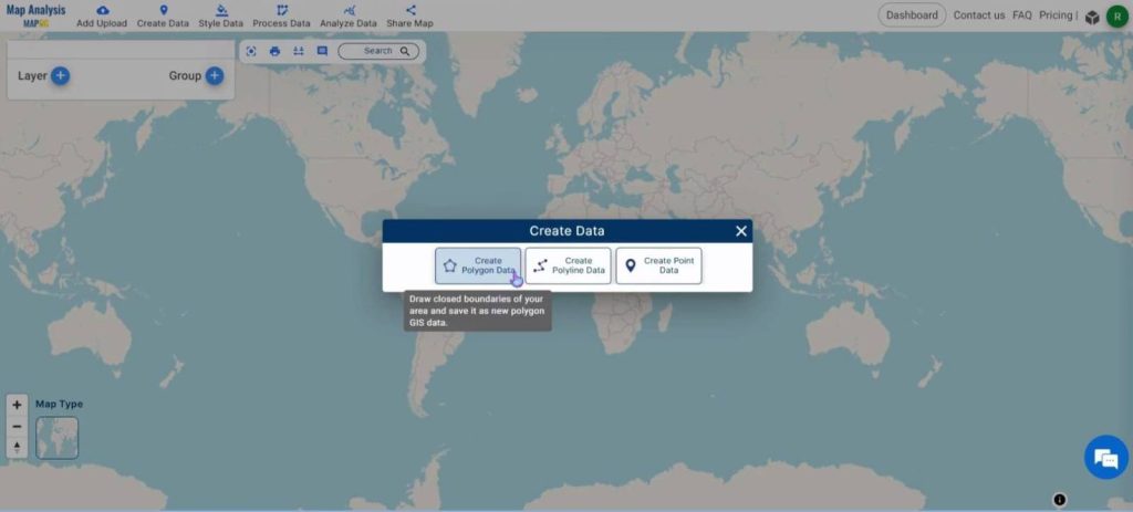
Open the MAPOG Map Analysis interface. Click on the ‘Create Data’ button in the top ribbon. A dialog box will open. Select the ‘Create Polygon Data‘ option.
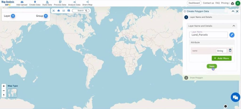
Change the name of the layer to a meaningful name and click on Save.
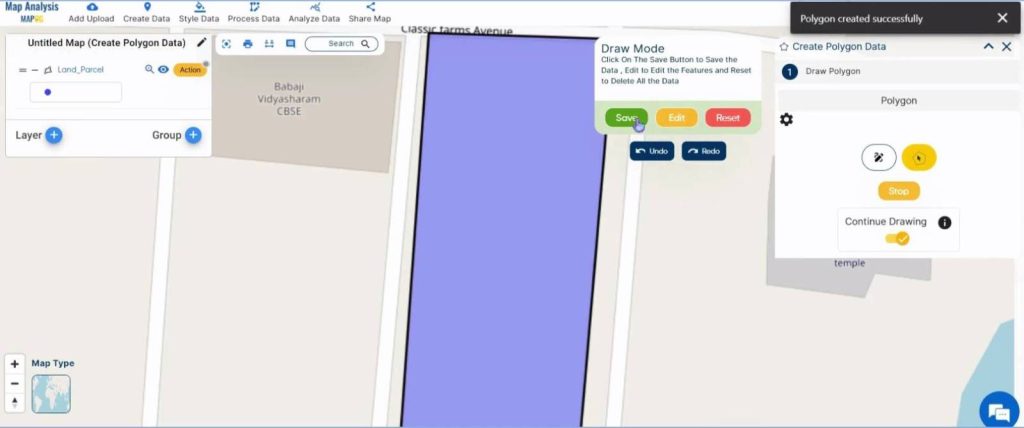
Zoom into the location and toggle Continue Drawing. Click along the boundary of the land parcel and finish it by clicking twice on the last point. Once the parcel has been digitized, click on Save.
Step 2: Rename the Map
Click on the Pencil icon near the name of the map.
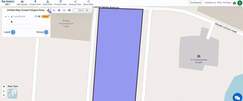
Assign a name and click on Save Map.
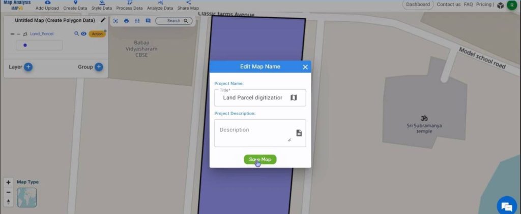
Step 3: Splitting the Polygon
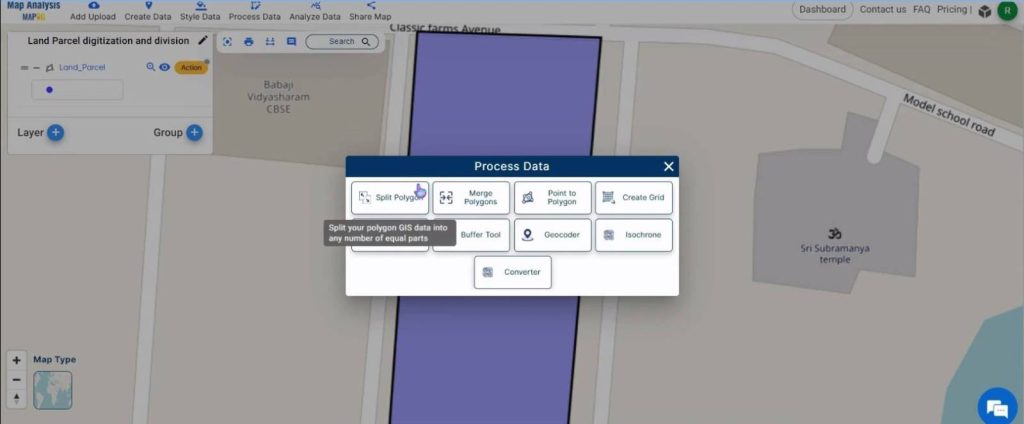
Next, click on the Process Data feature and select the Split Polygon option.
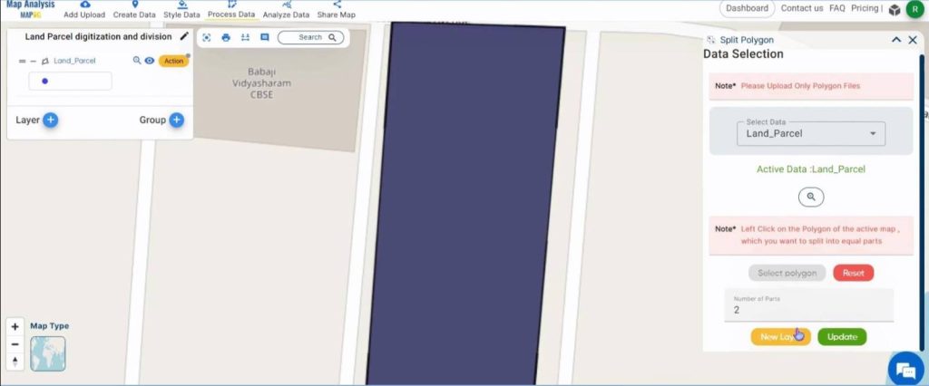
Under Select Data, select the polygon layer that was just digitized. Then, click on Select polygon and click on the digitized polygon. Next, enter the number of equal parts the polygon must be split into and click on New Layer.
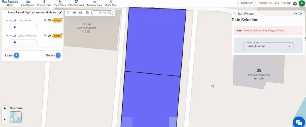
Shown below, is the final map.
Major Findings – Create a Map to Digitize and Divide Land Parcels
- Enhanced Precision: The digitization of land parcels enables stakeholders to achieve a higher accuracy in mapping and dividing land.
- Efficiency in Resource Allocation: Digitization optimizes resource allocation processes, saving time and resources for both government agencies and landowners.
- Empowerment of Stakeholders: Digitization provides stakeholders with the tools and information needed to participate in land division processes.
- Mitigation of Disputes: Well-documented digital maps help reduce disputes over land boundaries and ownership, reducing the burden on legal systems.
- Adaptability to Changing Needs: Digital platforms for land parcel division are adaptable and help ensure that land management practices remain effective over time.
Domain and Industry
- Government Agencies: Digitized land parcel mapping and equitable division processes empower government agencies with efficient tools for land management, enabling them to streamline administrative procedures and ensure fair resource allocation.
- Landowners and Communities: Digitization grants greater transparency and accessibility in land division processes.
- Urban Planners and Developers: Urban planners and developers benefit from digitized land parcel mapping by gaining access to accurate and up-to-date information, facilitating informed decision-making and sustainable development initiatives.
- Legal Systems: Digitized land parcel mapping helps reduce the burden on legal systems by providing clear and well-documented evidence in land disputes, ultimately promoting efficiency and fairness in legal proceedings.
Conclusion
In conclusion, the digitization of land parcels and the pursuit of equitable division represent transformative endeavors with far-reaching implications for urban planning, land management, and socio-economic development. Through advanced digital technologies, stakeholders can achieve greater accuracy, transparency, and efficiency in mapping and dividing land, thereby building trust, collaboration, and sustainable growth. As we navigate the complex terrain of land parcel digitization, it becomes evident that the benefits extend beyond administrative efficiency to encompass empowerment, environmental conservation, and economic prosperity. By embracing digitization, we unlock new opportunities to create inclusive, resilient, and thriving communities while shaping the future of land management practices.
Other articles:
- Protecting Wetlands: Guide to Create GIS Map for Nature
- GIS Analysis in Urban Planning: Reshaping Transportation Future Insights of state/city
- Fast Emergency Response: Using GIS and Isochrone Maps for 10-Minute Ambulance Arrival
- Mapping Tiger Attack Hotspots – Create an Online Map and Share
- Make Routes for Military Aerial Planning- Through Bearing angle and Distance calculation – Online Route Compass
- Mapping Healthcare Efficiency: GIS Buffer Analysis of Hospital Locations
- Add WMS- Two step online view of WMS layer on a map
- Plot ATM locations on a map and embed on your website
- Map habitat locations of endangered animals & keep track of their living
- Create a Map to find suitable sites for constructing a new house