In the world of Geographic Information Systems (GIS), creating new datasets from existing ones is very useful. Tools like MAPOG make this process simple and easy. This article will show you how to use MapOG’s Excel Attributes tool to blend different data sources and create new maps.
Key Concept to create a New GIS Datasets from another datasets
MAPOG offers several tools to help with data analysis, including Filters, Spatial Join, and Excel Attributes. We will focus on Excel Attributes, a tool that lets you merge data from Excel spreadsheets with existing GIS layers. This makes your maps more detailed and useful. Alongside this guide, datasets will be provided for practical application. Additionally, articles like “Creating Travel Guides: Mapping with GIS Buffer Zones” and “Creating GIS Solutions for Urban Agriculture Map” offer deeper insights into GIS applications.
MAPOG Map Analysis, a simple tool designed to simplify the creation and interpretation of new dataset.
Creating a new GIS dataset using MapOG’s Excel Attributes is straightforward. Here’s a step-by-step guide:
Step1: Add the Data
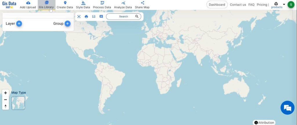
1.click on the “GIS Library”
2.Search the country name
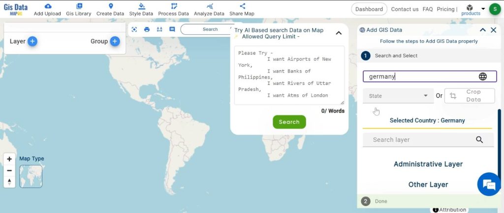
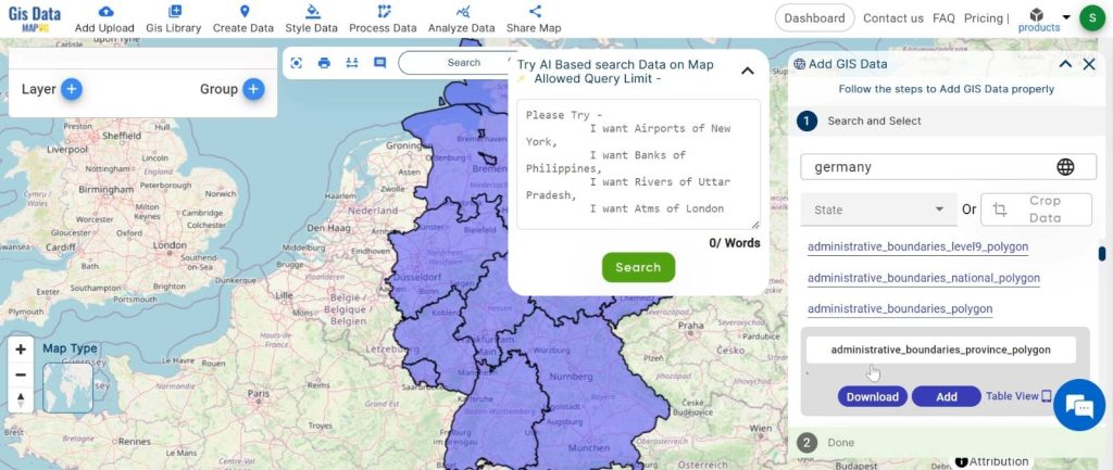
3.select the required layer.
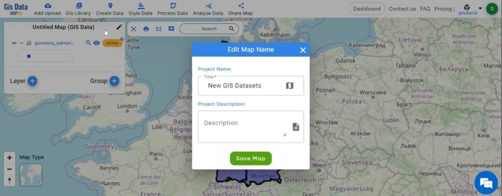
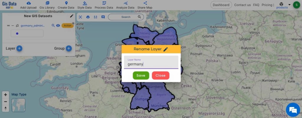
Step2: Name the untitled map and Rename the Layer
1.Map Name
Rename the Layer
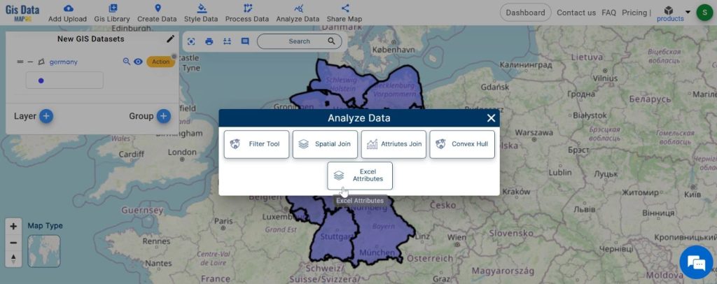
Step3: utilise the Excel Attribute tool.
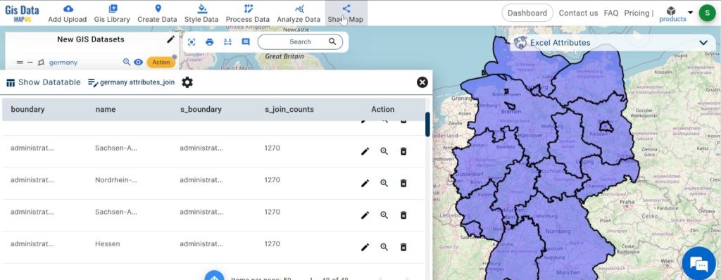
1.Click on the “Analyze Data” option and choose “Excel Attribute”.
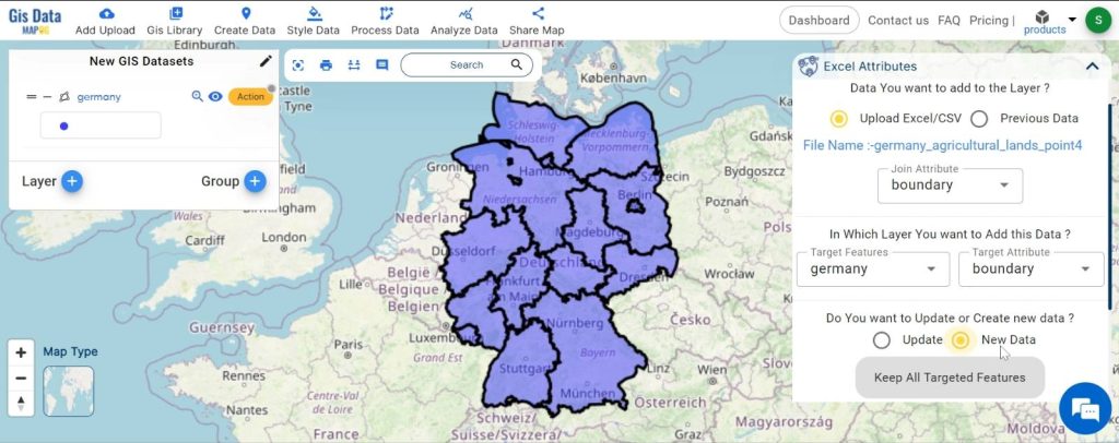
2.here upload the excel file.
set the join attribute. Choose the target feature and attribute. click on the “New Data” option
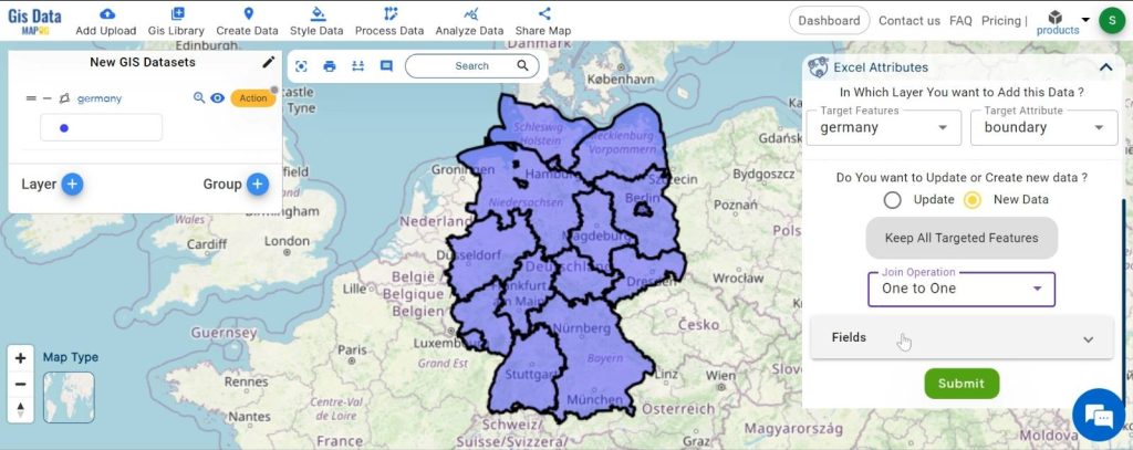
3. set the join operation. and click on the “submit” option.
Step4: preview and Share your new dataset.
Major Findings:
Combining Excel data with GIS datasets can show you many new insights. For example, you can mix population data with geographic regions to see population density. Environmentalists can combine wildlife data with habitat maps to find important areas for conservation. Mixing data gives a clearer picture, helping with better planning and decision-making.
Domain and Industry Applications
- Urban Planning: City planners can use combined data to analyze infrastructure needs, improve traffic flow, and enhance public services.
- Environmental Protection: Conservationists can track animal movements and monitor habitats to plan better protection measures.
- Healthcare: Public health officials can map disease outbreaks and healthcare access to improve resource distribution.
- Real Estate: Realtors and developers can analyze market trends and property values using geographic and demographic data.
MAPOG’s Excel Attributes tool helps create new GIS datasets from existing data. Whether you work in urban planning, environmental protection, healthcare, or real estate, mixing and analyzing data opens up many new possibilities. Start exploring and creating your own maps with MapOG, and help map the world in meaningful ways.