In the timeless pursuit of understanding our collective history, archaeologists rely on various innovative techniques to uncover ancient civilizations. MAPOG tools for site mapping can revolutionise the field, offering precise and efficient ways to document and analyse archaeological sites. In this article, we delve into the fascinating realm of archaeological site mapping, focusing on the utilisation of create polygon and grid tools to unravel the mysteries of the past.
Key Concept– Mapping Archaeological Site
The Create Polygon tool enables archaeologists to delineate the boundaries of archaeological sites with remarkable accuracy. Thus, researchers can create detailed maps that provide invaluable insights into past civilizations. Complementing the Create Polygon tool is the Create Grid tool, which facilitates systematic documentation and analysis of archaeological sites. By overlaying a grid onto a site map, researchers can divide the area into manageable units. This streamlines the excavation process, allowing archaeologists to methodically document findings while maintaining spatial context. Moreover, we encourage readers to explore further articles on our blog encompassing diverse facets like Create Point, Line, Polygon on Map, Create a Map: Filter Camping Spots in a Region Within – Points in polygon and more on.

Follow the below process Step-by-step for Mapping Archeological Site
Step 1: Open Map Analysis
Open Map analysis interface from MAPOG platform.
Step 2: Delineate Archeological Site
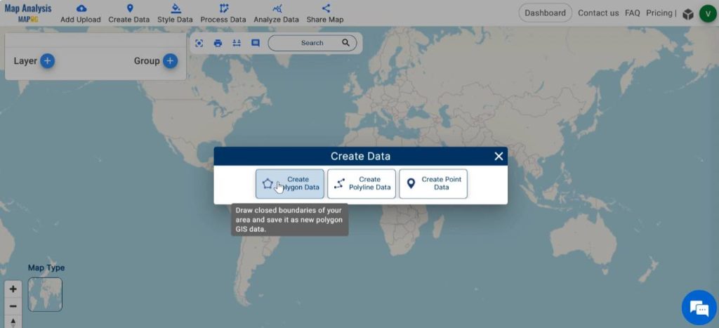
First, let us trace out the archaeological site on the map. For doing this, click on Create Data and select Create Polygon tool.
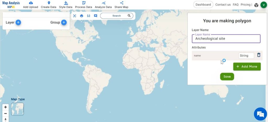
In the dialogue box, enter the appropriate name for the polygon layer and add all the attributes required in the given field. Then, click on save.
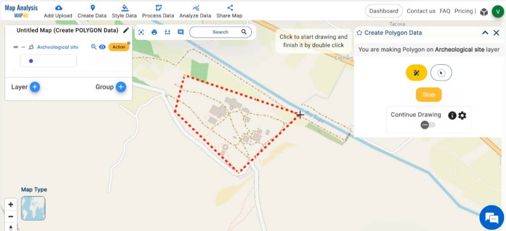
Select any of the given drawing methods and draw a polygon in the map enclosing the archeological site. Finalise the polygon by clicking on save.
Step 3: Save map
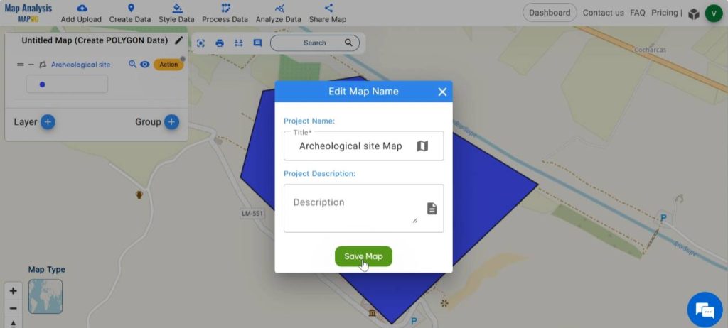
Then save your map with a suitable name. For this, click on the pencil icon near the “Untitled Map” text. Enter a suitable name, and if desired, provide a brief description of your project. Finally, save the map by clicking on the “Save Map” button.
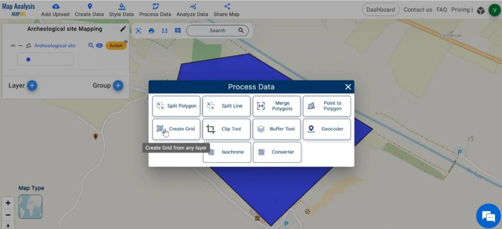
Step 4: Create grids
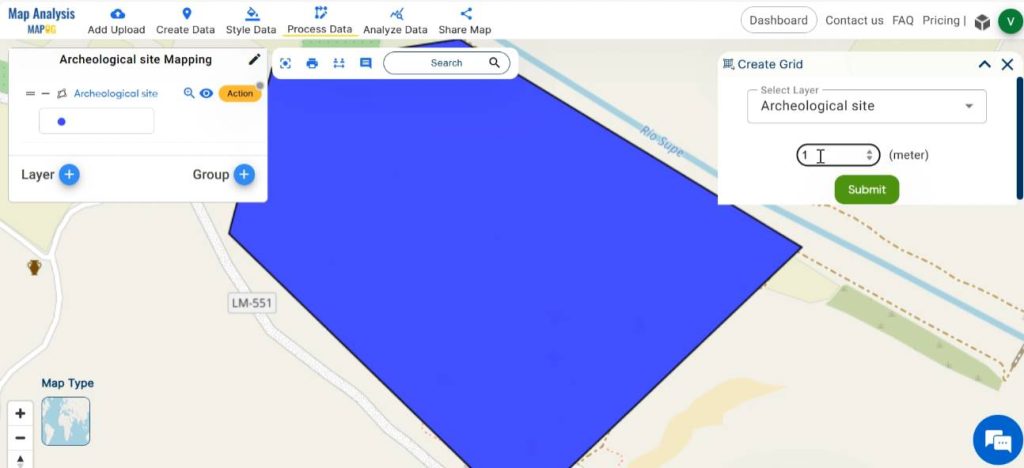
Next, we can divide the archeological site into small manageable units for carrying out excavation. In order to do this, click on Process Data and select the Create Grid tool.
Select the polygon layer and enter a suitable range for the grids. Click on submit.
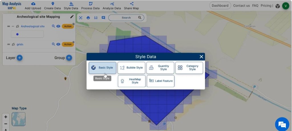
Step 5: Style the Map
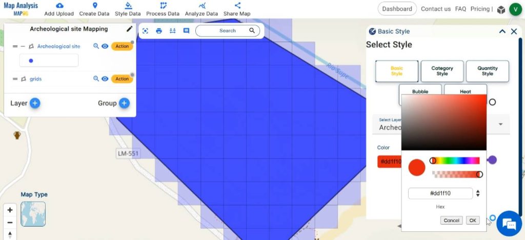
Enhance the visual appearance of the map by styling the layers with different and appealing colours. In order to do this, click on Style Data and select Basic Style.
Select the layer to be styled, then choose the suitable colour gradient for the layer from the available colour palette. Save your changes by clicking on Save Style.
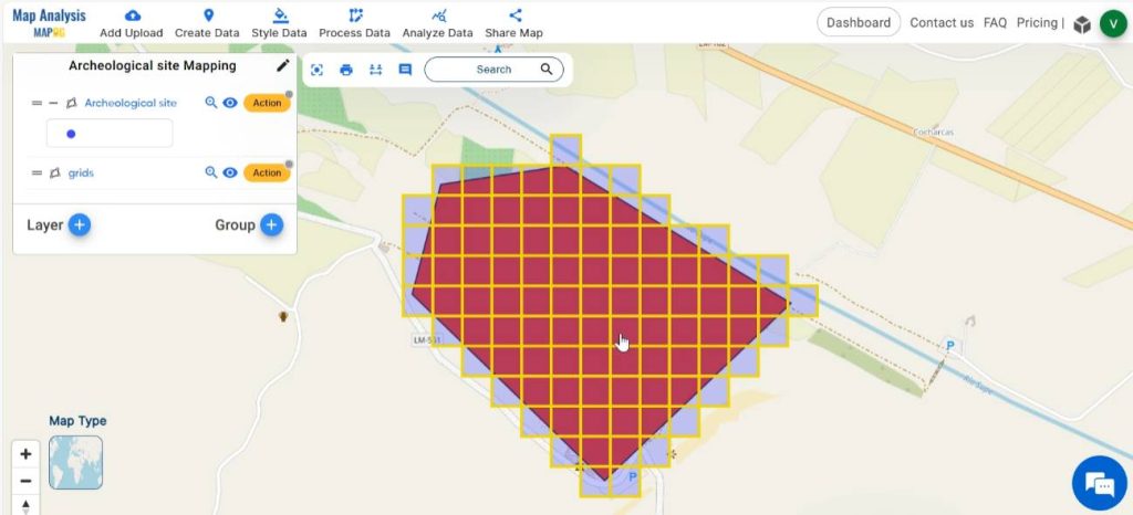
Thus, finally we have created a map in which the archaeological site is divided into manageable units, providing a valuable research tool and documentation resource for archeologists.
Major Findings
- Archeological Layout: The map displays a polygon that accurately outlines the archaeological site.
- Data management: The map incorporates a grid system overlaying the site area, facilitating organisation, data management, and spatial analysis of archaeological data.
- Spatial Distribution of Features: The map helps to analyse the spatial distribution of features and within the mapped area.
Industry and Domain
- Archaeologists: This map enables them to conduct systematic documentation, analysis, and interpretation of archaeological sites with precision and efficiency.
- Cultural Heritage Professionals: Various cultural heritage professionals, including archaeologists, conservators, and heritage managers, benefit from this map in preserving and managing archaeological sites.
Conclusion–Mapping Archaeological Site
In the realm of archaeology, the utilisation of MAPOG tools is revolutionising the process of site documentation and analysis. Through the strategic deployment of Create polygon and grid tools, researchers can unlock the secrets of ancient civilizations with unprecedented precision and efficiency. As we continue to venture into the depths of history, these innovative techniques serve as invaluable companions in our quest to unravel the mysteries of the past.
Explore more content on our blog:
Mapping EV Charging Station Accessibility with Isochrone Analysis