In today’s fast-paced world, businesses need tools that help them make data-driven decisions. Isochrone maps, which visualize areas accessible within a certain time or distance, can be a game-changer. They provide insights into customer reach, delivery zones, and more. This article explores how isochrone maps can benefit your business and use MAPOG to create meaningful visualizations.
What Are Isochrone Maps?
Isochrone maps display regions accessible within a specific time frame or distance from a central point. For example, they can show areas reachable within 30 minutes of driving or walking. These maps help businesses understand geographical accessibility and optimize operations accordingly.
Why Are Isochrone Maps Valuable for Businesses?
1. Enhanced Customer Targeting
By using isochrone maps, businesses can analyze which areas are most accessible to their target audience. This helps in crafting effective marketing campaigns and expanding the customer base.
2. Improved Decision-Making
When choosing new store locations or planning events, businesses can use isochrone maps to evaluate accessibility. This ensures investments are made in regions with maximum potential reach.
3. Resource Allocation
Isochrone maps help businesses allocate resources effectively by understanding which areas require more attention or services.
How to Use Isochrone Maps in MAPOG?
MAPOG offers an intuitive platform to create and utilize isochrone maps. Here’s how you can get started:
1. Add/Select Point Data
Enhance your map by uploading point data like business, competitor, or school locations, or use the “Select manually” option to search for desired locations.
2. Set Parameters
After adding a suitable name for the isochrone layer, Use MAPOG’s isochrone layer setting parameters like time or distance limits for transportation modes like driving, driving, walking, and cycling, with the ability to analyze multiple time frames simultaneously.
3. Visualize and Analyze
Generate the map and analyze the visualizations. For instance, you might identify underserved areas or overlap with competitors.
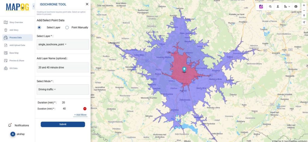
4. Share Insights
Export the map and share it with your team to align strategies or present insights to stakeholders.
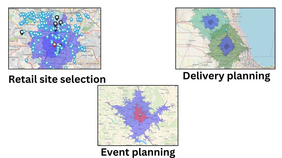
Real-Life Examples of Isochrone Maps in Action
- Retail site selection: Determine ideal store locations based on customer accessibility.
- Delivery planning: Optimize delivery routes and ensure timely services.
- Event planning: Identify target audiences within accessible zones.
Conclusion
Isochrone maps are a powerful tool for businesses to optimize operations, enhance customer experience, and make informed decisions. Platforms like MAPOG simplify the process, allowing you to create detailed, data-driven visualizations tailored to your needs. Start exploring how isochrone maps can transform your business strategies today.
Here are some other blogs you might be interested in
- Protecting Wetlands: Guide to Create GIS Map for Nature
- Mapping Tiger Attack Hotspots – Create an Online Map and Share
- Make Routes for Military Aerial Planning- Through Bearing angle and Distance calculation – Online Route Compass
- Mapping Healthcare Efficiency: GIS Buffer Analysis of Hospital Locations
- Add WMS- Two step online view of WMS layer on a map
- Plot ATM locations on a map and embed on your website
- Map habitat locations of endangered animals & keep track of their living