In the realm of GIS, we explore joining data to GeoJSON files, enhancing spatial analysis. Attribute Joins integrate supplementary data like demographics, enabling comprehensive mapping and analysis. This process unveils deeper insights, empowering informed decision-making in geographical contexts.
Key concept to Joining data to GeoJSON File
Within the GIS domain, we explore integrating data into GeoJSON files to enrich spatial analysis. Alongside this guide, datasets will be provided for practical application. Additionally, articles like “Creating Travel Guides: Mapping with GIS Buffer Zones” and “Creating GIS Solutions for Urban Agriculture Map” offer deeper insights into GIS applications.
MAPOG Map Analysis, a simple tool designed to simplify the creation and interpretation of travel maps.
Implementing Attribute Joins in GIS follows a systematic approach, empowering analysts to merge geographic data seamlessly and enhance spatial analysis. Let’s delve into the process:
Step1: Data Preparation:
Begin by gathering the GeoJSON file representing geographical boundaries and the supplementary dataset containing additional attributes.
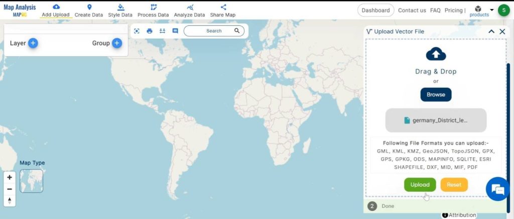
1.click on the “Add Upload” button and choose the “Upload Vector File” tool.
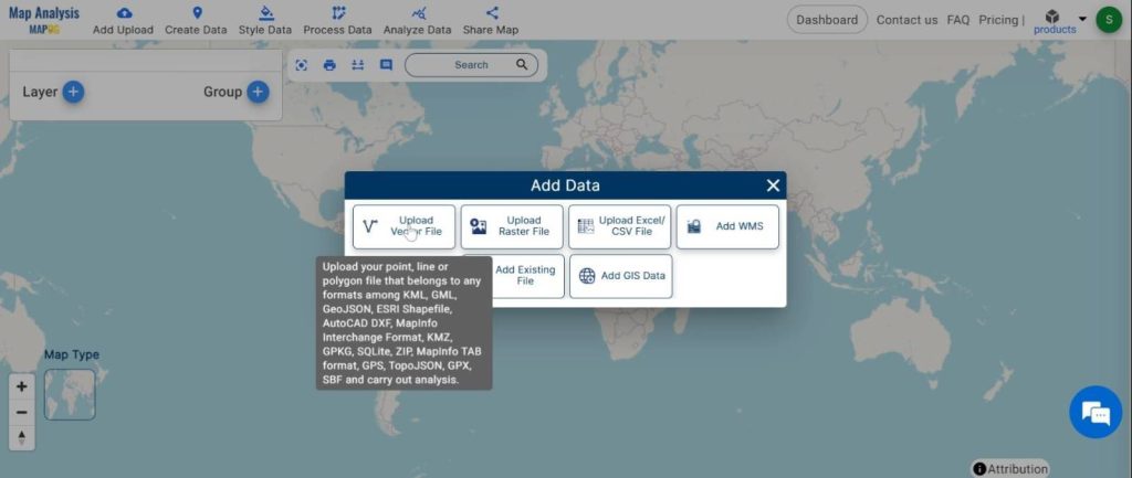
2.here select the GeoJSON file and click on the “Upload” button.
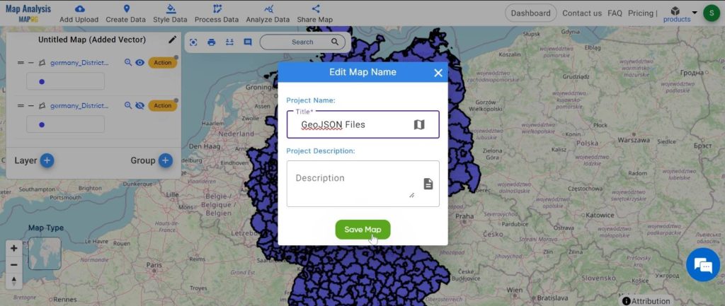
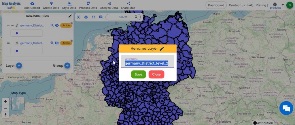
Step2: Name the untitled map and Rename the layer:
1.Here you have to name the untitled map
2.Rename the layer
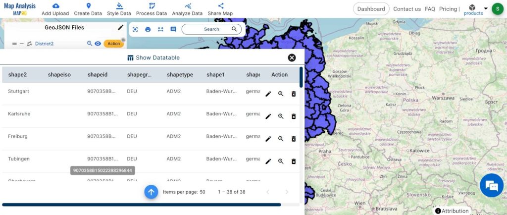
Step3: Identification of Common Fields:
Identify shared attributes, such as unique identifiers or geographic codes, between the GeoJSON file and the supplementary dataset.
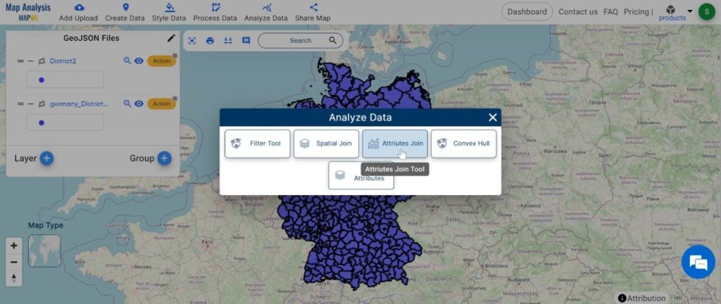
Step4: Utilizing GIS Tools:
Employ specialized GIS tools like MAPOG Map Analysis to import both datasets and specify the join fields.
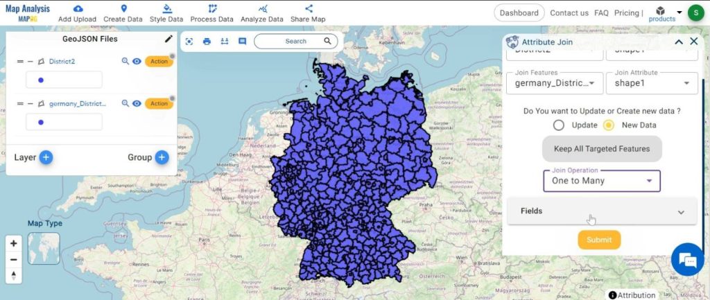
1.Click on the “Analyze Data” button and choose the “Attribute Join” tool.
2.Here select the target feature and set the attribute and similarly select the join feature and set the attribute. Here are two options: you can either update your existing data or obtain new data. Set the join operation. Click on the submit button.
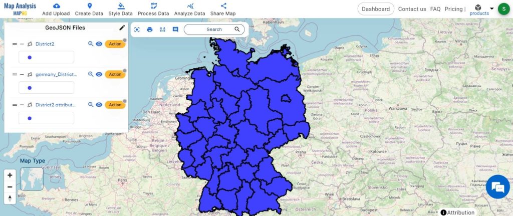
Step5: Analysis and Visualization:
Explore the merged dataset to uncover insights, visualise spatial relationships, and reveal hidden patterns within the data.

Major Findings:
- Attribute Joins enrich maps with additional data, enabling analysts to gain deeper insights into spatial relationships and patterns.
- Enriched maps facilitate data-driven decision-making across various domains, including urban planning, public health, and environmental conservation.
- The integration of geographic and attribute data enables comprehensive spatial analysis, allowing for the identification of trends and correlations.
- By visualising spatial disparities, stakeholders can target interventions more effectively, addressing issues such as healthcare disparities or resource allocation.
- Urban planners and policymakers can use enriched maps to allocate resources efficiently, identifying areas in need of development or infrastructure improvements.
Domain and Industry Implications:
Attribute Joins have far-reaching applications across domains such as urban planning, public health, marketing, and environmental conservation, empowering informed decision-making and resource allocation.
In conclusion, Attribute Joins in GeoJSON files revolutionize spatial analysis, empowering informed decision-making across domains. As we harness the power of GIS technologies, the transformative impact of Attribute Joins guides us towards a more sustainable future.
Link of the Data:
Explore the data further through our GIS Data product, uncovering valuable information for in-depth analysis and understanding.
Exploring Our Previous Blogs:
- GIS Analysis in Urban Planning: Reshaping Transportation Future Insights of state/city
- Make Routes for Military Aerial Planning- Through Bearing angle and Distance calculation – Online Route Compass
- Create Map for Real Estate Developer for Best Site Selection
- Create a Map: Spatial Join Analysis of ATM Points within District Boundaries