Large lakes present challenges in consistent and comprehensive environmental monitoring due to their vast size and varied conditions. “Lakes Monitoring Using Split Polygon and Split Line segmentation in MAPOG” is a systematic approach to segmenting the lake is necessary for efficient monitoring and effective management of environmental health.
Key Concepts
By utilizing the Split Polygon and Split Line tools in MAPOG, environmental scientists can segment lakes to facilitate targeted monitoring, assessment, and intervention strategies.
Steps to create Lakes Monitoring Using Split Polygon and Split Line Tools in MAPOG
Step 1: Add Lake Data
First, navigate to the Map Analysis interface. Then click on the GIS Library button in the upper left corner. A dialogue box will open. Their search for your desired country and add the Lake data.
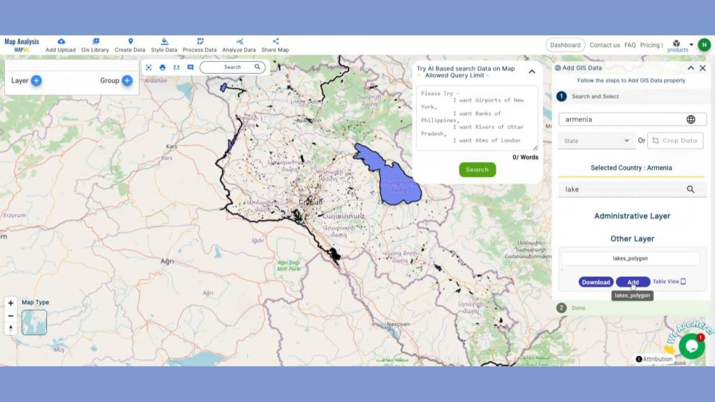
After adding the layer, rename that.
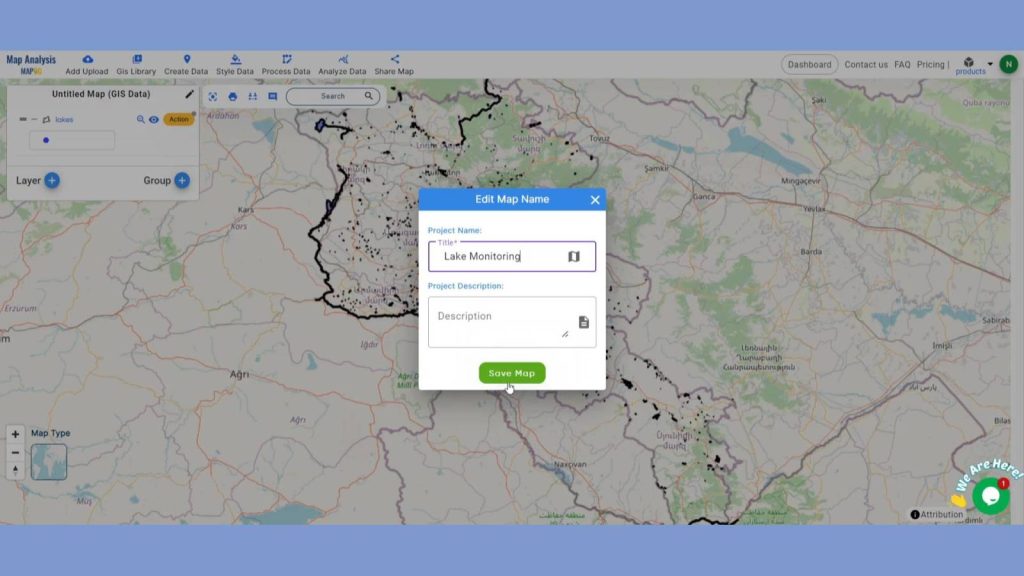
Step 2: Save Project
Now, click on the pencil icon situated right after the “Untitled Map” text to save the project. In the dialogue box write proper name and description that describe the project accurately. And click on save map option. Your project will be saved.
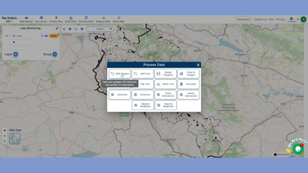
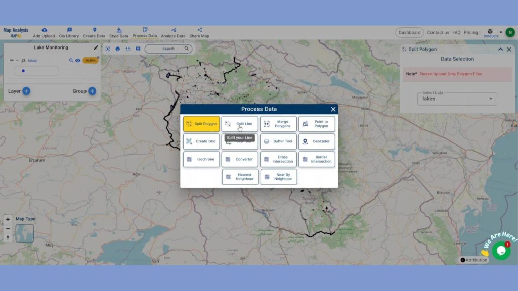
Step 3: Divide lake Polygons
We will now divide lakes into smaller parts for effective environmental monitoring and management. Click on the Split Polygon option using the Process data option in the header.
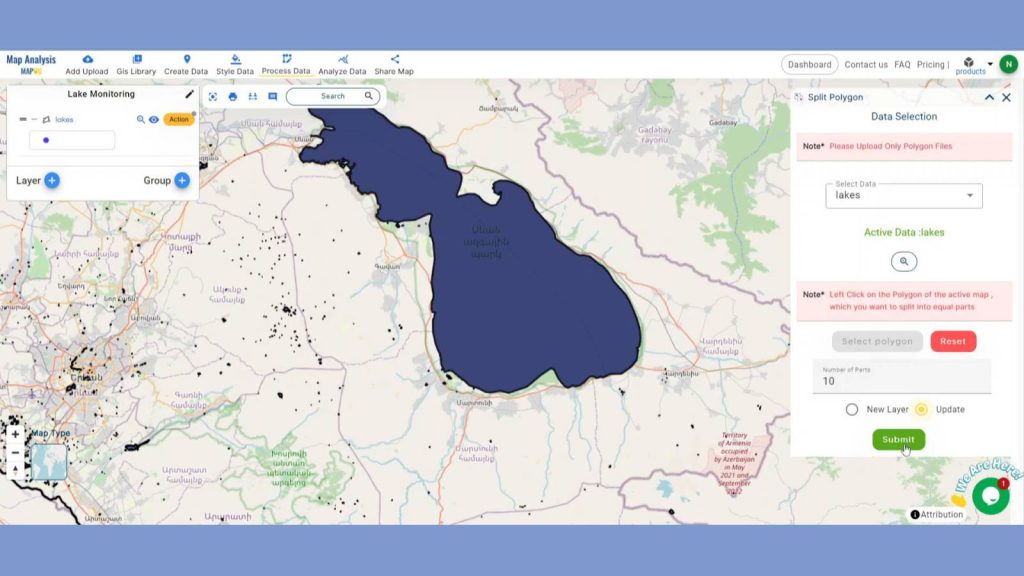
Select the Lake in the select layer option. Now select the big lakes using the select polygon option. Write the number of parts you want to split and click on new layer to create new layer or just update the existing file. Lastly, Click submit.
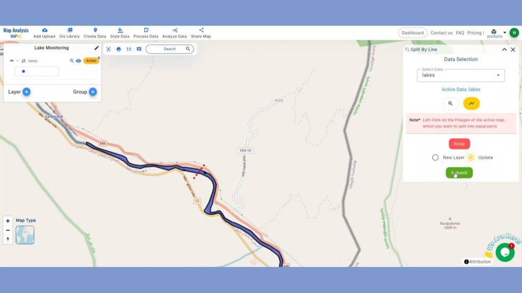
For the linier kind of lakes, we will use split line tool. Open the tool from Process data option.
Provide the lake polygon data in select data option. Select the draw line option and further divide them based on desired intervals or environmental gradients. Click on new layer to create new layer or just update the existing file.
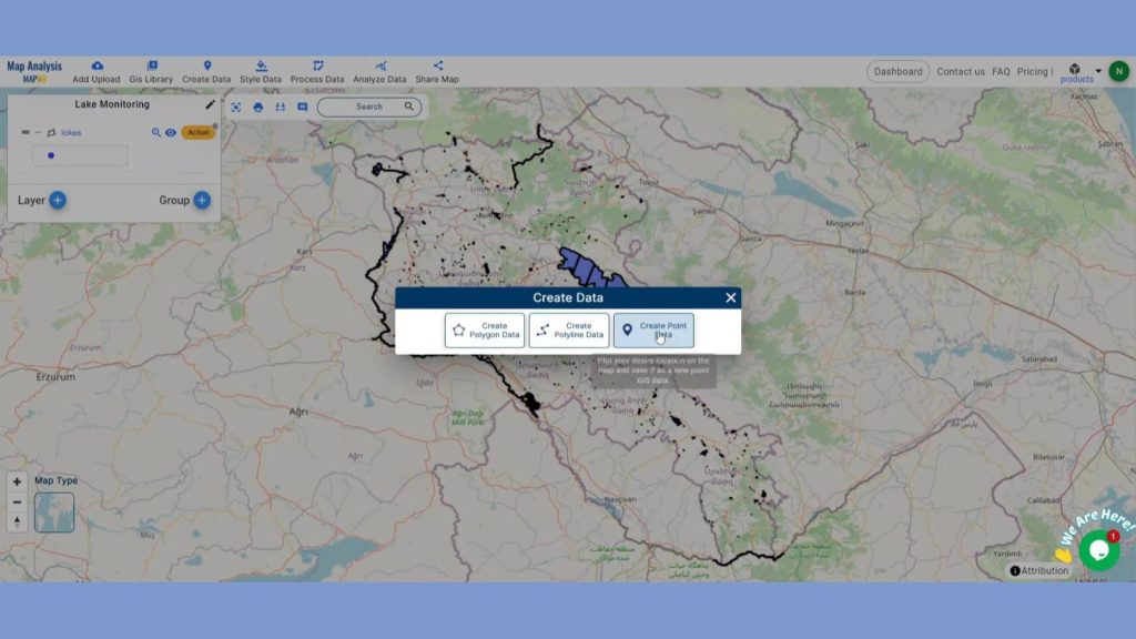
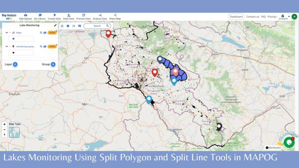
Step 4: Propose Location for Monitoring Equipment
Now we will Propose new locations for Monitoring Equipment like water quality sensors, biodiversity sampling points, using the create point data tool from create data option. After providing a suitable name click save.
Then by using the latitude and longitude option plot the Monitoring Equipment and provide the equipment name in the pop-up box and click add option. By doing this add all the Monitoring Equipment.
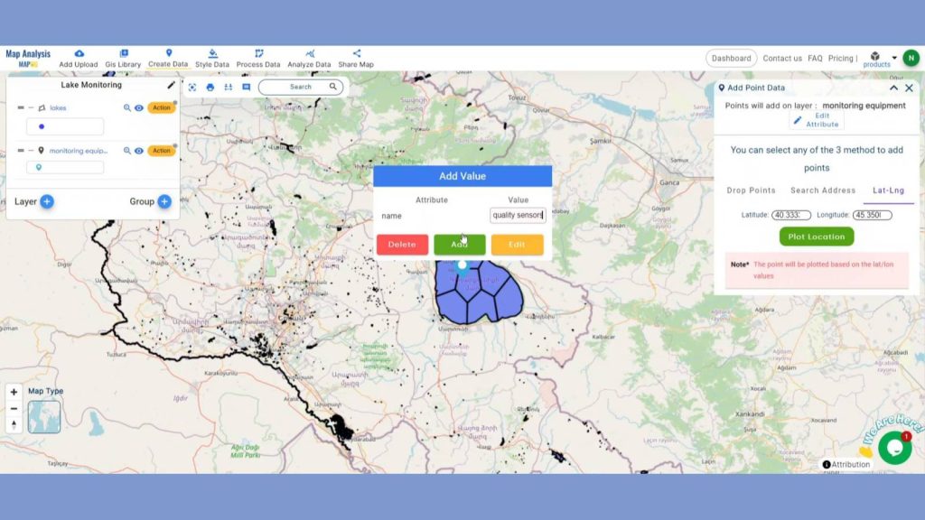
This will help us collect data on key environmental parameters such as pH, temperature, pollutant levels, and species presence.
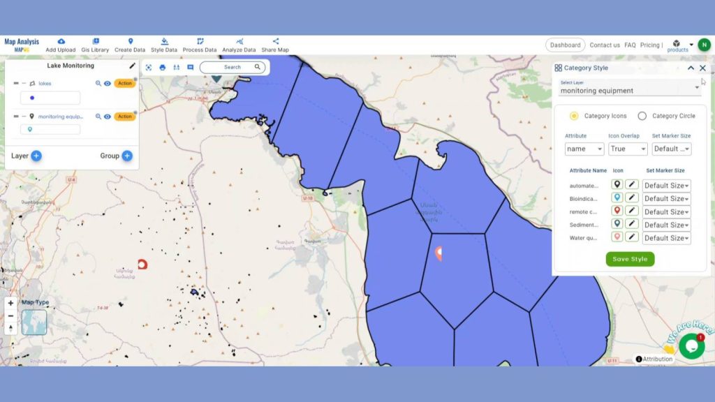
Step 5: Add Thematic Style
To take the whole thing to a new level by adding Category style in the monitoring equipment layer. Go to the Style Data in the header and click on Category style. Choose the monitoring equipment layer, in the attribute section choose name attribute and save style.
Step 4: Results & Analysis
Given the fact that lakes are rather large water bodies, it represents a complex task to single out a small area for monitoring, the methodological approach of using the Split Polygon and Split Line tools in MAPOG to segment a large lake for environmental monitoring purpose is systematic and efficient. It improves the effectiveness of the tracking activities, helps to identify the targeted activity and thus, strengthen the health and sustainability of the lake ecosystems.
Major Findings
1. Improved Data Precision: Segmenting the lake into smaller polygons and lines allows for more precise and localized data collection, enhancing the accuracy of environmental assessments.
2. Efficient Resource Allocation: By identifying and focusing on critical segments with significant environmental concerns, resources can be allocated more effectively, ensuring that areas most in need of intervention receive attention.
3. Enhanced Monitoring Coverage: Systematic segmentation ensures comprehensive coverage of the lake, reducing the likelihood of missing critical environmental issues and providing a thorough understanding of the lake’s overall health.
Domain and Industry
This map is a powerful tool for Improved Monitoring Efficiency, Targeted Interventions, Effective Management and beyond.
Conclusion
In MAPOG, division of lakes by splitting polygons and lines enable more accurate and timely measurement and assessment of environment. By identifying the different lake variants, it helps in strategic collection of data that facilitates this extensive management and overall protection of the lake.
LINKS FOR THE DATA 👍
Here are some other blogs you might be interested in
- Create a Map for Pipeline Impact Zones: A Step-by-Step Guide
- Revolutionizing EIAs: The Role of GIS Maps, Bearing Angle, Route Compass, and Distance in Civil Engineering
- Creating an Online Interactive Map for Residential Land Use and Buffer Analysis with Thematic Visualization
- Grid Mapping for Accurate Spatial Analysis: Divide and Conquer with GRID Map Tool