“Land Use Compliance using Border Intersection in MAPOG” enables urban planners to quickly identify and address non-compliant land use by analyzing the intersections of property boundaries with zoning attributes.
Key Concepts
Identifying these non-compliance areas quickly and accurately is crucial for effective urban management and enforcement.
Steps to create Land Use Compliance using Border Intersection in MAPOG
Step 1: Add Land use Data
First, navigate to the Map Analysis interface. Then click on the GIS Library button in the upper left corner. A dialogue box will open. Their search for your desired country and add the land use data.
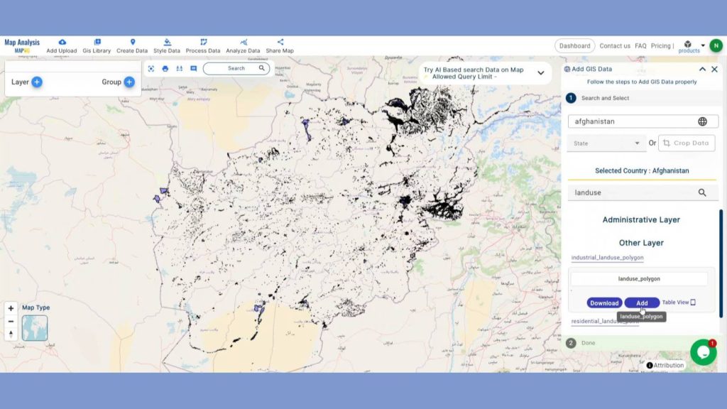
After adding those layers, rename them.
Learn how to improve urban planning with accurate proximity analysis and visually appealing thematic maps by reading ‘Creating an Online Interactive Map for Residential Land Use and Buffer Analysis with Thematic Visualization‘ in MAPOG. Simplify decision-making and effortlessly maximise land-use strategies!
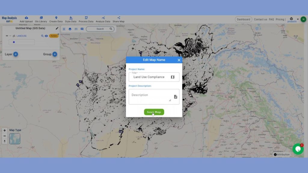
Step 2: Save Project
Now, click on the pencil icon situated right after the “Untitled Map” text to save the project. In the dialogue box write proper name and description that describe the project accurately. And click on save map option. Your project will be saved.
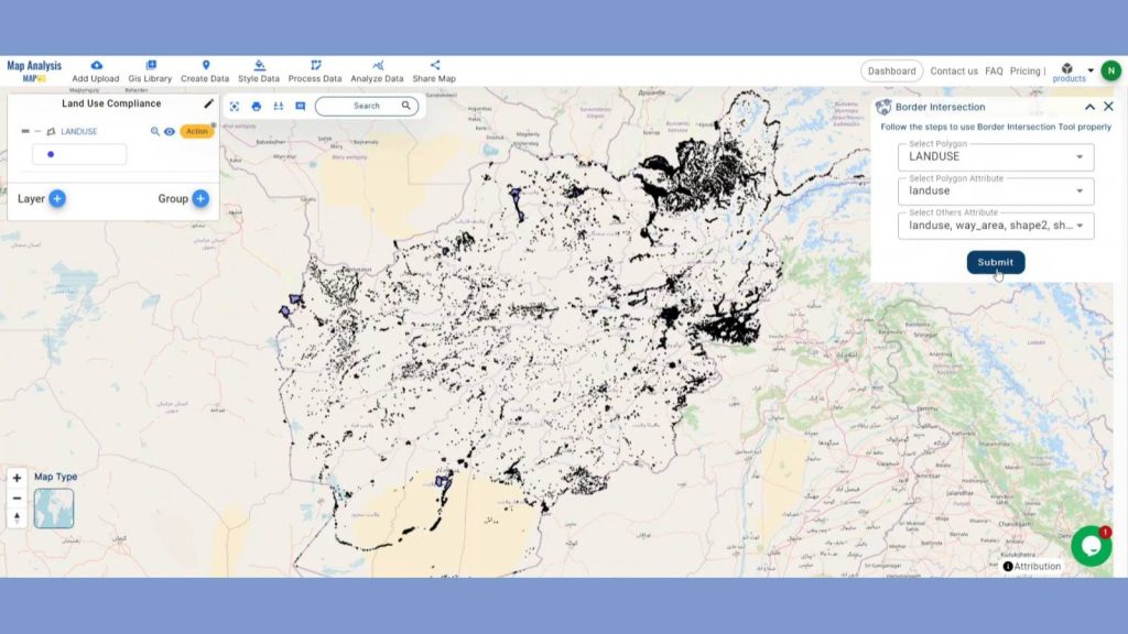
Step 3: Identify Border Intersection
We will now Identify intersections to detect zones where the property use may be in violation of zoning laws. Click on the Border Intersection option using the Process data option in the header.
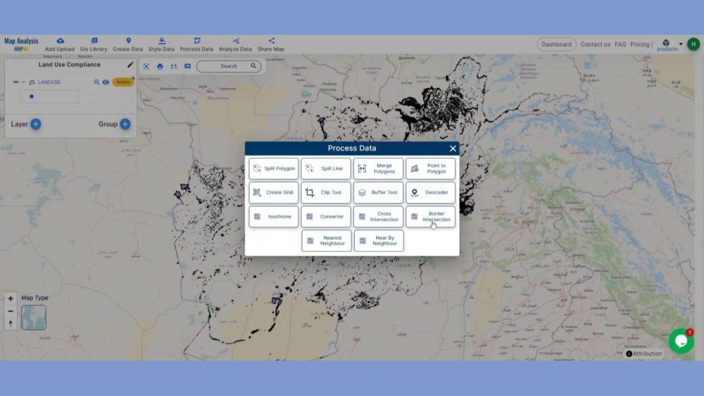
In the select polygon section provide the Land use polygon layer and Select Polygon Attribute section provide the land use attribute. Next in the select other attribute section provide the attributes you want in the output result. Lastly, Click submit.
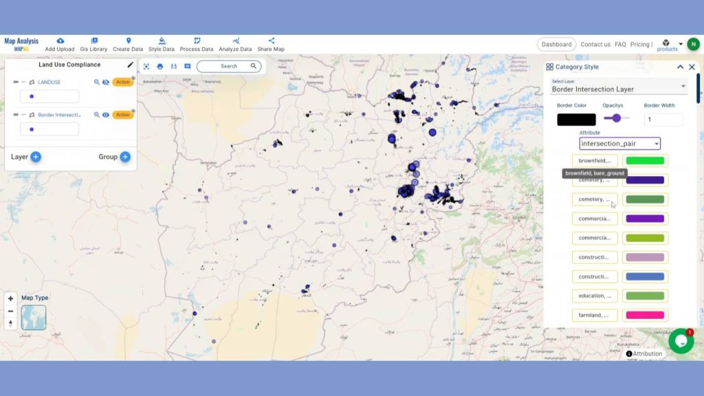
Step 4: Add Thematic Style
To take the whole thing to a new level by adding Category style in the border intersection layer. Go to the Style Data in the header and click on Category style. Choose the border intersection layers, in the attribute section choose Intersection pair attribute and save style.
Uncover the potential of ‘Category Style Map: Mapping Education Institution Diversity’ by using MAPOG! With simple, color-coded mapping, you can visualize and distinguish between different types of educational institutions based on their demographics, improving analysis and decision-making.
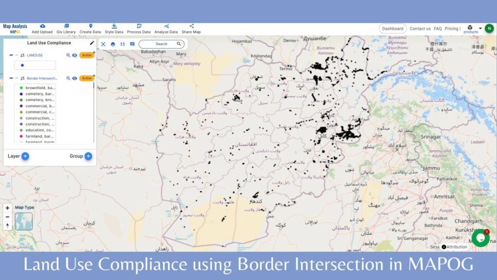
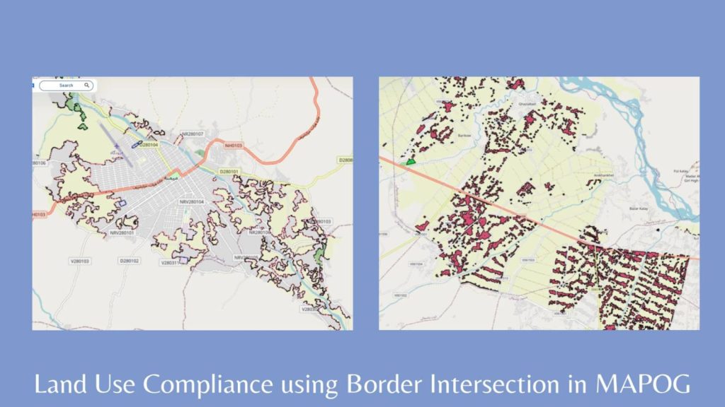
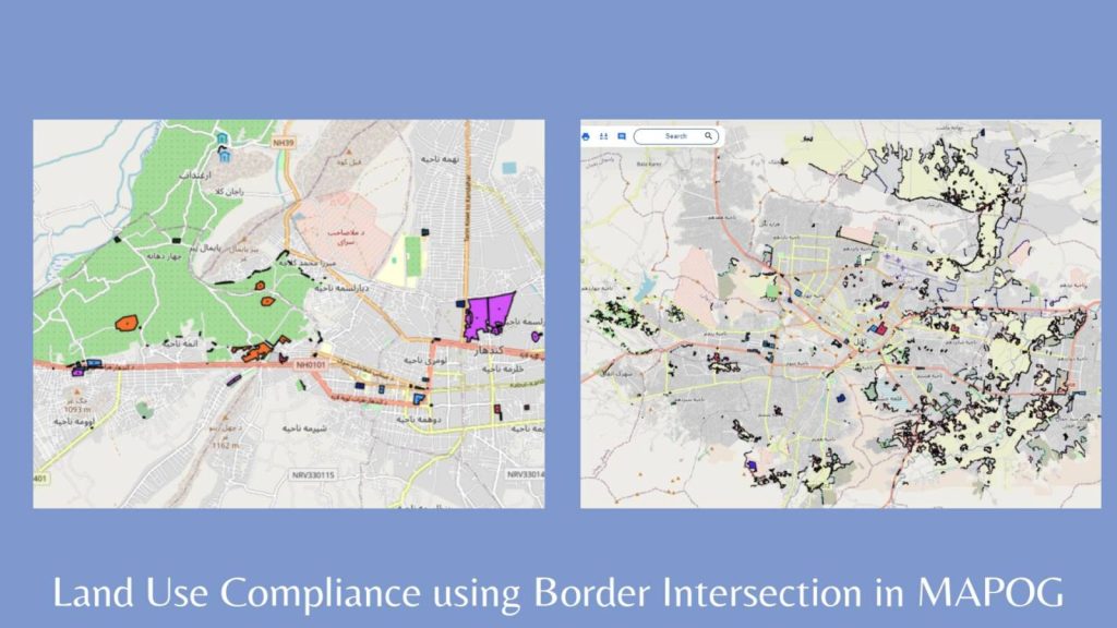
Step 4: Results & Analysis
Using the Border Intersection tool in MAPOG we’ve analyzed that mainly the residential areas are sharing borders with farmland and industrial areas. This tool for land use compliance provides urban planners and compliance officers with a powerful method to ensure properties adhere to zoning regulations.
Major Findings
1. Identified Non-Compliance Zones: Pinpointed specific areas where the property’s land use does not conform to zoning regulations.
2. Detailed Compliance Map: Created a comprehensive map highlighting both compliant and non-compliant sections of the property boundary.
3. Targeted Recommendations: Generated actionable recommendations to address and rectify non-compliance issues based on the analysis results.
Domain and Industry
This approach facilitates the quick identification of non-compliant areas, supports effective enforcement, and promotes orderly urban development.
Questions
- How does the Border Intersection tool identify non-compliance zones?
- What data inputs are required for accurate compliance analysis?
- How can the results from the Border Intersection tool be used for enforcement actions?
Conclusion
Using the Border Intersection tool in MAPOG for land use compliance provides urban planners and compliance officers with a powerful method to ensure properties adhere to zoning regulations. This approach facilitates the quick identification of non-compliant areas, supports effective enforcement, and promotes orderly urban development.
Here are some other blogs you might be interested in
- Create a Map for Pipeline Impact Zones: A Step-by-Step Guide
- Revolutionizing EIAs: The Role of GIS Maps, Bearing Angle, Route Compass, and Distance in Civil Engineering
- Grid Mapping for Accurate Spatial Analysis: Divide and Conquer with GRID Map Tool
- Creating Quantity Style Map: Styling Natural Wealth