In the world, natural disasters cast shadows of uncertainty and vulnerability over communities. Among these, landslides emerge as a silent threat. In the face of such threats, the platform MAPOG helps to Create a Map for Landslide Mitigation and Rapid Response. MAPOG is armed with advanced GIS tools and it’s a very powerful platform used for disaster management, mitigation, and rapid response during a disaster.
Key Concept to Create a Map for Landslide Mitigation and Rapid Response:
MAPOG‘s advanced GIS capabilities empower us to analyze topographic and geological data. By leveraging this technology, we can visually represent areas prone to landslides, along with nearby hospitals and settlement data. The links for GIS Data, integral to this analysis, are provided at the end. one can explore our other blog also Fast Emergency Response: Using GIS and Isochrone Maps for 10-Minute Ambulance Arrival.
Steps to Create a Map for Landslide Mitigation and Rapid Response:
Step 1:
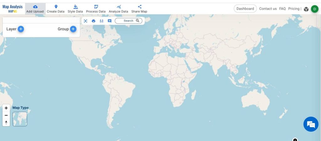
Open the MAPOG Map Analysis interface, Then click on the Add Upload option from the menu toolbar.
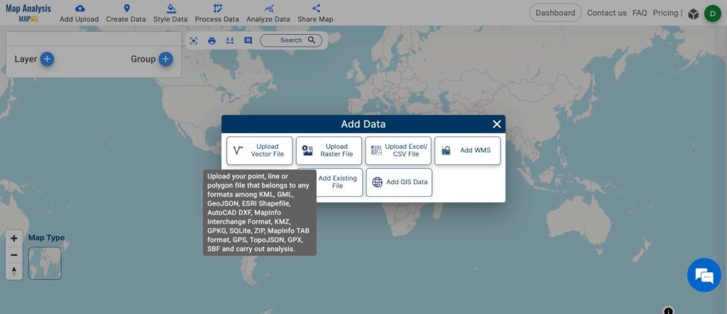
Now, select “Upload Vector File.”
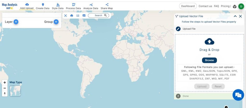
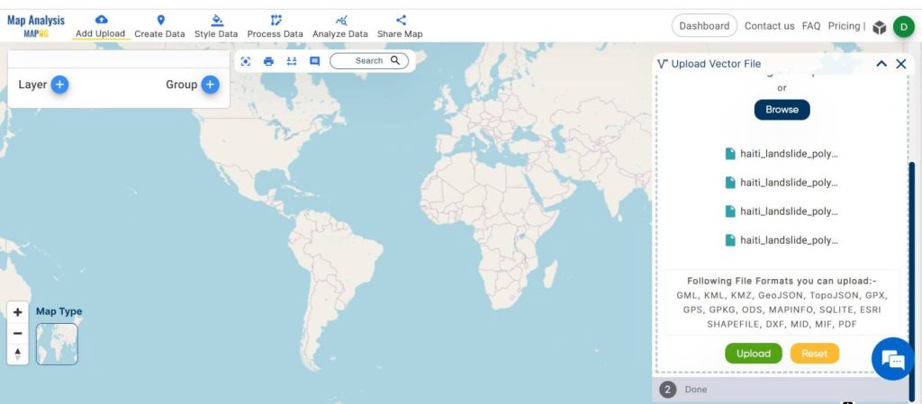
By clicking the Browse option choose the desired file and upload that.
Step 2:
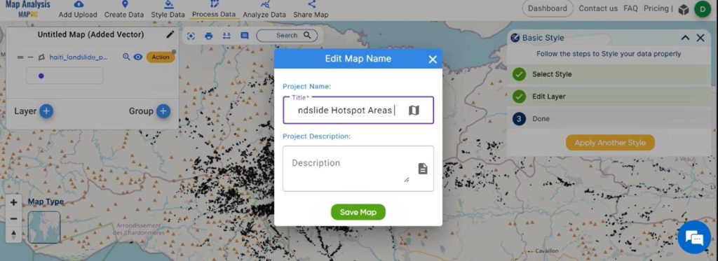
Once your vector data is added successfully then go to “Edit Map Name” and give a name to the untitled project. And click “Save Map”.
Step 3:
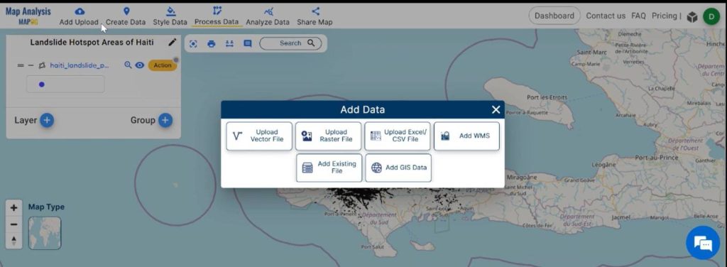
For adding settlement and hospital data, use the “Add Upload” menu toolbar. A panel window will open. Choose “Add GIS Data“.
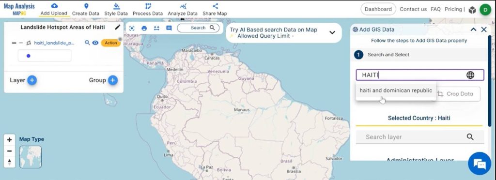
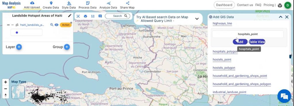
After that specify the country name from the right side of the screen select your preferred data types and press the “Add” option. To add more than one data you can click “Add Another Data” and do the same process.
Step 4:
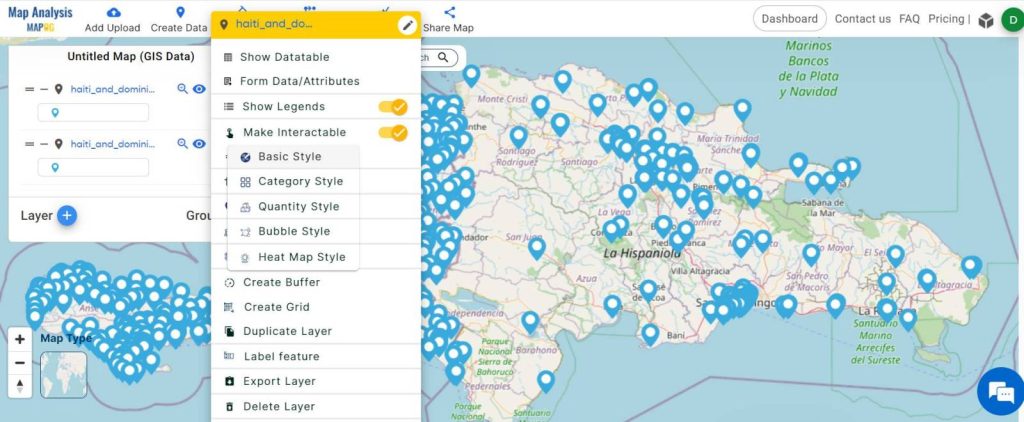
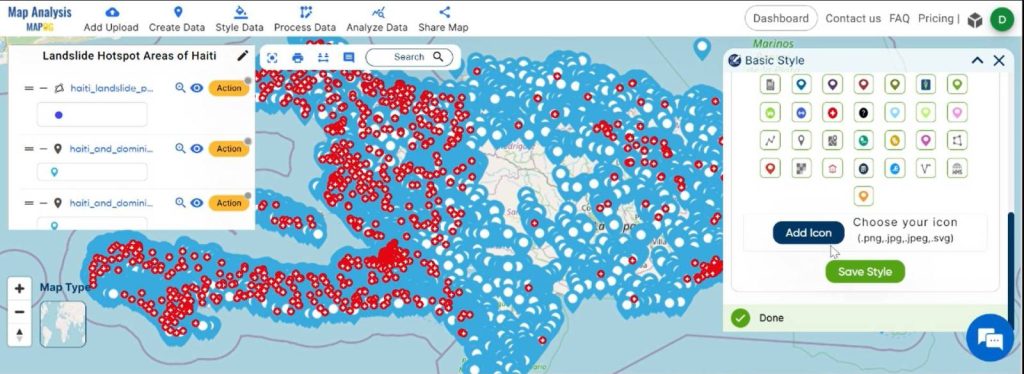
To change the style or icons just go and click “Action” right side of the layer. A new window will open click on “Basic Style”. Choose appropriate icons or colors as per your data. Click on “Save Style”.
Step 5:
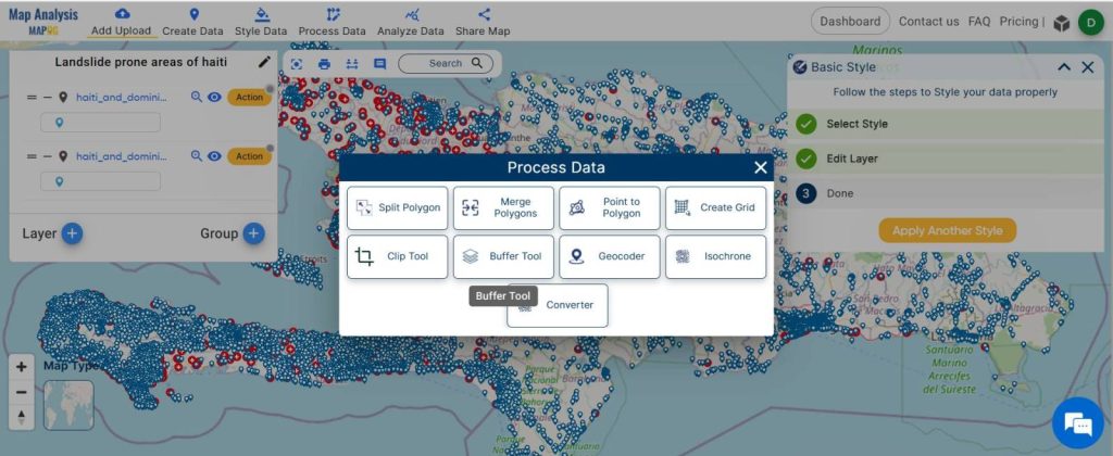
For generating Buffer Zones, first go to “Process Data” from the menu toolbar. A panel window will open, then click the “Buffer tool“.
Enter the range of the buffer zone and “ Submit”.
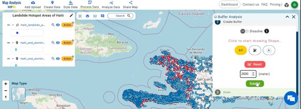
To style the buffer zone, go to “ Basic style ” from the “Action” option right side of the layer and select the color as per your requirement, “Save Style.”
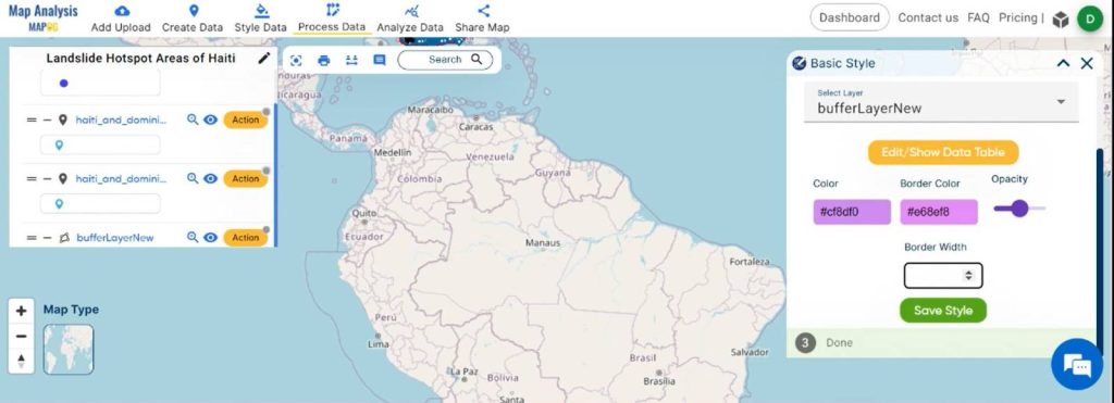
The Final Map is ready now.
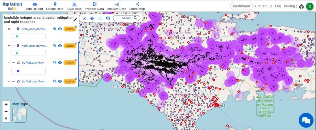
Major Findings to Create a Map for Landslide Mitigation and Rapid Response:
Landslide Hotspots Identification:
- The map reveals critical landslide hotspots, aiding in the visual representation of vulnerable areas prone to disasters.
Settlements Mapping:
- The inclusion of settlements provides a comprehensive view of human habitats near landslide-prone zones.
Hospital Locations Highlighted:
- Pinpointing hospitals near hotspots facilitates efficient emergency response strategies for potential casualties.
Domain and Industry:
Disaster Mitigation Insights:
- The analysis equips communities with actionable knowledge to proactively address vulnerabilities, enhancing overall disaster resilience.
Rapid Response Preparedness:
- Emergency response teams benefit from a clear understanding of the geographical context, enabling quicker and more effective response efforts.
Community Empowerment:
- By providing communities with insights into local vulnerabilities, the platform empowers them to take preventive measures, fostering a proactive approach to disaster management.
Enhanced Disaster Resilience:
- The collective data aids in strengthening the resilience of communities, as they gain knowledge to prepare and respond effectively to potential landslides.
Conclusion:
In conclusion, we’ve crafted a map showcasing some landslide-prone areas as an example alongside its nearest hospitals and settlements. MAPOG emerges as a guiding light for disaster mitigation and rapid response efforts, contributing to the creation of safer places.
Links to the Data