Mapping locations through addresses using the Geocoder tool is a game-changer in the field of Geographic Information Systems (GIS).
MAPOG Map Analysis leverages this technology to convert addresses into precise geographic coordinates, enhancing accuracy in urban planning, navigation, and emergency services.
Discover how MAPOG’s powerful Geocoder tool can transform your mapping projects.
KEY CONCEPTS
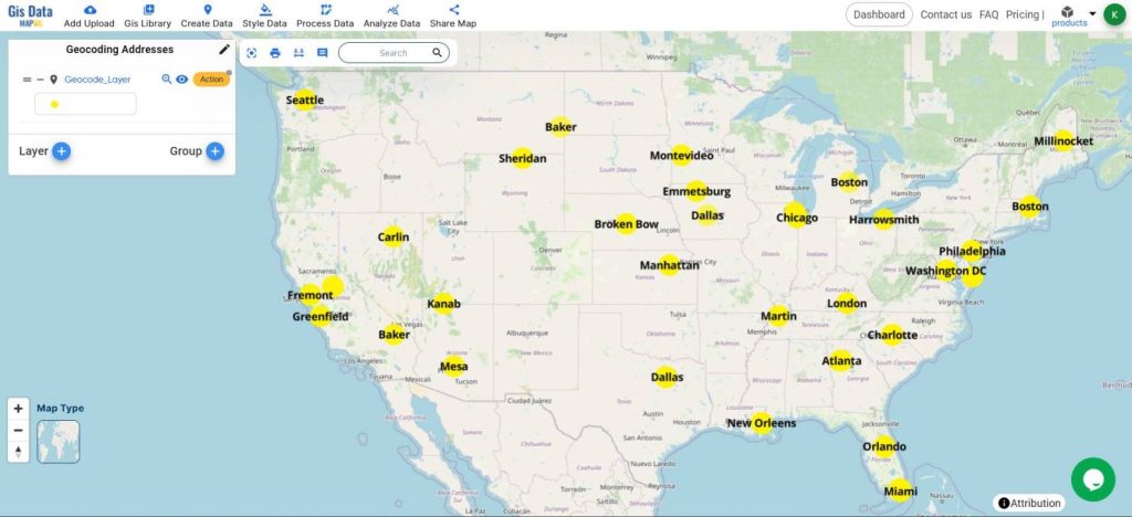
Our goal is to create a simple and interactive map of Points from the Excel Sheet pinned at the exact addresses with the city labeling using the Geocoder tool.
Learn more about mapping points here Create Point, Line, Polygon on Map
Steps for Creating a Map through Geocoding
Below are the steps to follow to create the map
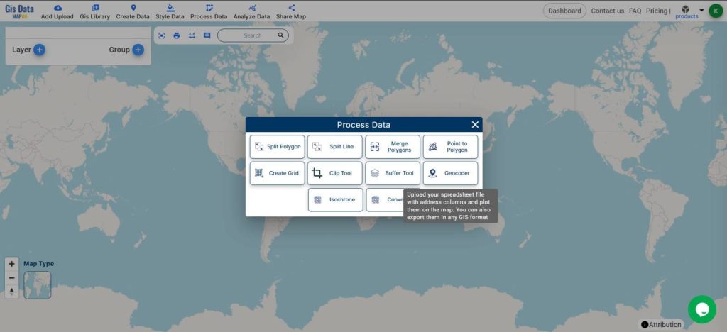
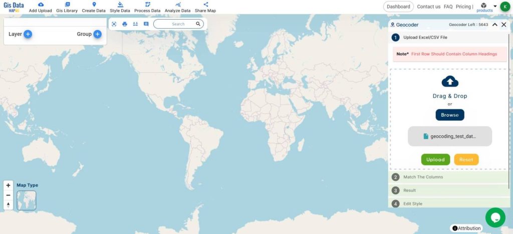
- Open Map Analysis
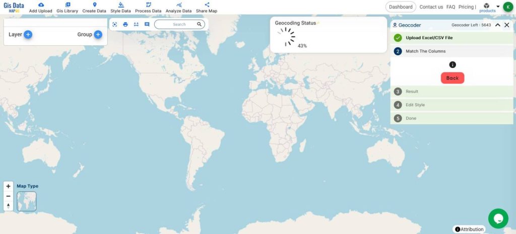
- Click on Process Data, Geocoder
- Upload the Excel sheet with the addresses with the proper city, zip code, and state
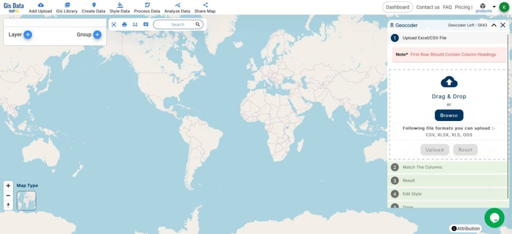
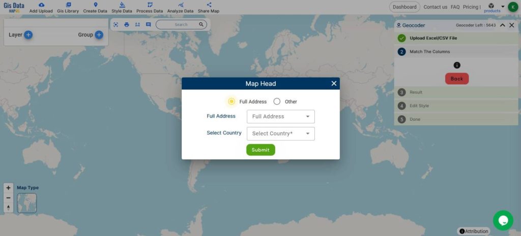
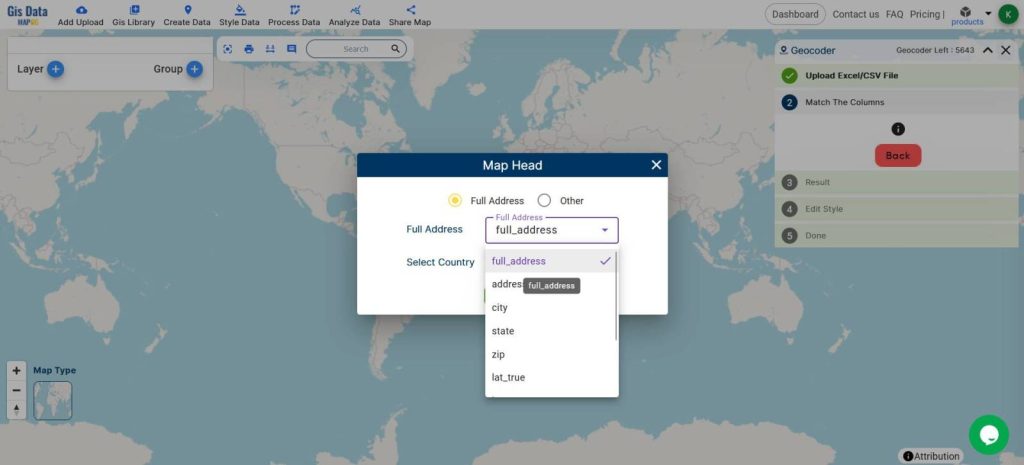
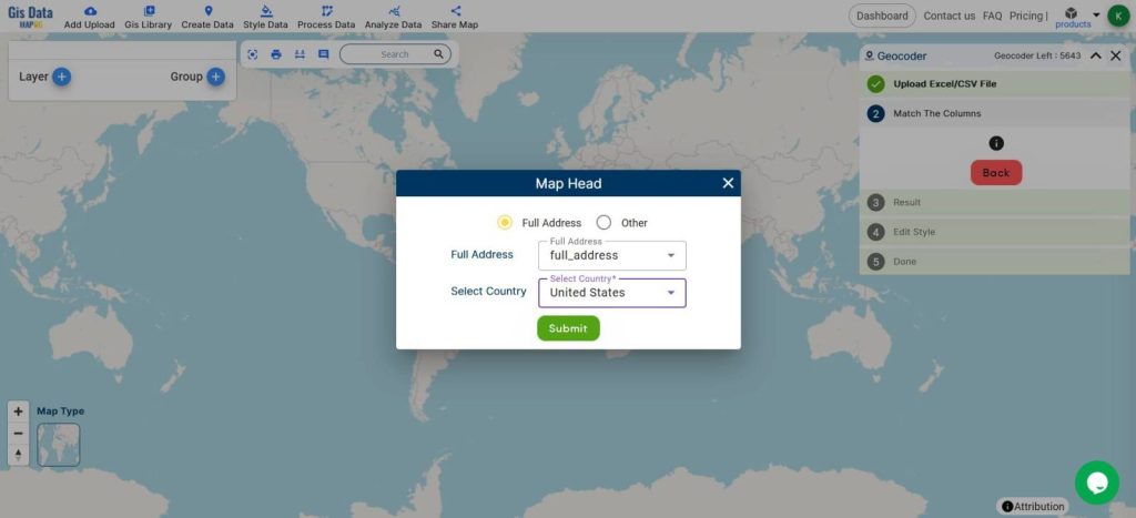
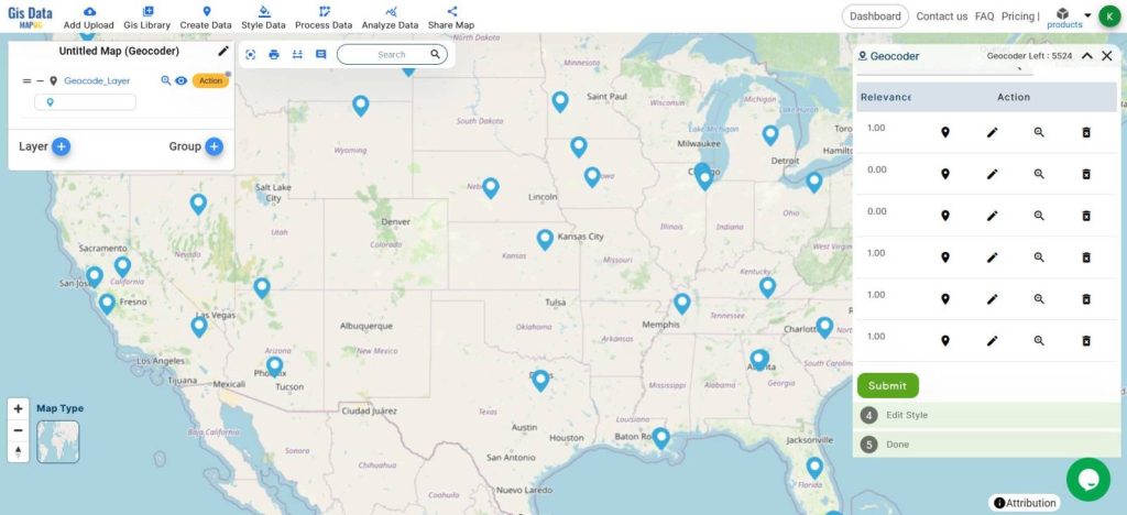
- Assign the columns accordingly
I am assigning the full address column and the country.
- Geocoding is under process
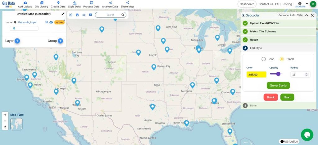
- Customize the icons and click Save Style
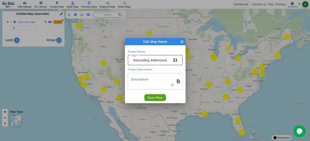
- Rename the Map
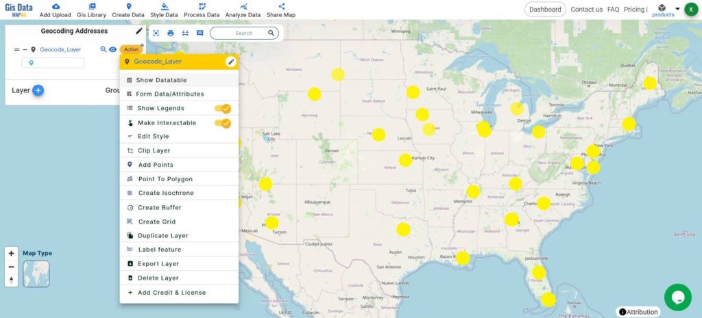
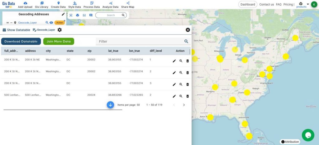
- View the data table from Layer Action, Show Datatable
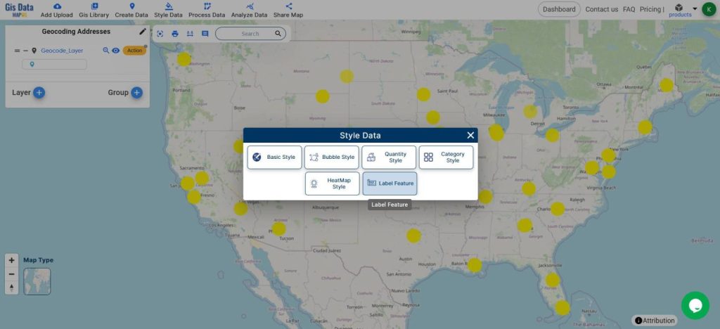
- From the Style Data, Label Features
- Select the Layer
- Choose the ‘City’ attribute
- Adjust the formatting accordingly
- Save Label
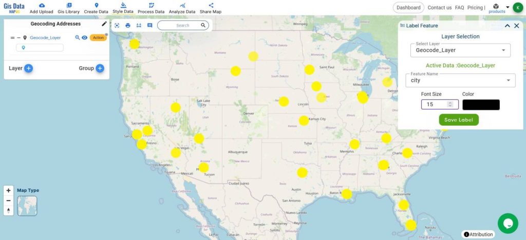
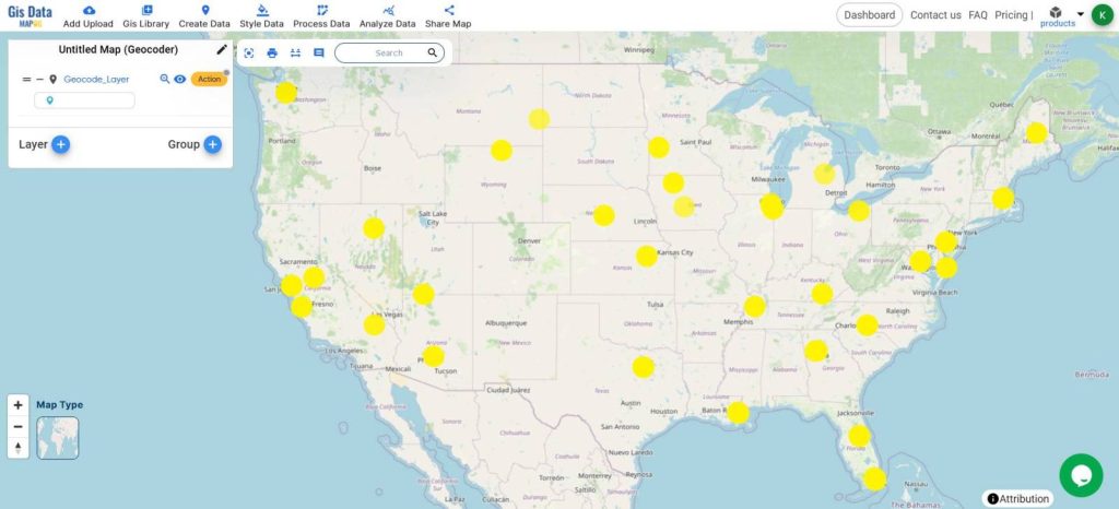
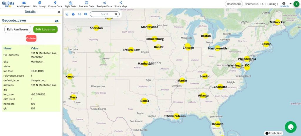
A simple and interactive map of Points pinned at the exact addresses with the city labeling will be created which can be later used for required analyses.

Click on a point to know more about the details.
Mapping locations through addresses using the Geocoder tool offers several benefits:
- Improved Data Accuracy: It converts addresses into precise geographic coordinates, ensuring accurate location plotting for analysis and decision-making.
- Enhanced Accessibility: Facilitates easy integration of location data into GIS, making it accessible for various applications like urban planning, logistics, and emergency response.
MAJOR FINDINGS
- Enhanced Accuracy: The Geocoder tool improves location data precision by converting addresses into exact geographic coordinates.
- Increased Efficiency: It streamlines location-based analysis, making workflows faster and more efficient.
- Broad Applicability: The tool is versatile, benefiting sectors like logistics, public safety, real estate, and environmental management.
BENEFICIAL DOMAIN: Urban Planning and Emergency Response
- Urban Planning: The Geocoder tool enhances accuracy in mapping, aiding in efficient city planning and development.
- Emergency Response: It improves the precision of location data, crucial for timely and effective emergency services.
For any inquiries or support needs, feel free to contact us at support@mapog.com.
CONCLUSION
In conclusion, the Geocoder tool proves to be an invaluable asset for mapping locations through addresses, significantly enhancing accuracy and efficiency in various applications.
From urban planning to emergency response, its benefits are clear and impactful. For a deeper understanding and practical insights, explore MAPOG Map Analysis.
VIEW OUR PREVIOUS BLOGS
Online Conversion: Points into Polygon Map
Create a Category Style Map – Mapping Rivers in different Colors
Mapping Vasco da Gama’s Journey to India: A Historical Exploration with MAPSTORY