Sailing with MAPSTORY marks a historical journey tracing down the path of the legendary explorer, Vasco da Gama during his voyage to India with “Mapping Vasco da Gama’s Journey to India: A Historical Exploration with MAPSTORY”. Engage in the reenactment of his expedition using MAPOG in recreating the trip and details step by step.
Key Concepts
The purpose of “Mapping Vasco da Gama’s Journey to India: A Historical Exploration with MAPSTORY” using MAPOG is to trace and visualize the historic voyage, uncovering key landmarks and maritime routes, fostering a deeper understanding of global exploration and cultural exchange.
Steps to Mapping Vasco da Gama’s Journey to India
Step 1: Create Story
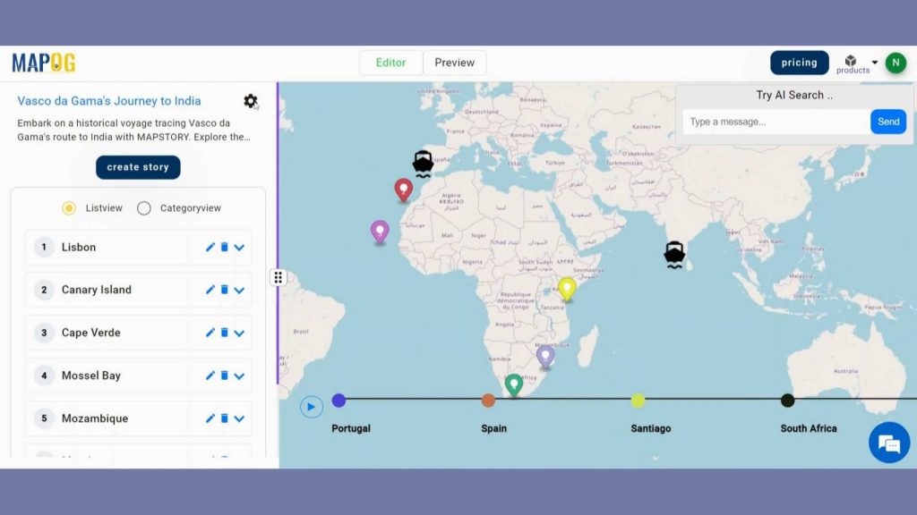
First, navigate to the MAP STORY and click on the create button. A box will open named Map Details, provide a name and description to the project. Then hit save.
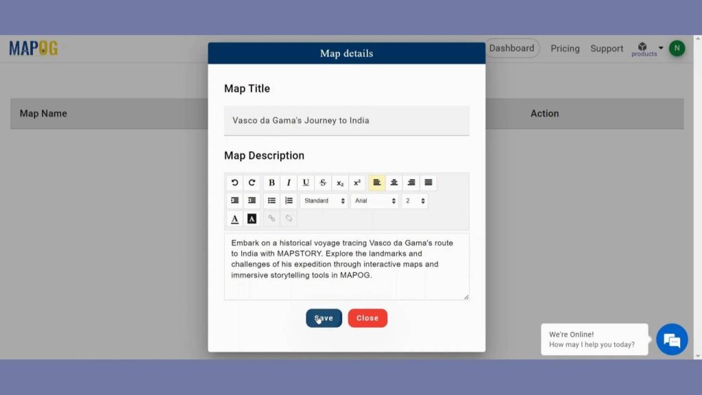
After coming to the MAP STORY interface, you will find create story button in the left panel. Click on that to create your own story.
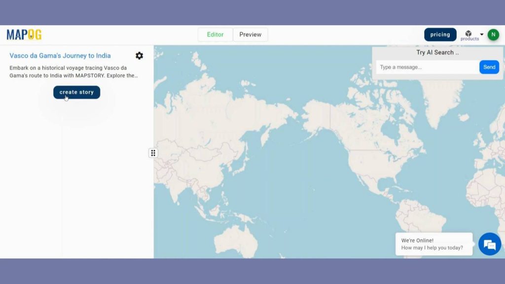
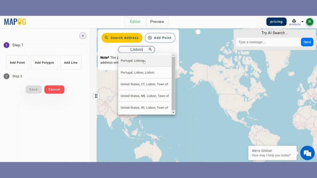
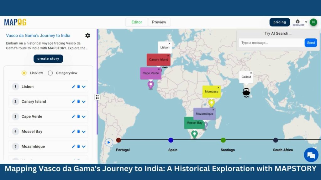
Step 2: Add Point
By clicking the Create story user will get three options like add Point, Line, Polygon. Click on add point to plot the landmarks. You can add the points either by searching address or by manually. AI feature will give you the description also when you search for your points.
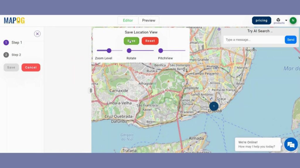
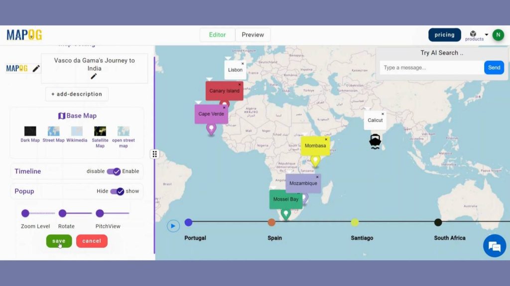
After you added the point to map canvas you can change the zoom level, pitch view and rotation of the point. Save the location view when you are satisfied.

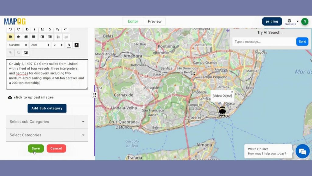
Step 3: Customize Point View
Now we are going to enhance visualization of those points. In step 1 users can put circle, markers and even custom legends to the points and click save to save the view.
Then to make the point more appealing, in step 2 you can add a title, descriptions, and images that describes the point. Include more categories if needed. Then hit save. Like that repeat the steps for the remaining voyage.
Use the Map Settings icon in the upper left corner.
Adjust the timeline’s visibility. Press the Play button on the timeline to test the tale.
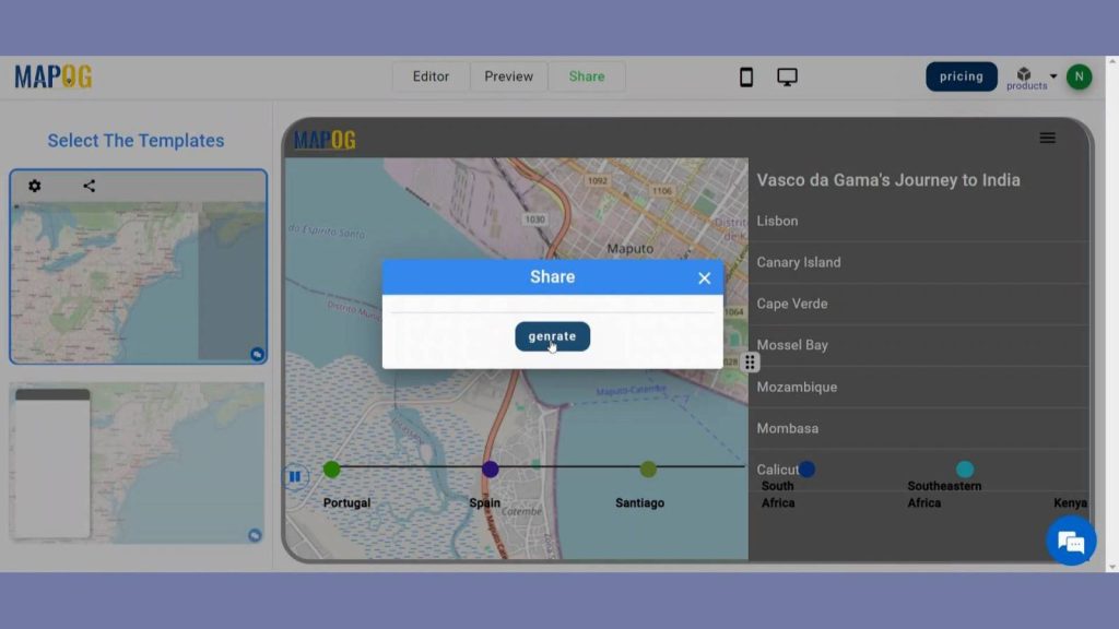
Step 3: Preview the Story
By clicking the PREVIEW, you can see the story. Select which of the two templates to view. To see the story, click the Play button on the timeline.
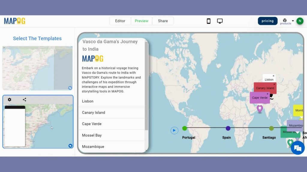
Use the share button to distribute the map.
Step 4: Results & Analysis
By carrying out this mission, we want to safeguard as well as indorse historic narrations with the aim of unveiling how civilizations and navigators’ forms links as well indicating that man created history.
Major Findings
1. Route Visualization: Using MAPSTORY in MAPOG, Vasco da Gama’s journey to India was mapped out, providing a visual representation of the path taken by the explorer across the Atlantic Ocean, around the Cape of Good Hope, and through the Indian Ocean.
2. Exploration Timeline: MAPSTORY allowed for the creation of a timeline illustrating key milestones and events of Vasco da Gama’s expedition, providing insights into the duration and sequence of his voyage.
3. Geographic Insights: MAPOG’s spatial analysis capabilities enabled the identification of geographical features encountered along Vasco da Gama’s route, such as coastal landmarks, navigational challenges, and points of interest, enriching our understanding of the historical journey.
Domain and Industry
Map Story has applications in many domains like Education, Tourism, Maritime Industry, Cultural Heritage Preservation, etc.
Questions
1. How can MAPSTORY in MAPOG aid in tracing Vasco da Gama’s historical journey to India, and what spatial analysis tools does it offer for exploring his route?
2. What unique features does MAPOG provide for visualizing and analyzing historical explorations, such as Vasco da Gama’s voyage to India, using MAPSTORY?
3. In what ways does MAPSTORY within MAPOG enhance the understanding of Vasco da Gama’s expedition, including geographical landmarks, navigation challenges, and cultural encounters along his route?
Conclusion
In conclusion, MAPSTORY in MAPOG offers a captivating journey through Vasco da Gama’s historic voyage to India, providing an immersive exploration of his route and the lands he discovered, enriching our understanding of global history and maritime exploration.
Here are some other blogs you might be interested in