Precision Farming Planning in MAPOG revolutionizes agriculture through advanced mapping tools. It optimizes resource allocation, enhancing crop yield and sustainability. By employing precise field mapping and strategic planning, farmers achieve efficient irrigation, fertilization, and pest control, ensuring a reliable and high-quality agricultural output for a thriving and eco-friendly farming future.
Key Concepts to create Precision Farming Planning with MAPOG
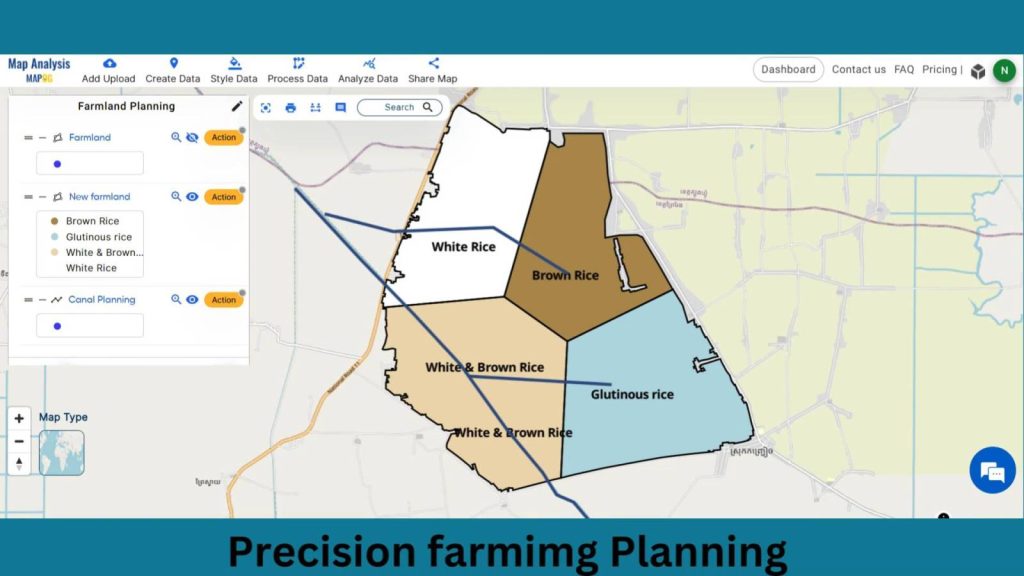
Our goal is to define specific zones within farming fields and plan irrigation for them. This map’s thematic structure is undoubtedly what gives it it’s fascinating details. Join us as we walk you through the process of making this effective map on the MAPOG. Let’s get started!
Steps to create Precision Farming Planning with MAPOG
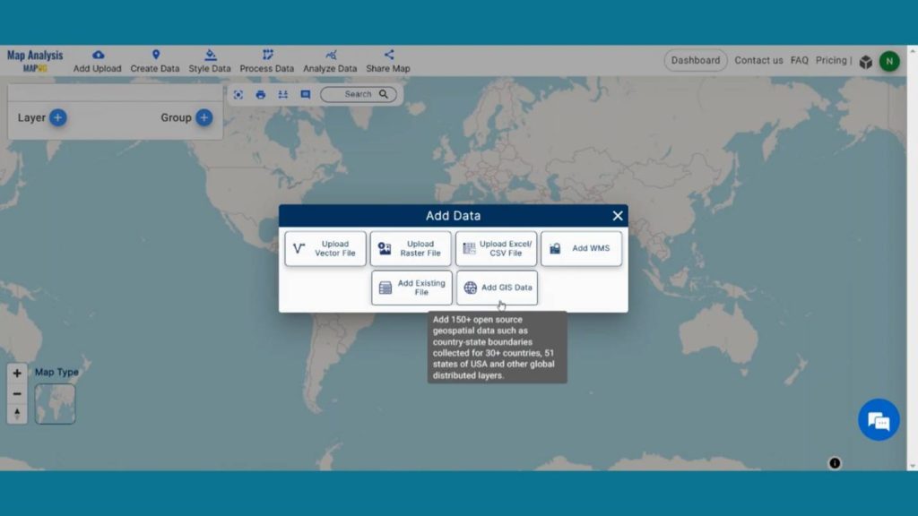
Step 1: Add GIS Data
First, navigate to the Map Analysis interface. Then click on the “Add upload” button in the upper left corner. A dialogue box will open. Click on “Add GIS Data” to add data.
In the right corner box Provide the country name.
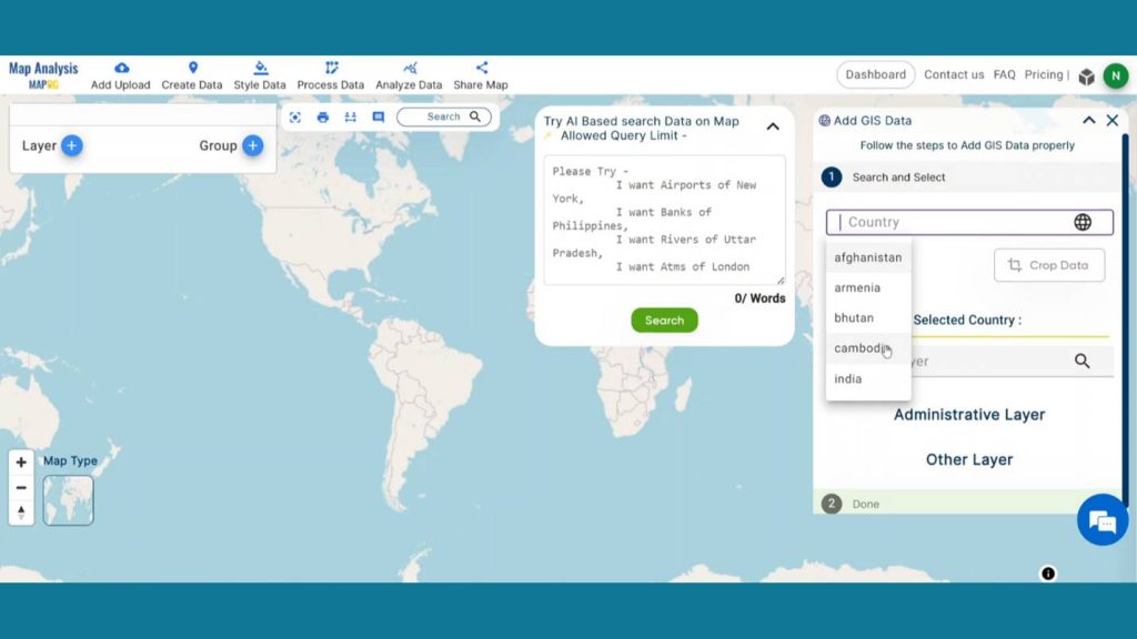
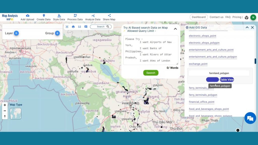
Now, in the other layer option search for farmland layer and by clicking Add option add this layer to map canvas.
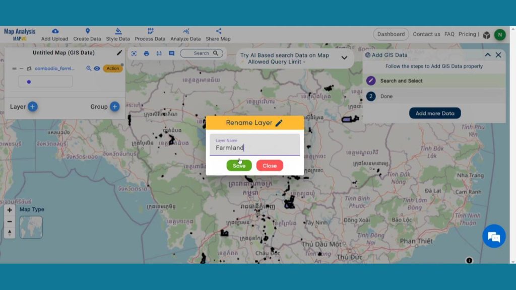
Now click the Action Button of the Farmland layer and click on that pencil icon and rename that layer as Farmland.
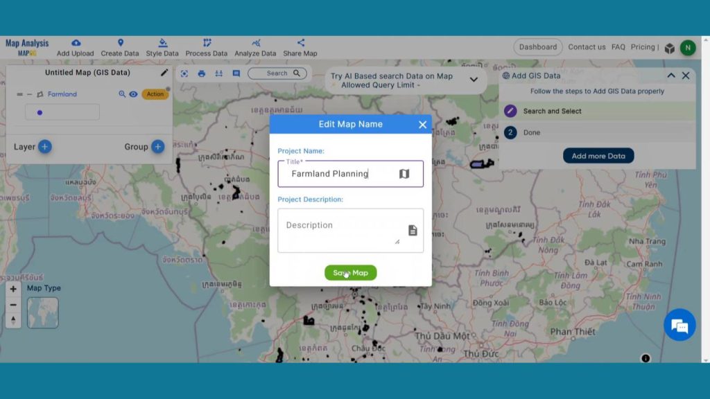
Step 2: Save Project
Now, click on the pencil icon situated right after the “Untitled Map” text to save the project. In the dialogue box write proper name and description that describe the project accurately. And click on save map option. Your project will be saved.
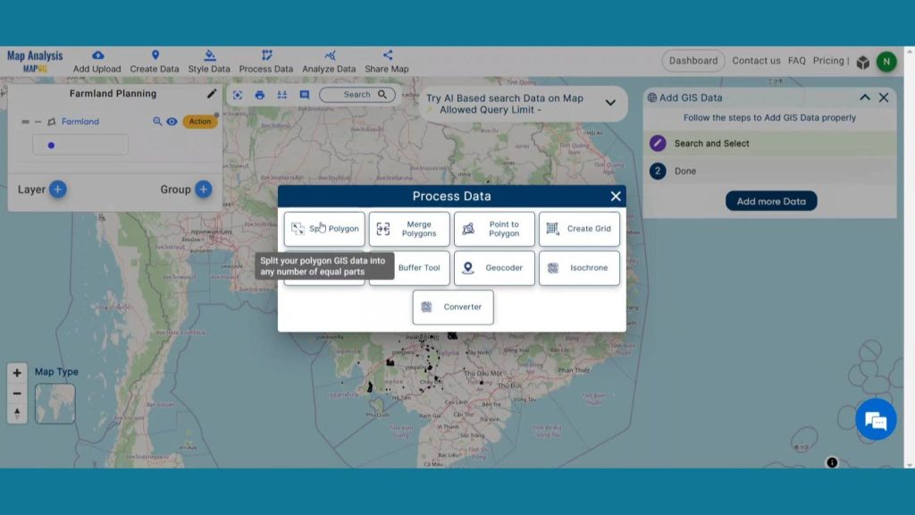
Step 3: Split Farmland
Now we are going to split the farmland using split polygon. To do that click on Process Data from header and click on Split polygon.
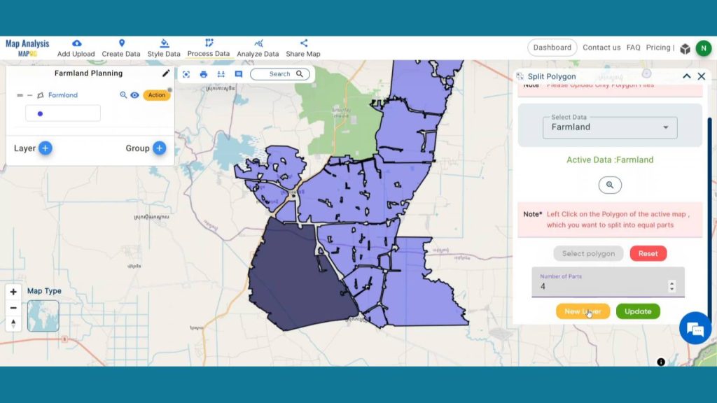
In data selection select the farmland layer. Then select your desirable polygon and provide the number of parts you want to split. Then click on New polygon. Your new layer will be added on map screen.
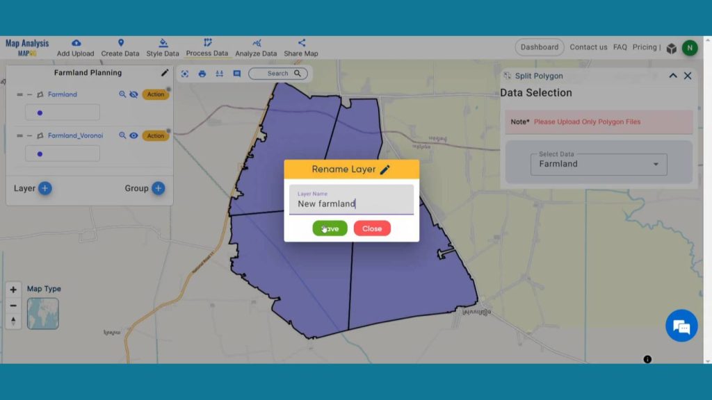
Rename the layer for better understanding.
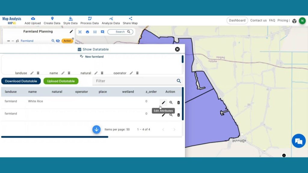
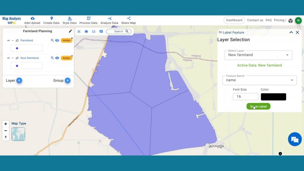
Step 4: Add Label Feature
Enhance the visualization of the layers using label feature. To do that head on to action button of new farmland layer and click on show data table. Then in the action button click on the pencil icon to edit the attributes. Provide new crop names in the name columns and save them.
Then click on label feature and select the layer, feature, color and font size. Then click on save label.
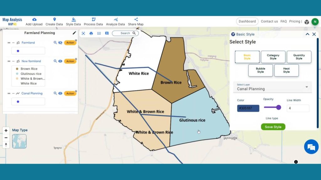
Step 5: Add Thematic Style
Enhance the visualization of the layer using Basic style data option. Select the New farmland from select layer drop down menu. Then come to the opacity section and set the opacity as zero and save style.
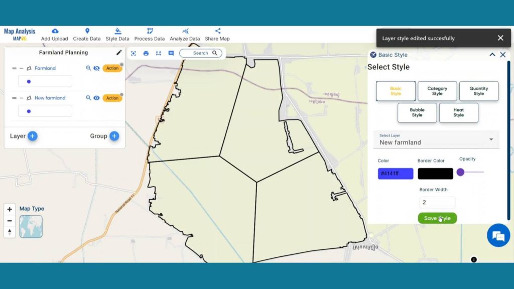
By doing this layer will become transparent, and we will be able to see the land use layers underneath it.
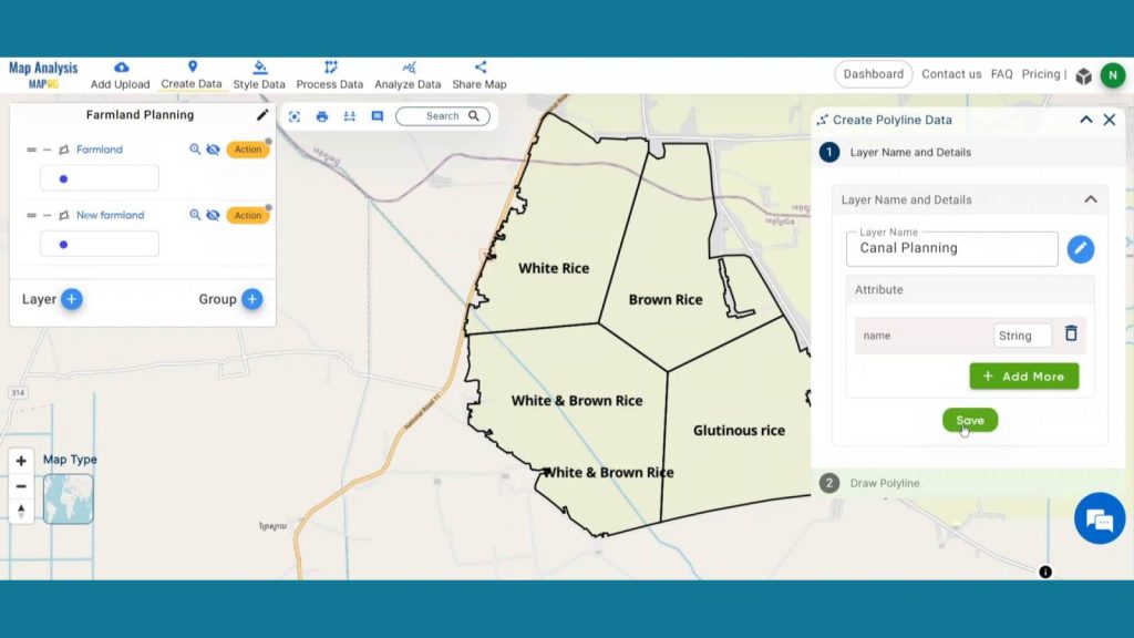
Step 6: Plan Canal Paths
Click on Create data and then click on Create Polyline Data to plan new paths.
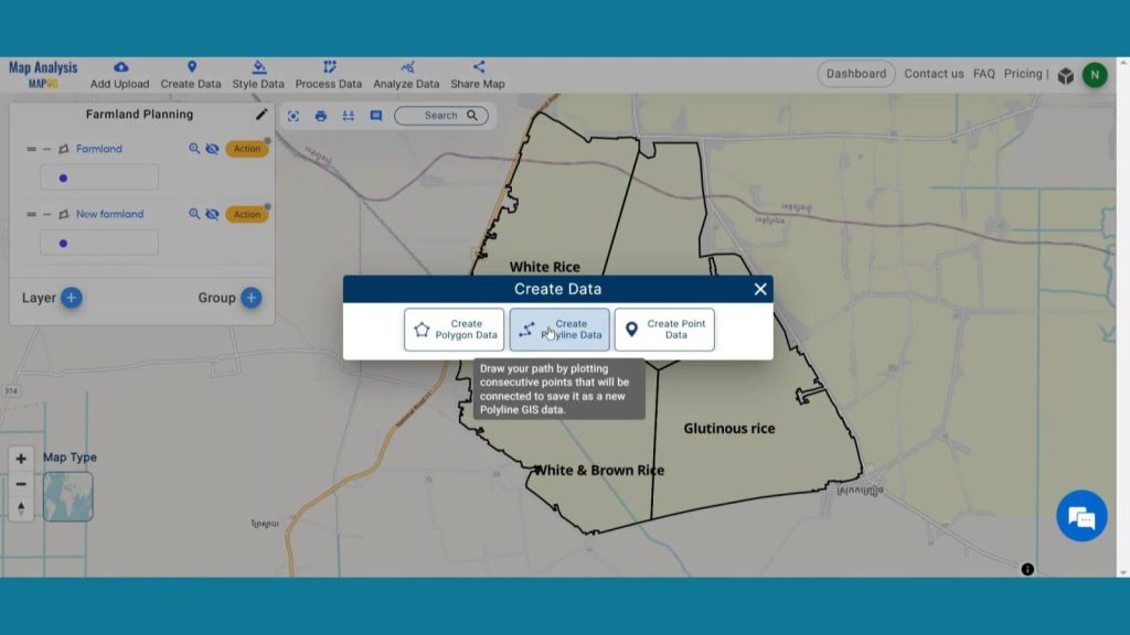
Change the layer name to Canal Planning and click on save.
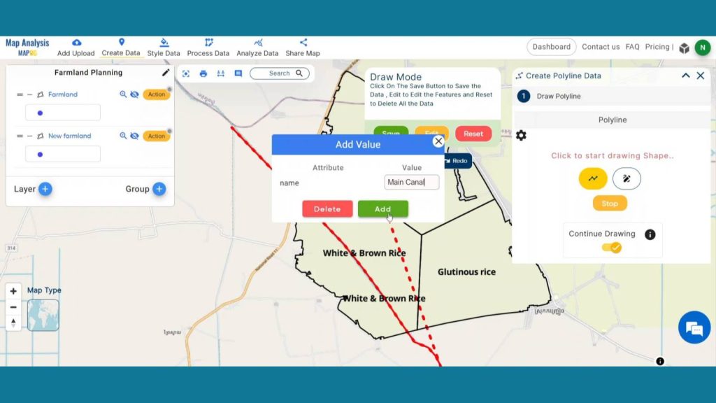
Click on the polyline icon and continue drawing, and plan your new canal paths. Name the first digitized path as main Canal and like this create new paths.
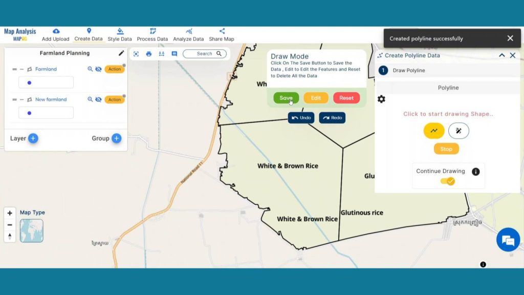
Lastly hit save to save the polylines.
“Create online Map – For Water Resource Allocation for Village” helps optimize water distribution and improve management. Using create polyline data allows precise mapping of water pipelines, ensuring efficient resource allocation and reducing wastage.
Step 6: Enhance visualization
Enhance the visualization of Split farmland and irrigation layers using style data option in the header. Click on Category style option and provide suitable colors to name attribute.
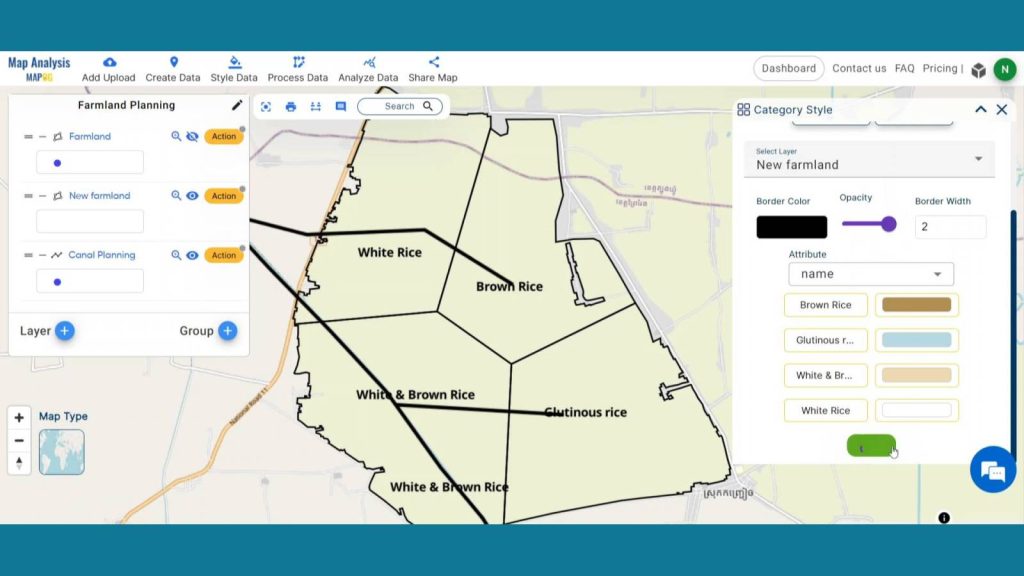
And add basic style to Canal planning layer.
Step 8: Results & Analysis
With our map now enriched with details, let’s make those final adjustments. This tool is ideal for farmers. Precision farming, enabled by accurate mapping, can lead to improved crop yields as farmers can address specific needs of different areas within their fields.
Major Findings
Optimized Resource Utilization: Precision mapping in MAPOG identifies optimal irrigation and fertilization zones, minimizing resource waste while maximizing crop yield.
Early Detection of Crop Stress: MAPOG’s advanced monitoring enables timely identification of crop stress through precise mapping, facilitating proactive intervention and minimizing potential yield loss.
Data-Driven Decision Making: Through accurate field mapping and data analysis, Precision Farming in MAPOG empowers farmers to make informed decisions on crop management, fostering sustainable and efficient agricultural practices.
Domain and Industry
This map is a powerful tool for Agriculture, Environmental Conservation, Food Supply Chain Management and beyond.
Conclusion
In conclusion, Precision Farming Planning in MAPOG emerges as a transformative solution, optimizing agriculture through precise mapping. With enhanced proactive crop management, and data-driven decisions, it marks a significant step towards sustainable and high-yield farming, ensuring a resilient future for agriculture.
LINKS FOR THE DATA 👍
Here are some other blogs you might be interested in
- Protecting Wetlands: Guide to Create GIS Map for Nature
- GIS Analysis in Urban Planning: Reshaping Transportation Future Insights of state/city
- Fast Emergency Response: Using GIS and Isochrone Maps for 10-Minute Ambulance Arrival
- Mapping Tiger Attack Hotspots – Create an Online Map and Share
- Make Routes for Military Aerial Planning- Through Bearing angle and Distance calculation – Online Route Compass
- Mapping Healthcare Efficiency: GIS Buffer Analysis of Hospital Locations
- Add WMS- Two step online view of WMS layer on a map
- Plot ATM locations on a map and embed on your website
- Map habitat locations of endangered animals & keep track of their living