MAPOG‘S Navigating Mining Area Safety with Route Compass utilizes virtual reality technology to ensure site safety in traditional mining operations areas. This innovative technology creates an artificial environment, safeguarding people and equipment, and facilitating regulation observance. Immerse yourself in the dynamic landscapes of urban planning through “GIS Analysis in Urban Planning: Reshaping Transportation Future Insights of state/city” discovering the transformative role of GIS in optimizing transportation for a sustainable and interconnected future.
Now we are on Google Play store also. Below is the link for download.

Route Compass Mobile App for calculating distance and bearing angle.
Key concepts to Create Safety Route in Mining Area with Route Compass
This is the comprehensive route output map that will be presented to us at the project’s conclusion. Our goal is to simply illustrate the path of the mining area. This map’s theme clearly provides useful information about the roads in such a remote place. Join us as we walk you through the process of making this effective map in MAPOG. Now let’s get started!
Steps to Create a Safety Route with Route Compass Tool In MAPOG
Step 1: Open Route Compass Tool
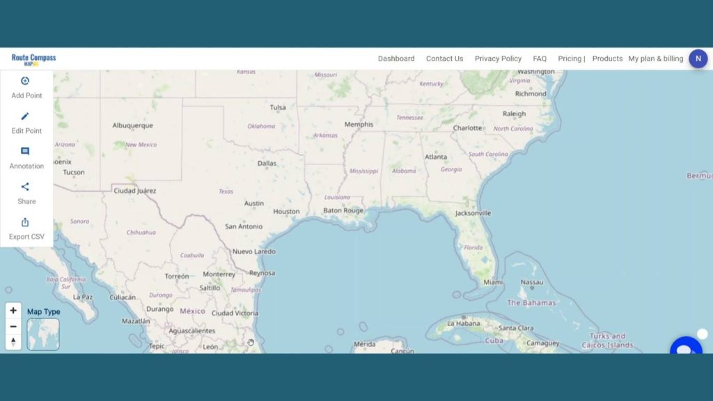
First, go to the Route Compass Tool interface.
Step 2: Add Points:
Now, after coming to the Route Compass interface you’ll see the Add point button click on the Latitude & Longitude button and search for the location you desire.
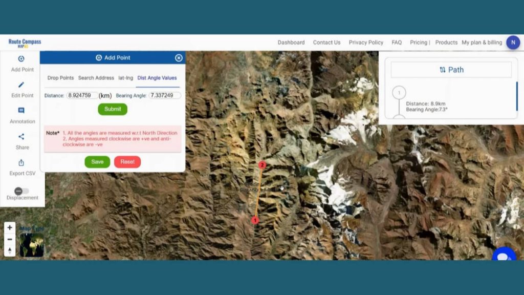
After providing the latitude and longitude a point will be dropped there. That is our first point.
Step 3: Create Routes
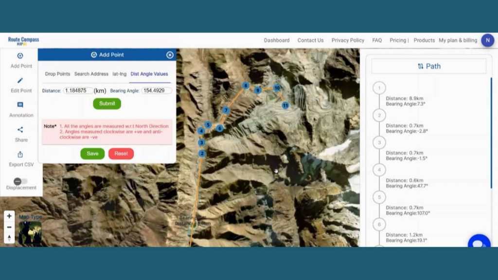
Now, let’s add the way points as per our source and destination. We are going to put nearly 9 waypoint areas in the map that are very important & related to under transportation using the Latitude & Longitude, Distance and bearing angle & Drop point method.
Step 4: Save Route Map
After finishing the routes click on the save button showing the left side of the screen under the add points button. By clicking the save button a dialogue box will open. Give the proper project name and description related to the project and click on create map. And the map will be saved.
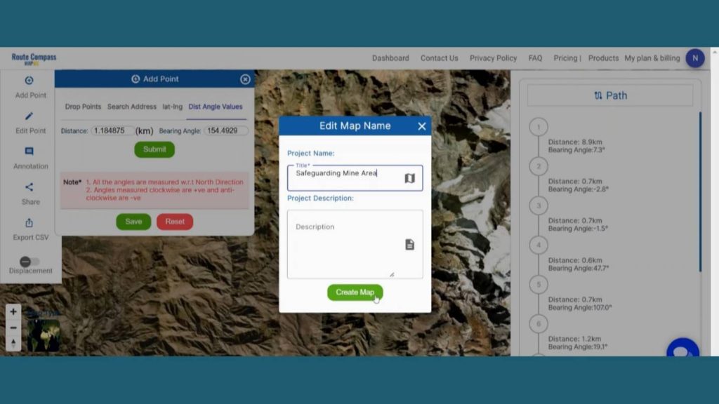
You can even view the distance and bearing angle between 2 points on the right side of the screen. It helps the user to get more detailed information about the route they are creating.
Step 4: Edit Text
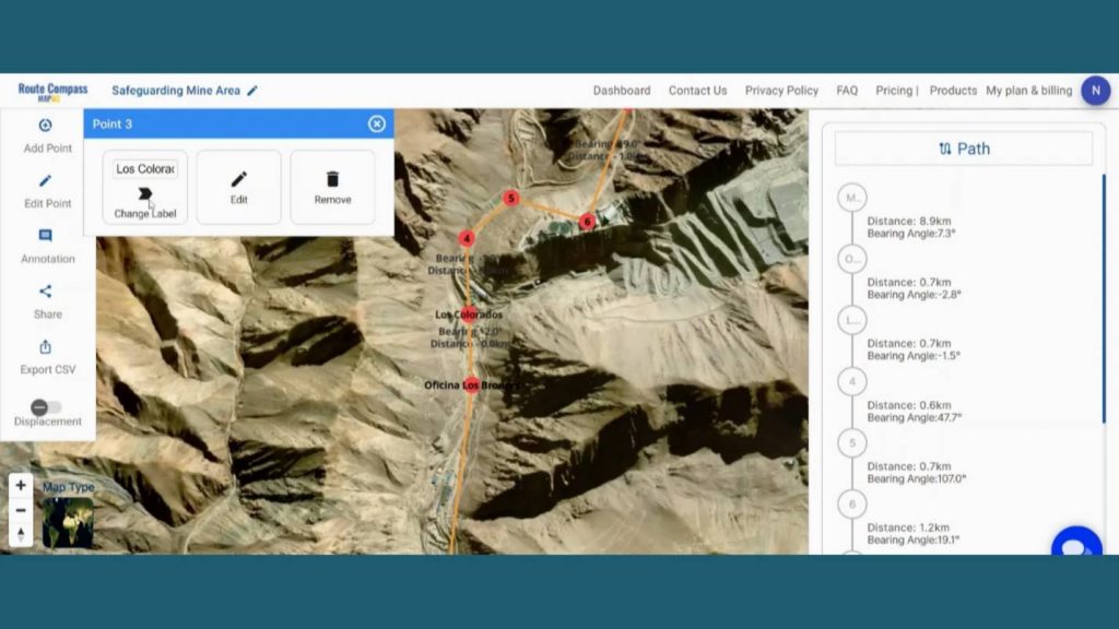
To add any text by the points, Go to the Edit option. It lets the user change the labels of the waypoints for better understanding.
Step 5: Add Icons for better explanation
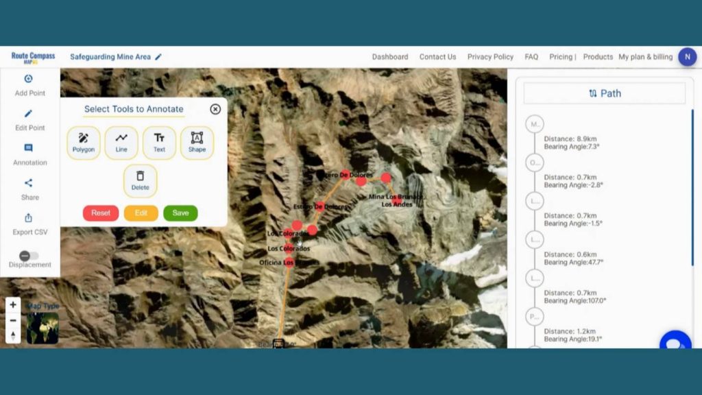
Additionally, MAPOG gives the opportunity to enhance the map by adding the Icons. First go to the Annotation and click on the shape button.
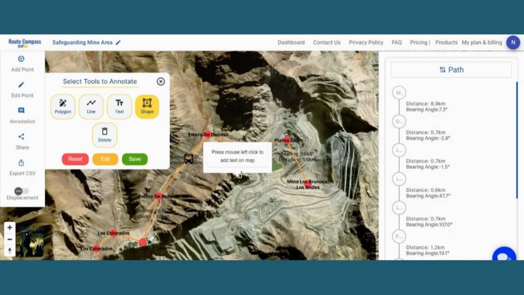
An icon box will open on the screen. Then you can search for a particular icon and drop it on the map. This lets the user explain the exact use of any particular path or location to provide context to the audience.
Step 6: Share Route map
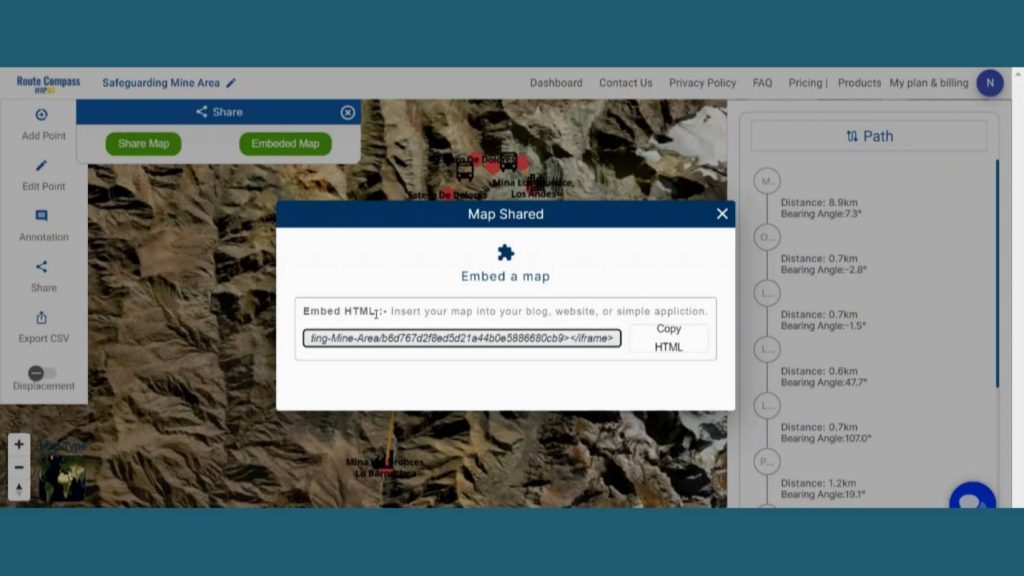
Users can even share their map by clicking the share button. There are two options. By share map users can Send or post it in their social networks by copy link option or preview option.
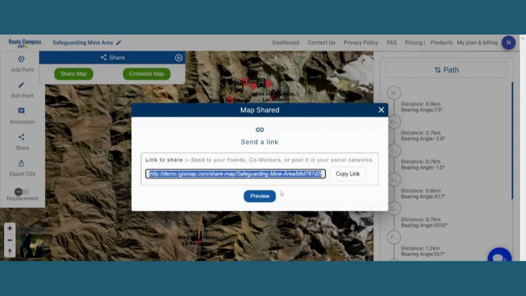
And by Embedded map option users can Insert their map into your blog, website, or simple application by using copy html option.
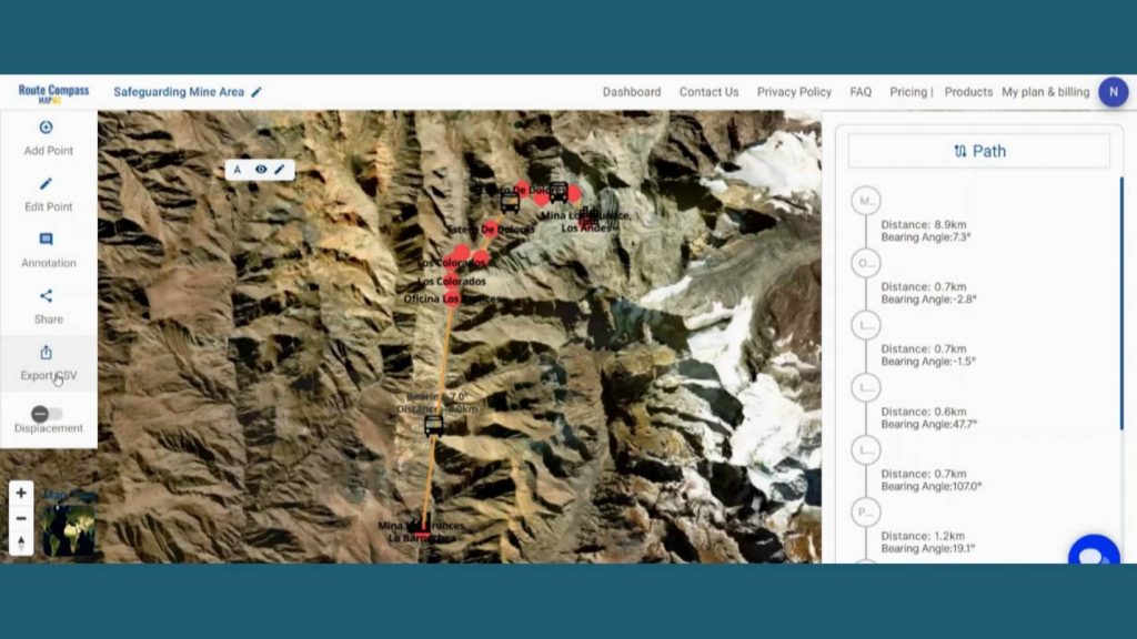
Here is an Export CSV option that lets the user download the route data for further uses. The data come with all the details like distance latitude, longitude and bearing angle.
Step 7: Results & Analysis
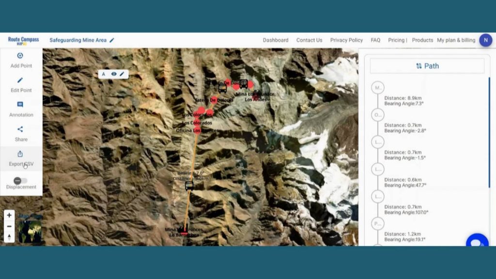
With our map now enriched with details, let’s make those final adjustments. You’ve just crafted a thematic map, a valuable asset for Mining Industry, Technology and GIS Providers, and Safety and Compliance Consultants and beyond.
Major Findings
Improved Navigation Efficiency: MAPOG’s Route Compass enhanced navigation efficiency, optimizing routes for safer transportation of materials and equipment, reducing risks associated with challenging terrain.
Enhanced Safety Protocols: The Route Compass facilitated the implementation of advanced safety protocols, defining buffer zones and providing real-time hazard alerts, contributing to a safer working environment for mining operations.
Increased Compliance with Regulations: Through its features, MAPOG’s Route Compass helped mining operations comply with safety regulations. This ensured that the mining activities adhered to industry standards and guidelines, promoting a secure work environment.
Domain and Industry
This map is a powerful tool for Terrain Optimization, Safety Optimization, Compliance with Regulations, Optimized Workflow, and Technology Showcase. As the narrative unfolds, venture into the realm of urgent response with “Fast Emergency Response: Using GIS and Isochrone Maps for 10-Minute Ambulance Arrival“
Conclusion
I’ve found that utilizing MAPOG has been pivotal in Navigating Mining Area Safety with Route Compass for Transportation in such a remote site with flourishing details. In summary, the Route Compass application in MAPOG caters to the needs of outdoor Survey, providing them with a comprehensive tool for planning, navigating in diverse landscapes.
Here are some other blogs you might be interested in
- Protecting Wetlands: Guide to Create GIS Map for Nature
- Mapping Tiger Attack Hotspots – Create an Online Map and Share
- Make Routes for Military Aerial Planning- Through Bearing angle and Distance calculation – Online Route Compass
- Mapping Healthcare Efficiency: GIS Buffer Analysis of Hospital Locations
- Add WMS- Two step online view of WMS layer on a map
- Plot ATM locations on a map and embed on your website
- Map habitat locations of endangered animals & keep track of their living