In the dynamic world of global trade, navigating efficiently is crucial for success, and MAPOG’s Route Compass not only sets efficiency as a goal but redefines it. This cutting-edge tool transforms the landscape of global commerce by optimizing logistics routes with unparalleled precision, revolutionizing how businesses approach efficiency in the intricate tapestry of Optimizing World Trade Routes.

Key Concept
The key concept behind MAPOG’s Route Compass lies in its transformative role in enhancing the efficiency of global trade navigation. In the highly dynamic realm of international commerce, where streamlined routes are paramount, this cutting-edge tool stands as a game-changer. MAPOG’s Route Compass goes beyond conventional mapping, offering a comprehensive solution that optimizes logistics routes with unparalleled precision.
Step-by-Step Guide
Step 1: Open the MAPOG Route Compass Tool
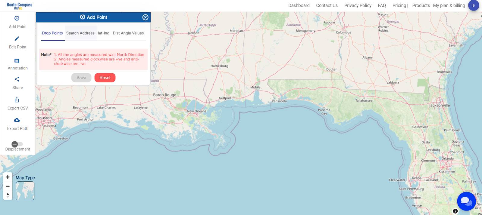
Begin by launching the MAPOG platform and accessing the Route Compass tool. Once within the tool interface, locate and click on the “Add Points” option to initiate the route planning process.
Step 2: Add Points According to Your Route
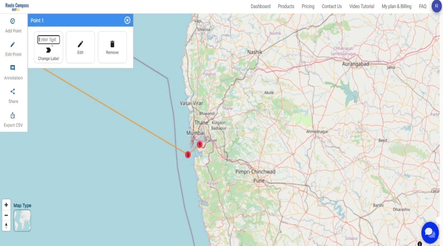
In the newly opened window, add the specific points to define your route.
Click on ‘drop points’ and Add points accordingly
Step 3: Name the Points
To enhance clarity, label the points by assigning meaningful names. Click on the points that require renaming. A label box will appear; modify the name to your preference. After making the changes, click on “Change Label.” This step ensures that the labelled names accurately represent the corresponding locations on the map.
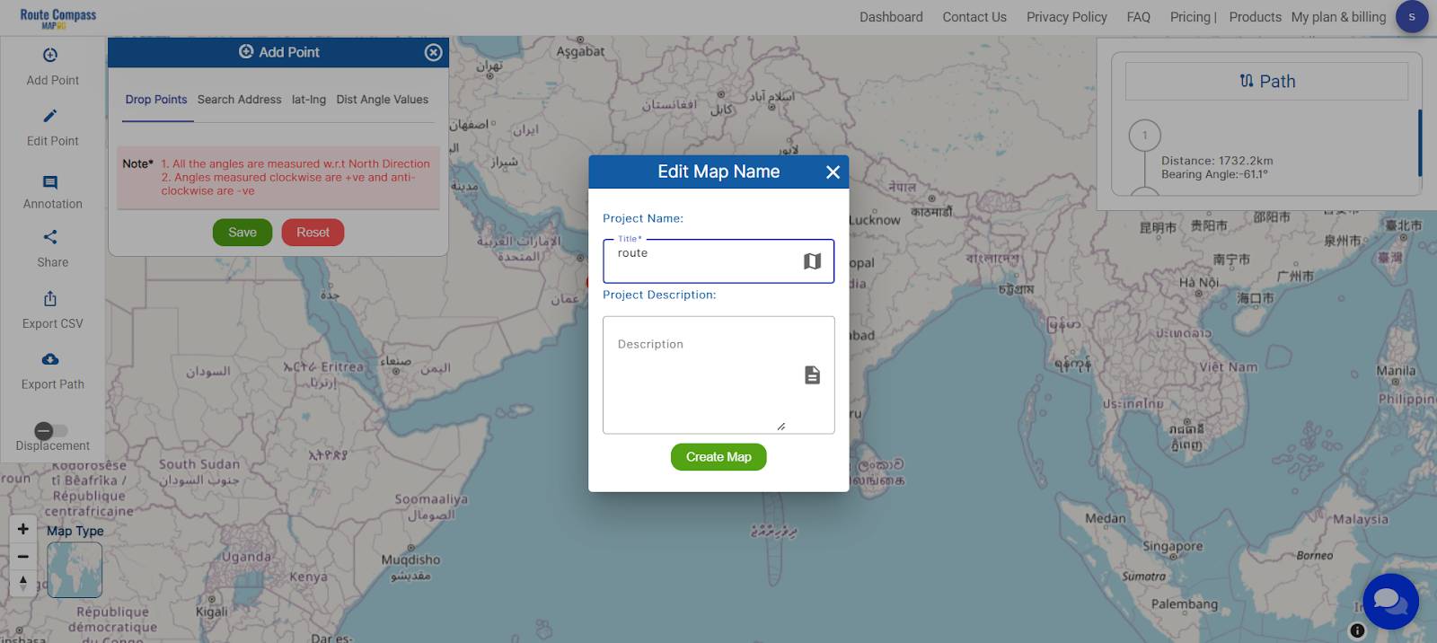
Step 4: Save and Rename Project
Save your project by clicking the pencil icon above, where you can also rename your project for better organization.
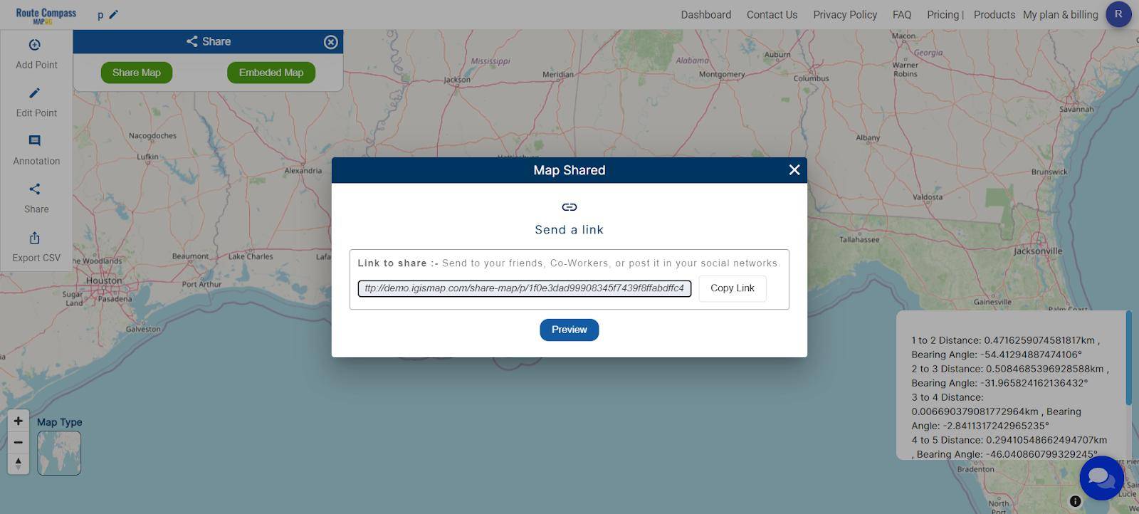
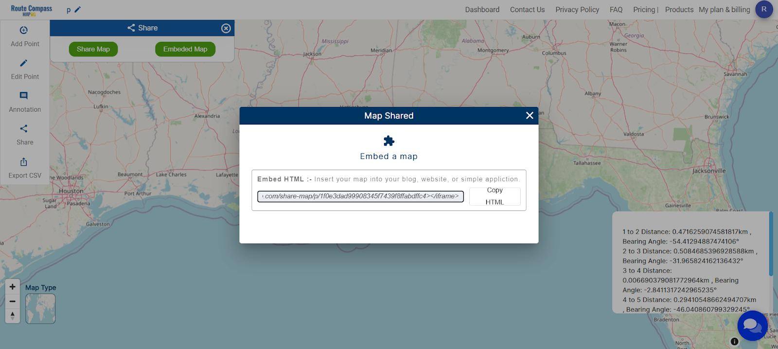
Step 5: Sharing and Embedding Options
Facilitate collaboration by sharing your project. Use the ‘Share Map’ option to send it to friends or post it on social media. For embedding into a blog or website, opt for ‘Embed HTML’ for seamless integration.
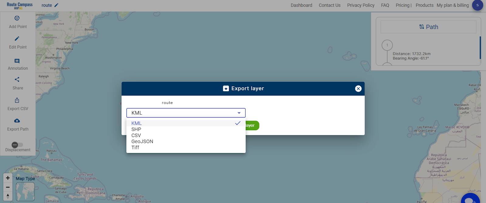
Step 6: Download Information in CSV Format or export path in other formats
For added convenience, MAPOG Route Compass allows the download of all information in a CSV file format. This feature ensures accessibility and easy sharing of project data. You can also use the export path tool for downloading the data.
Major Findings
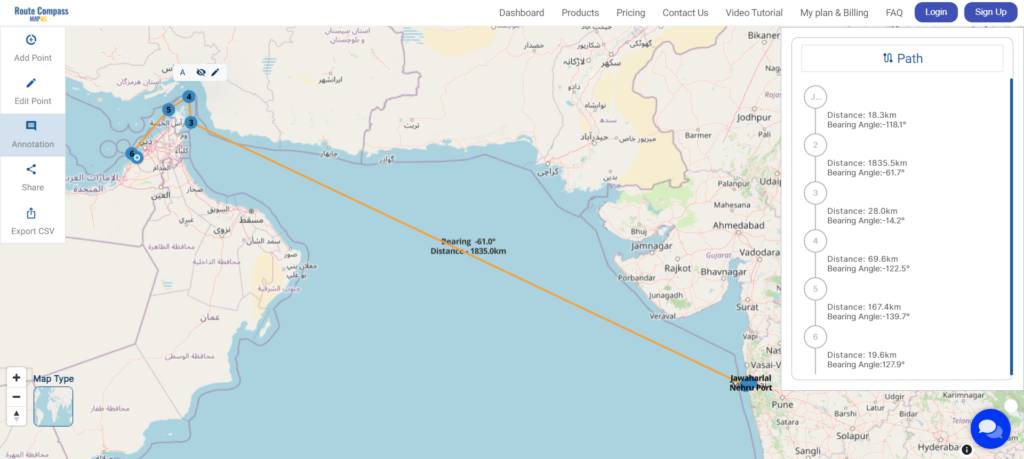
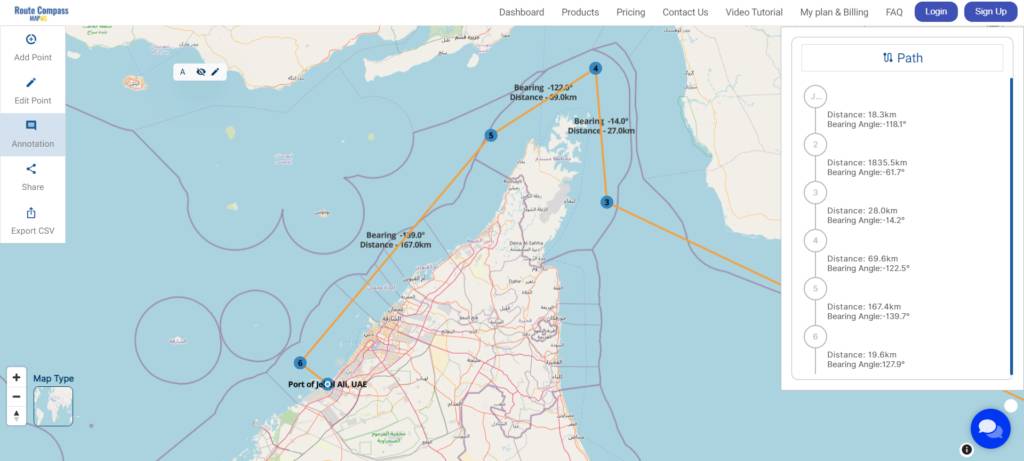
The application of MAPOG Route Compass for the route from Port 1 to Port 2 yielded insightful results and valuable analytical perspectives. The calculated route effectively presented a visually clear and optimized path, complete with essential metrics such as distance in kilometers and bearing angles. This visual representation not only aids in logistical planning but also serves as a user-friendly tool for understanding the intricacies of the chosen route.
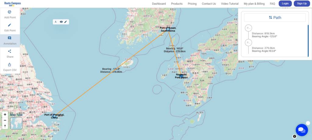
In-depth analysis of the results reveals several key advantages. Firstly, the efficient path-planning capabilities of the Route Compass ensure streamlined journeys, crucial for the optimization of transportation routes. The precise distance metrics offered by the tool contribute to informed decision-making, especially concerning fuel efficiency and resource allocation. Furthermore, the insights derived from bearing angles empower navigators to make strategic adjustments based on directional considerations, enhancing overall route optimization.
Domains and Industries Benefiting
- Logistics and Transportation
- Global Trade and Commerce
- Supply Chain Management
- Shipping and Freight Services
- Manufacturing and Distribution
- E-commerce and Retail
- Government and Infrastructure
- Tourism and Travel
- Emergency Services
- Environmental Planning
Conclusion
In conclusion, MAPOG’s Route Compass emerges as a transformative tool in the global navigation landscape, reshaping efficiency and connectivity across various industries. Its precise route planning proves invaluable for logistics, transportation, global trade, and supply chain management. The ripple effects of this innovative solution extend to shipping, manufacturing, e-commerce, government planning, tourism, emergency services, and environmental initiatives.
For further inquiries or assistance, feel free to contact us at support@mapog.com. More than just optimizing routes, MAPOG’s Route Compass is about forging a connected and efficient future for businesses and communities.
Other Articles
- Protecting Wetlands: Guide to Create GIS Map for Nature
- GIS Analysis in Urban Planning: Reshaping Transportation Future Insights of state/city
- Fast Emergency Response: Using GIS and Isochrone Maps for 10-Minute Ambulance Arrival
- Mapping Tiger Attack Hotspots – Create an Online Map and Share
- Make Routes for Military Aerial Planning- Through Bearing angle and Distance calculation – Online Route Compass
- Mapping Healthcare Efficiency: GIS Buffer Analysis of Hospital Locations
- Add WMS- Two step online view of WMS layer on a map
- Plot ATM locations on a map and embed on your website
- Map habitat locations of endangered animals & keep track of their living