Transforming point data into polygon features is a crucial aspect of Geographic Information Systems (GIS) analysis. This process, known as Point to Polygon conversion, allows for a deeper understanding of spatial relationships and enables effective visualization of data. In this article, we’ll explore the key concepts, process, major findings, and applications of this technique in various domains and industries.
Key Concept to Transforming Points into Areas
Point to Polygon conversion involves the transformation of discrete point features into continuous polygon features based on their spatial proximity or other defined criteria. This process helps in aggregating point data into meaningful areas, facilitating analysis and interpretation. Alongside this guide, datasets will be provided for practical application. Additionally, articles like “Creating Travel Guides: Mapping with GIS Buffer Zones” and “Creating GIS Solutions for Urban Agriculture Map” offer deeper insights into GIS applications.
MAPOG Map Analysis, a simple tool designed to simplify the creation and interpretation of travel maps.
Implementing Point to Polygon conversion in GIS is a systematic process that empowers analysts to seamlessly merge point data into polygon features, thereby enhancing spatial analysis. Here’s a step-by-step guide to the process:
Step1: Loading Data:
Import the point data, such as agriculture data, into the GIS environment.
1.Click on the “Add Upload” button and choose “Add GIS Data“.
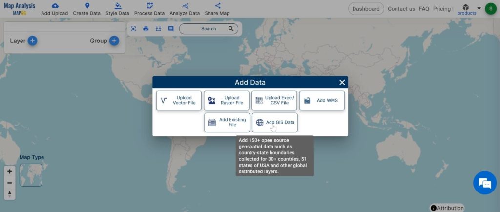
2.Here search the country name.
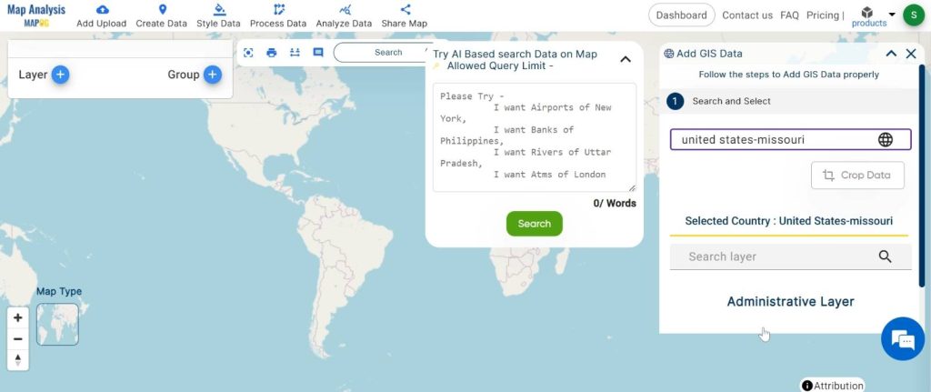
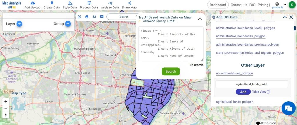
3.Now add the data.
Step2: Name the untitled map and Rename the layer:
1.Here you have to name the untitled map
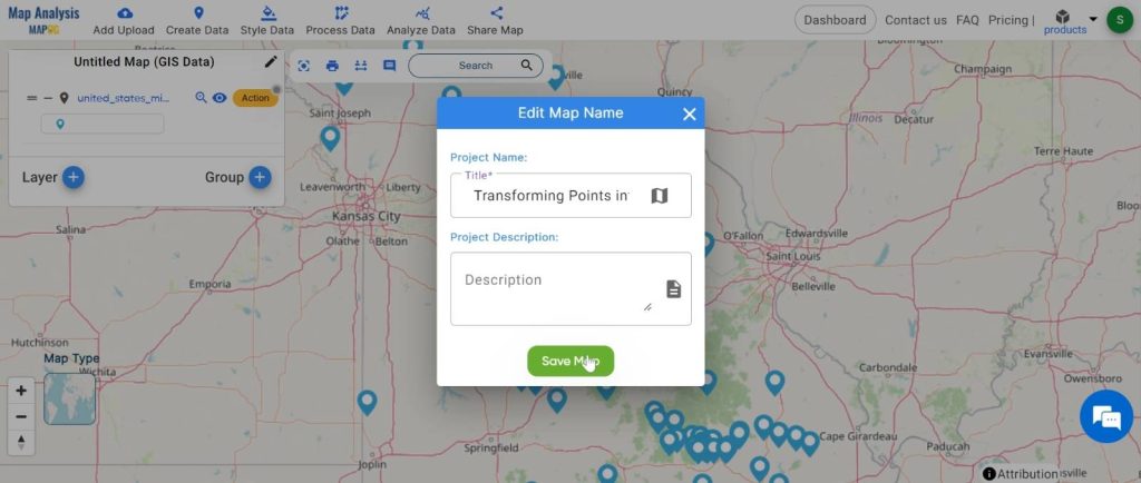
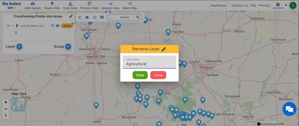
2.Rename the layer
Step3: Executing the Tool:
Apply the Point to Polygon tool to generate polygons from the points, considering spatial relationships.
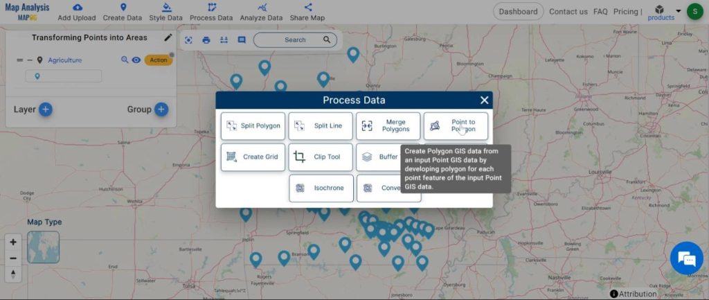
1. Click on the “Process data” button and choose the “Point to polygon” tool.
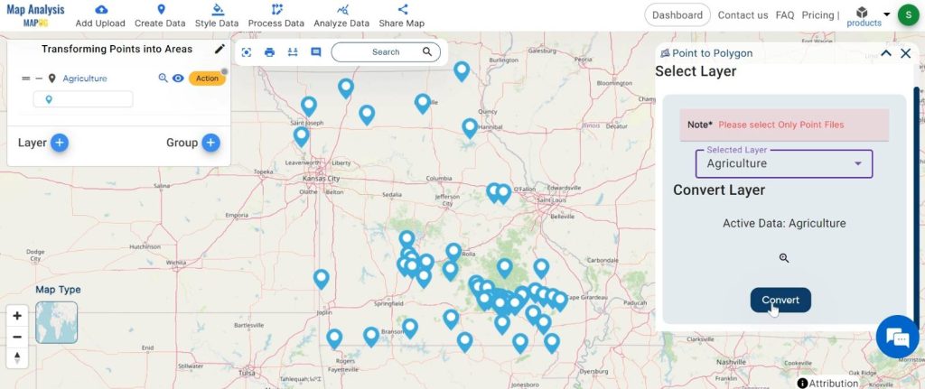
2.Here select the point layer and click on the “convert” button.
Step4: Customizing Appearance:
Adjust the map appearance to enhance visualization and interpretation.
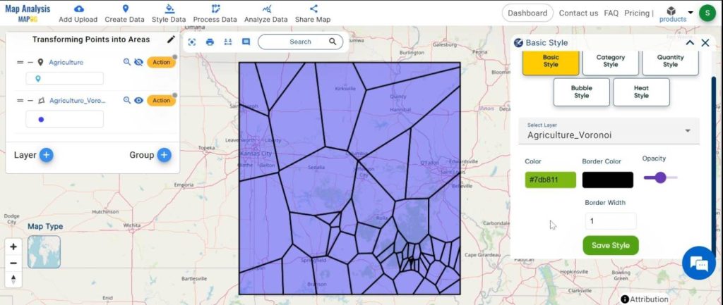
1.Click on the “Action” button and choose “Basic style“.
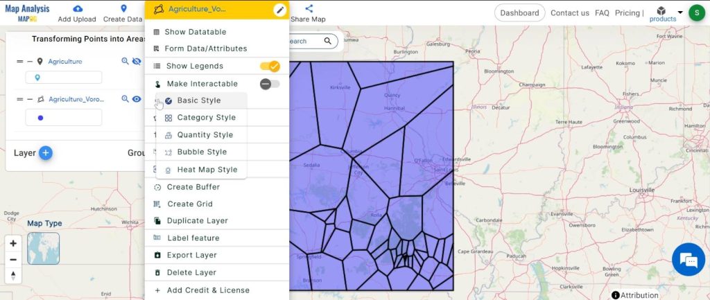
2.Here change the polygon colour and click on the “Save Style” button.
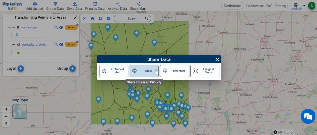
Step5: Sharing Results:
Share the generated map with others for collaborative analysis or presentation purposes.
Major Findings:
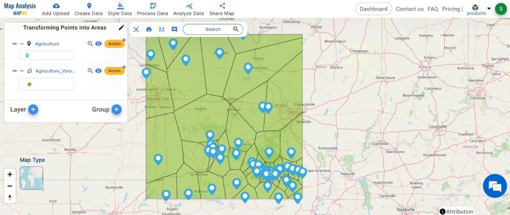
Upon execution of the Point to Polygon tool, the agriculture point data is transformed into distinct polygonal areas, representing different agricultural zones or features. This transformation enables:
- Clear visualization of spatial patterns and distributions.
- Enhanced understanding of agricultural landscapes and potential areas for intervention.
- Simplification of data for further analysis and decision-making processes.
Domain and Industry:
Point to Polygon conversion finds applications across various domains and industries, including: Agriculture, Environmental Science, Urban Planning
In conclusion, the Point to Polygon tool is a valuable asset in GIS analysis, offering a straightforward yet powerful method to convert point data into meaningful polygon features. By transforming discrete points into continuous areas of interest, this technique opens up a plethora of possibilities for spatial analysis and decision-making across diverse domains and industries.
Link of the Data:
Explore the data further through our GIS Data product, uncovering valuable information for in-depth analysis and understanding.