In the realm of GIS, “GIS Proximity Analysis for Resource Management” unveils spatial relationships through distance metrics, elucidating crucial connections between features like settlements and vegetation.
Key Concept to GIS Proximity Analysis for Resource Management
Proximity analysis in GIS dissects spatial relationships based on closeness. It’s instrumental in uncovering correlations between geographical entities, aiding decision-making in various domains.
At the end of this article, we’ll also provide a link where readers can access the data we used in our analysis. Additionally, we’ll share examples of how GIS analysis is used in various fields, such as urban planning, military operations, and real estate development. These examples include articles like “GIS Analysis in Urban Planning: Reshaping Transportation Future Insights of state/city,” “Creating Safe Routes for Armies and Rescue Teams,” and “Create Map for Real Estate Developer for Best Site Selection.”
MAPOG Map Analysis, a simple tool designed to simplify the creation and interpretation of Category Style analysis.
Implementing Proximity Analysis in GIS is a structured methodology, empowering us to analyze spatial relationships and unveil hidden patterns.
Let’s delve into the process:
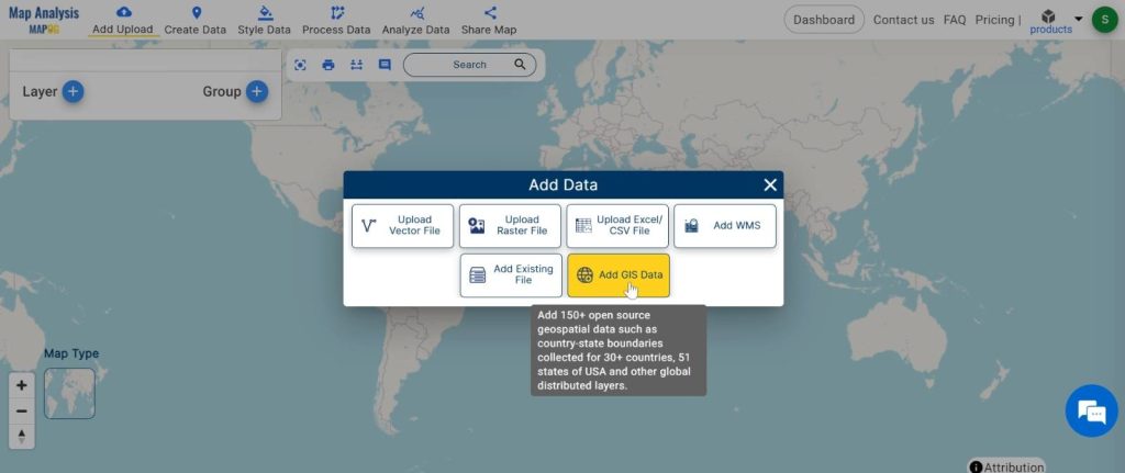
Step1: Upload the datasets:
We begin by uploading two datasets – one containing information about settlements and the other about vegetation.
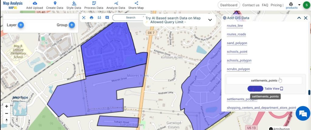
1.Click On the “Add Upload” button and choose the “Add GIS Data” option.
2.Search the country name
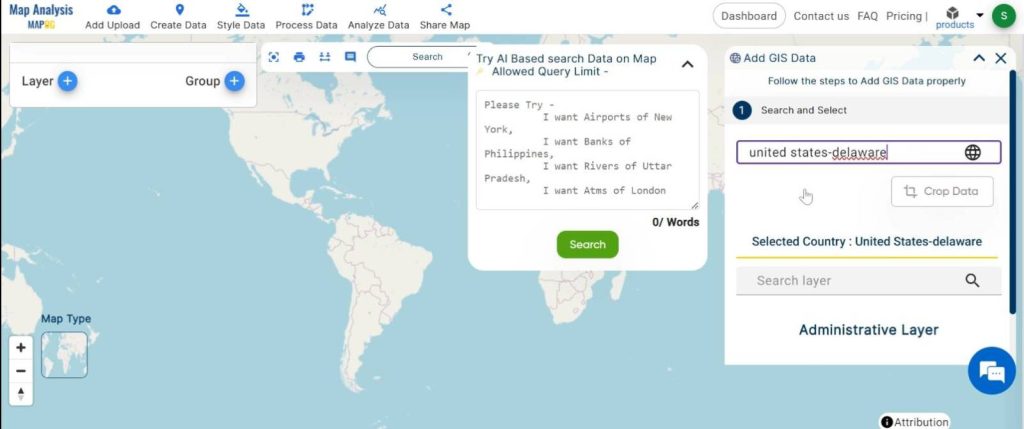
3.Add the Settlement and Vegetation data. Click on the “Add” Option.
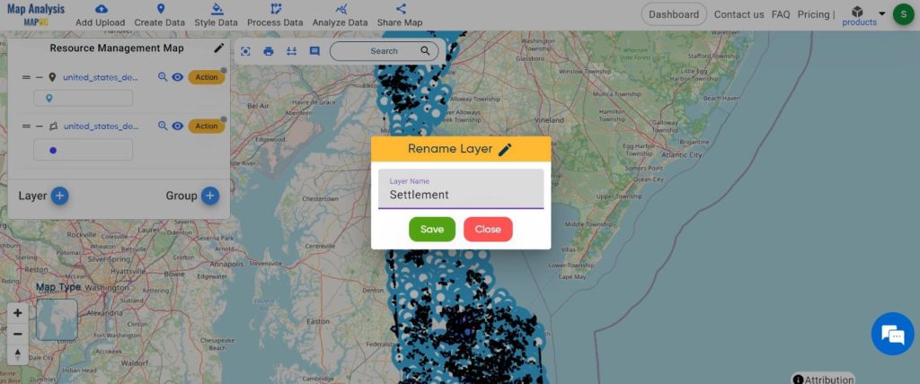
Step 2: Name the untitled map and Rename the layer:
1.Here you have to name the untitled map
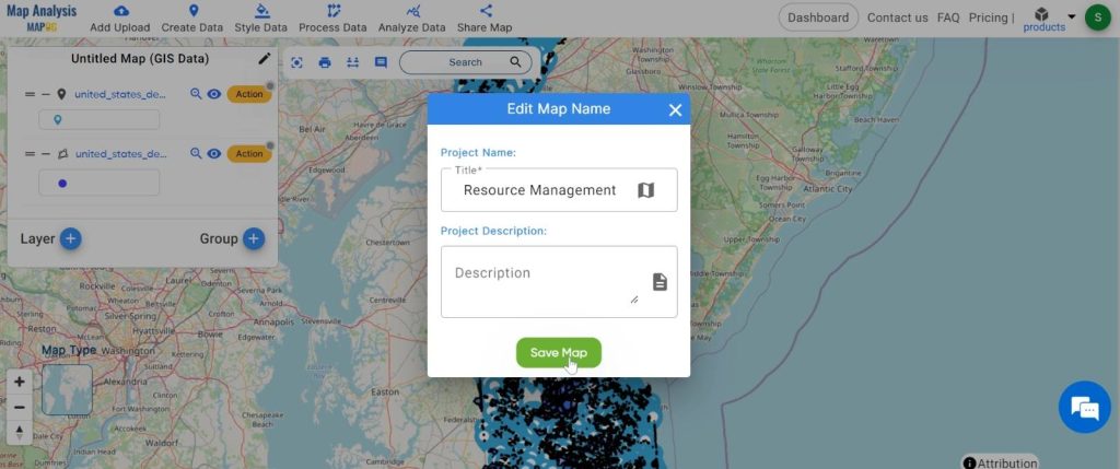
2.Rename the layer
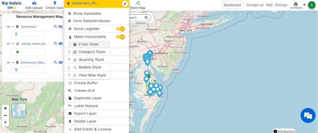
Step3: Change the basic style:
We adjust the visualisation of the datasets to make them more visually understandable.
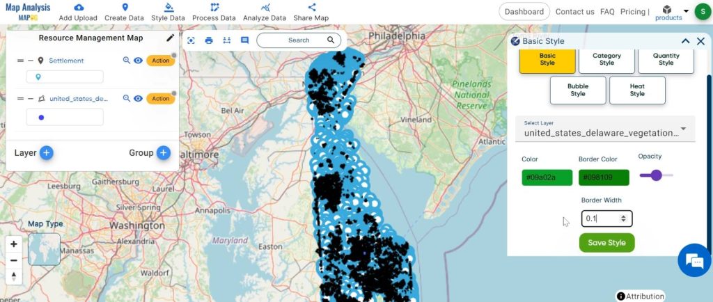
1.Click on the “Action” button and choose the “Basic Style” option.
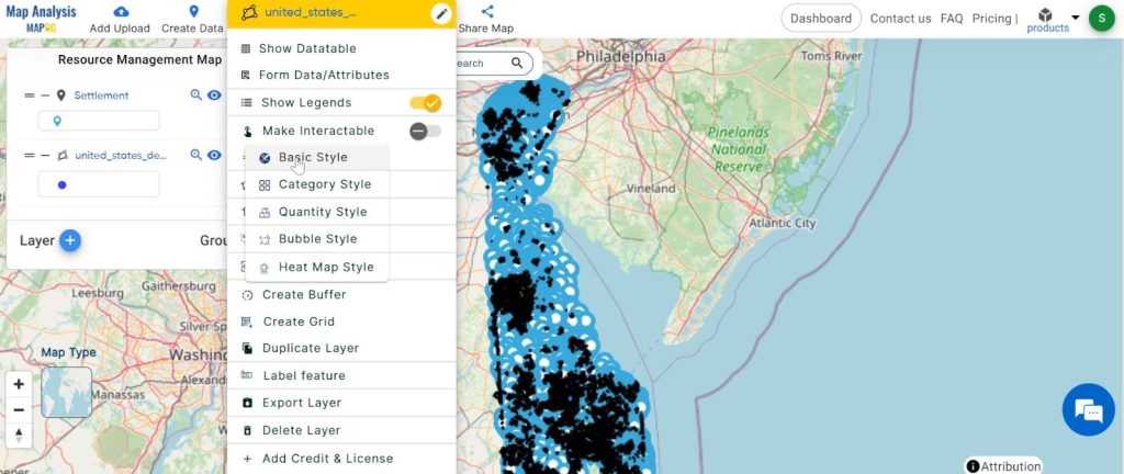
2.You can see the “Basic Style” Tool successfully opened on the right side of the screen.
Here, change the colour and click on the “Save Style”.
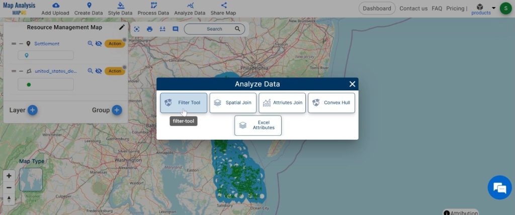
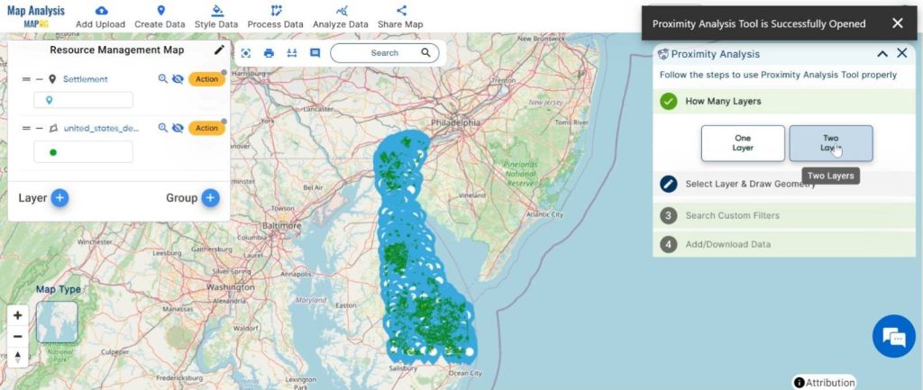
Step4: Apply proximity analysis:
Here comes the essence. We apply proximity analysis to filter the datasets and extract the information we need.
1.Click on the “Analyze Data” button and choose “Filter Tool”.
2.Now click on the “Two Layer”
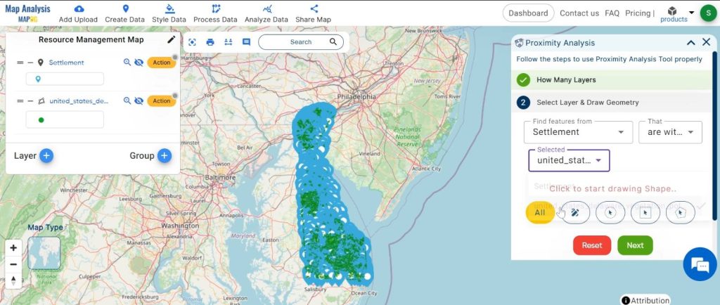
2.Here, select the finding feature and selected layer and click on the “Next” button.
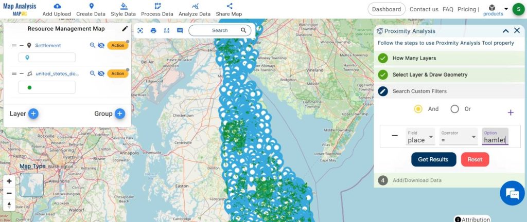
3.Choose the field and write the option and click on the “Get Result” option.
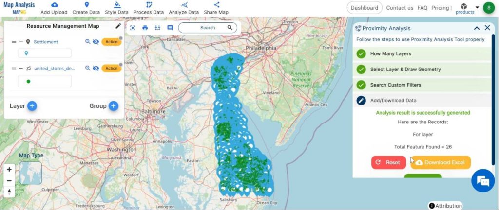
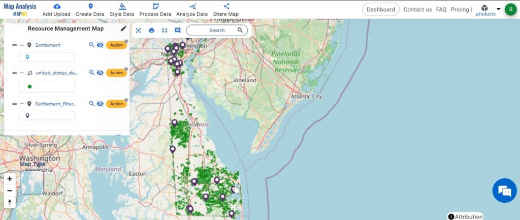
We can see the finding feature.
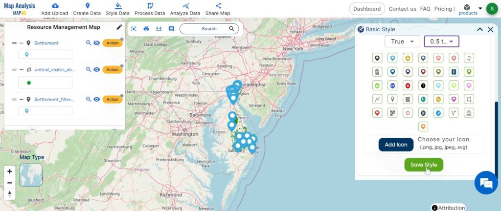
Step5: Change the basic style:
Visualising the founding features changes the basic style.
1.Click on the “Action” button and choose the “Basic Style” option.
2.You can see the “Basic Style” Tool successfully opened on the right side of the screen.
Here, change the icon and click on the “Save Style”.
Major Findings:
Our analysis uncovers areas where settlements interface with dense vegetation, highlighting ecological significance and potential conflict zones. Additionally, it identifies connectivity corridors crucial for conservation efforts.
Domain and Industry:
Proximity analysis finds application across sectors, from conservation to urban planning. It guides decisions in resource management, environmental protection, and sustainable development.
In the GIS landscape, proximity analysis serves as a beacon, illuminating spatial intricacies crucial for informed decision-making. Its systematic process and transformative insights pave the way for sustainable resource management and harmonious coexistence between humanity and nature.
Link of the Data:
Explore the data further through our GIS Data product, uncovering valuable information for in-depth analysis and understanding.
Exploring Our Previous Blogs:
- GIS Analysis in Urban Planning: Reshaping Transportation Future Insights of state/city
- Make Routes for Military Aerial Planning- Through Bearing angle and Distance calculation – Online Route Compass
- Create Map for Real Estate Developer for Best Site Selection
- Create a Map: Filter Camping Spots in a Region Within – Points in polygon