In today’s rapidly evolving urban landscapes, GIS for Smart City Planning plays a crucial role in building efficient, livable, and sustainable environments. By leveraging GIS in urban planning, city authorities can effectively manage traffic congestion, design accessible green spaces, and streamline infrastructure development. Geographic Information Systems empower planners with data-driven insights, helping them transform challenges into innovative solutions for smarter cities.
Key concept
GIS is a technology that captures, stores, analyzes, and visualizes spatial data. Creating a map using MAPOG for a Smart City Planning is a straightforward process that can help you visualize and manage key aspects like traffic management, green spaces, and urban infrastructure by using a buffer tool. There are use case in our blog for Analysis of Forest Fire and Map Risk Areas with Buffer Tool
Process
First: Upload GIS layers
- Open MAPOG and click on GIS Data and search the Country and apply.
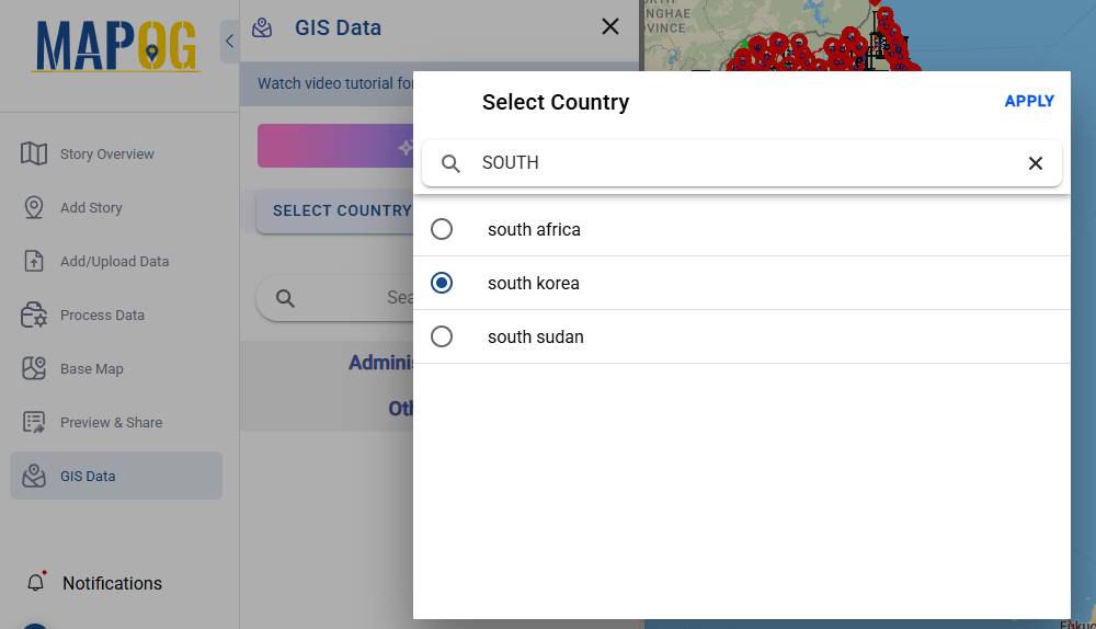
- From the “Other Layer” select
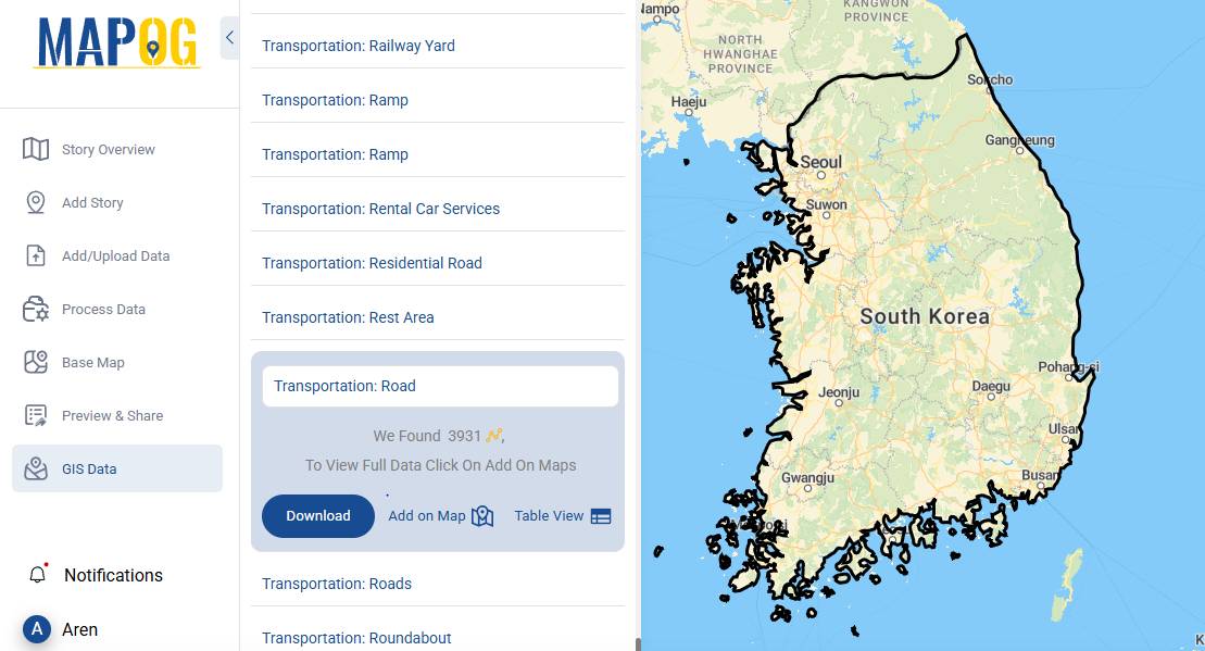
- “Transportation Road”,
- “Agriculture: Forest”
- “Buildings: Points”
- “Boundary: National Parks” one by one and click “Add on map” to visualize on the base map.
Second: Personalized your Layer
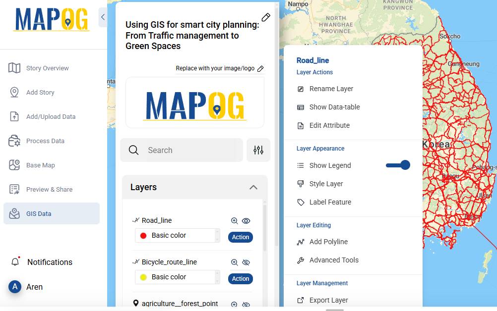
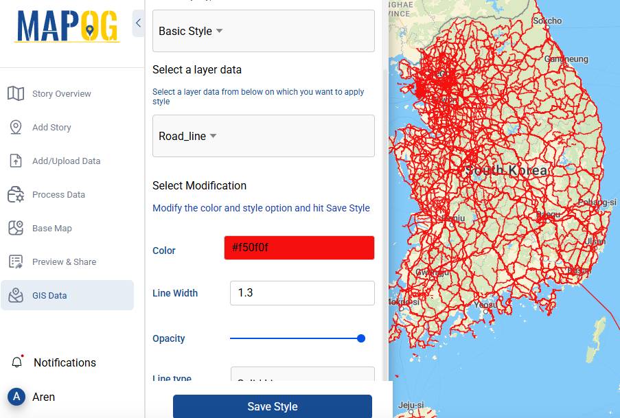
- To customize the layers go to the “Action” button and click “Edit layer” and change the color, icons, radius and click “save styles” for better visualization.
Third : Steps for Green spaces
- Go to the Process Data button and select Buffer Tool now select the layers and set the radius to 2000 meters and Convert.
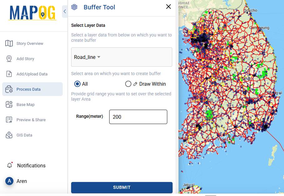
Last Step: Export Map
- Finally, we can Share and Publish the map. For instance you can export your map as an interactive web map or PDF to share publicly or privately with others. MAPOG’s collaboration features enable you to gather feedback and make real-time updates, ensuring everyone is on the same page. These tools streamline communication and foster teamwork, ultimately leading to more efficient and effective urban planning outcomes. By using these features, you can create a seamless workflow that keeps all stakeholders informed, engaged and visualize throughout the process.
Major Findings
GIS is a central tool for data-driven urban planning, integrating and visualizing diverse datasets like traffic patterns and land use to create more sustainable urban solutions. GIS helps identify suitable locations for new parks, urban gardens, and green corridors, ensuring equitable access for all residents.
Industry & Domain
Imagine a city struggling with traffic congestion and a lack of green spaces. Using GIS, planners can:
- Analyzed traffic patterns and redesigned key intersections to reduce congestion.
- Identified underutilized land for new parks and urban gardens.
- Integrated green spaces with public transport routes, encouraging residents to walk or cycle.
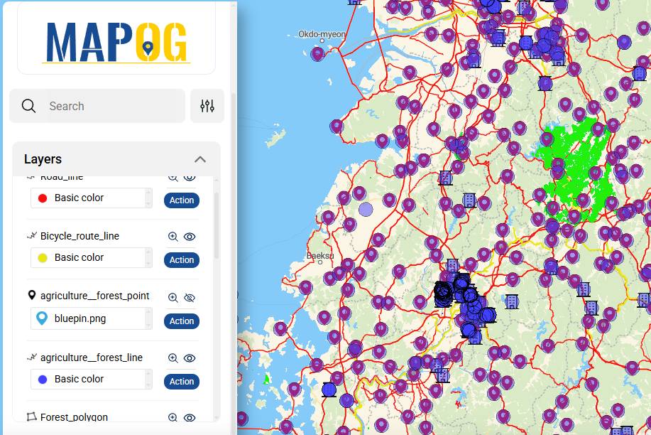
GIS Data Used
Conclusion: GIS as an Indispensable Tool
GIS offers solutions to some of the most pressing urban challenges. From optimizing traffic management to creating vibrant green spaces, GIS empowers cities to become more sustainable, livable, and resilient. Platforms like MAPOG make this technology accessible to planners, enabling them to turn data into actionable insights, visualize and build cities of the future.
Set forth into our blogs to discover more applications, such as:
- Mapping River Intersections for Environmental Monitoring and Urban ,
- GIS Analysis in Urban Planning: Reshaping Transportation Future Insights of state
By leveraging GIS, cities can transform into smarter, greener, and more efficient urban spaces.
References :