Finding the best areas for organic farming is crucial for maximizing yield and ensuring sustainability. With MAPOG’s map analysis, you can easily identify suitable locations for organic farming.
Our Buffer Tool helps pinpoint optimal zones by evaluating various environmental factors, ensuring your farm thrives.
Explore how MAPOG can guide you to the perfect spot for your organic farm.
KEY CONCEPTS
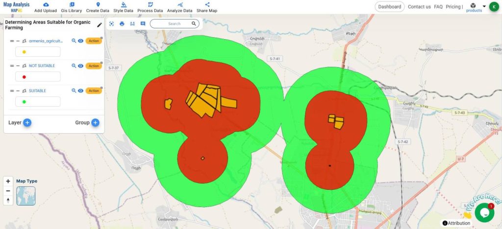
Our goal is to create a map of Suitable Areas for creating an Organic Farm using the Buffer Tool.
Learn more about the Buffer tool here Precision Agriculture: Using GIS Buffer Zones for Eco-Friendly Fertilizer Management
Steps for Creating Suitable Site Mapping using the Buffer Tool:
Below are the steps to follow
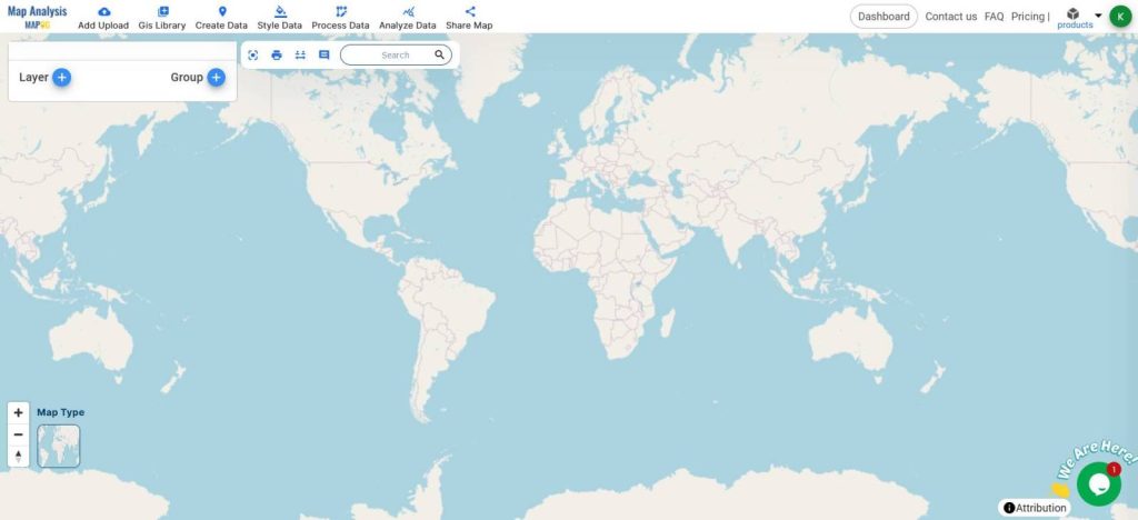
- Open Map Analysis
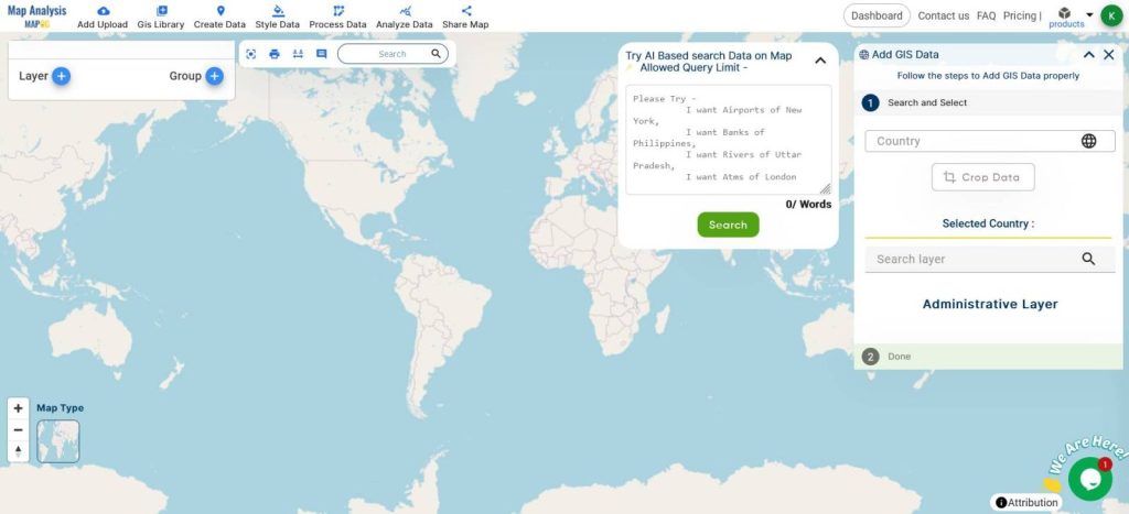
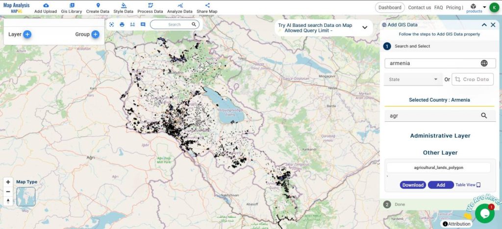
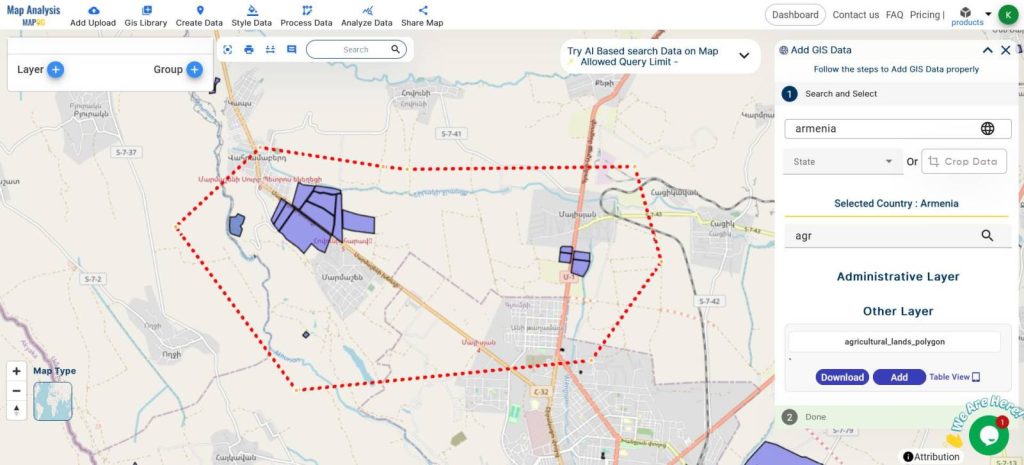
- Click on GIS Libraries, Add the Agricultural Land Data
- Crop the Data while adding for a specific area
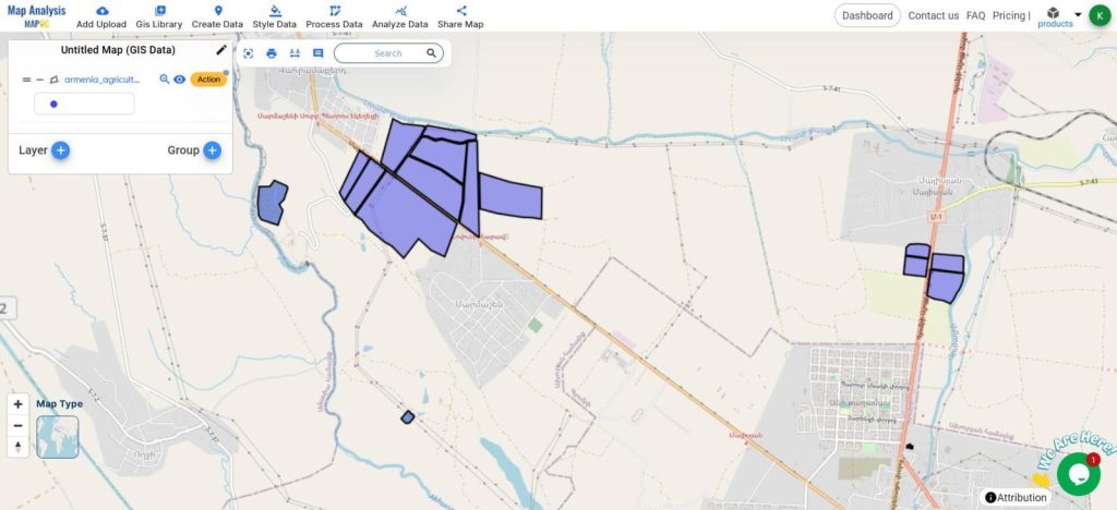
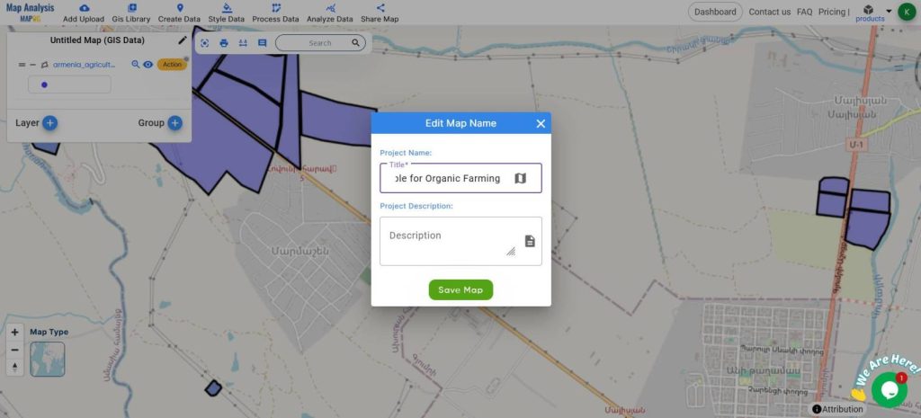
- Rename the Map from the edit icon on the top of the layers panel
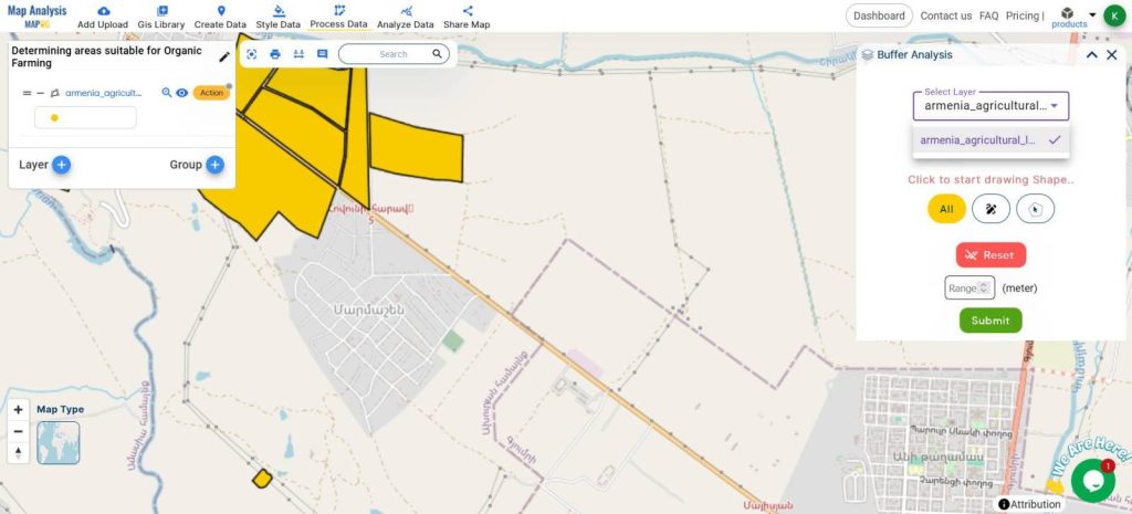
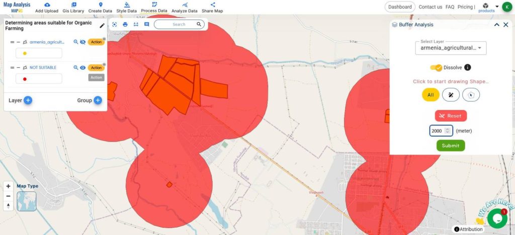
- From Process Data, Click on the Buffer tool
- Select the polygon layer
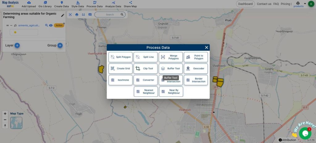
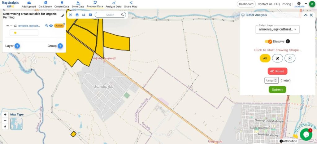
- Enable the Dissolve Buffer Switch
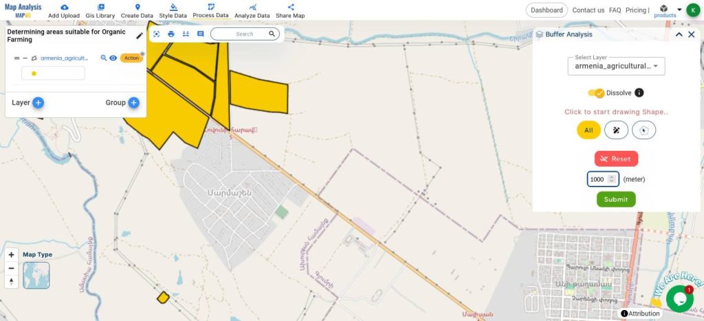
- Give the radius of 1000m
- Hit Submit
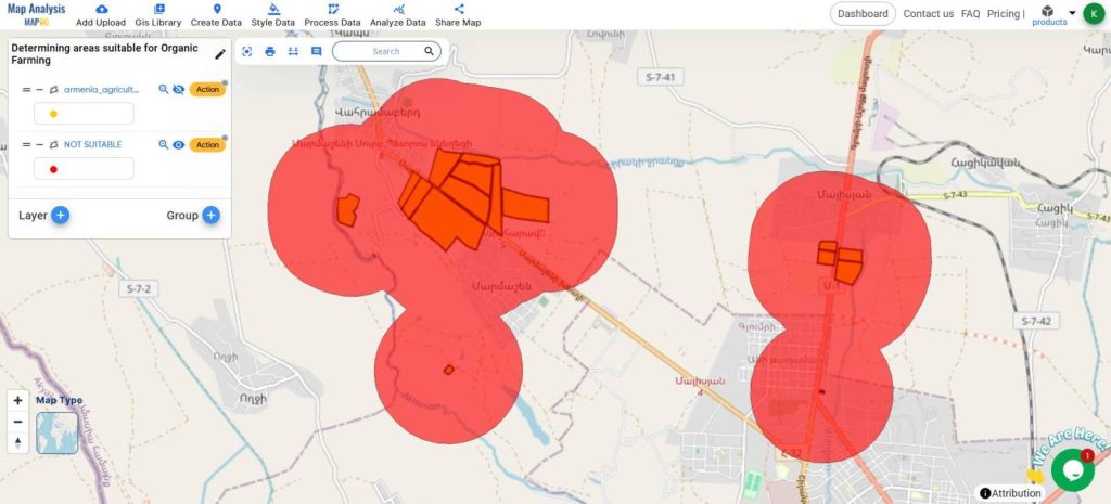
Color this buffer RED, because this area is unsuitable for Organic farming because of the pesticides and other harmful chemicals that drain through the soil at these distances from the conventional farmlands.
- Repeat the buffer for 2000m and now color this GREEN, this area is ideal for starting organic farming because the soil will be of high quality.
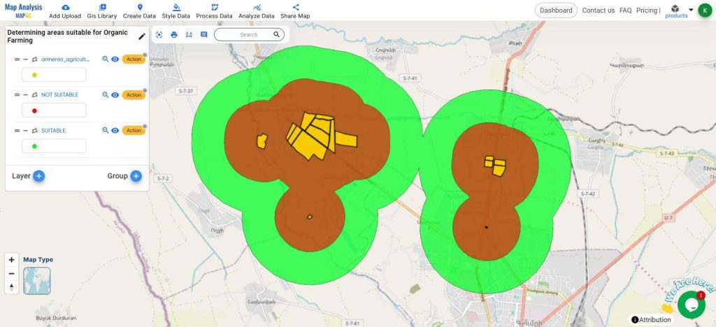
A simple and interactive map will be created with two buffer zones showing the suitable and not suitable areas for starting an organic farm.
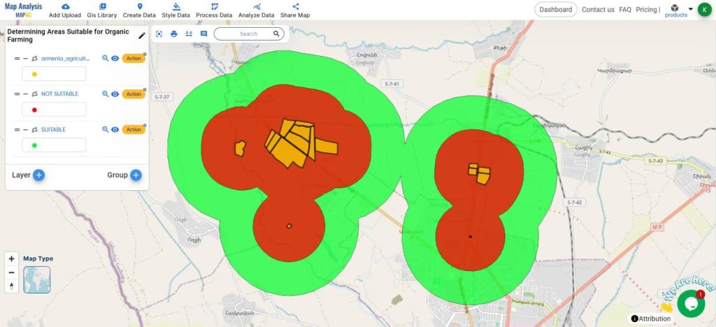
Through these buffers, the decision makers can make decisions as to where to establish the farming.
MAJOR FINDINGS
- Identification of Prime Locations: MAPOG’s map analysis highlights specific regions that are most suitable for organic farming based on various environmental and geographical factors.
- Buffer Tool Insights: The Buffer Tool effectively determines optimal zones by assessing the impact of surrounding areas, ensuring that selected locations are conducive to organic farming practices.
- Enhanced Decision-Making: The analysis provides comprehensive data that aids farmers in making informed decisions about where to establish their organic farms, minimizing risks and maximizing potential success.
BENEFICIAL DOMAIN: Optimal Site Selection and Risk Reduction
- Optimal Site Selection: The analysis helps farmers identify the best locations for organic farming by evaluating various environmental and geographical factors, ensuring higher productivity and sustainability.
- Risk Reduction: It provides detailed data that minimizes potential farming risks, enhancing the chances of successful and profitable organic farming ventures.
For any inquiries or support needs, feel free to contact us at support@mapog.com.
CONCLUSION
MAPOG’s map analysis and Buffer Tool provide invaluable insights for determining the best areas for organic farming.
By identifying optimal locations and minimizing risks, these tools ensure farmers can make informed decisions, leading to more successful and sustainable farming practices.
VIEW OUR PREVIOUS BLOGS
Adding More Attributes to a Shapefile – Create new map and share