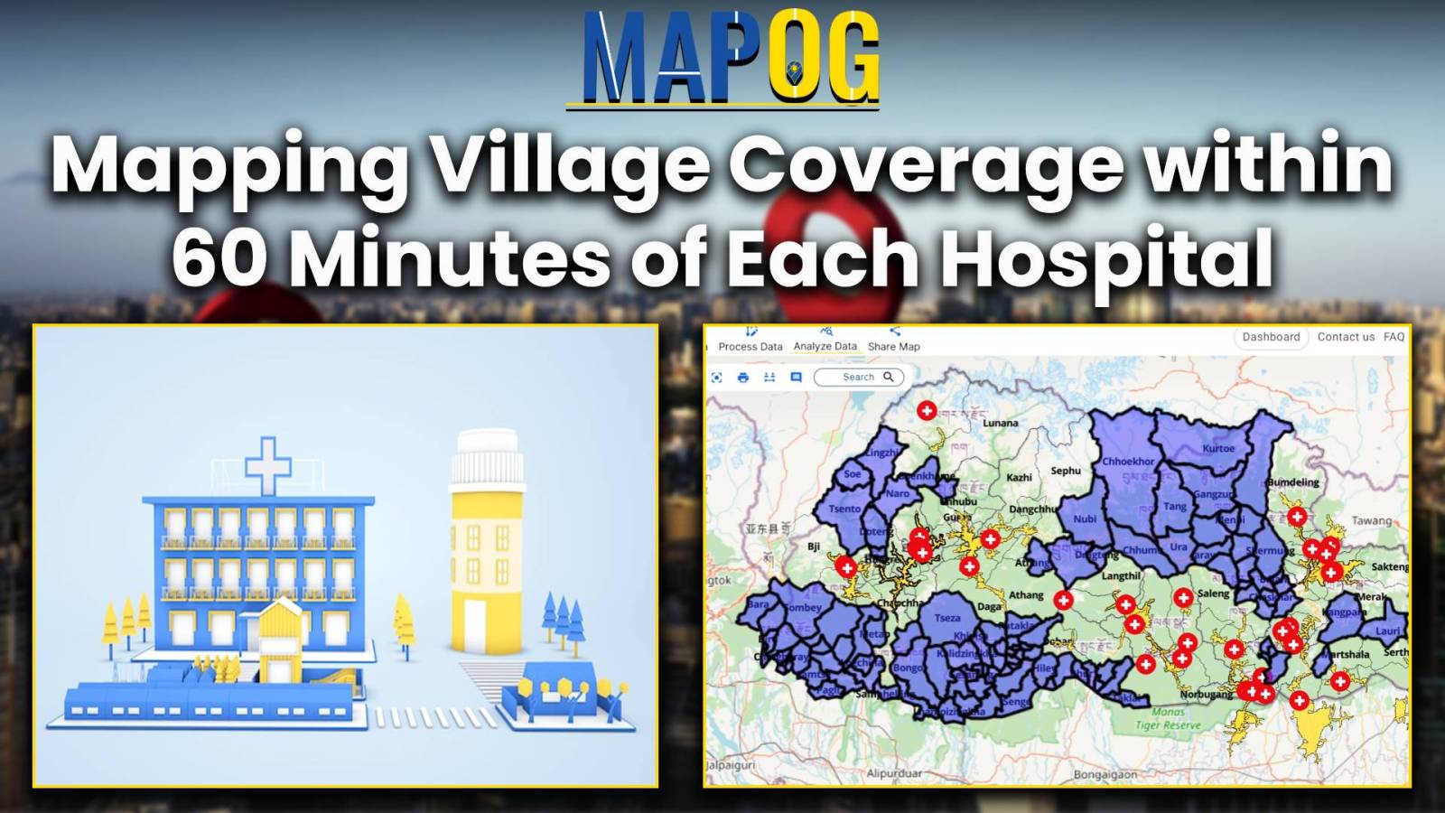
Mapping Village Coverage within 60 Minutes of Each Hospital
Improve public health by analyzing hospital accessibility with MAPOG. Discover how to strategize healthcare infrastructure for diverse communities.
Improve public health by analyzing hospital accessibility with MAPOG. Discover how to strategize healthcare infrastructure for diverse communities.
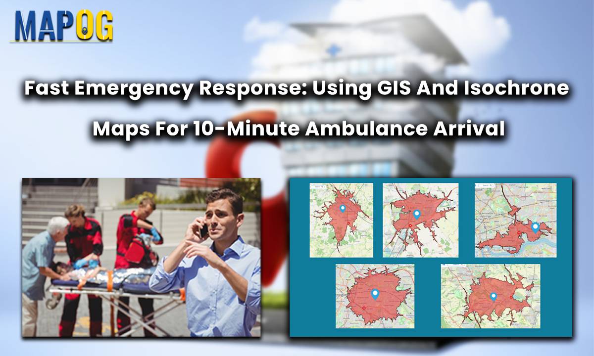
In a groundbreaking move for public safety, the Ambulance Plotting System has been introduced in Great Britain. Integrated within the MAPOG framework, this innovative system guarantees a life-saving presence within a mere 10 minutes at fatal accident sites. By swiftly coordinating emergency responses, it aims to significantly reduce fatalities and enhance overall patient outcomes. This … Read more