Isochrone

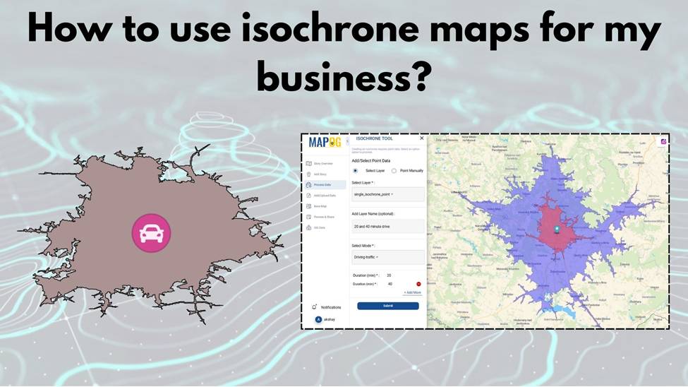
How to Choose the Perfect Retail Shop Location Using Isochrone Maps – Boost Foot Traffic & Sales

Choosing the perfect spot for your retail shop can make all the difference.  With MAPOG Map Analysis, you can use the Isochrone tool to identify areas with the best customer accessibility.  Isochrone maps help you visualize travel times, ensuring you find locations that maximize foot traffic and sales potential. Explore smarter site selection with MAPOG’s … Read more

How to Use Isochrone Maps for Business Growth & Location Planning

In today’s fast-paced world, businesses need tools that help them make data-driven decisions. Isochrone maps, which visualize areas accessible within a certain time or distance, can be a game-changer. They provide insights into customer reach, delivery zones, and more. This article explores how isochrone maps can benefit your business and use MAPOG to create meaningful … Read more

Fire Station Reachability Analysis: A Mapping Approach

Fire Station Reachability Analysis: A Mapping Approach

In emergency management, the strategic placement of fire stations plays a critical role in ensuring the safety and well-being of communities. Rapid response times can mean the difference between containment and devastation during a fire emergency. MAPOG offers powerful tools for evaluating potential fire station locations by analysing accessibility to road and travel time to … Read more

Mapping EV Charging Station Accessibility

Mapping EV Charging Station Accessibility with Isochrone Analysis

In today’s era of rapid urbanization and the push for sustainable transportation, the accessibility of charging stations for electric vehicles (EVs) has emerged as a critical consideration. In this article, we delve into the importance of evaluating the accessibility of charging stations, employing the powerful methodology of MAPOG MAP Analysis. By harnessing this innovative approach, … Read more